Kon Tum Province
| Kon Tum Province Tỉnh Kon Tum | |
|---|---|
| Province | |
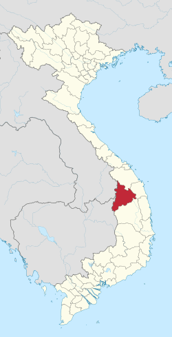 Location of Kon Tum within Vietnam | |
| Coordinates: 14°45′N 107°55′E / 14.750°N 107.917°ECoordinates: 14°45′N 107°55′E / 14.750°N 107.917°E | |
| Country |
|
| Region | Central Highlands |
| Capital | Kon Tum |
| Area | |
| • Total | 9,614.5 km2 (3,712.2 sq mi) |
| Population (2009) | |
| • Total | 432,900 |
| • Density | 45/km2 (120/sq mi) |
| Demographics | |
| • Ethnicities | Vietnamese, Xơ Đăng, Ba Na, Giẻ Triêng, Ra Glai |
| Time zone | UTC+7 (ICT) |
| Calling code | 60 |
| ISO 3166 code | VN-28 |
| Website |
www |
Kon Tum Province lies in the Central Highlands region of Vietnam and shares borders with Laos and Cambodia. It has an area of 9,934 square km and a population of approximately 330,000. The economy is primarily agricultural.
Name
The name Kon Tum comes from the name of a village of the Bahnar ethnic group. In the Bahnar language, kon means "village" and tum means "pool". Prior to the adoption of the Vietnamese alphabet in the 1920s, the name was rendered as 崑嵩.
Administrative divisions
Kon Tum is subdivided into ten district-level sub-divisions:
| Second Tier subdivisions |
Area (km²) |
Third Tier subdivisions | ||
|---|---|---|---|---|
| Ward | Township | Commune | ||
| Kon Tum city | 432.98 | 10 | 11 | |
| Đắk Glei District | 1495.26 | 1 | 11 | |
| Đắk Hà District | 844.47 | 1 | 10 | |
| Đắk Tô District | 509.24 | 1 | 8 | |
| Ia H'Drai District | 980.13 | 3 | ||
| Kon Plông District | 1381.20 | 9 | ||
| Kon Rẫy District | 886.60 | 1 | 6 | |
| Ngọc Hồi District | 824.00 | 1 | 7 | |
| Sa Thầy District | 1435.22 | 1 | 10 | |
| Tu Mơ Rông District | 857.18 | 11 | ||
They are further subdivided into six commune-level towns (or townlets), 83 communes, and 10 wards.
Geography
Neighboring provinces are Quảng Nam to the north, Quảng Ngãi to the east and Gia Lai to the south. The capital city is Kon Tum.
Demographics
Ethnic groups in Kon Tum Province include the Viet, Ba Na, Brau, Giẻ Triêng, Jarai, Rơ Măm, and Xo Dang.
Notable residents
- Siu Black, popular singer
See also
External links
Places adjacent to Kon Tum Province | |
|---|---|
| Đắk Lắk Province |  | |
|---|---|---|
| Đắk Nông Province | ||
| Gia Lai Province | ||
| Kon Tum Province | ||
| Lâm Đồng Province | ||
※ denotes provincial seat. | ||