Kinnear's Mills, Quebec
| Kinnear's Mills | |
|---|---|
| Municipality | |
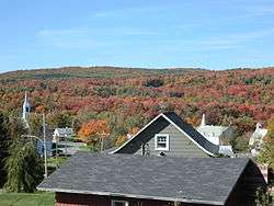 View of the village from the main route. | |
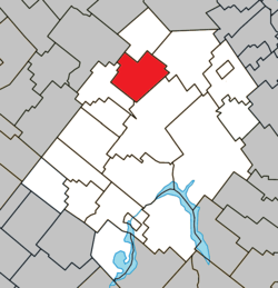 Location within Les Appalaches RCM | |
 Kinnear's Mills Location in province of Quebec | |
| Coordinates: 46°13′N 71°23′W / 46.22°N 71.38°WCoordinates: 46°13′N 71°23′W / 46.22°N 71.38°W[1] | |
| Country |
|
| Province |
|
| Region | Chaudière-Appalaches |
| RCM | Les Appalaches |
| Constituted | July 1, 1855 |
| Government[2] | |
| • Mayor | Paul Vachon |
| • Federal riding | Mégantic—L'Érable |
| • Prov. riding | Lotbinière-Frontenac |
| Area[2][3] | |
| • Total | 93.10 km2 (35.95 sq mi) |
| • Land | 94.09 km2 (36.33 sq mi) |
|
There is an apparent contradiction between two authoritative sources | |
| Population (2011)[3] | |
| • Total | 369 |
| • Density | 3.9/km2 (10/sq mi) |
| • Pop 2006-2011 |
|
| • Dwellings | 175 |
| Time zone | UTC−5 (EST) |
| • Summer (DST) | UTC−4 (EDT) |
| Postal code(s) | G0N 1K0 |
| Area code(s) | 418 and 581 |
| Highways |
|
| Website |
www |
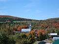
Kinnear's Mills is a municipality located in the Les Appalaches Regional County Municipality in the Chaudière-Appalaches region of Quebec, Canada. Its population was 369 as of the Canada 2011 Census. It is known as the "Village of Churches," as four churches (Anglican, Catholic, Methodist, and United) are located close to each other in the village centre.
James G. Kinnear (1924 - 2010 ) published a book, "Kinnear's Mills," documenting the creation of the village and the family of James Kinnear, after whom the municipality is named.
Gallery

References
External links

- Kinnear's Mills' website
- Kinnear's Mills Heritage Site
Places adjacent to Kinnear's Mills, Quebec | |
|---|---|
| Cities & Towns | |
|---|---|
| Municipalities | |
| Parishes | |
| |
This article is issued from
Wikipedia.
The text is licensed under Creative Commons - Attribution - Sharealike.
Additional terms may apply for the media files.