Kikorongo
| Kikorongo | |
|---|---|
 Kikorongo Location in Uganda | |
| Coordinates: 00°00′00″S 29°59′55″E / -0.00000°N 29.99861°E | |
| Country |
|
| Region | Western Region |
| Sub-Region | Rwenzururu |
| District | Kasese District |
Kikorongo, also Kikorongo Junctiom, is a settlement in Kasese District, in the Western Region of Uganda.
Location
The town is located on the Fort Portal–Kasese–Mpondwe Road, about 25 kilometres (16 mi) south of Kasese.[1] This is about 38 kilometres (24 mi) east of Mpondwe, the town at the international border with DR Congo.[2] The coordinates of Kikorongo are: 0°00'00.0"N, 29°59'55.0"E (Latitude:0.000005; Longitude:29.998618).[3] As one can deduce from the latitude, the settlement sits directly at the Equator.
Points of interest
The Fort Portal–Kasese–Mpondwe Road joins the Kikorongo–Ishaka Road at Kikorongo.[4]
See also
References
- ↑ GFC (21 May 2016). "Distance between Kasese Airport, Kasese, Western Region, Uganda and Kikorongo Junction, Fort Portal–Mpondwe Road, Kasese, Western Region, Uganda". Globefeeed.com (GFC). Retrieved 21 May 2016.
- ↑ GFC (21 May 2016). "Distance between Kikorongo Junction, Fort Portal-Mpondwe Road, Kasese, Western Region, Uganda and Mpondwe lhubiriha Market, Kasese, Western Region, Uganda". Globefeed.com (GFC). Retrieved 21 May 2016.
- ↑ Google (21 May 2016). "Location of Kikorongo, Kasese District, Uganda" (Map). Google Maps. Google. Retrieved 21 May 2016.
- ↑ Google (21 May 2016). "Junction of Fort Portal–Kasese–Mpondwe Road With Kikorongo–Ishaka Road at Kikorongo" (Map). Google Maps. Google. Retrieved 21 May 2016.
External links
Capital: Kasese | ||
| Towns and villages | 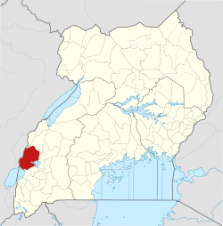 | |
| Economy |
| |
| Transport | ||
| Energy |
| |
| Notable landmarks | ||
| Health | ||
| Notable people | ||
This article is issued from
Wikipedia.
The text is licensed under Creative Commons - Attribution - Sharealike.
Additional terms may apply for the media files.