Nyamagasani II Hydroelectric Power Station
| Nyamagasani II Hydroelectric Power Station | |
|---|---|
 Map of Uganda showing the location of Nyamagasani 2 Hydroelectric Power Station | |
| Country | Uganda |
| Location | Kyarumba, Kasese District |
| Coordinates | 00°10′20″N 29°54′03″E / 0.17222°N 29.90083°ECoordinates: 00°10′20″N 29°54′03″E / 0.17222°N 29.90083°E |
| Status | Under construction |
| Owner(s) | Nyamagasani 2 Hydroelectric Power Project Limited |
| Dam and spillways | |
| Impounds | Nyamagasani River |
| Reservoir | |
| Normal elevation | 1,392 m (4,567 ft) |
| Commission date | 2018 (expected) |
| Type | Run-of-the-river |
| Turbines | 3 |
| Installed capacity | 5 MW (6,700 hp) |
Nyamagasani II Hydroelectric Power Station, also 'Nyamagasani 2 Hydroelectric Power Station, is a 5 megawatts (6,700 hp) mini hydro power station, under construction in the Western Region of Uganda.[1]
Location
The power station is located near the village of Kyarumba, in Kaghema parish, Kyarumba sub-county, in Kasese District, in the foothills of the Rwenzori Mountains.[1] This about 45.5 kilometres (28 mi), by road, southwest of Kasese, the nearest large town and the location of the district headquarters.[2] Nyamagasani II Power Station lies close to its sister station Nyamagasani I Hydroelectric Power Station, which is under simultaneously development, by the same developers.[1] Nyamagasani 2 is located at an altitude of about 1,392 metres (4,567 ft).[3]
Overview
Nyamagasani II HEPS is a run-of-river mini-hydro power plant, whose planned installed capacity is 5 MW.[1] The project company, Nyamagasani 2 HPP Limited, is majority-owned by DI Frontier Market Energy & Carbon Fund, a Denmark-based renewable energy investment company.[4]
Timeline
The project received GetFit approval in June 2015, and financial close was achieved in 2016. Construction started in 2017, with completion expected in the fourth quarter of 2018.[1]
Funding
Construction is budgeted to cost US$19.8 million, with US$3.7 million in GetFit subsidies. The funding includes money to build new 33 kV high-voltage lines to evacuate the power generated to Nkenda sub-station,[1] approximately 36 kilometres (22 mi), to the northeast of Kyarumba, as the crow flies.[5] This includes power generated from the adjacent Nyamagasi 1 Power station.[1]
See also
References
- 1 2 3 4 5 6 7 GetFit Uganda (31 December 2016). "GetFit Uganda: 2016 Annual Report: Nyamagasani II Power Station". Kampala: GetFit Uganda. Retrieved 23 December 2017.
- ↑ Globefeed.com (23 December 2017). "Distance between Kasese, Western Region, Uganda and Kyarumba, Uganda". Globefeed.com. Retrieved 23 December 2017.
- ↑ Mapcarta (23 December 2017). "Average Elevation of Kyarumba Village". Mapcarta.com. Retrieved 23 December 2017.
- ↑ Frontier Energy (23 December 2017). "Nyamagasani 2 Hydro Power Project". Copenhagen: Frontier Investment Management ApS. Retrieved 23 December 2017.
- ↑ Globefeed.com (23 December 2017). "Distance between Kyarumba, Uganda and Nkenda, Busongora, Western Region, Uganda". Globefeed.com. Retrieved 23 December 2017.
External links
Capital: Kasese | ||
| Towns and villages | 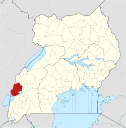 | |
| Economy |
| |
| Transport | ||
| Energy |
| |
| Notable landmarks | ||
| Health | ||
| Notable people | ||