Nkusi Hydroelectric Power Station
| Nkusi Hydroelectric Power Station | |
|---|---|
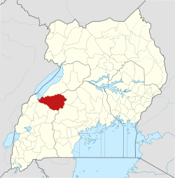
 Map of Uganda showing the location of Nkusi Power Station | |
| Country | Uganda |
| Location | Nkusi Falls, Hoima District |
| Coordinates | 01°07′10″N 30°40′05″E / 1.11944°N 30.66806°ECoordinates: 01°07′10″N 30°40′05″E / 1.11944°N 30.66806°E |
| Status | Under construction |
| Dam and spillways | |
| Impounds | Nkusi River |
| Reservoir | |
| Normal elevation | 800 m (2,600 ft) |
| Commission date | 2018 (expected) |
| Installed capacity | 9.6 MW (12,900 hp) |
Nkusi Hydroelectric Power Station, also referred to as Nkusi Power Station, is a 9.6 MW (12,900 hp) hydroelectric power station under construction in the Western Region of Uganda.[1]
Location
The power station is located across River Nkusi at the border between Hoima District and Kibaale District. This location is near Nguse village, where Nkusi Falls and the mouth of the river are located. The village, is approximately 1 kilometre (1 mi), south of the power station and is located in Kitebere Parish, Ndaiga subcounty, Buyaga West County, in Kibaale District. The river, that forms the boundary between the two districts, meanders before it gushes over the falls into Lake Albert. The project area is found in both Kibale and Hoima districts.[2] The power house, which lies in Hoima District, lies in proximity to UNHCR Kyangwali Refugee Settlement (Kyangwali), which is approximately 77 kilometres (48 mi), by road, southwest of Hoima, the largest city in Bunyoro sub-region.[3] This is approximately 296 kilometres (184 mi), by road, northwest of Kampala, the largest city and capital of Uganda.[4] The coordinates of the power house are: 01°07'10.0"N, 30°40'05.0"E (Latitude:1.119444; Longitude:30.668056).[5][6]
Overview
The power station is a run-of-river hydro power plant with installed capacity of 9.6 megawatts (12,900 hp).[1] It is being developed by its owner, PA Technical Services, who are expected to it, when construction is complete.[2][6]
Due to the location on steep cliffs, along the lake shore, the approach to the power station is via watercraft (barge or boat) on Lake Albert. To access the water intake part of the station, there is a suspended footpath navigating the vertical cliffs over Nkusi Falls. Parts of the power station is accessed via a tunnel.[1] The power generated will be evacuated to a 132/33 kV substation near the power station, for integration into the national power grid.[1][6]
Financing and construction timetable
The budgeted cost of construction is US$23 million.[1] Construction began in June 2015,[1] with commissioning expected in the first half of 2018.[1]
See also
References
- 1 2 3 4 5 6 7 GETFit Uganda (31 December 2016). "GETFit Uganda Annual Report 2016: Nkisi Hydroelectric Power Project". Kampala: GETFit Uganda. Retrieved 16 August 2017.
- 1 2 Robert Ndyabarema et. al. (29 April 2015). "Lower Nkusi Hydropower Project: Environmental and Social Impacts Impacts Assessment Study (ESIA): Final ESIA Report" (PDF). Kampala: Nkusishp.com. Retrieved 16 August 2017.
- ↑ GFC (16 August 2017). "Distance between Hoima, Western Region, Uganda and Kyangwali, Western Region, Uganda". Globefeed.com (GFC). Retrieved 16 August 2017.
- ↑ GFC (16 August 2017). "Distance between Post Office Building, Kampala Road, Kampala, Uganda and Kyangwali, Western Region, Uganda". Globefeed.com (GFC). Retrieved 16 August 2017.
- ↑ Google (16 August 2017). "Location of Nkusi Hydroelectric Power Station" (Map). Google Maps. Google. Retrieved 16 August 2017.
- 1 2 3 Secretary ERA (17 November 2014). "Notice of Intended Application for a License for the Establishment of a 9 MW Hydro Power Plant on River Nkusi at the Border of Kibaale and Hoima Districts". Kampala: Electricity Regulatory Authority (ERA). Retrieved 16 August 2017.
External links
Capital: Hoima | ||
| Towns and villages |  | |
| Geography | ||
| Economy | ||
| Banking | ||
| Energy |
| |
| Transport | ||
| Health | ||
| Notable landmarks | ||
| Notable people |
| |
Capital: Kibaale | ||
| Counties and sub-counties |
|  |
| Towns and villages |
| |
| Geography | ||
| Economy | ||
| Energy | ||
| Health | ||
| Notable landmarks | ||
| Transport | ||
| Education | ||
| Notable people | ||