Kfar Dibiane
| Kfardebian كفردبيان | |
|---|---|
| Municipality | |
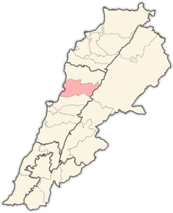
 Kfardebian Location in Lebanon | |
| Coordinates: 34°1′30″N 35°38′1″E / 34.02500°N 35.63361°ECoordinates: 34°1′30″N 35°38′1″E / 34.02500°N 35.63361°E | |
| Country |
|
| Governorate | Mount Lebanon |
| District | Keserwan |
| Area | |
| • Total | 29.6 km2 (11.4 sq mi) |
| Elevation | 1,220 m (4,000 ft) |
| Time zone | UTC+2 (EET) |
| • Summer (DST) | UTC+3 (EEST) |
| Dialing code | +961 |
Kfar Dibiane (Arabic: كفر دبيان; also spelled Kfardebian and also known as Moucha'a Keserwan) is a municipality in the Keserwan District of the Mount Lebanon Governorate in Lebanon. It is located 45 kilometers north of Beirut. Its average elevation is 1,220 meters above sea level and its total land area is 2,960 hectares.[1] Kfardebian inhabitants are predominantly Melkite and Maronite Christians.[2]
Kfardebian gathers the best skiing resorts in the Middle East named Mzaar Kfardebian & Faqra Kfardebian, as well as many historical and touristic sites.
References
- ↑ "Kfar Dibiane". Localiban. Localiban. 2008-01-21. Retrieved 2016-03-29.
- ↑ "Elections municipales et ikhtiariah au Mont-Liban" (PDF). Localiban. Localiban. 2010. p. 19. Archived from the original (pdf) on 2015-07-24. Retrieved 2016-02-12.
This article is issued from
Wikipedia.
The text is licensed under Creative Commons - Attribution - Sharealike.
Additional terms may apply for the media files.