Altıntaş, Midyat
| Altıntaş ܟܝܦܝܪܙܝ | |
|---|---|
| Village | |
 Altıntaş Location in Turkey | |
| Coordinates: 37°26′38″N 41°31′37″E / 37.444°N 41.527°E | |
| Country |
|
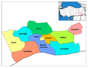
| Province | Mardin Province |
| District | Midyat |
| Population (2013) | |
| • Total | 275 |
Altıntaş (Classical Syriac: ܟܝܦܝܪܙܝ: Keferze, Kefr Zek, Kefr Zeh, or Kfarze, Kurdish: Kevirzê) is a village in Mardin Province in southeastern Turkey. It is located in the district of Midyat and the historical region of Tur Abdin.
Etymology
The Turkish name of the village comprises two words, "altın" ("gold" in Turkish) and "taş" ("stone" in Turkish), therefore Altıntaş translates to "gold stone".[1]
History
The Church of Mor Izozoel in Keferze was likely constructed in the late 7th century AD.[2] The village is first mentioned in 935 AD, and was looted by Yazidis and Kurds in c. 1413. Keferze was attacked in 1855 by Prince Asdin Schin Buqtoyo and resulted in the death of many Christians. Gertrude Bell travelled through the village in c. 1900.
In 1914, Keferze was inhabited by approximately 160 Syriac Orthodox Christian families and 70 Muslim families.[3] During the Assyrian Genocide, the majority of the Christian population of the village was expelled or killed. Part of the nave vault of the Church of Mor Izozoel collapsed during the First World War or immediately after, and was restored in 1936.[1]
Kurds of Keferze belong to the Dermemikan clan, and the village acts as the centre of the tribe.[4] The Kurdish poet Şivan Perwer is a descendant of the Muslim population of Keferze.[4] In 2005, the village was populated by 12 Syriac Orthodox Christian families and 35-40 Kurdish families.[5] The Syriac Orthodox Christian population of Keferze speak Turoyo.
References
Bibliography
- Csató, Éva Ágnes; Isaksson, Bo; Jahani, Carina (2005). Linguistic Convergence and Areal Diffusion: Case Studies from Iranian, Semitic and Turkic. Psychology Press.
- Gaunt, David; Bet̲-Şawoce, Jan; Donef, Racho (2006). Massacres, Resistance, Protectors: Muslim-Christian Relations in Eastern Anatolia During World War I. Gorgias Press.
- Sinclair, T.A. (1989). Eastern Turkey: An Architectural & Archaeological Survey, Volume III. Pindar Press.
| Wikimedia Commons has media related to Altıntaş, Midyat. |
Coordinates: 37°26′38″N 41°31′37″E / 37.444°N 41.527°E