Karpuzlu
| Karpuzlu | |
|---|---|
 Karpuzlu | |
| Coordinates: 37°33′33″N 27°50′04″E / 37.55917°N 27.83444°ECoordinates: 37°33′33″N 27°50′04″E / 37.55917°N 27.83444°E | |
| Country | Turkey |
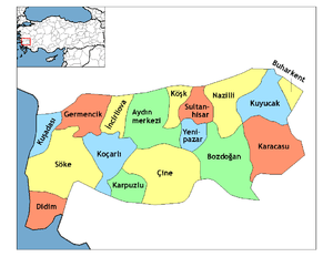
| Province | Aydın |
| District | Karpuzlu |
| Government | |
| • Mayor | Hilmi Dönmez (MHP) |
| • Kaymakam | Mehmet Öztürk |
| Area[1] | |
| • District | 252.53 km2 (97.50 sq mi) |
| Population (2012)[2] | |
| • Urban | 2,072 |
| • District | 11,817 |
| • District density | 47/km2 (120/sq mi) |
| Post code | 09540 |
| Website | www.karpuzlu.bel.tr |
Karpuzlu is a town and district of Aydın Province, in the Aegean region of Turkey, 56 km (35 mi) from the city of Aydın. It became a district centre after separation from Çine one in 1990.
Karpuzlu is reached by turning off the road from Aydın to Çine. There is infrequent public transport (by minibus) from both towns to Karpuzlu, which can also be reached by the mountain road from Bodrum or Milas. This latter route is popular with tourists on "jeep safaris" coming to see the ruins of Alinda.
The town is partially situated on the slopes of a hill on the top of which can be seen the well-preserved ruins of the ancient acropolis of Alinda.
The modern district of Karpuzlu covers part of the Çine plain that is part of the southern reaches of the fertile Menderes River (Meander) valley. The main crops are cotton, corn and many other grains and vegetables.
Karpuzlu itself is a very small town of 2,300 people.
See also
References
- ↑ "Area of regions (including lakes), km²". Regional Statistics Database. Turkish Statistical Institute. 2002. Retrieved 2013-03-05.
- ↑ "Population of province/district centers and towns/villages by districts - 2012". Address Based Population Registration System (ABPRS) Database. Turkish Statistical Institute. Retrieved 2013-02-27.