Karapınar
| Karapınar | |
|---|---|
| District | |
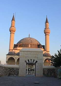 Selimiye Külliyesi; Sultan Selim Mosque of 1563 | |
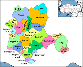 Location of Karapınar within Turkey. | |
 Karapınar Location of Karapınar within Turkey. | |
| Coordinates: 37°43′N 33°33′E / 37.717°N 33.550°E | |
| Country |
|
| Province | Konya |
| Government | |
| • Mayor | Mehmet Mugayıtoğlu (AKP) |
| Area[1] | |
| • District | 2,115.95 km2 (816.97 sq mi) |
| Elevation | 987 m (3,238 ft) |
| Population (2012)[2] | |
| • Urban | 32,734 |
| • District | 48,176 |
| • District density | 23/km2 (59/sq mi) |
| Time zone | UTC+2 (EET) |
| • Summer (DST) | UTC+3 (EEST) |
| Postal code | 42xxx |
| Area code(s) | 0332 |
| Licence plate | 42 |
| Website | www.karapinar.gov.tr |
Karapınar is a town and district of Konya Province in the Central Anatolia region of Turkey. According to 2000 census, population of the district is 55,734 of which 35,285 live in the town of Karapınar.[3][4] Volcanic Karapınar Field is located nearby.
See also
Notes
- ↑ "Area of regions (including lakes), km²". Regional Statistics Database. Turkish Statistical Institute. 2002. Retrieved 2013-03-05.
- ↑ "Population of province/district centers and towns/villages by districts - 2012". Address Based Population Registration System (ABPRS) Database. Turkish Statistical Institute. Retrieved 2013-02-27.
- ↑ Turkish Statistical Institute. "Census 2000, Key statistics for urban areas of Turkey" (in Turkish). Archived from the original (XLS) on 2007-09-27. Retrieved 2008-03-24.
- ↑ GeoHive. "Statistical information on Turkey's administrative units". Archived from the original on 2007-10-19. Retrieved 2008-03-24.
References
- Falling Rain Genomics, Inc. "Geographical information on Karapınar, Turkey". Retrieved 2008-03-24.
External links
- District governor's official website (in Turkish)
- District municipality's official website (in Turkish)
| Wikimedia Commons has media related to Karapınar. |
.jpeg)
Karapinar rug, probably 18th century. Sold for £31,250 ($41,090), 2017
Coordinates: 37°42′53″N 33°33′03″E / 37.71472°N 33.55083°E
This article is issued from
Wikipedia.
The text is licensed under Creative Commons - Attribution - Sharealike.
Additional terms may apply for the media files.