Jonesboro, Indiana
| City of Jonesboro, Indiana | |
|---|---|
| City | |
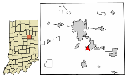 Location of Jonesboro in Grant County, Indiana. | |
| Coordinates: 40°28′46″N 85°37′46″W / 40.47944°N 85.62944°WCoordinates: 40°28′46″N 85°37′46″W / 40.47944°N 85.62944°W | |
| Country | United States |
| State | Indiana |
| County | Grant |
| Government | |
| • Mayor | Bob McNutt (R) |
| Area[1] | |
| • Total | 0.89 sq mi (2.31 km2) |
| • Land | 0.89 sq mi (2.31 km2) |
| • Water | 0.00 sq mi (0.00 km2) |
| Elevation | 853 ft (260 m) |
| Population (2010)[2] | |
| • Total | 1,756 |
| • Estimate (2016)[3] | 1,665 |
| • Density | 1,868.69/sq mi (721.76/km2) |
| Time zone | UTC-5 (EST) |
| • Summer (DST) | UTC-4 (EDT) |
| ZIP code | 46938 |
| Area code(s) | 765 |
| FIPS code | 18-38862[4] |
| GNIS feature ID | 0437105[5] |
| Website | http://jonesboroindiana.net/ |
Jonesboro is a city in Grant County, Indiana, United States, located along the Mississinewa River opposite Gas City. The population was 1,756 at the 2010 census.
History
Jonesboro was established in 1837 by Obadiah Jones, and named for him.[6]
Geography
Jonesboro is located at 40°28′46″N 85°37′47″W / 40.47944°N 85.62972°W (40.479340, -85.629847).[7]
According to the 2010 census, Jonesboro has a total area of 0.89 square miles (2.31 km2), all land.[8]
Demographics
| Historical population | |||
|---|---|---|---|
| Census | Pop. | %± | |
| 1850 | 288 | — | |
| 1860 | 454 | 57.6% | |
| 1870 | 581 | 28.0% | |
| 1880 | 729 | 25.5% | |
| 1890 | 687 | −5.8% | |
| 1900 | 1,838 | 167.5% | |
| 1910 | 1,573 | −14.4% | |
| 1920 | 1,429 | −9.2% | |
| 1930 | 1,496 | 4.7% | |
| 1940 | 1,791 | 19.7% | |
| 1950 | 1,973 | 10.2% | |
| 1960 | 2,260 | 14.5% | |
| 1970 | 2,466 | 9.1% | |
| 1980 | 2,279 | −7.6% | |
| 1990 | 2,073 | −9.0% | |
| 2000 | 1,887 | −9.0% | |
| 2010 | 1,756 | −6.9% | |
| Est. 2016 | 1,665 | [3] | −5.2% |
| U.S. Decennial Census[9] | |||
2010 census
As of the census[2] of 2010, there were 1,756 people, 684 households, and 486 families residing in the city. The population density was 1,973.0 inhabitants per square mile (761.8/km2). There were 770 housing units at an average density of 865.2 per square mile (334.1/km2). The racial makeup of the city was 97.7% White, 0.1% African American, 0.5% Native American, 0.6% from other races, and 1.2% from two or more races. Hispanic or Latino of any race were 2.4% of the population.
There were 684 households of which 34.9% had children under the age of 18 living with them, 49.6% were married couples living together, 14.9% had a female householder with no husband present, 6.6% had a male householder with no wife present, and 28.9% were non-families. 23.8% of all households were made up of individuals and 9.2% had someone living alone who was 65 years of age or older. The average household size was 2.57 and the average family size was 2.94.
The median age in the city was 39 years. 25.8% of residents were under the age of 18; 8.2% were between the ages of 18 and 24; 24.4% were from 25 to 44; 26.9% were from 45 to 64; and 14.9% were 65 years of age or older. The gender makeup of the city was 48.5% male and 51.5% female.
2000 census
As of the census[4] of 2000, there were 1,887 people, 768 households, and 545 families residing in the city. The population density was 2,221.8 people per square mile (857.1/km²). There were 817 housing units at an average density of 961.9 per square mile (371.1/km²). The racial makeup of the city was 97.51% White, 0.16% African American, 0.26% Native American, 0.05% Asian, 1.01% from other races, and 1.01% from two or more races. Hispanic or Latino of any race were 1.75% of the population.
There were 768 households out of which 32.4% had children under the age of 18 living with them, 54.6% were married couples living together, 12.8% had a female householder with no husband present, and 29.0% were non-families. 25.0% of all households were made up of individuals and 8.2% had someone living alone who was 65 years of age or older. The average household size was 2.46 and the average family size was 2.91.
In the city, the population was spread out with 25.4% under the age of 18, 7.6% from 18 to 24, 29.4% from 25 to 44, 24.3% from 45 to 64, and 13.3% who were 65 years of age or older. The median age was 37 years. For every 100 females, there were 90.2 males. For every 100 females age 18 and over, there were 90.1 males.
The median income for a household in the city was $36,974, and the median income for a family was $42,036. Males had a median income of $33,611 versus $21,042 for females. The per capita income for the city was $16,723. About 4.1% of families and 6.5% of the population were below the poverty line, including 6.2% of those under age 18 and 5.6% of those age 65 or over.
Education
The city has a lending library, the Jonesboro Public Library.[10]
Notable person
Harry Knight, Indy car driver
References
- ↑ "2016 U.S. Gazetteer Files". United States Census Bureau. Retrieved Jul 28, 2017.
- 1 2 "American FactFinder". United States Census Bureau. Retrieved 2012-12-11.
- 1 2 "Population and Housing Unit Estimates". Retrieved June 9, 2017.
- 1 2 "American FactFinder". United States Census Bureau. Retrieved 2008-01-31.
- ↑ "US Board on Geographic Names". United States Geological Survey. 2007-10-25. Retrieved 2008-01-31.
- ↑ Couch, Ernie (25 October 2000). Indiana Trivia. Thomas Nelson Inc. p. 27. ISBN 978-1-4185-7362-1.
- ↑ "US Gazetteer files: 2010, 2000, and 1990". United States Census Bureau. 2011-02-12. Retrieved 2011-04-23.
- ↑ "G001 - Geographic Identifiers - 2010 Census Summary File 1". United States Census Bureau. Retrieved 2015-07-28.
- ↑ "Census of Population and Housing". Census.gov. Archived from the original on May 12, 2015. Retrieved June 4, 2015.
- ↑ "Indiana public library directory" (PDF). Indiana State Library. Retrieved 7 March 2018.
External links
Municipalities and communities of Grant County, Indiana, United States | ||
|---|---|---|
| Cities | ||
| Towns | ||
| Townships | ||
| CDPs | ||
| Unincorporated communities | ||
| Footnotes | ‡This populated place also has portions in an adjacent county or counties | |