Mier, Indiana
| Mier, Indiana | |
|---|---|
| Census-designated place | |
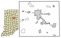 Location of Mier in Grant County, Indiana. | |
 Mier Location of Mier in Grant County, Indiana.  Mier Mier (the US) | |
| Coordinates: 40°34′31″N 85°49′24″W / 40.57528°N 85.82333°WCoordinates: 40°34′31″N 85°49′24″W / 40.57528°N 85.82333°W | |
| Country | United States |
| State | Indiana |
| County | Grant |
| Township | Richland |
| Area | |
| • Total | 0.2 sq mi (0.6 km2) |
| • Land | 0.2 sq mi (0.6 km2) |
| • Water | 0.0 sq mi (0.0 km2) |
| Elevation | 820 ft (250 m) |
| Population (2010) | |
| • Total | 78 |
| • Density | 326/sq mi (125.9/km2) |
| FIPS code | 18-49212[1] |
| GNIS feature ID | 439130[2] |
Mier is an unincorporated community and census-designated place (CDP) in Richland Township, Grant County, Indiana, in the United States.[2] As of the 2010 census it had a population of 78.[1]
History
The community was named after Ciudad Mier, in Mexico.[3] A post office was established at Mier in 1849, and remained in operation until it was discontinued in 1928.[4]
Geography
Mier is located in northwestern Grant County, crossed by State Roads 13, 18, and 19. State Road 18 leads east 3 miles (5 km) to Sweetser and west 2.5 miles (4.0 km) to Converse, while State Road 13 leads north 6.5 miles (10.5 km) to Somerset and south 4.5 miles (7.2 km) to Swayzee. State Road 19 follows State Road 13 south from Mier and State Road 18 west from it. Marion, the Grant County seat, is 9 miles (14 km) to the east via State Road 18.
According to the U.S. Census Bureau, the Mier CDP has an area of 0.23 square miles (0.6 km2), all of it land.[1]
Demographics
| Historical population | |||
|---|---|---|---|
| Census | Pop. | %± | |
| U.S. Decennial Census[5] | |||
References
- 1 2 3 "Geographic Identifiers: 2010 Demographic Profile Data (G001): Mier CDP, Indiana". American Factfinder. U.S. Census Bureau. Retrieved December 5, 2016.
- 1 2 U.S. Geological Survey Geographic Names Information System: Mier, Indiana
- ↑ Baker, Ronald L. (October 1995). From Needmore to Prosperity: Hoosier Place Names in Folklore and History. Indiana University Press. p. 219. ISBN 978-0-253-32866-3.
...and named for Mier, Mexico...
- ↑ "Grant County". Jim Forte Postal History. Retrieved 12 September 2014.
- ↑ "Census of Population and Housing". Census.gov. Retrieved June 4, 2016.
Municipalities and communities of Grant County, Indiana, United States | ||
|---|---|---|
| Cities | ||
| Towns | ||
| Townships | ||
| CDPs | ||
| Unincorporated communities | ||
| Footnotes | ‡This populated place also has portions in an adjacent county or counties | |