Van Buren Township, Grant County, Indiana
| Van Buren Township | |
|---|---|
| Township | |
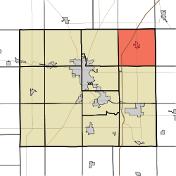 Location of Van Buren Township in Grant County | |
| Coordinates: 40°36′31″N 85°30′17″W / 40.60861°N 85.50472°WCoordinates: 40°36′31″N 85°30′17″W / 40.60861°N 85.50472°W | |
| Country | United States |
| State | Indiana |
| County | Grant |
| Government | |
| • Type | Indiana township |
| Area | |
| • Total | 35.51 sq mi (92.0 km2) |
| • Land | 35.48 sq mi (91.9 km2) |
| • Water | 0.03 sq mi (0.08 km2) 0.08% |
| Elevation | 843 ft (257 m) |
| Population (2010) | |
| • Total | 1,934 |
| • Density | 54.5/sq mi (21.0/km2) |
| GNIS feature ID | 0453946 |
Van Buren Township is one of thirteen townships in Grant County, Indiana, United States. As of the 2010 census, its population was 1,934 and it contained 838 housing units.[1]
Geography
According to the 2010 census, the township has a total area of 35.51 square miles (92.0 km2), of which 35.48 square miles (91.9 km2) (or 99.92%) is land and 0.03 square miles (0.078 km2) (or 0.08%) is water.[1] The streams of Brushy Run, Little Black Creek and Roods Run run through this township.
Cities and towns
Unincorporated towns
- Doyle Ferguson
- Farrville
(This list is based on USGS data and may include former settlements.)
Adjacent townships
- Jefferson Township, Huntington County (north)
- Salamonie Township, Huntington County (northeast)
- Jackson Township, Wells County (east)
- Washington Township, Blackford County (southeast)
- Monroe Township (south)
- Center Township (southwest)
- Washington Township (west)
- Wayne Township, Huntington County (northwest)
Cemeteries
The township contains six cemeteries: Cory, Doyle, Farrville, Landess, Lee and Masonic.
Major highways
Education
Van Buren Township residents may obtain a free library card from the Van Buren Public Library in Van Buren.[2]
References
- 1 2 "Population, Housing Units, Area, and Density: 2010 - County -- County Subdivision and Place -- 2010 Census Summary File 1". United States Census. Retrieved 2013-05-10.
- ↑ "Sign Up for a Library Card". Van Buren Public Library. Retrieved 7 March 2018.
External links
Municipalities and communities of Grant County, Indiana, United States | ||
|---|---|---|
| Cities | ||
| Towns | ||
| Townships | ||
| CDPs | ||
| Unincorporated communities | ||
| Footnotes | ‡This populated place also has portions in an adjacent county or counties | |
This article is issued from
Wikipedia.
The text is licensed under Creative Commons - Attribution - Sharealike.
Additional terms may apply for the media files.