Sims, Indiana
| Sims, Indiana | |
|---|---|
| Census-designated place | |
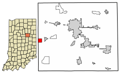 Location of Sims in Grant County, Indiana. | |
 Sims Location of Sims in Grant County, Indiana.  Sims Sims (the US) | |
| Coordinates: 40°29′59″N 85°51′19″W / 40.49972°N 85.85528°WCoordinates: 40°29′59″N 85°51′19″W / 40.49972°N 85.85528°W | |
| Country | United States |
| State | Indiana |
| County | Grant |
| Township | Sims |
| Area | |
| • Total | 1.0 sq mi (2.6 km2) |
| • Land | 1.0 sq mi (2.6 km2) |
| • Water | 0.0 sq mi (0.0 km2) |
| Elevation[1] | 860 ft (260 m) |
| Population (2010) | |
| • Total | 156 |
| • Density | 156/sq mi (60.4/km2) |
| ZIP code | 46986 |
| FIPS code | 18-69894[2] |
| GNIS feature ID | 443539 |
Sims is an unincorporated community and census-designated place (CDP) in Sims Township, Grant County, Indiana. In 2010 it had a population of 156.[3]
History
The community took its name from Sims Township.[4] A post office was established at Sims in 1881, and remained in operation until it was discontinued in 1992.[5]
Geography
Sims is located at 40°29′59″N 85°51′19″W / 40.49972°N 85.85528°W near the western border of Grant County. It is 2 miles (3 km) west of Swayzee and 13 miles (21 km) southwest of Marion, the county seat. A rail line operated by the Central Railroad Company of Indianapolis passes along the north side of town.
According to the U.S. Census Bureau, the Sims CDP has a total area of 1.0 square mile (2.6 km2), all of it land.[3]
Demographics
| Historical population | |||
|---|---|---|---|
| Census | Pop. | %± | |
| U.S. Decennial Census[6] | |||
References
- ↑ "US Board on Geographic Names". United States Geological Survey. 2007-10-25. Retrieved 2008-01-31.
- ↑ "American FactFinder". United States Census Bureau. Retrieved 2008-01-31.
- 1 2 "Geographic Identifiers: 2010 Demographic Profile Data (G001): Sims CDP, Indiana". American Factfinder. U.S. Census Bureau. Retrieved December 5, 2016.
- ↑ Baker, Ronald L. (October 1995). From Needmore to Prosperity: Hoosier Place Names in Folklore and History. Indiana University Press. p. 302. ISBN 978-0-253-32866-3.
...named for Sims Township, in which it is located...
- ↑ "Grant County". Jim Forte Postal History. Retrieved 12 September 2014.
- ↑ "Census of Population and Housing". Census.gov. Retrieved June 4, 2016.
Municipalities and communities of Grant County, Indiana, United States | ||
|---|---|---|
| Cities | ||
| Towns | ||
| Townships | ||
| CDPs | ||
| Unincorporated communities | ||
| Footnotes | ‡This populated place also has portions in an adjacent county or counties | |
This article is issued from
Wikipedia.
The text is licensed under Creative Commons - Attribution - Sharealike.
Additional terms may apply for the media files.