Jiuzhaigou County
| Jiuzhaigou County 九寨沟县 · གཟི་རྩ་སྡེ་དགུ་རྫོང་། | |
|---|---|
| County | |
.png) Location of Jiuzhaigou County (light red) in Aba (yellow) and Sichuan (light gray) | |
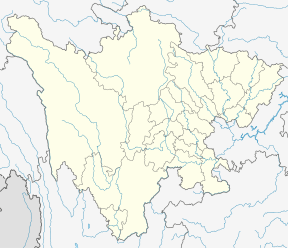 Jiuzhaigou Location of the seat in Sichuan | |
| Coordinates: 33°16′N 104°14′E / 33.267°N 104.233°ECoordinates: 33°16′N 104°14′E / 33.267°N 104.233°E | |
| Country | People's Republic of China |
| Province | Sichuan |
| Autonomous prefecture | Ngawa Tibetan and Qiang Autonomous Prefecture |
| Area | |
| • Total | 5,286 km2 (2,041 sq mi) |
| Elevation[1] (County seat) | 1,400 m (4,600 ft) |
| Population (2015)[2] | 67,519 |
| Time zone | UTC+8 (China Standard) |
| Postal code | 623400 |
| Website |
www |
Jiuzhaigou County (simplified Chinese: 九寨沟县; traditional Chinese: 九寨溝縣; pinyin: Jiǔzhàigōu Xiàn; Tibetan: གཟི་རྩ་སྡེ་དགུ་རྫོང་།, Wylie: gZi rtsa sde dgu rDzong, ZYPY: Sirza Degu Zong ) is a county of Sichuan Province, China. It is under the administration of the Ngawa Tibetan and Qiang Autonomous Prefecture.[3] Formerly called Nanping County (南坪县; Nánpíng Xiàn), it was renamed in 1998 to reflect the fact that the Jiuzhaigou Valley is located within its administration.[4] The county seat, Nanping Town, was created in 2013 by the merger of Yongle Town (永乐镇), Yongfeng Township (永丰乡), and Anle Township (安乐乡).[5]
The county consists of nine villages in a valley in Sichuan Province. The main ethnic group in the county is Han, with the second being Tibetan. The county seat has an altitude of about 1,400 m (4,600 ft).[1] It has a total area of 2,041 square miles (5,286 km2).[2] As of 2015, the county's total population was 67,519.[2]
Administrative divisions
Jizhagou County contains two towns and thirteen townships:
- Nanping Town (南坪镇)
- Zhangzha Town (漳扎镇)
- Yonghe Township (永和乡)
- Baihe Township (白河乡)
- Lingjiang Township (陵江乡)
- Heihe Township (黑河乡)
- Yuwa Township (玉瓦乡)
- Dalu Township (大录乡)
- Shuanghe Township (双河乡)
- Baohua Township (保华乡)
- Luoyi Township (罗依乡)
- Wujue Township (勿角乡)
- Majia Township (马家乡)
- Guoyuan Township (郭元乡)
- Caodi Township (草地乡)
Climate
| Climate data for Jiuzhaigou (1981−2010) | |||||||||||||
|---|---|---|---|---|---|---|---|---|---|---|---|---|---|
| Month | Jan | Feb | Mar | Apr | May | Jun | Jul | Aug | Sep | Oct | Nov | Dec | Year |
| Record high °C (°F) | 17.9 (64.2) |
24.0 (75.2) |
31.2 (88.2) |
34.1 (93.4) |
34.9 (94.8) |
35.8 (96.4) |
37.5 (99.5) |
37.4 (99.3) |
35.7 (96.3) |
27.7 (81.9) |
23.7 (74.7) |
19.6 (67.3) |
37.5 (99.5) |
| Average high °C (°F) | 8.0 (46.4) |
10.6 (51.1) |
15.2 (59.4) |
20.5 (68.9) |
24.3 (75.7) |
26.7 (80.1) |
29.0 (84.2) |
28.1 (82.6) |
23.5 (74.3) |
18.6 (65.5) |
14.5 (58.1) |
9.3 (48.7) |
19 (66.3) |
| Daily mean °C (°F) | 2.5 (36.5) |
5.2 (41.4) |
9.2 (48.6) |
13.9 (57) |
17.5 (63.5) |
20.2 (68.4) |
22.7 (72.9) |
22.0 (71.6) |
18.1 (64.6) |
13.5 (56.3) |
8.5 (47.3) |
3.4 (38.1) |
13.1 (55.5) |
| Average low °C (°F) | −2 (28) |
0.9 (33.6) |
4.6 (40.3) |
8.7 (47.7) |
12.4 (54.3) |
15.5 (59.9) |
18.0 (64.4) |
17.5 (63.5) |
14.3 (57.7) |
9.8 (49.6) |
4.0 (39.2) |
−1.3 (29.7) |
8.5 (47.3) |
| Record low °C (°F) | −8.5 (16.7) |
−7.1 (19.2) |
−6.7 (19.9) |
0.2 (32.4) |
3.7 (38.7) |
8.4 (47.1) |
10.3 (50.5) |
8.9 (48) |
5.9 (42.6) |
−1.5 (29.3) |
−3.7 (25.3) |
−8.6 (16.5) |
−8.6 (16.5) |
| Average precipitation mm (inches) | 2.0 (0.079) |
3.6 (0.142) |
18.6 (0.732) |
46.0 (1.811) |
79.1 (3.114) |
82.6 (3.252) |
78.9 (3.106) |
90.3 (3.555) |
76.7 (3.02) |
54.2 (2.134) |
8.2 (0.323) |
0.7 (0.028) |
540.9 (21.296) |
| Average relative humidity (%) | 55 | 55 | 58 | 61 | 65 | 69 | 70 | 71 | 74 | 73 | 64 | 57 | 64 |
| Source: China Meteorological Data Service Center | |||||||||||||
References
- 1 2 九寨沟县情概况 [Jiuzhaigou County profiles]. Aba Government (in Chinese). Archived from the original on 2017-08-12. Retrieved 2017-08-11.
- 1 2 3 九寨沟县概况 [Jiuzhaigou County Profiles]. Jiuzhaigou County Government (in Chinese). Jiuzhaigou County Government Office. 2015. Archived from the original on 2017-08-12. Retrieved 2017-08-12.
- ↑ 2016年统计用区划代码 [Statistical zoning code, 2016 (Ngawa Tibetan and Qiang Autonomous Prefecture)]. National Bureau of Statistics of the People's Republic of China (in Chinese). National Bureau of Statistics of the People's Republic of China. 2016. Archived from the original on 2017-08-12. Retrieved 2017-08-11.
- ↑ Guo, Zhen, ed. (2007-03-23). 一九九七年全国省级行政区一览 [List of National Administrative Regions in 1997]. State Council of the People's Republic of China (in Chinese). XZQH (行政区划网). Archived from the original on 2017-08-12. Retrieved 2017-08-12.
- ↑ 2013年中华人民共和国县以下行政区划变更情况(12月份) [Changes in administrative divisions below county level in China, Dec. 2013]. Ministry of Civil Affairs of the People's Republic of China (in Chinese). 2014-02-24. Archived from the original on 2017-08-12. Retrieved 2017-08-12.
External links