Daocheng County
| Daocheng County 稻城县 · འདབ་པ་ | |
|---|---|
| County | |
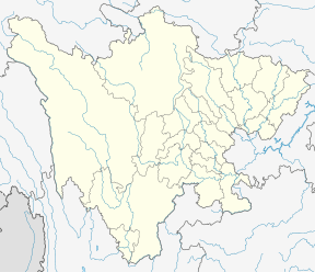 Daocheng Location of in Sichuan | |
| Coordinates: 28°46′N 100°19′E / 28.767°N 100.317°E | |
| Country | People's Republic of China |
| Province | Sichuan |
| Autonomous prefecture | Garzê |
| Township-level divisions |
2 towns 12 townships |
| County seat | Jinzhu |
| Area | |
| • Total | 7,323 km2 (2,827 sq mi) |
| Elevation | 3,753 m (12,313 ft) |
| Population (2006) | 30,000 |
| Time zone | UTC+8 (China Standard) |
Daocheng County or Dapba in Tibetan (Tibetan: འདབ་པ་རྫོང།, ZYPY: Dabba Zong ; simplified Chinese: 稻城县; traditional Chinese: 稻城縣; pinyin: Dàochéng Xiàn), historically Daoba (稻坝; 稻壩; Dàobà), is a county of western Sichuan Province, China, located in the eastern Hengduan Mountains. It is under the administration of the Garzê Tibetan Autonomous Prefecture with an overwhelmingly Tibetan population. Its latitude ranges from 27° 58' to 29° 30' N and longitude 99° 56' to 100° 36', and reaches 174 kilometres (108 mi) in north-south extent and 63 km (39 mi) in east-west width, with elevations ranging from 2,000 to 6,032 m (6,562 to 19,790 ft).
History
The explorer Joseph Rock departed from Lijiang in 1928 and visited Daocheng.[1]
After the fall of Qing Dynasty, Xiangcheng and Daocheng fell into chaos. Daocheng was controlled by local chiefs (土头,; tǔtóu) centered in Daoba and the Kongkaling (贡嘎岭,; Gònggālĭng) region from 1930s to 1950s.[2]
Climate
| Climate data for Daocheng (1981−2010) | |||||||||||||
|---|---|---|---|---|---|---|---|---|---|---|---|---|---|
| Month | Jan | Feb | Mar | Apr | May | Jun | Jul | Aug | Sep | Oct | Nov | Dec | Year |
| Record high °C (°F) | 18.7 (65.7) |
18.7 (65.7) |
23.5 (74.3) |
23.7 (74.7) |
25.2 (77.4) |
27.0 (80.6) |
27.9 (82.2) |
24.9 (76.8) |
23.8 (74.8) |
21.5 (70.7) |
19.0 (66.2) |
17.2 (63) |
27.9 (82.2) |
| Average high °C (°F) | 6.4 (43.5) |
7.5 (45.5) |
10.3 (50.5) |
13.5 (56.3) |
17.3 (63.1) |
19.5 (67.1) |
18.4 (65.1) |
17.8 (64) |
16.8 (62.2) |
14.4 (57.9) |
10.2 (50.4) |
7.3 (45.1) |
13.3 (55.9) |
| Daily mean °C (°F) | −4.5 (23.9) |
−2.4 (27.7) |
1.3 (34.3) |
5.0 (41) |
9.5 (49.1) |
12.4 (54.3) |
12.3 (54.1) |
11.5 (52.7) |
10.1 (50.2) |
6.0 (42.8) |
0.1 (32.2) |
−3.8 (25.2) |
4.8 (40.6) |
| Average low °C (°F) | −13.2 (8.2) |
−10.6 (12.9) |
−6.2 (20.8) |
−2.3 (27.9) |
2.2 (36) |
6.7 (44.1) |
8.0 (46.4) |
7.4 (45.3) |
5.5 (41.9) |
−0.4 (31.3) |
−7.2 (19) |
−12.1 (10.2) |
−1.8 (28.7) |
| Record low °C (°F) | −26.5 (−15.7) |
−23.6 (−10.5) |
−18.4 (−1.1) |
−10.4 (13.3) |
−6.7 (19.9) |
−1.7 (28.9) |
0.1 (32.2) |
−0.1 (31.8) |
−3.0 (26.6) |
−10.2 (13.6) |
−21.0 (−5.8) |
−27.6 (−17.7) |
−27.6 (−17.7) |
| Average precipitation mm (inches) | 0.8 (0.031) |
1.6 (0.063) |
6.9 (0.272) |
14.4 (0.567) |
33.8 (1.331) |
111.1 (4.374) |
194.8 (7.669) |
160.4 (6.315) |
101.1 (3.98) |
23.4 (0.921) |
5.0 (0.197) |
1.1 (0.043) |
654.4 (25.763) |
| Average relative humidity (%) | 37 | 39 | 44 | 49 | 52 | 63 | 75 | 76 | 73 | 62 | 50 | 41 | 55 |
| Source: China Meteorological Data Service Center | |||||||||||||
References
- ↑ "Archived copy". Archived from the original on 2014-04-10. Retrieved 2014-05-31.
- ↑ "乡城、稻城土头统治的由来及其嬗变" by 秦和平
External links
| Wikivoyage has a travel guide for Daocheng. |
| County-level divisions |  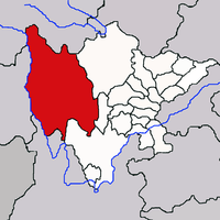 | |
|---|---|---|
| Towns and villages |
| |
| Geography | ||
| Landmarks | ||