Dawu County, Sichuan
| Dawu County 道孚县 · རྟའུ་རྫོང | |
|---|---|
| County | |
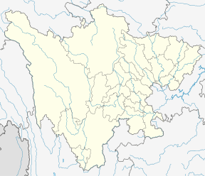 Dawu Location in Sichuan | |
| Coordinates: 30°59′N 101°08′E / 30.983°N 101.133°E | |
| Country | People's Republic of China |
| Province | Sichuan |
| Autonomous prefecture | Garzê |
| Township-level divisions |
2 towns 20 townships |
| County seat | Xianshui (鲜水镇) |
| Area | |
| • Total | 7,546 km2 (2,914 sq mi) |
| Elevation | 2,992 m (9,816 ft) |
| Population (2001) | |
| • Total | 46,900 |
| • Density | 6.2/km2 (16/sq mi) |
| Time zone | UTC+8 (China Standard) |
| Dawu County, Sichuan | |||||||
| Chinese name | |||||||
|---|---|---|---|---|---|---|---|
| Simplified Chinese | 道孚县 | ||||||
| Traditional Chinese | 道孚縣 | ||||||
| |||||||
| Tibetan name | |||||||
| Tibetan | རྟའུ་རྫོང | ||||||
| |||||||
Dawu County (Tibetan: རྟའུ་རྫོང་། ), also written Tawu County or Daofu County (Chinese: 道孚县), is a county of northwestern Sichuan Province, China. It is under the administration of the Garzê Tibetan Autonomous Prefecture, and as of 2001, had a population of 46,900 residing in an area of 7,546 square kilometres (2,914 sq mi). By road it is 219 km (136 mi) from Kangding, the prefectural seat, and 585 km (364 mi) from Chengdu, the provincial capital. It borders the counties of Xinlong to the west, Kangding and Yajiang to the south, and Jinchuan and Zamtang of Ngawa Prefecture as well as Luhuo to the north.
In January 1981 it was struck by an earthquake.
Climate
| Climate data for Dawu (1981−2010) | |||||||||||||
|---|---|---|---|---|---|---|---|---|---|---|---|---|---|
| Month | Jan | Feb | Mar | Apr | May | Jun | Jul | Aug | Sep | Oct | Nov | Dec | Year |
| Record high °C (°F) | 22.4 (72.3) |
25.9 (78.6) |
29.9 (85.8) |
28.8 (83.8) |
31.6 (88.9) |
31.2 (88.2) |
33.4 (92.1) |
30.8 (87.4) |
30.3 (86.5) |
27.5 (81.5) |
22.9 (73.2) |
22.0 (71.6) |
33.4 (92.1) |
| Average high °C (°F) | 10.0 (50) |
12.3 (54.1) |
15.2 (59.4) |
17.9 (64.2) |
21.1 (70) |
22.7 (72.9) |
24.0 (75.2) |
23.8 (74.8) |
21.6 (70.9) |
18.1 (64.6) |
13.7 (56.7) |
10.2 (50.4) |
17.5 (63.6) |
| Daily mean °C (°F) | −1.6 (29.1) |
1.8 (35.2) |
5.6 (42.1) |
9.0 (48.2) |
12.6 (54.7) |
15.0 (59) |
16.1 (61) |
15.7 (60.3) |
13.3 (55.9) |
8.9 (48) |
2.8 (37) |
−1.5 (29.3) |
8.1 (46.7) |
| Average low °C (°F) | −9.6 (14.7) |
−6.3 (20.7) |
−2.1 (28.2) |
1.8 (35.2) |
5.7 (42.3) |
9.5 (49.1) |
10.9 (51.6) |
10.4 (50.7) |
8.2 (46.8) |
3.0 (37.4) |
−4.4 (24.1) |
−9.0 (15.8) |
1.5 (34.7) |
| Record low °C (°F) | −21.7 (−7.1) |
−14.7 (5.5) |
−12.1 (10.2) |
−6.1 (21) |
−3.7 (25.3) |
0.8 (33.4) |
2.1 (35.8) |
1.9 (35.4) |
−1.0 (30.2) |
−6.4 (20.5) |
−12.4 (9.7) |
−24 (−11) |
−24 (−11) |
| Average precipitation mm (inches) | 1.6 (0.063) |
3.2 (0.126) |
11.6 (0.457) |
29.1 (1.146) |
64.2 (2.528) |
135.6 (5.339) |
118.3 (4.657) |
103.2 (4.063) |
104.2 (4.102) |
36.5 (1.437) |
4.8 (0.189) |
1.0 (0.039) |
613.3 (24.146) |
| Average relative humidity (%) | 46 | 44 | 48 | 53 | 58 | 68 | 71 | 70 | 71 | 67 | 57 | 51 | 59 |
| Source: China Meteorological Data Service Center | |||||||||||||
External links
| Wikivoyage has a travel guide for Daofu. |
See this link for a book-length study of a Tibetan village in Dawu County:
| County-level divisions |  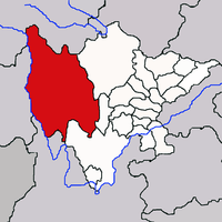 | |
|---|---|---|
| Towns and villages |
| |
| Geography | ||
| Landmarks | ||
This article is issued from
Wikipedia.
The text is licensed under Creative Commons - Attribution - Sharealike.
Additional terms may apply for the media files.