Jijiga
| Jigjiga Jigjiga Laaca | |
|---|---|
| City | |
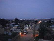
 Main street in Jijiga's Laanta Hawada neighbourhood | |
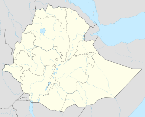 Jigjiga Location within Ethiopia | |
| Coordinates: 9°21′N 42°48′E / 9.350°N 42.800°E | |
| Country |
|
| Region | Somali |
| Zone | Jijiga |
| Government | |
| • President | Mustafa Omar |
| Elevation | 1,609 m (5,279 ft) |
| Population (2015 (projection))[1] | |
| • Total | 798,076 |
| estimated | |
| Time zone | UTC+3 (EAT) |
Jijiga (Somali: Jigjiga; Arabic: جيجيغا) is a city in Somali Region of Ethiopia. it became the capital of the Somali Regional State in 1995 after it was moved from Godey . Located in the Faafan zone with 60 km (37 mi) west of the border with Somalia, the city has an elevation of 1,609 metres above sea level.
Jigjiga and the surrounding lands was traditionally inhabited by the Jidwaaq and Ogaden clans.[2]
History
In the medieval times, Jigjiga was under the Adal Sultanate domain.
Jijiga was mentioned by W.C. Barker in 1842 as one of the mahalla or halting-places of the caravan route between Zeila and Harar.[3]
A British hunter Colonel Swayne passed through Jijiga in February 1893, which he described as a stockaded fort with a garrison of 25 men next to a group of wells.[4] According to I. M. Lewis, Sayyid Mohammed Abdullah Hassan's men invaded Jijiga in March 1900. Although the attackers suffered heavy losses, which allowed the Ethiopian authorities to declare a victory, Sayyid Mohammed's men recovered livestock that the Ethiopians had taken from the Somalis and proved that his was a force to be reckoned with.[5] However, Richard Pankhurst states that Jijiga was founded in 1916 by Fitawrari Tekle Hawariat Tekle Mariyam, who had the town methodically organized in a square grid of streets.[6]
During the Second Italo-Ethiopian War, Jijiga served for some time as Dejazmach Nasibu Emmanual's headquarters and a supply center for the Ethiopian army. An Italian force under Colonel Navarra occupied the city on the evening of 5 May 1936.[7] Two days later, while inspecting a ruined Ethiopian Orthodox church in the city, Marshal Rodolfo Graziani fell into a concealed hole, which he was afterwards convinced was a mantrap; Anthony Mockler suggests this mishap contributed to his murderously paranoid mindset which led to the atrocities that followed the attempt on Graziani's life 19 February 1937.[8]
On 17 March 1941, during the East African Campaign of World War II, Jijiga was occupied by the 23rd Nigerian Brigade of the British 1st African Division. This was after the Italian garrison had already abandoned the city.[9]
Once they had possession of Jijiga, however, the British were slow in returning the city to the Ethiopians. At first, it was included as part of The Reserved Area, as defined in the Anglo-Ethiopian Agreement of 31 January 1942, which also included much of the Haud. Only after patient pressure from Emperor Haile Selassie, in 1948 the two countries began to discuss an agreement for the evacuation of the British from this territory. Although Ethiopian officers began to take over the administration from British officers in May–July, the protocol agreeing to the transfer was not signed until 24 July of that year. A brief demonstration of overt Somali nationalism occurred in Jijiga when the Somali Youth League (SYL) raised their flag before their headquarters in defiance of the law and the new Ethiopian administrators. Major Demeka, the governor-designate of the Ogaden Province, requested the British military administration, which was still in charge, to remove the flag. When the leaders refused to pull down their flag, the police brought it down with a machine gun mounted on an armored car. In the disturbances that followed, one policeman was killed and another wounded while the police opened fire on the crowd and killed 25 of them. The SYL was proscribed shortly afterwards in Ethiopia.[7]
Germame Neway, one of the leaders of the unsuccessful 1960 coup, served as governor over Jijiga in 1959. He had been transferred there for his civic responsibility and concern for the underprivileged while administering a district in Sidamo Province. The obstruction he encountered, not only in Sidamo but in Jijiga, convinced him of the need for radical measures.[10] In the early stage of the Ethiopian Revolution individual units from the Third Division put the local governor under house arrest around 13 April 1974.[7] During the Ogaden War, Jijiga experienced the Battle of Jijiga and was occupied by the Western Somali Liberation Front's Ahmad ibn Ibrihim al-Ghazi division led by Col. Yusuf Dheere, later with the Somali National Army, from September 1977 until February/March 1978.
The Regional government held a conference in this city to promote peace and development between 10–13 March 1996, which was attended by 535 from the local woredas, as well as the Deputy Prime Minister and Defense Minister of Ethiopia, Tamirat Layne, the Foreign Minister, Seyoum Mesfin, the presidents of the Tigray and Harari Regional states and representatives from Amhara and the Southern Nations, Nationalities, and People's Regions.[11] On 28 May 2007, during the celebration of Ginbot 20 (celebrating the downfall of the Derg), Jijiga and Degehabur were the scenes of attacks on civilians and government officials. At least 16 people were killed and 67 injured, including Abdulahi Hassan Mohammed, president of the Somali Region, who was speaking at the ceremony. The Ethiopian government blamed the attack on the Ogaden National Liberation Front.[12]
On 29 May 2008, following a heavy downpour the Jijiga River broke its banks and flooded several kebeles in the town and the vicinity. The flooding killed 29 people and displaced 350 households.[13] On 27 September of that year, a bomb exploded outside a hotel in Jijiga killing four and wounding 20. Local police apprehended a suspect whom they claimed was a member of Al-Itihaad al-Islamiya.[14]
Demographics
Jijiga is mainly inhabited by the Jidwaaq clan. Based on figures from the Central Statistical Agency in 2015, Jijiga has an estimated total population of 250,000 of whom 123,422 are men and 126,578 are women.[15] The current population of this city is 250,000. The 1997 census reported this town had a total population of 65,795 of whom 33,266 were men and 32,529 women. The dominant ethnic group living in the town was Somali (84.0%), the next 3 largest groups were the Amhara (15.0%), the Oromo (0.44%), and the Gurage (1.30%); all other ethnic groups made up 0.08% of the population.[16] This city is the largest settlement in Jijiga woreda.
Climate
The climate of Jijiga is a subtropical highland climate (Köppen climate classification: Cwb). extremely wet and lush during rainy season, as with the rest of the Ethiopian highlands, Seasonal differences relate only to rainfall, as temperatures year round are cool to mild in the mornings and uniformly very warm though not hot during the afternoons.
There are two rainy seasons: the main meher rains occur from July to September, and the short belg rains in April and May. The dry season, known as bega, is cooler by morning than the wet seasons due to lower cloud cover, but equally hot by afternoon though less humid.
| Climate data for Jijiga | |||||||||||||
|---|---|---|---|---|---|---|---|---|---|---|---|---|---|
| Month | Jan | Feb | Mar | Apr | May | Jun | Jul | Aug | Sep | Oct | Nov | Dec | Year |
| Average high °C (°F) | 25.8 (78.4) |
26.7 (80.1) |
28.2 (82.8) |
26.7 (80.1) |
27.3 (81.1) |
26.7 (80.1) |
25.6 (78.1) |
25.9 (78.6) |
26.5 (79.7) |
26.7 (80.1) |
26.2 (79.2) |
25.6 (78.1) |
26.5 (79.7) |
| Daily mean °C (°F) | 16.4 (61.5) |
18.4 (65.1) |
20.3 (68.5) |
20.2 (68.4) |
20.9 (69.6) |
21.1 (70) |
20.5 (68.9) |
20.6 (69.1) |
20.7 (69.3) |
18.9 (66) |
17.4 (63.3) |
16.9 (62.4) |
19.4 (66.8) |
| Average low °C (°F) | 7.1 (44.8) |
10.2 (50.4) |
12.4 (54.3) |
13.7 (56.7) |
14.6 (58.3) |
15.5 (59.9) |
15.5 (59.9) |
15.3 (59.5) |
14.9 (58.8) |
11.2 (52.2) |
8.7 (47.7) |
8.2 (46.8) |
12.3 (54.1) |
| Average rainfall mm (inches) | 11 (0.43) |
25 (0.98) |
47 (1.85) |
105 (4.13) |
93 (3.66) |
56 (2.2) |
84 (3.31) |
127 (5) |
101 (3.98) |
41 (1.61) |
16 (0.63) |
6 (0.24) |
712 (28.02) |
| Average relative humidity (%) | 49.4 | 46.7 | 51.7 | 61.6 | 63.1 | 64.5 | 63.9 | 64.1 | 62.7 | 57.7 | 49.9 | 50.3 | 57.1 |
| Source #1: Climate Data[17] | |||||||||||||
| Source #2: humidity | |||||||||||||
Ecology
Although there is sparse vegetation in the vicinity, there is some history of animal life in the past. For example, the area was earlier a habitat for the African wild dog, Lycaon pictus,[18] although this canid is likely extirpated at present in the local area, due to an expanding human population.
In his memoirs of his homeland, Nega Mezlekia describes Jijiga as sitting "on a vast, unmitigated plain, with vast lush greenery in sight,the soaring Eastern Ethiopian Highlands slowing climbing west, the occasional tall grassland tree used as shelter by the wandering hyena, and the inevitable sacred tree in every compound. The city is surrounded by rocky green tall mountains on all sides save the north, which is open as far as the eye can see."[19]
Notes
- ↑ "Ethiopia Population", World Population, accessed 22 January 2017
- ↑ Asiwaju, "Partitioned Africans: Ethnic Relations Across Africa's International", (1985), p. 173
- ↑ Barker, "Extract Report on the Probable Geographical Position of Harrar; With Some Information Relative to the Various Tribes in the Vicinity", Journal of the Royal Geographical Society, 12 (1842), p. 244
- ↑ H. G. C. Swayne, "A Trip to Harar and Imé", Geographical Journal, 2 (September 1893), p. 251
- ↑ I. M. Lewis, A Modern History of the Somali, fourth edition (Oxford: James Currey, 2002), p. 71.
- ↑ Richard Pankhurst, Economic History of Ethiopia (Addis Ababa: Haile Selassie University, 1968), p. 621
- 1 2 3 "Local History in Ethiopia The Nordic Africa Institute website (accessed 31 May 2008)
- ↑ Anthony Mockler, Haile Selassie's War (New York: Olive Branch, 2003), p. 144
- ↑ Mockler, pp. 365f
- ↑ Bahru Zewde, A History of Modern Ethiopia: 1855-1991, 2nd edition (Oxford: James Currey, 2001), p. 213
- ↑ Report on the Peace and Development Conference Jigjiga, 10-13 March 1996 UNDP Emergencies Unit for Ethiopia report, April 1996 (accessed 26 December 2008)
- ↑ Many killed in Ethiopia attacks (al Jazeera)
- ↑ "Focus On Ethiopia, February 2008", UN-OCHA website (accessed 19 March 2009)
- ↑ "2008 Human Rights Reports: Ethiopia", Bureau of Democracy, Human Rights, and Labor, US State Department (accessed 8 July 2009)
- ↑ CSA 2005 National Statistics Archived 2006-11-23 at the Wayback Machine., Table B.4
- ↑ 1994 Population and Housing Census of Ethiopia: Results for Somali Region, Vol. 1 Archived 2008-11-19 at the Wayback Machine. Tables 2.4, 2.14 (accessed 10 January 2009). The results of the 1994 census in the Somali Region were not satisfactory, so the census was repeated in 1997.
- ↑ "Climate Data : Ethiopia". Retrieved 10 May 2013.
- ↑ C. Michael Hogan. 2009. Painted Hunting Dog: Lycaon pictus, GlobalTwitcher.com, ed. N. Stromberg Archived 2010-12-09 at the Wayback Machine.
- ↑ Nega Mezlekia, Notes from the Hyena's Belly: An Ethiopian Childhood (New York: Picador,2000), p. 5. ISBN 0-312-28914-6
External links
| Wikimedia Commons has media related to Jijiga. |
- Cities of Ethiopia: Jijiga by John Graham (Addis Tribune, 28 December 2001)