Dembidolo
| Dambi dolo Sayo, Saïo | |
|---|---|
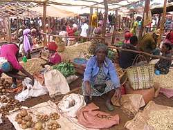 Market of Dembibolo | |
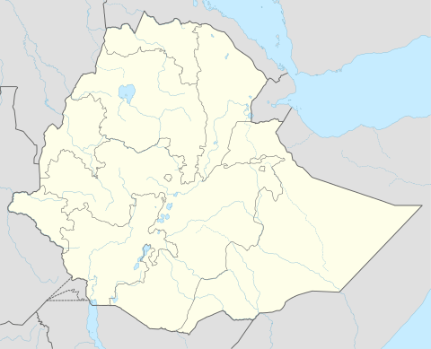 Dambi dolo Location within Ethiopia | |
| Coordinates: 8°32′N 34°48′E / 8.533°N 34.800°ECoordinates: 8°32′N 34°48′E / 8.533°N 34.800°E | |
| Country | Ethiopia |
| Region | Oromia |
| Zone | Kelam Welega Zone |
| Elevation | 1,701 m (5,581 ft) |
| Population (2007) | |
| • Total | 29,448 |
| Time zone | UTC+3 (EAT) |
Dambi Dolo, formerly Sayo or Saïo, is a market town and separate woreda in south-western Ethiopia. It is the capital of Kelam Welega Zone of the Oromia Region. This town has a latitude and longitude of 8°32′N 34°48′E / 8.533°N 34.800°E with an elevation between 1701 and 1827 meters above sea level.
Dambi Dolo is known for goldsmith work and for tej production.[1] The town also possesses an airport (ICAO code HADD, IATA DEM).
History
Originally known as Sayo, after the semi-autonomous kingdom that had ruled in this area in the years after 1900, by 1920 this town served as the seat of the governors of this part of south-western Ethiopia until the Italian conquest.[2] Richard Pankhurst notes that during this period Dembidolo was "a great commercial centre for coffee, where by the 1930's perhaps 500,000 kilos of beans, besides large quantities of wax and skins, were exported every year to the Sudan."[3] Emperor Iyasu V visited Dembidolo around 1912, and was welcomed by Dejazmach Jote.[4]
By 1958 Dambi Dolo became one of 27 places in Ethiopia ranked as First Class Township. That same year, the Commercial Bank of Ethiopia opened a branch in the town.[4]
The last military action of the Oromo Liberation Front (OLF) before the demise of the Derg 1991 occurred at Dembidolo, when some of its units reportedly killed more than 700 government soldiers.[4] Afterwards, the OLF assumed civilian control of Dembidolo and its surrounding territory. However, when the OLF found that their efforts to field candidates in the rest of the Oromia region were frustrated by the Oromo Peoples' Democratic Organization the OLF withdrew from the government in 1992. This proved to be a disaster for the OLF, as EPRDF forces captured Dembidolo and forcibly drove the OLF membership into exile.[5]
Currently a modern water supply system is under construction in the town and will be completed by October 2017.[6]
Demographics
The 2007 national census reported a total population for this town of 29,448, of whom 15,144 were men and 14,304 were women. The majority of the inhabitants were Protestants, with 58.23% reporting that as their religion, while 30.14% observed Ethiopian Orthodox Christianity, 8.81% observed Islam, and 2.07% were Catholic.[7]
The 1994 census reported this town had a total population of 19,587 of whom 9,832 were males and 9,755 were females. It is the largest settlement in Sayo woreda.
Notes
- ↑ As attested, for example, by Matt Philips and Jean-Bernard Carillet, Ethiopia and Eritrea, third edition (n.p.: Lonely Planet, 2006), p.251
- ↑ Donald Donham includes Sayo as one of the "strictly limited" number of local domains that were permitted a degree of independence in return for accepting the rule of Emperor Menelik II. Donham, "The making of an imperial state" in The Southern Marches of Imperial Ethiopia, Donald Donham and Wendy James, editors (Oxford: James Currey, 2002) p. 37
- ↑ Richard Pankhurst, Economic History of Ethiopia (Addis Ababa (Finfinne): Haile Selassie I University, 1968), p. 450
- 1 2 3 "Local History in Ethiopia" (pdf) The Nordic Africa Institute. Retrieved 28 November 2007
- ↑ Political Competition in Oromia, Human Rights Watch. Retrieved 17 March 2009
- ↑ "Ministry Completes 1b Br Worth Water Projects". Retrieved 2017-06-29.
- ↑ 2007 Population and Housing Census of Ethiopia: Results for Oromia Region, Vol. 1 Archived 13 November 2011 at the Wayback Machine., Tables 2.1, 2.5, 3.4 .. Retrieved 13 January 2012