Interstate 15 in California
| ||||
|---|---|---|---|---|
|
SR 15 and I-15 highlighted in red | ||||
| Route information | ||||
| Defined by Streets and Highways Code § 315 | ||||
| Length | 295.37 mi[1][lower-alpha 1] (475.35 km) | |||
| Existed | 1957 – present | |||
| Component highways | ||||
| Major junctions | ||||
| South end |
| |||
| North end |
| |||
| Location | ||||
| Counties | San Diego, Riverside, San Bernardino | |||
| Highway system | ||||
| ||||
.svg.png)
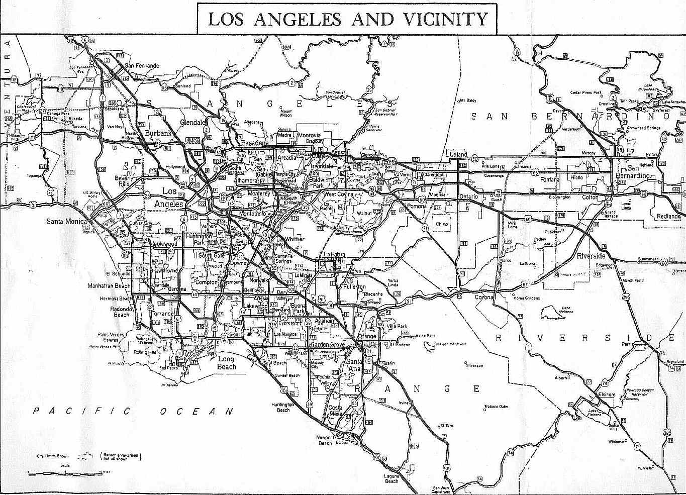
Route 15, consisting of the contiguous segments of State Route 15 (SR 15) and Interstate 15 (I-15), is a major north–south state highway in the U.S. state of California, connecting San Bernardino, Riverside, and San Diego Counties. The route consists of the southernmost 289.24 miles (465.49 km)[2] of I-15, a major Interstate Highway that extends north through Nevada, Arizona, Utah, Idaho, and Montana to the Canada–US border. It is a major thoroughfare for traffic between San Diego and the Inland Empire, as well as between Southern California, Las Vegas, Nevada, and points beyond.
South of its junction at Interstate 8 in San Diego, the highway becomes SR 15, extending 6.13 miles (9.87 km)[1] to Interstate 5, about 12 miles (19 km) from the Mexican border. This segment was initially signed as a state route instead of an Interstate, but it is being upgraded to Interstate standards so it would become part of I-15 in the future. Including this segment, the entire length of Route 15 is 295.37 miles (475.35 km)[1] in California.
Interstate 15 has portions designated as the Escondido Freeway, Avocado Highway, Temecula Valley Freeway, Corona Freeway, Ontario Freeway, Barstow Freeway, CHP Officer Larry L. Wetterling and San Bernardino County Sheriff's Lieutenant Alfred E. Stewart Memorial Highway, or Mojave Freeway.
Route description
I-15 and SR 15 are part of the California Freeway and Expressway System,[3] and are part of the National Highway System,[4] a network of highways that are considered essential to the country's economy, defense, and mobility by the Federal Highway Administration.[5] I-15 from SR 76 to SR 91 and SR 58 to SR 127 is eligible to be included in the State Scenic Highway System,[6] but it is not officially designated as a scenic highway by the California Department of Transportation.[7]
SR 15 begins south of I-5 at 32nd Street near Harbor Drive. After this, SR 15 has an interchange with SR 94,[8] which has been cited as not being up to Interstate standards.[9] The route interchanges with I-805; however, one can only continue in the same direction that they were going at this interchange, since this is the interchange of two north–south freeways, resulting in the overall shape of an "X." Between the Polk Avenue and Orange Avenue overpasses, the freeway goes under a city park that was built on top of the freeway during construction in 2001. Pedestrian bridges were also built at Monroe Avenue and Landis Street to reduce the effects of the freeway geographically dividing the community.[10] Between I-8 and I-805, SR 15 follows the former alignment of 40th Street, which was its former routing as a city street.[8] It continues seamlessly into the southern terminus of I-15 at I-8 in San Diego. On the northbound conversion to I-15 at I-8, there is no "End SR 15" sign.[11]
There are various local names for the highway, such as the Escondido Freeway between San Diego and Escondido. I-15 between SR 163 and Pomerado Road/Miramar Road is known as the Semper Fi Highway in recognition of the nearby Marine Corps Air Station Miramar.[9] I-15 between Scripps Poway Pkwy and Camino Del Norte is known as the Tony Gwynn Memorial Freeway in recognition of Tony Gwynn, also known as Mr. Padre, who played for the San Diego Padres. North of the Escondido city limits, it is known as the Avocado Highway, whose designation ends upon entering Temecula. There are other local names as noted below.
Heading northward, I-15 currently begins at I-8, at the same place that its continuation, SR 15, begins its southward journey. I-15 goes through Mission Valley and intersects with SR 52, before merging with SR 163. After traversing the Marine Corps Air Station Miramar, I-15 comes into Rancho Peñasquitos, where it intersects with the end of SR 56. Northward, the route crosses Lake Hodges inside the upper San Diego city limits. I-15 continues north into Escondido, where it interchanges with SR 78.
North of Escondido, I-15 goes through hilly terrain and farmland, passing under the Lilac Road Bridge and approaching the community of Fallbrook near the SR 76 interchange. It passes the community of Rainbow and then crosses the county line into Riverside County and descends into the Inland Empire. In Temecula, SR 79 runs concurrently with I-15 for 3.2 miles (5 km) before it branches off toward Hemet. In Murrieta, I-15 splits from its first and only spur route in California, I-215, which retains the Escondido Freeway designation and runs through the two largest cities in the Inland Empire, San Bernardino and Riverside. I-15 continues north as the Temecula Valley Freeway.[12]
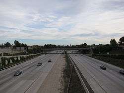
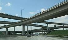
I-15 runs along the eastern edge of the Santa Ana Mountains, passing through the cities of Wildomar and Lake Elsinore. In the city of Lake Elsinore, I-15 intersects SR 74, an important surface route connecting the Coachella Valley with the communities of Idyllwild, Hemet, Perris, Lake Elsinore and San Juan Capistrano. It continues through the suburban areas in the western Inland Empire as the Corona Freeway, passing Corona. During this stretch of the highway, I-15 intersects SR 91, a major east-west highway; the oft-congested interchange serves as an important link from Southwest Riverside County to Orange County. North of SR 91, I-15 continues through the bedroom communities of Norco and Eastvale, while skirting the western edge of the city of Jurupa Valley. I-15 enters San Bernardino County just past its intersection with SR 60, another major east-west highway, which connects I-15 with the city of Ontario and the Chino Valley. I-15 passes through the city of Ontario on its way to I-10, the main east-west artery though Southern California. North of I-10, I-15 passes through the major suburban communities of Rancho Cucamonga and Fontana as the highway intersects SR 210, an east-west highway skirting the San Bernardino Mountain Range. SR 210 connects I-15 to major foothill communities, such as Pasadena, Rialto and San Bernardino. I-15 also crosses old US Route 66 during this stretch of highway, which is signed as SR 66, Foothill Boulevard. At this juncture, I-15 takes a strongly northeastern alignment as it moves to rejoin with its spur route, I-215, in Devore, north of the city of San Bernardino. The highway then rejoins I-215, before heading northwards and upward through the Cajon Pass, an important mountain pass that is the primary route between Southern California and points eastwards and northeastwards.
The portion of I-15 that is located between its northern and southern junctions with I-215 is also used by many local residents as the major north–south route for the western portions of the San Bernardino-Riverside-Ontario metropolitan area. (I-215 serves a similar function in the eastern portion of the metropolitan area. These two highways are the only continuous north–south freeways in the area.)
North of Limonite Avenue (south of SR 60), I-15 is known as the Ontario Freeway. After its merger with I-215 in Devore, I-15 is called the Barstow Freeway or the Mojave Freeway. A short section between SR 138 and Oak Hill Road is also designated as the CHP Officer Larry L. Wetterling and San Bernardino County Sheriff’s Lieutenant Alfred E. Stewart Memorial Highway, named after two officers killed in the line of duty.[13] On this stretch of highway, I-15 northbound splits from I-15 southbound, where the road ascends up a steep grade until it reaches Cajon Summit (elevation 4190 feet) just south of the High Desert communities of Hesperia and Oak Hills. Tractor-trailer trucks headed southbound are required to travel at the posted speed limit of 45 mph or less due to the steep downward grade. The southbound lanes provide a runaway truck ramp as a safety feature. The two halves of the highway rejoin shortly before reaching Cajon Summit.
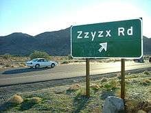
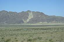
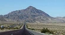
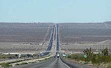
North of the Cajon Pass, I-15 traverses the Mojave Desert towns of Hesperia and Victorville. I-15 passes through desert for 30 miles (48 km) before reaching Barstow, then continues past Zzyzx Road, before reaching the town of Baker. The sign for Zzyzx Road — alphabetically the last place name in the world — is a landmark of sorts on the drive between Los Angeles and Las Vegas. I-15 enters Nevada near the casino town of Primm, formerly known as Stateline, Nevada.

I-15 continues thereafter to Las Vegas, Salt Lake City, and on into Idaho and Montana, before ending at the Canada–US border, where Alberta Highway 4 continues the ribbon of asphalt into Canada. Because it joins with the western end of I-70 in Southwestern Utah, I-15 also forms part of a major east–west corridor connecting Southern California with Denver, St. Louis, and points east.
The Mojave Freeway is fairly busy on weekdays, since it connects the rapidly growing exurbs of the Victor Valley with the Los Angeles area. On weekends and holidays, however, it can sometimes be jammed with Californians driving to Las Vegas for short vacations.[lower-alpha 2]
Express lanes
There are high-occupancy toll lanes in the center of I-15 from SR 163 to SR 78; solo drivers are required to pay a toll using a FasTrak transponder.[14]
The lanes were constructed as reversible carpool lanes in 1988; a decade later, they were converted into express lanes. Between 2004 and 2008, construction extended the lanes north from SR 56 to Del Lago Boulevard just south of Escondido. Then, between 2009 and 2012, work was done to widen the southern reversible segment from two lanes to four, and then extend the corridor north to SR 78. The lanes, dubbed a "highway within a highway," include a movable "zipper" barrier for 16 miles (26 km), which can be changed to create an extra lane as demand allows. In addition, five direct access ramps allow for easier access, as well as access to bus service from MTS Rapid.
Construction is underway to add two tolled express lanes in each direction from Cajalco Road to SR 60. This project is expected to be complete by 2020.[15] A separate project in San Bernardino County would extend the express lanes further north to Duncan Canyon Road.[16]
History
I-15 replaced US 395 between San Diego and Temecula. The highway replaced US 66 between San Bernardino and Barstow. The route north of Barstow replaced US 91.
I-15 was initially planned to run from I-10 in San Bernardino along the current I-215 alignment then up through the Cajon Pass and on to Las Vegas, with a distance of 186.24 miles (299.72 km) within the state. California successfully argued in favor of the addition south to San Diego, suggesting that the freeway would connect the major military bases, the former March AFB (now March ARB) and the former NAS Miramar (now MCAS Miramar). US 395 was then signed TEMP-15 and the "old" I-15 between Devore and San Bernardino became part of modern-day I-215.
On January 24, 1957, the State Highway Commission defined the Escondido Freeway as what are now Routes 15 and 215 from Route 805 to Route 91. This entire segment was previously U.S. Route-395 when it was named. Since then, the definition was extended on Route 15 south to Route 8 by Assembly Concurrent Resolution 34, Chapter 67 in 1979.[17] Meanwhile, the segment of Route 15 from the San Diego County Line to the I-15/I-215 interchange was named the Temecula Valley Freeway in 1990.[18]
The original definition for the Corona Freeway, as named by the State Highway Commission on July 23, 1958, stated that it was "Routes 71, 91, and 15 from Route 10 West of Pomona to Route 215".[19]
This legal definition has been amended twice: First in 1990, the California Assembly passed Concurrent Resolution 125, Chapter 78, renaming I-15 between the San Diego County Line (which is further south from Interstate 215) and Bundy Canyon Road near Lake Elsinore as the Temecula Valley Freeway.[18]
Then in 1993, the California Assembly passed legislation officially designating State Route 71 as a part of the Chino Valley Freeway.[20] However, the name "Corona Freeway" is, confusingly, sometimes still applied to this portion of State Route 71; thus, despite the official change, guide signs on I-10 eastbound and SR 57 southbound at the Kellogg Interchange in Pomona still refer to SR 71 as the "Corona Freeway".
Present SR 15 was signed after the creation of I-15 in 1968. Since I-15's terminus was at I-8, SR 15 was signed mostly along 40th Street and Wabash Boulevard in San Diego to its merge with I-5. The portion between Adams Avenue and Interstate 805 remained a city street for a long time, and this portion was not completed until January 2000. For this reason, the freeway is often referred to as the 40th Street Freeway.[9]
Before the completion of the freeway, from 1968 to 1992, the neighborhood was known for prostitution, drugs, drive-by shootings, and gangs. The indirect cause of all this was due to Caltrans' plans to build a freeway in this area on land where houses were. Because families did not want to live in these houses since they would be soon torn down, they rented them to those who were only going to be in the area on a temporary basis; many of these people were involved in illegal activities. Even though the freeway was officially added to the Caltrans proposals as early as 1968, it was not until March 1992 that construction began. Many in the city opposed the building of this freeway, although some petitioned for the freeway to be built because of the poor conditions in the neighborhood.[21]
State Route 31
In 1933, Interstate 15 was defined as Legislative Route 193, running from pre-1964 Legislative Route 43 (present State Route 91) in Corona to pre-1964 Legislative Route 9 (now State Route 66), and was extended north to pre-1964 Legislative Route 31 (present I-15 and I-215) in 1935.[22] The piece south of U.S. Route 60 (Mission Boulevard), running along North Main Street, Hamner Avenue and Milliken Avenue, was state-maintained by 1955, but was not assigned a signed number.[23] This was still the only existing piece in 1963, and had a planned freeway replacement to the east.[24]
In the 1964 renumbering, the route was assigned as State Route 31. It was added to the Interstate Highway System in February 1972 as a realignment of Interstate 15 (the former alignment became Interstate 15E).[25] Legislative changes were made in 1974, eliminating SR 31 (along with State Route 71 south of Corona) in favor of I-15.[26] However, SR 31 continued to be signed—as temporary Interstate 15—until present I-15 was finished. (A 1986 map shows state maintenance continuing north past SR 60 to Jurupa Street, where it turned east to I-15.[27])
Future
The segment signed as California State Route 15 from Interstate 5 to Interstate 8 in San Diego will be re-designated as part of I-15 once this segment is completely upgraded to Interstate standards.
Most of Interstate 15 is undergoing major improvements from Devore to the Nevada State Line, beginning in 2002 and costing $349 million. This project will improve traffic flow on the heavily traveled highway for those going to and from Las Vegas. Most of the construction was completed by winter 2009.[28] Projects include adding 39 miles (63 km) of truck lanes on hills at various locations, repaving 76 miles (122 km) of I-15 at various locations, adding exit numbers, renovating and rehabilitating the rest area between Baker and the Nevada State Line (Valley Wells Rest Area), reconstructing bridges in Baker, and moving the agriculture inspection station from Yermo to the Nevada State Line and including a truck weigh station. The new agricultural inspection opened in September 2018.[29]
As of March 2008, construction is underway to add a northbound truck descending lane and to repave lanes between Bailey Road and Yates Well Road.
Redesignation of SR 15 as I-15 will eventually occur when the freeway's interchange with SR 94 is upgraded to Interstate standards. The interchange currently has left-exits and blind merges, and is due to be updated with a long-awaited widening of both SR 15 and SR 94 by 2019. At that time SR 15 will be resigned as part of I-15. The remaining portion of SR 15 conforms with Interstate standards.[9]
Exit list
| County | Location | mi[30] | km | Exit[30] | Destinations | Notes |
|---|---|---|---|---|---|---|
| San Diego | San Diego | — | 32nd Street to Harbor Drive | At-grade intersection | ||
| 0.00 | 0.00 | 1A | Main Street | Southbound exit and northbound entrance; southern end of state maintenance | ||
| 0.40– 0.59 | 0.64– 0.95 | 1B-C | Southbound exit and northbound entrance; signed as exits 1B (north) and 1C (south); exit 13A on I-5 | |||
| 0.60 | 0.97 | 1D | Ocean View Boulevard / Imperial Avenue | Signed as exit 1 northbound | ||
| 1.85 | 2.98 | 2A | Market Street | |||
| 2.23 | 3.59 | 2B-C | Signed as exits 2B (east) and 2C (west) northbound; southbound exit to SR 94 east is via exit 3; exits 2A-C on SR 94 | |||
| 3.37 | 5.42 | 3 | Northbound exit and southbound entrance; exit 14 on I-805 | |||
| Southbound exit and northbound entrance; exit 14 on I-805 | ||||||
| 4.66 | 7.50 | 5A | University Avenue – City Heights Transit Plaza | |||
| 5.07 | 8.16 | 5B | El Cajon Boulevard – Boulevard Transit Plaza | Former I-8 Business | ||
| 5.64 | 9.08 | 6A | Adams Avenue | |||
| 6.13 | 9.87 | 6B | Northern end of SR 15; southern end of I-15; exits 7A-B on I-8 | |||
| 6.82 | 10.98 | 7 | Friars Road – Qualcomm Stadium | Signed as exits 7A (east) and 7B (west) northbound | ||
| 8.37 | 13.47 | 8 | Aero Drive | |||
| 9.24 | 14.87 | 9 | Balboa Avenue / Tierrasanta Boulevard | Former eastern end of SR 274 | ||
| 10.00 | 16.09 | 10 | Clairemont Mesa Boulevard | Southbound exit is part of exit 11 | ||
| 10.58 | 17.03 | 11 | Exit 7 on SR 52 | |||
| — | Southern end of Express Lanes | |||||
| — | Southbound exit and northbound entrance to/from Express Lanes | |||||
| 12.12 | 19.51 | 12 | Southbound exit and northbound entrance; former US 395 south | |||
| 13.33 | 21.45 | 13 | Miramar Way | Serves Marine Corps Air Station Miramar | ||
| 14.29 | 23.00 | 14 | Miramar Road / Pomerado Road | |||
| 15.00 | 24.14 | 15 | Carroll Canyon Road | |||
| — | Hillery Drive – Mira Mesa | Access via Express Lanes | ||||
| 15.92 | 25.62 | 16 | Mira Mesa Boulevard | |||
| 17.31 | 27.86 | 17 | Mercy Road / Scripps Poway Parkway | |||
| 18.18 | 29.26 | 18 | Poway Road (CR S4) / Rancho Peñasquitos Boulevard | |||
| — | Northbound exit and southbound entrance via Express Lanes | |||||
| — | Sabre Springs-Peñasquitos Transit Station | Access via Express Lanes | ||||
| 19.47 | 31.33 | 19 | Exit 9 on SR 56 | |||
| 20.57 | 33.10 | 21 | Carmel Mountain Road | |||
| 21.92 | 35.28 | 22 | Camino del Norte | |||
| 22.94 | 36.92 | 23 | Bernardo Center Drive | |||
| — | George Cooke Express Drive – Rancho Bernardo | Access via Express Lanes | ||||
| 23.69 | 38.13 | 24 | Rancho Bernardo Road | |||
| 26.03 | 41.89 | 26 | Pomerado Road (CR S5) / West Bernardo Drive | |||
| Escondido | 26.97 | 43.40 | 27 | Via Rancho Parkway | ||
| — | Del Lago Boulevard / Beethoven Drive | Access via Express Lanes | ||||
| 27.65 | 44.50 | 28 | Centre City Parkway (I-15 Bus. north) | Northbound exit and southbound entrance; former US 395 north | ||
| 28.77 | 46.30 | 29 | Felicita Road / Citracado Parkway | |||
| 30.09 | 48.43 | 30 | 9th Avenue / Auto Park Way | |||
| 30.63 | 49.29 | 31 | Valley Parkway (CR S6) – Downtown Escondido | |||
| — | Hale Avenue | Northbound exit and southbound entrance via Express Lanes | ||||
| — | Northern end of Express Lanes | |||||
| 31.52 | 50.73 | 32 | SR 78 exit 17 westbound, 17A-B eastbound | |||
| 32.86 | 52.88 | 33 | El Norte Parkway | |||
| 33.92 | 54.59 | 34 | Centre City Parkway (I-15 Bus. south) | Southbound exit and northbound entrance; former US 395 south | ||
| | 36.64 | 58.97 | 37 | Deer Springs Road (CR S12), Mountain Meadow Road | ||
| | 40.84 | 65.73 | 41 | Gopher Canyon Road, Old Castle Road | ||
| | 43.28 | 69.65 | 43 | Old Highway 395 | Former US 395 | |
| | 46.49 | 74.82 | 46 | |||
| | 50.59 | 81.42 | 51 | Mission Road (CR S13) – Fallbrook | ||
| | 54.07 | 87.02 | 54 | Rainbow Valley Boulevard | ||
| Riverside | Temecula | 57.70 | 92.86 | 58 | Southern end of SR 79 overlap; former SR 71 south | |
| 59.24 | 95.34 | 59 | Rancho California Road, Old Town Front Street | |||
| 60.88 | 97.98 | 61 | Northern end of SR 79 overlap | |||
| Murrieta | 62 | French Valley Parkway | Southbound exit only | |||
| 63.00 | 101.39 | 63 | Northbound exit and southbound entrance; former I-15E north / US 395 north | |||
| 63.73 | 102.56 | 64 | ||||
| 64.85 | 104.37 | 65 | California Oaks Road, Kalmia Street | |||
| Wildomar | 67.90 | 109.27 | 68 | Clinton Keith Road | ||
| 69.33 | 111.58 | 69 | Baxter Road | |||
| 70.56 | 113.56 | 71 | Bundy Canyon Road | |||
| Lake Elsinore | 73.42 | 118.16 | 73 | Diamond Drive, Railroad Canyon Road | ||
| 74 | Franklin Street | To be constructed in a future phase of the Railroad Canyon Road interchange reconstruction project[31] | ||||
| 75.21 | 121.04 | 75 | Main Street (I-15 Bus. north) | |||
| 76.54 | 123.18 | 77 | ||||
| 78.11 | 125.71 | 78 | Nichols Road | |||
| 80.95 | 130.28 | 81 | Lake Street (I-15 Bus. south) | |||
| | 84.66 | 136.25 | 85 | Indian Truck Trail | ||
| | 87.65 | 141.06 | 88 | Temescal Canyon Road | Former SR 71 | |
| Corona | 89.90 | 144.68 | 90 | Weirick Road, Dos Lagos Drive | ||
| 91.07 | 146.56 | 91 | Cajalco Road | |||
| 92.08 | 148.19 | 92 | El Cerrito Road | |||
| 92.95 | 149.59 | 93 | Ontario Avenue | Former SR 71 | ||
| 94.61 | 152.26 | 95 | Magnolia Avenue | |||
| — | Northbound exit and southbound entrance for Express Lanes only | |||||
| 95.76 | 154.11 | 96 | Signed as exits 96A (east) and 96B (west) southbound; former US 91; SR 91 exit 51 | |||
| Norco | 97.14 | 156.33 | 97 | Hidden Valley Parkway | ||
| 97.90 | 157.55 | 98 | Second Street (I-15 Bus. north) | |||
| 99.86 | 160.71 | 100 | Sixth Street (I-15 Bus. south) | |||
| Eastvale–Jurupa Valley line | 102 | Schleisman Road | Proposed interchange[32] | |||
| 102.52 | 164.99 | 103 | Limonite Avenue | |||
| 104.19 | 167.68 | 105 | Cantu-Galleano Ranch Road | |||
| 105.73 | 170.16 | 106 | Signed as exits 106A (east) and 106B (west) northbound; SR 60 exit 41 eastbound, 41A westbound | |||
| San Bernardino | Ontario | 107.55 | 173.08 | 108 | Jurupa Street, Auto Center Drive | Former SR 31 south |
| 108.93 | 175.31 | 109 | Signed as exits 109A (west) and 109B (east) southbound; former US 99; exits 58A-B on I-10 | |||
| Rancho Cucamonga | 109.59 | 176.37 | 110 | 4th Street | ||
| 111.85 | 180.01 | 112 | Former US 66 | |||
| Rancho Cucamonga–Fontana line | 113.32 | 182.37 | 113 | Baseline Road | ||
| 114.63– 115.37 | 184.48– 185.67 | 115 | Signed as exits 115A (east) and 115B (west) northbound (reverse southbound), exit 64A on SR 210; future I-210 | |||
| Fontana | 116.16 | 186.94 | 116 | Summit Avenue | ||
| 117.91 | 189.76 | 118 | Duncan Canyon Road | |||
| 119.38 | 192.12 | 119 | Sierra Avenue | |||
| San Bernardino | 122.19 | 196.65 | 122 | Glen Helen Parkway | ||
| 122.91 | 197.80 | 123 | Former I-15E south / US 66 west / US 91 south / US 395 south; I-215 exit 54B | |||
| 124.09 | 199.70 | 124 | Kenwood Avenue | Former US 66 east | ||
| | 129.14 | 207.83 | 129 | Cleghorn Road | Former US 66 west | |
| | 130.50 | 210.02 | 131 | |||
| Hesperia | 137.75 | 221.69 | 138 | Oak Hill Road | ||
| 140 | Ranchero Road | |||||
| 141.45 | 227.64 | 141 | Northbound exit and southbound entrance; southern end of US 395 | |||
| Southbound exit and northbound entrance | ||||||
| 143.13 | 230.35 | 143 | Main Street – Hesperia, Phelan | |||
| Victorville | 146.72 | 236.12 | 147 | Bear Valley Road – Lucerne Valley | ||
| 148 | La Mesa Road, Nisqualli Road | |||||
| 149.64 | 240.82 | 150 | Southern end of SR 18 overlap; former US 66 east / US 91 north | |||
| 150.56 | 242.30 | 151A | Roy Rogers Drive | |||
| 151.16 | 243.27 | 151B | Mojave Drive | |||
| 152.62 | 245.62 | 153A | Northern end of SR 18 overlap; former US 66 / US 91 | |||
| 152.75 | 245.83 | 153B | E Street | |||
| 153.53 | 247.08 | 154 | Stoddard Wells Road | |||
| Apple Valley | 156.64 | 252.09 | 157 | Stoddard Wells Road – Bell Mountain | ||
| 160.96 | 259.04 | 161 | Dale Evans Parkway – Apple Valley | |||
| | 164.82 | 265.25 | 165 | Wild Wash Road | ||
| | 169.29 | 272.45 | 169 | Hodge Road | ||
| Barstow | 174.97 | 281.59 | 175 | Outlet Center Drive | ||
| 177.90 | 286.30 | 178 | Lenwood Road | |||
| 179.46 | 288.81 | 179 | ||||
| 180.78 | 290.94 | 181 | L Street / West Main Street (I-15 Bus. north / CR 66) | |||
| 182.67 | 293.98 | 183 | ||||
| 183.55 | 295.40 | 184A | Northbound exit and southbound entrance; southbound access is via exit 184; western terminus of I-40 | |||
| 184.08 | 296.25 | 184B | East Main Street (I-15 Bus. south / CR 66) | Signed as exit 184 southbound; former US 66 | ||
| 186.01 | 299.35 | 186 | Old Highway 58 west | Former US 91 south/US 466/SR 58 west | ||
| | 188.72 | 303.72 | 189 | Fort Irwin Road | Serves Fort Irwin | |
| | 190.96 | 307.32 | 191 | Ghost Town Road | Serves the ghost town of Calico | |
| Yermo | 193.77 | 311.84 | 194 | Calico Road – Yermo | ||
| 195.51 | 314.64 | 196 | Yermo Road – Yermo | |||
| | 197.62 | 318.04 | 198 | Minneola Road | ||
| | 205.54 | 330.78 | 206 | Harvard Road | ||
| | 212.76 | 342.40 | 213 | Field Road | ||
| | 216.53 | 348.47 | Clyde V. Kane Rest Area | |||
| | 220.72 | 355.21 | 221 | Afton Road | ||
| | 229.56 | 369.44 | 230 | Basin Road | ||
| | 233.37 | 375.57 | 233 | Rasor Road | ||
| Zzyzx | 239.31 | 385.13 | 239 | Zzyzx Road – Zzyzx | ||
| Baker | 244.95 | 394.21 | 245 | Baker Boulevard (I-15 Bus. north) – Baker | Northbound exit and southbound entrance; former US 91 north / US 466 east | |
| 245.70 | 395.42 | 246 | ||||
| 247.59 | 398.46 | 248 | Baker Boulevard (I-15 Bus. south) – Baker | Southbound exit and northbound entrance; former US 91 south / US 466 west | ||
| Halloran Springs | 258.74 | 416.40 | 259 | Halloran Springs Road | ||
| | 264.70 | 425.99 | 265 | Halloran Summit Road | ||
| | 270.29 | 434.99 | Valley Wells Rest Area | |||
| Cima | 271.86 | 437.52 | 272 | Cima Road | ||
| Mountain Pass | 280.60 | 451.58 | 281 | Bailey Road | ||
| | 285.59 | 459.61 | 286 | Nipton Road | ||
| | Agricultural Inspection Station (southbound only); opened in 2018[29] | |||||
| | 290.53 | 467.56 | 291 | Yates Well Road | ||
| | 295.37 | 475.35 | Continuation into Nevada | |||
1.000 mi = 1.609 km; 1.000 km = 0.621 mi
| ||||||
See also

Notes
- ↑ Mileage is the entire route, including both SR 15 and I-15
- ↑ The highway was featured on the television program Dangerous Drives (Speed), which illustrated the difficulties of patrolling the highway due to excessive speed and congestion. The 45-minute episode "Dangerous Drives: Highway Patrol" originally aired in January 2010.
References
- 1 2 3 California Department of Transportation (July 2007). "Log of Bridges on State Highways". Sacramento: California Department of Transportation.
- ↑ Federal Highway Administration (October 31, 2002). "Table 1: Main Routes of the Dwight D. Eisenhower National System Of Interstate and Defense Highways as of October 31, 2002". Route Long and Finder List. Federal Highway Administration. Retrieved November 29, 2011.
- ↑ California State Legislature. "Section 250–257". Streets and Highways Code. Sacramento: California State Legislature. Retrieved June 9, 2017.
- ↑ Federal Highway Administration (March 25, 2015). National Highway System: San Diego, CA (PDF) (Map). Scale not given. Washington, DC: Federal Highway Administration. Retrieved October 19, 2017.
Federal Highway Administration (March 25, 2015). National Highway System: California (North) (PDF) (Map). Scale not given. Washington, DC: Federal Highway Administration. Retrieved October 19, 2017. - ↑ Natzke, Stefan; Neathery, Mike & Adderly, Kevin (June 20, 2012). "What is the National Highway System?". National Highway System. Washington, DC: Federal Highway Administration. Retrieved July 1, 2012.
- ↑ California State Legislature. "Section 260–284". Streets and Highways Code. Sacramento: California State Legislature. Retrieved June 9, 2017.
- ↑ California Department of Transportation (September 7, 2011). "Officially Designated State Scenic Highways and Historic Parkways". Sacramento: California Department of Transportation.
- 1 2 Thomas Brothers (2000). California Road Atlas and Driver's Guide (Map). Thomas Brothers. pp. 214, 216.
- 1 2 3 4 Faigin, Daniel P. "Routes 9 through 16". California Highways. Retrieved May 1, 2008.
- ↑ District 11. "Fact Sheet for SR 15 Project". California Department of Transportation. Archived from the original on June 9, 2008.
- ↑ "California 15 and Interstate 15 north from Interstate 5 to California 163". California @ AARoads.com. Retrieved May 1, 2008.
- ↑ Thomas Brothers (2000). California Road Atlas and Driver's Guide (Map). Thomas Brothers. pp. V, 99, 106.
- ↑ "ACR-127 CHP Officer Larry L. Wetterling and San Bernardino County Sheriff's Lieutenant Alfred E. Stewart Memorial Highway". California Legislative Information. Retrieved May 22, 2013.
- ↑ "Interstate 15 Express Lanes". Sandag.org. Retrieved March 31, 2012.
- ↑ "Home". 15 Express Lanes Info.
- ↑ https://www.dailybulletin.com/2018/02/28/toll-lanes-could-be-coming-to-15-freeway-through-part-of-san-bernardino-county/
- ↑ California Department of Transportation (January 2009). 2008 Named Freeways, Highways, Structures and Other Appurtenances in California (PDF). California Department of Transportation. p. 60. Archived from the original (PDF) on October 14, 2012. Retrieved November 29, 2011.
- 1 2 California Department of Transportation 2009, p. 63
- ↑ California Department of Transportation 2009, p. 69
- ↑ California Department of Transportation 2009, p. 67
- ↑ Brooks, Jeanne F. (January 9, 2000). "A Neighborhood's Rough Road: Mid City's I-15 Stretch to Open After Tortuous 40-Year Saga". The San Diego Union-Tribune. Copley News Service. Retrieved January 18, 2008 – via ProQuest. (Subscription required (help)).
- ↑ Faigin, Daniel P. (July 18, 2012). "Routes 193 through 200". California Highways. Self-published. Retrieved July 18, 2012.
- ↑ H.M. Gousha. 1955 Gousha Los Angeles district map (Map). H.M. Gousha. Archived from the original on July 26, 2011. Retrieved November 29, 2011.
- ↑ 1963 Caltrans Los Angeles and vicinity map (Map). Retrieved November 29, 2011.
- ↑ Faigin, Daniel P. (July 18, 2012). "Interstate Highway Types and the History of California's Interstates". California Highways. Retrieved July 18, 2012.
- ↑ Faigin, Daniel P. (July 18, 2012). "Routes 25 through 32". California Highways. Retrieved July 18, 2012.
- ↑ 1986 Caltrans Los Angeles and vicinity map (Map). Retrieved November 29, 2011.
- ↑ Interstate 15 Major Improvements from Barstow to Nevada stateline (PDF) (Map). California Department of Transportation. June 2004. Archived from the original (PDF) on September 11, 2008.
- 1 2 "Caltrans opens new Agricultural Inspection Station on I-15, dismantling old station in Yermo". Daily Press. September 7, 2018. Retrieved October 9, 2018.
- 1 2 Warring, KS (January 14, 2007). "Interstate 15 Freeway Interchanges" (PDF). California Numbered Exit Uniform System. California Department of Transportation. Retrieved February 5, 2009.
- ↑ "City of Lake Elsinore : I-15/Railroad Canyon Road & Franklin Interchange Project". www.lake-elsinore.org.
- ↑ Bender, Mary (July 20, 2005). "Country Road to Get New Course: Schleisman, Plans Are Under Way to Widen the Artery in the High-Growth Area, and Link it to I-15". City of Riverside. Retrieved July 18, 2012.
External links
| Wikimedia Commons has media related to Interstate 15 in California. |
Route map:
- Interstate 15 Express Lanes in San Diego County
- Interstate 15 @ Interstate-Guide.com
- California @ AARoads.com – Interstate 15
- Caltrans: Interstate 15 highway conditions
- California Highways: Interstate 15
| Previous state: Terminus |
California | Next state: Nevada |