Ingenio, Las Palmas
| Ingenio | |||
|---|---|---|---|
| municipality | |||
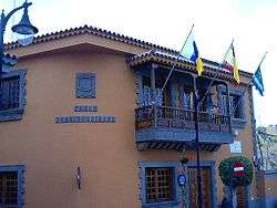 Town hall | |||
| |||
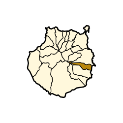 Municipal location in Gran Canaria | |||
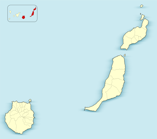 Ingenio Location in the province of Las Palmas  Ingenio Ingenio (Canary Islands)  Ingenio Ingenio (Spain, Canary Islands) | |||
| Coordinates: 27°55′17″N 15°25′57″W / 27.92139°N 15.43250°W | |||
| Country | Spain | ||
| Autonomous Community | Canary Islands | ||
| Province | Las Palmas | ||
| Island | Gran Canaria | ||
| Government | |||
| • Mayor | Juan José Gil Méndez (PP) | ||
| Area[1] | |||
| • Total | 38.15 km2 (14.73 sq mi) | ||
| Elevation(AMSL) | 558 m (1,831 ft) | ||
| Population (2013)[2] | |||
| • Total | 29,978 | ||
| • Density | 790/km2 (2,000/sq mi) | ||
| Time zone | UTC+0 (CET) | ||
| • Summer (DST) | UTC+1 (CEST (GMT +1)) | ||
| Postal code | 35250 | ||
| Area code(s) | +34 (Spain) + 928 (Las Palmas) | ||
| Website | www.ingenio.es | ||


Ingenio is a town and a Spanish municipality in the eastern part of the island of Gran Canaria in the Province of Las Palmas in the Canary Islands. Its population is 29,978 (2013),[2] and the area is 38.15 km2 (14.73 sq mi).[1]
Ingenio is situated between the mountains and the Atlantic Ocean, 24 km (15 mi) south of the island's capital Las Palmas and 9 km (6 mi) south of Telde. The municipality includes the town Carrizal. The GC-1 motorway passes east of the town, and the Gran Canaria Airport is situated in the eastern part of the municipality. In agriculture, sugar cane is one of the dominant crops in Ingenio.
The municipality is home to the International Folklore Festival which has the participation of music groups worldwide including Mexico, Colombia, Romania, Russia and Uganda.
Historical population
| Historical population | ||||||||||||||||||||||||||||
|---|---|---|---|---|---|---|---|---|---|---|---|---|---|---|---|---|---|---|---|---|---|---|---|---|---|---|---|---|
|
| |||||||||||||||||||||||||||
See also
References
- 1 2 Instituto Canario de Estadística, area
- 1 2 Instituto Canario de Estadística Archived 2014-04-22 at Archive.is, population
External links
Places adjacent to Ingenio, Las Palmas | |
|---|---|