La Oliva
| La Oliva | |||
|---|---|---|---|
| Municipality | |||
| |||
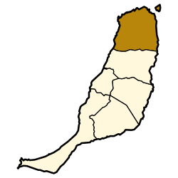 Municipal location in Fuerteventura | |||
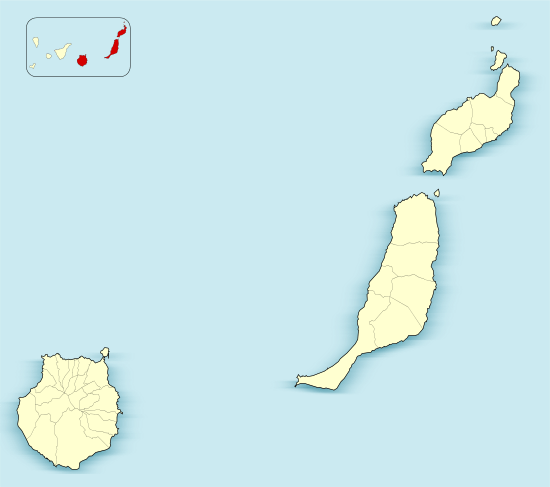 La Oliva Location in the province of Las Palmas  La Oliva La Oliva (Canary Islands)  La Oliva La Oliva (Spain, Canary Islands) | |||
| Coordinates: 28°36′40″N 13°55′40″W / 28.61111°N 13.92778°WCoordinates: 28°36′40″N 13°55′40″W / 28.61111°N 13.92778°W | |||
| Country | Spain | ||
| Autonomous Community | Canary Islands | ||
| Province | Las Palmas | ||
| Island | Fuerteventura | ||
| Area[1] | |||
| • Total | 356.13 km2 (137.50 sq mi) | ||
| Population (2013)[2] | |||
| • Total | 25,083 | ||
| • Density | 70/km2 (180/sq mi) | ||


La Oliva (pronounced [la oliˈβa]) is a town and a municipality in the northern part of the island of Fuerteventura in the Province of Las Palmas, Canary Islands, Spain. The population is 25,083 (2013),[2] and the area is 356.13 km².[1] The municipality includes the Lobos Island to the northeast. The largest town of the municipality, Corralejo, is a port town and beach resort at the northernmost point of the island. La Oliva is the historic seat of the island Colonel, who resided in the stately Casa de los Coroneles.
An anonymous manuscript relates that the town of La Oliva was founded in 1500 by individuals known to the Hernández brothers, residents of the Villa de Betancuria.
Gallery
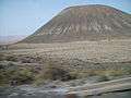 "Montaña Quemada" Canyon
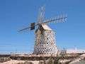 A stone-built windmill near the beach of La Oliva
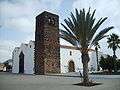 Church of Our Lady of La Candelaria
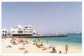 Corralejo beach
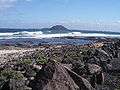 Los Lobos Island
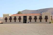
Casa de los Coroneles, La Oliva
See also
References
- 1 2 Instituto Canario de Estadística, area
- 1 2 Instituto Canario de Estadística Archived 2014-04-19 at the Wayback Machine., population
External links
| Wikimedia Commons has media related to La Oliva. |
Places adjacent to La Oliva | ||||||||||
|---|---|---|---|---|---|---|---|---|---|---|
| ||||||||||
This article is issued from
Wikipedia.
The text is licensed under Creative Commons - Attribution - Sharealike.
Additional terms may apply for the media files.