Santa María de Guía de Gran Canaria
| Santa María de Guía de Gran Canaria | |
|---|---|
| Municipality | |
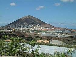 View of La Atalaya | |
 Municipal location in Gran Canaria | |
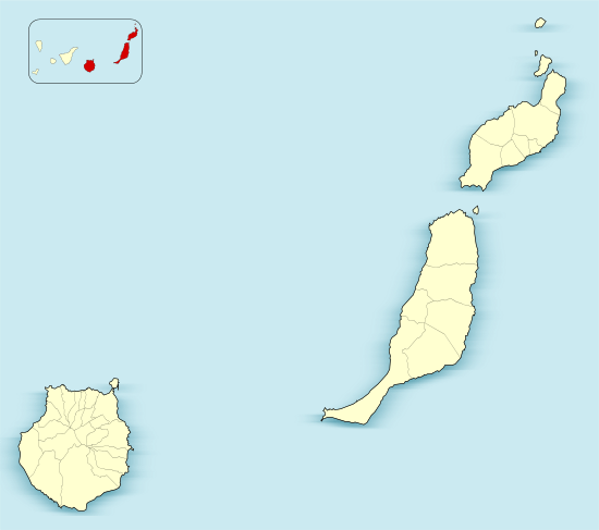 Santa María de Guía de Gran Canaria Location in the province of Las Palmas  Santa María de Guía de Gran Canaria Santa María de Guía de Gran Canaria (Canary Islands)  Santa María de Guía de Gran Canaria Santa María de Guía de Gran Canaria (Spain, Canary Islands) | |
| Coordinates: 28°8′20″N 15°37′58″W / 28.13889°N 15.63278°WCoordinates: 28°8′20″N 15°37′58″W / 28.13889°N 15.63278°W | |
| Country | Spain |
| Autonomous Community | Canary Islands |
| Province | Las Palmas |
| Island | Gran Canaria |
| Government | |
| • Mayor | Pedro Manuel Rodríguez Pérez (CC) |
| Area[1] | |
| • Total | 42.59 km2 (16.44 sq mi) |
| Elevation(AMSL) | 180 m (590 ft) |
| Population (2013)[2] | |
| • Total | 13,811 |
| • Density | 320/km2 (840/sq mi) |
| Time zone | UTC+0 (CET) |
| • Summer (DST) | UTC+1 (CEST (GMT +1)) |
| Postal code | 35459 |
| Area code(s) | +34 (Spain) + 928 (Las Palmas) |
| Website | www.santamariadeguia.es |
Santa María de Guía de Gran Canaria is a town and a municipality in Las Palmas province of the Canary Islands. It is located on the north side of Gran Canaria island. Its population is 13,811 (2013),[2] and the area is 42.59 km2 (16.44 sq mi).[1]
The town Santa María de Guía is situated in a valley 2 km (1 mi) from the coast, 19 km (12 mi) west of Las Palmas. The municipality stretches from the coast into the mountainous interior of the island. The GC-2 motorway passes north of the town.
Population
| Historical population | ||||||||||||||||||||||||||||
|---|---|---|---|---|---|---|---|---|---|---|---|---|---|---|---|---|---|---|---|---|---|---|---|---|---|---|---|---|
|
| |||||||||||||||||||||||||||
Heritage sites
The caves of Valerón, also called cenobio de Valerón, is a property of cultural interest in the "archaeological site" category. It is the largest pre-Hispanic collective granary. Its size is representative of Gran Canaria agriculture, unique among the Canaries islands in that it was traditionally dominated by plantations, with much of these being grains, rather than by stock-breeding.[3]
See also
Notes and references
Notes
References
- 1 2 Instituto Canario de Estadística, area
- 1 2 Instituto Canario de Estadística, population
- ↑ Cenobio de Valeron, section "El yacimiento arqueologico". On arqueologiacanaria.com.
External links
Places adjacent to Santa María de Guía de Gran Canaria | ||||||||||
|---|---|---|---|---|---|---|---|---|---|---|
| ||||||||||