San Bartolomé, Las Palmas
| San Bartolomé | ||
|---|---|---|
| Municipality | ||
| ||
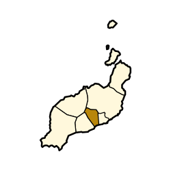 Municipal location in Lanzarote | ||
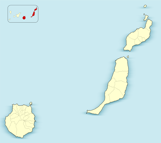 San Bartolomé Location in the province of Las Palmas  San Bartolomé San Bartolomé (Canary Islands)  San Bartolomé San Bartolomé (Spain, Canary Islands) | ||
| Coordinates: 29°0′6″N 13°36′42″W / 29.00167°N 13.61167°WCoordinates: 29°0′6″N 13°36′42″W / 29.00167°N 13.61167°W | ||
| Country |
| |
| Autonomous Community |
| |
| Province | Las Palmas | |
| Island | Lanzarote | |
| Government | ||
| • Mayor | María Dolores Corujo Berriel (PSOE) | |
| Area | ||
| • Total | 41 km2 (16 sq mi) | |
| Elevation(AMSL) | 240 m (790 ft) | |
| Population (2012) | ||
| • Total | 18,487 | |
| • Density | 450/km2 (1,200/sq mi) | |
| Time zone | UTC+0 (CET) | |
| • Summer (DST) | UTC+1 (CEST (GMT +1)) | |
| Postal code | 35550 | |
| Area code(s) | +34 (Spain) + 928 (Las Palmas) | |
| Website | www.sanbartolome.es | |


San Bartolomé (Spanish meaning Saint Bartholomew) is a village and ayuntamiento (county) in the Canary Islands (Spain), belonging to the Province of Las Palmas. It is situated in the center of the island of Lanzarote. The county of San Bartolomé stretches to the southern coast of the island.
Its area is 40.89 km², its density is 403.06/km² and its population 16,481 inhabitants (ISTAC, 2003). Its altitude is 240 meters above sea level.
The village is located north-west of Arrecife (the capital of Lanzarote) on the main highway LZ1 and west of Teguise (the former capital) and Haría. The Timanfaya-Mountains are about 20 km west of S.B. There is no industry. Most of the inhabitants work as craftsmen, farmers or in the service for tourism which is the biggest economic factor on Lanzarote.
See also
External links
Places adjacent to San Bartolomé, Las Palmas | |
|---|---|