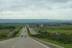
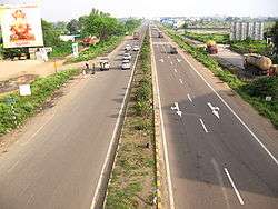
National Highway (India)
.jpg)
The national highways network of India is a network of trunk roads that is owned by Ministry of Road Transport and Highways.It is constructed and managed by National Highways Authority of India (NHAI), National Highways and Infrastructure Development Corporation (NHIDCL) and Public Works Department (PWD) of the state governments. NHAI was established by National Highways Authority of India Act, 1988. Section 16(1) of the Act states that the function of NHAI is to develop, maintain and manage the national highways and any other highways vested in, or entrusted to, it by the Government of India. These highways as of June 2017 measure over 115,435 km (71,728 mi).[1] Indian government led by PM Modi has vowed to double the highway length from 96,000 to 2,00,000 km.[2]
As of June 2017, 23 km per day of highway construction has been achieved which is unprecedented in Indian history.[3]
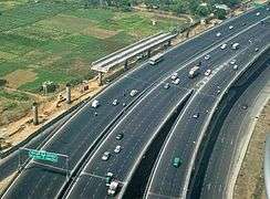
In India, National Highways are at-grade roads whereas Express Highways, commonly known as Expressways, are controlled-access highways, mostly six-lane or above, where entrance and exit is controlled by the use of slip roads (ramps) that are incorporated into the design of the highway. The at-grade national highways do not have shoulder lanes.
The National Highways Authority of India (NHAI) is the nodal agency responsible for building, upgrading and maintaining most of the national highways network. It operates under the Ministry of Road Transport and Highways. The National Highways Development Project (NHDP) is a major effort to expand and upgrade the network of highways. NHAI often uses a public-private partnership model for highway development, maintenance and toll-collection.
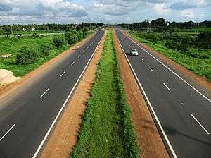
While national highways constitute 1.8% of Indian roads, they carry 40% of the traffic.[4] The majority of existing national highways are two-lane roads (one lane in each direction), though much of this is being expanded to four-lanes and some to six or more lanes. Some sections of the network are toll roads.
Bharatmala, a centrally-sponsored and funded road and highways project of the Government of India [5] with a target of constructing 83,677 km (51,994 mi)[6] of new highways at an estimated cost of ₹5.35 trillion (US$75 billion) has been started in 2018. Bharatmala Phase -I plans to construct 34,800 km of highways (including remaining projects under NHDP) at an estimated cost of Rs.5,35,000 crore by 2021-22.[7]
Current system
India has 111,111 km (69,041 mi) of national highways (NH) connecting all the major cities and state capitals as of March 2018.
[8] National highways comprise 2.7% of India's total road network, but carry about 40% of road traffic.[9] Most of them have two lanes. About 26,000 km (16,000 mi) have been widened to four lanes with two lanes in each direction as of May 2016.[8] Only a few national highways are built with cement concrete. As of March 2016, 20,703 km (12,864 mi) of national highways were still single-laned roads.
India has the distinction of having the world's second highest-altitude motor highway — Leh-Manali Highway, connecting Manali, Himachal Pradesh in Himachal Pradesh to Leh in Ladakh, Kashmir.
National highways form the economic backbone of the country and have often facilitated development along their routes. Many new towns have sprung up along major highways. Highways have large numbers of small restaurants and inns (known as dhabas) along their length. They serve popular local cuisine and serve as truck stops.
The Ministry of Road Transport and Highways, Government of India adopted a new systematic numbering of national highways in April 2010. The new system will indicate the direction of national highways whether it is east-west (odd numbers) or north-south (even numbers). It will also be indicative of the geographical region where they are, even numbers increasing from east to west from NH2 and odd numbers increasing from north to south from NH1.[10]
Recent developments

Under former Prime Minister Atal Bihari Vajpayee India launched a massive programme of highway upgrades, called the National Highways Development Project (NHDP), in which the main north-south and east-west corridors and highways connecting the four metropolitan cities (Delhi, Mumbai, Chennai and Kolkata) have been fully paved and widened into four-lane highways. Some of the busier national highway sectors in India have been converted to four or six lane Limited access Highways — for example, Delhi-Agra, Delhi-Jaipur, Ahmedabad-Vadodara, Mumbai-Pune, Mumbai-Surat, Bangalore-Mysore, Bangalore-Chennai, Chennai-Tada, Delhi-Meerut Hyderabad-Vijayawada, Bhubaneswar-Puri, Guntur-Vijayawada, Jammu-Udhampur.
The National Highways Act, 1956[11] provides for private investment in the building and maintenance of the highways. Some existing roads have been reclassified as national highways. Bypasses have recently been constructed around larger towns and cities to provide uninterrupted passage for highway traffic. The hugely varied climatic, demographic, traffic, and sometimes political situation in India results in national highways being single lane in places with low traffic to six lanes in places with heavy traffic. National highways are being upgraded or are under construction. Some national highways are long while some are short spurs off other national highways to provide connectivity to nearby ports or harbours.
The length of national highways in the country was 29,023 km in 1980, which expanded to 76,818 km by the end of 2012. Over 50% of the total road network or 23,814 was added under the Vajpayee government between 1997 and 2002 — the largest construction of national highways during any five-year period since independence.[12] The UPA government added 18,000 km of highway in its ten-year administration between 2004 and 2014.[13][14]
The longest national highway is NH44,[15] which runs between Srinagar in Jammu and Kashmir and Kanyakumari in Tamil Nadu, at the southernmost point of the Indian mainland, covering a distance of 2,369 km (1,472 mi). The shortest national highway is NH966B,[16][17] which spans 6 km (3.7 mi), to the Ernakulam-Kochi Port.
Statewise
| SL No | State / Union Territory | State
PWD |
NHAI | NHIDCL [20] | National Highway Length (km) |
|---|---|---|---|---|---|
| 1 | Andaman and Nicobar Islands | 87 | 331 | ||
| 2 | Andhra Pradesh | 6,286 | |||
| 3 | Arunachal Pradesh | 1,035 | 2,537 | ||
| 4 | Assam | 1,010 | 3,845 | ||
| 5 | Bihar | 4,839 | |||
| 6 | Chandigarh | 15 | |||
| 7 | Chhattisgarh | 3,232 | |||
| 8 | Dadra and Nagar Haveli | 31 | |||
| 9 | Daman and Diu | 22 | |||
| 10 | Delhi | 79 | |||
| 11 | Goa | 262 | |||
| 12 | Gujarat | 5,017 | |||
| 13 | Haryana | 2,641 | |||
| 14 | Himachal Pradesh | 320 | 2,643 | ||
| 15 | Jammu & Kashmir | 436 | 2,601 | ||
| 16 | Jharkhand | 2,661 | |||
| 17 | Karnataka | 6,761 | |||
| 18 | Kerala | 1,782 | |||
| 19 | Lakshadweep | 0 | |||
| 20 | Madhya Pradesh | 7,884 | |||
| 21 | Maharashtra | 15,437 | |||
| 22 | Manipur | 1,751 | 1,746 | ||
| 23 | Meghalaya | 823 | 1,204 | ||
| 24 | Mizoram | 372 | 1422.5 | ||
| 25 | Nagaland | 324 | 1,547 | ||
| 26 | Odisha | 4,837 | |||
| 27 | Puducherry | 64 | |||
| 28 | Punjab | 2,769 | |||
| 29 | Rajasthan | 7,906 | |||
| 30 | Sikkim | 595 | 463 | ||
| 31 | Tamil Nadu | 5,381 | |||
| 32 | Tripura | 573 | 3,786 | ||
| 33 | Telangana | 854 | |||
| 33 | Uttarakhand | 660 | 2,842 | ||
| 34 | Uttar Pradesh | 8,711 | |||
| 35 | West Bengal | 4 | 2,998 | ||
| India total | 48,590[21] | 7,990| | 115,435 |
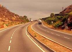
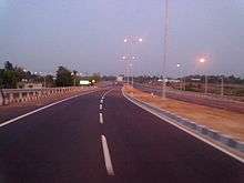
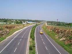
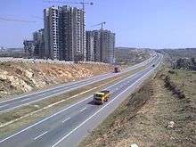
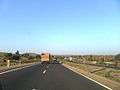
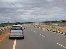
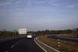
Gallery

_in_Karnataka.jpg)


References and notes
- ↑ "Ministry of Road Transport and Highways". Retrieved 25 October 2017.
- ↑ "National Highways road length to be increased from 96,000 km to 2,00,000 km: Nitin Gadkari". The Financial Express. 17 December 2016. Retrieved 27 June 2017.
- ↑ "Govt aimed to build 15,000 km of roads in 2016-17 but laid down only 8,200 km". hindustantimes.com/. 1 April 2017. Retrieved 27 June 2017.
- ↑ "Indian road network". National Highways Authority of India. Retrieved 18 April 2015.
- ↑ "Bharat Mala: PM Narendra Modi's planned Rs 14,000 crore road from Gujarat to Mizoram", The Economic Times, New Delhi, 29 April 2015
- ↑ "Ministry proposes construction of 20,000 km of roads under Bharat Mala project", The Economic Times, New Delhi, 9 January 2016
- ↑ "Bharatmala Pariyojana - A Stepping Stone towards New India | National Portal of India". www.india.gov.in. Retrieved 2018-01-18.
- 1 2
- ↑ Mahapatra, Dhananjay (2 July 2013). "NDA regime constructed 50% of national highways laid in last 30 years: Centre". The Times of India. Retrieved 18 April 2015.
- ↑ "New numbers for national highways". The Times of India. 21 October 2011. Retrieved 18 April 2015.
- ↑ "The National Highways Act, 1956". Retrieved 2 December 2012.
- ↑ "NDA regime constructed 50% of national highways laid in last 30 years: Centre - The Times of India". The Times of India. Retrieved 17 November 2015.
- ↑ http://timesofindia.indiatimes.com/india/National-highways-to-grow-by-50000km-in-6-months/articleshow/48930651.cms
- ↑ http://indianexpress.com/article/india/india-others/national-highway-upgrade-22000-km-to-be-made-four-lane/
- ↑ . Maps of India.
- ↑ "List of highways in Kerala". ListKerala.com.
- ↑ "National Highway 47A". India9.com.
- ↑ "National Highways Summary - Ministry of Road Transport & Highways, Government of India". morth.nic.in. Retrieved 21 August 2017.
- ↑ "Welcome to NHAI". www.nhai.org. Retrieved 21 August 2017.
- ↑ http://nhidcl.com/wp-content/uploads/2017/02/All-projects.pdf
- ↑ http://nhai.gov.in/writereaddata/Portal/Images/pdf/AnnualReport201516.pdf
