Hiuchigatake
| Hiuchi | |
|---|---|
| Mount Hiuchigatake | |
 | |
| Highest point | |
| Elevation | 2,356[1] m (7,730 ft) |
| Coordinates | 36°57′7″N 139°17′19″E / 36.95194°N 139.28861°ECoordinates: 36°57′7″N 139°17′19″E / 36.95194°N 139.28861°E |
| Naming | |
| Native name | 燧ヶ岳 |
| Geography | |
 Hiuchi Honshu, Japan Hiuchi Hiuchi (Fukushima Prefecture) | |
| Geology | |
| Age of rock | Quaternary |
| Mountain type | Stratovolcano[2] |
| Last eruption | July 1544[1] |
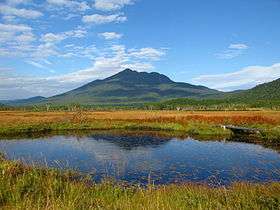
Hiuchi, also Hiuchigatake (Japanese: 燧ヶ岳) is a stratovolcano in Oze National Park, Japan. The volcano rises in the north of Lake Ozenuma. It is one of the 100 Famous Japanese Mountains.[2][3]
Morphology
Hiuchi initially formed around 350,000 years ago. Around 160,000–170,000 years ago, Hiuchi erupted, creating a large pyroclastic flow deposit. At the summit of the volcano lie two lava domes, Akanagure (赤ナグレ) and Mi-ike (御池岳). Akanagure, the southern dome, produced a series of viscous lava flows that flowed down the southern and western parts of the volcano about 3500 years ago. Mi-ike is responsible for the only recorded activity.
Historic eruptions
1544 eruptions
The only recorded activity was on July 28, 1544. A moderate phreatic eruption at the Mi-ike Lava Dome produced lahars and an associated tephra layer.[1][4]

See also
References
- 1 2 3 "Hiuchigatake: National catalogue of the active volcanoes in Japan" (PDF). Japan Meteorological Agency. Retrieved 2017-12-13.
- 1 2 "燧ヶ岳" (in Japanese). kotobank. Retrieved 2017-12-13.
- ↑ "日本百名山" (in Japanese). kotobank. Retrieved 2017-12-13.
- ↑ Yukio Hayakawa (1994). "燧ヶ岳で見つかった約500年前の噴火堆積物". 火山 (in Japanese). 39 (5). doi:10.18940/kazan.39.5_243.
Further reading
- Yukio HAYAKAWA, Fusao ARAI and Tomohiro KITAZUME (1997). "Eruptive History of Hiuchi Volcano". Journal of Geography (Chigaku Zasshi). 106 (5): 660–664. doi:10.5026/jgeography.106.5_660.
External links
| Wikimedia Commons has media related to Mount Hiuchi (Fukushima). |
| Hokkaidō | |||||||||
|---|---|---|---|---|---|---|---|---|---|
| Tōhoku region Jōshinetsu region |
| ||||||||
| Kantō region | |||||||||
| Chūbu region |
| ||||||||
| Western Japan | |||||||||
| |||||||||