Ontario Highway 407
| ||||
|---|---|---|---|---|
 | ||||
| Route information | ||||
|
Maintained by Province of Ontario 407 ETR Concession Company Limited | ||||
| Length | 138.7 km[1][2] (86.2 mi) | |||
| History |
Proposed 1959–1986,[3] Opened June 7, 1997–June 20, 2018[4] | |||
| Major junctions | ||||
| West end |
| |||
|
| ||||
| East end |
| |||
| Highway system | ||||
| ||||
King's Highway 407 (pronounced "four-oh-seven") is a tolled 400-series highway in the Canadian province of Ontario. Comprising a privately leased segment as well as a publicly owned segment, the route spans the entire Greater Toronto Area (GTA) north of the city of Toronto, travelling through the suburbs of Burlington, Oakville, Mississauga, Brampton, Vaughan, Markham, Pickering, Whitby, and Oshawa before ending in Clarington, north of Bowmanville. The segment between Burlington and Brougham in Pickering is leased to and operated by the 407 ETR Concession Company Limited and is officially known as the 407 Express Toll Route (407 ETR). It begins at the junction of the Queen Elizabeth Way (QEW) and Highway 403 in Burlington, and travels 107.9 km (67.0 mi) across the GTA to Brock Road in Pickering. East of Brock Road, the freeway continues east as Highway 407 East (Highway 407E), a toll route operated by the provincial government, for 30.8 km (19.1 mi) to Taunton Road in Clarington. Highway 407 is the first electronically operated toll highway opened in the world; there are no toll booths along the length of the route. Distances are calculated automatically using transponders or licence plates, which are scanned at entrance and exit points. Major interchanges along the route include the QEW, Highway 403, Highway 401, Highway 410, Highway 427, Highway 400, Highway 404, and Highway 412.
Highway 407 was planned in the late 1950s as a freeway bypassing the Toronto segment of Highway 401, the busiest highway in the world.[5][6] However, construction did not begin until 1987. During the early 1990s, the provincial government proposed tolling the highway to alleviate a revenue shortfall. The central sections of Highway 407 opened in 1997, and the remaining sections were built quickly over the following four years, with the final segment opening in mid-2001. Despite being included in the 400-series network, the Highway 407 ETR section is not considered part of the provincial highway network due to it now being privately operated.[7] The segment is operated privately under a 99-year lease agreement with the provincial government, which was sold in 1998 for about C$3.1 billion to a consortium of Canadian and Spanish investors operating under the name 407 International Inc.[8] The privatization of the Highway 407 ETR section has been the source of significant criticism,[9] especially regarding the increases in tolls, plate denial, and false charges. In addition, the safety of segments constructed following the sale of the freeway has been called into question. Many have come to regard Highway 407 ETR as a luxury, as opposed to the bypass of Highway 401 it was originally conceived to be.
The first phase of a provincially-owned and tolled extension of the route, known solely as Highway 407 (and not as Highway 407 ETR), opened to traffic from Brock Road in Pickering to Harmony Road in Oshawa on June 20, 2016. Included as part of this extension was construction of a tolled north-south link between Highways 401 and 407 known as Highway 412. Construction is currently underway to extend the provincially owned portion of Highway 407 easterly to Highway 35 / Highway 115 in Clarington. This construction is being completed in two stages, with the first phase opening on January 2, 2018 as a 9.6 km extension to Taunton Road[10], and the second phase opening in 2020. This construction includes an additional link to Highway 401 east of Oshawa that will be known as Highway 418.
Even though the highway does not enter Toronto city proper, Toronto is used as a control city for Highway 407 in Halton and Durham Regions due to the similar sizes of the suburban municipalities the highway passes through.
Route description
Highway 407 is a 138.7-kilometre (86.2 mi)[1] controlled-access highway that encircles the GTA, passing through Burlington, Oakville, Mississauga, Brampton, Vaughan, Markham, Pickering, Whitby, and Oshawa as well as travelling immediately north of Toronto.[11][12] Although the general public felt that tolling made the highway a luxury rather than its original purpose of relieving traffic on Highway 401,[13][14] Highway 407 ETR has had average daily trip counts of over 350,000 vehicles in June 2014.[15] The 407 ETR is contractually responsible for maintaining high traffic levels as justification for increasing tolls, but conduct their own traffic studies.[13] Despite increased usage, parallel roads that Highway 407 was intended to supplement continue to grow congested, forcing the MTO to revisit costly widening projects of Highway 401 and the QEW.[13]
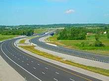
Highway 407 has been designed with aesthetics and environmental concerns in mind by featuring landscaped embankments, 79 storm drainage ponds, as well as a curb and gutter system.[16] Unlike most other Ontario highways, it features concrete pavement as opposed to top-coated asphalt. Because of this, the high-mast lighting along the urban portions of the route feature fewer luminaires than asphalt-surfaced freeways.[17]
Burlington–Vaughan
Highway 407 begins in Burlington within Halton Region at the Freeman Interchange between Highway 403 and the QEW, from which it branches off northward. The six-lane route passes under Brant Street, Upper Middle Road, and Guelph Line (Halton Regional Road 1) before it interchanges with Dundas Street (Halton Regional Road 5, formerly Highway 5). It briefly enters greenspace as it curves gently to the northeast, avoiding the nearby Niagara Escarpment. The route is crossed by Walkers Line, east of which residential subdivisions line the south side and greenspace lines the north. At an interchange with Appleby Line (Halton Regional Road 20), the highway straightens and travels parallel to Dundas Street before passing over Bronte Creek and under the Canadian National Railway's (CN) Halwest Subdivision.[11][12]

East of Bronte Creek, Highway 407 enters an agricultural area, interspersed with woodlots. It enters Oakville at the Tremaine Road (Halton Regional Road 22) overpass, then gradually swerves to the north as it encounters an interchange with Bronte Road (Halton Regional Road 25, formerly Highway 25). The route crosses Sixteen Mile Creek just north of Glenarchy Conservation Area, then travels parallel to the creek for several kilometres. It swerves north after an interchange with Neyagawa Boulevard, near the hamlet of Glenarchy. After diverging from the creek, it curves northeast, parallel to and north of Burnhamthorpe Road, where it interchanges with Trafalgar Road (Halton Regional Road 3). Highway 407 then encounters Highway 403 at a large interchange where it curves sharply to the northwest; Highway 403, meanwhile, curves from the southeast to the northeast.[11][12]
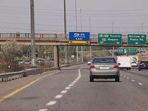
Now travelling parallel to and immediately west of the Halton–Peel regional boundary and Oakville–Mississauga city boundary, the six-lane Highway 407 progresses northwest alongside a power transmission corridor, with residential areas to the east and farmland to the west. The route continues as such northwest to Highway 401, passing under Lower Base Line and Eglinton Avenue and interchanging at Britannia Road and Derry Road before crossing the Canadian Pacific Railway's (CP) Galt Subdivision. At Highway 401, the route makes a sharp curve to the northeast, while interconnecting ramps weave across both freeways over several kilometres. It enters Peel Region at the Winston Churchill Boulevard (Peel Regional Road 19) overpass and follows another power transmission corridor just north of the Brampton–Mississauga boundary.[11][12]
Highway 407 swerves east and encounters an interchange with Mississauga Road (Peel Regional Road 1) just prior to crossing the Credit River and the Orangeville Brampton Railway, after which it enters the urban GTA. After passing interchanges with Mavis Road (Peel Regional Road 18) and Hurontario Street (formerly Highway 10), the route encounters Highway 410 at another sprawling interchange located over Etobicoke Creek. Over the next 7 kilometres (4.3 mi), the route nudges northward into Brampton, interchanging with Dixie Road (Peel Regional Road 4) and Bramalea Road and meeting another CN railway line, before crossing Steeles Avenue (Peel Regional Road 15). Highway 407 curves back to the northeast as it interchanges with Airport Road (Peel Regional Road 7) and passes beneath another CN line, before encountering the final interchange in Peel Region at Goreway Drive. It crosses the West Humber River and former Highway 50 in Claireville Conservation Area before curving east into Vaughan, in York Region.[11][12]
Vaughan–Pickering
Immediately after crossing into Vaughan, Highway 407 encounters the first of three large interchanges with other 400-series highways in York Region. The Highway 427 interchange is a four-level partial stack located just north of Steeles Avenue in Vaughan and adjacent to the 407 ETR Concession Company offices. The interchange features weaved ramps which connect to former Highway 27, located just to the east. The route continues eastward, parallel to and between Steeles Avenue and Highway 7. It dives through the Humber River valley alongside a CN line and along the northern border of Thackeray Conservation Lands, passing beneath a CP line. After an interchange with Pine Valley Drive (York Regional Road 57), the route becomes sandwiched between the industrial lands of the Pine Valley Business Park and the Emery Creek Corporate Park. A partial interchange with Weston Road (York Regional Road 56) lies just west of the large four-level stack interchange with Highway 400, the only of its kind in Ontario. An interchange with Jane Street (York Regional Road 55) is interwoven into the east side of the Highway 400 interchange, below which pass the tunnels of the Line 1 Yonge–University subway, with the Highway 407 station (with its large commuter parking lot and GO Transit bus terminal serving the highway corridor) located to the south.[11][12]

Still travelling alongside a power transmission corridor, Highway 407 crosses a complex rail wye which provides access to the CN freight yards to the north. After interchanging with Keele Street (York Regional Road 6), the route gently curves northward, passing under the CN Newmarket Subdivision, which carries the GO Transit Barrie Line and crossing the Don River. It curves back eastward as it interchanges with Dufferin Street (York Regional Road 53), travelling adjacent to and south of Highway 7. After interchanges with Bathurst Street (York Regional Road 38) and Yonge Street (York Regional Road 1), Highway 407 crosses the CN Bala Subdivision, which carries the GO Transit Richmond Hill Line. After an interchange with Bayview Avenue (York Regional Road 34), the highway swerves south and enters Markham. A partial interchange with Leslie Street (York Regional Road 12) precedes the third and final large freeway–freeway junction at Highway 404.[11][12]
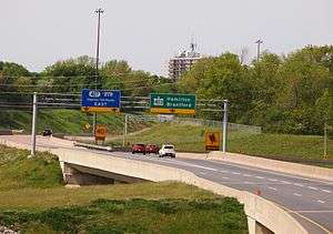
East of Highway 404, the freeway travels generally parallel to the Rouge River. It interchanges with Woodbine Avenue (York Regional Road 8) and Warden Avenue (York Regional Road 65), east of which the route travels alongside a CN line and crosses the GO Transit Unionville Line. Highway 407 continues straight eastward into a residential area, interchanging with Kennedy Road (York Regional Road 3), McCowan Road (York Regional Road 67), and Markham Road (York Regional Road 68), where it crosses the river and diverges from both the CN line and power transmission corridor. The route interchanges with Ninth Line (York Regional Road 69) and Donald Cousens Parkway (York Regional Road 48) before exiting the urban GTA and curving northeast over a CP line and into Rouge Park.[11][12]
Until the opening of the first phase of 407E in June 2016, the final interchange along Highway 407 was with York–Durham Line (York/Durham Regional Road 30), the boundary between York Region and Durham Region as well as Markham and Pickering.[11][12] The route curves eastward, then crosses West Duffins Creek north of the community of Whitevale and south of the future Pickering Airport and planned community of Seaton. Sandwiched between farm fields, the highway is crossed by North Road, where a future interchange is planned,[18] and Sideline 24. Highway 407 ended just south of Brougham at a signalized intersection with Brock Road (Durham Regional Road 1) until the end of 2015, where it continued eastward as Highway 7.[11][12] A new interchange has been built in conjunction with the provincially-maintained and tolled extension, Highway 407E, which was constructed east of this point, and ties in with the current freeway, eliminating the at-grade intersection.[19]
Pickering–Oshawa
Immediately east of Brock Road, this tollway falls under the ownership of the Province of Ontario and is now referred to as Ontario Highway 407 (Or Highway 407 East) instead of 407 ETR. This route runs parallel to both Highway 7 and Durham Regional Road 3 (with some crossovers) through the North of Pickering, Whitby, and Oshawa, until its eastern terminus at the proposed interchange between Highway 418 and Taunton Road[20]. A major interchange of this route includes with Highway 412, which is a spur connecting the 407 with Highway 401 in Whitby. Both the 407 East Extension, as far as Harmony Road in Oshawa and Highway 412 opened to traffic on June 20, 2016.[21] The highway will be further extended eastward through Clarington by 2020. The tolls along this portion of the highway began on February 1, 2017. [22]
Tolls
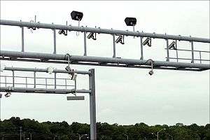
Unlike most other toll highways, Highway 407 features no toll booths. Rather, a system of cameras and transponders allows for automatic toll collection. It is one of the earliest examples of a highway to exclusively use open road tolling. Highway 407 is otherwise designed as a normal freeway; interchanges connect directly to crossroads. A radio antenna detects when a vehicle with a transponder has entered and exited the highway, calculating the toll rate. For vehicles without a transponder, an automatic license plate recognition system is used. In both cases, monthly statements are mailed to users. The automatic plate recognition system is linked to several provincial and U.S. state motor vehicle registries.[23] Toll rates are set by both the 407 ETR and the Province of Ontario for each of the respective sections they own. However, the province set out limitations in the 407 ETR lease contract for maintaining traffic volumes to justify toll rates. Despite this, rates have increased annually against the requests of the provincial government, resulting in several court battles and the general public regarding the route as a luxury.[14]
Plate denial
As part of the contractual agreement with the government, the MTO is required to deny licence plate validation stickers to drivers who have an outstanding 407 ETR bill over 125 days past due.[24] This process was temporarily halted in February 2000 due to numerous false billing claims. Following a judicial decision by the Ontario Divisional Court on November 7, 2005, the Ontario Registrar of Motor Vehicles was ordered to begin denying the validation or issue of Canadian license plates and vehicle permits for 407 ETR users who have failed to pay owed fees. On November 22, 2005, the MTO announced that it would appeal the decision but would begin to deny plates until the appeal was decided. On February 24, 2006, the Ontario Court of Appeals denied the government leave to appeal the 2005 decision. As a result, plate denial remains in place.[25]
Rates
- Users of both 407 ETR and Highways 407E/412/418 only receive one bill invoice, with trips on each highway specified.[26]
- 407 ETR Transponders are compatible with Highways 407E, 412, and later 418.[26]
407 ETR
- All dollar amounts listed are Canadian dollars. EB = eastbound, WB = westbound
The rate rose for tolls in 2018.
As of February 1, 2018, the base tolls for driving on the 407 ETR are as follows:[27]
| Duty Class | Light[28] | Heavy[29] | Heavy Multi-unit[30] | |||||||||||
|---|---|---|---|---|---|---|---|---|---|---|---|---|---|---|
| Zone | 1 | 2 | 3 | 4 | 1 | 2 | 3 | 4 | 1 | 2 | 3 | 4 | ||
| Time | Off peak | 23.38¢/km | 46.76¢/km | 70.14¢/km | ||||||||||
| Midday (Weekdays) | 33.81¢/km | 67.62¢/km | $1.01/km | |||||||||||
| Midday (Weekends & Holidays) | 30.83¢/km | 61.66¢/km | 92.49¢/km | |||||||||||
| Peak Period (a.m.) | EB WB |
39.33 37.08 |
39.57 38.49 |
39.21¢ | 36.38 39.21 |
78.66 74.16 |
79.14 76.98 |
78.42¢ | 72.76 78.42 |
$1.18 $1.11 |
$1.19 $1.15 |
$1.18 | $1.09 $1.18 | |
| Peak Hours (a.m.) | EB WB |
47.09 42.18 |
46.66 43.78 |
46.24 44.60 |
41.39 46.24 |
94.18 84.36 |
93.32 87.56 |
92.48 89.20 |
82.78 92.48 |
$1.41 $1.27 |
$1.40 $1.31 |
$1.39 $1.34 |
$1.24 $1.39 | |
| Peak Period (p.m.) | EB WB |
38.11 42.55 |
41.05 42.55 |
42.17¢ | 40.68 37.75 |
76.22 85.10 |
82.10 85.10 |
84.34¢ | 81.36 75.50 |
$1.14 $1.28 |
$1.23 $1.28 |
$1.27 | $1.22 $1.13 | |
| Peak Hours (p.m.) | EB WB |
43.30 51.00 |
49.21 48.34 |
50.55 47.91 |
48.76 42.89 |
86.60 $1.02 |
98.42 96.68 |
$1.01 95.82 |
97.52 85.78 |
$1.30 $1.53 |
$1.48 $1.45 |
$1.52 $1.44 |
$1.46 $1.29 | |
| Minimum Charge (vehicle with transponder) |
Peak | N/A | $19.85/journey | $36.95/journey | ||||||||||
| Off Peak | $12.80/journey | $23.85/journey | ||||||||||||
| Accessory Charge | Trip Toll | $1/journey | $2/journey | $3/journey | ||||||||||
| Additional Charge Journey Without Transponder |
Video Toll | $4.15/journey* | $50.00/journey** | $50.00/journey** | ||||||||||
| Account Fee | $3.95 | |||||||||||||
| Transponder Lease | Annually | $23.50 | ||||||||||||
| Monthly | $3.95 | |||||||||||||
- Starting February 1, 2018, there are 4 zones: 1 from QEW to 401, 2 from 401 to 427, 3 from 427 to 404 and 4 from 404 to 407E(Brock Rd.)
- The toll rate that applies to a specific trip is determined by the time at which a vehicle enters the highway.
- Off peak rates are in effect from 19:00 - 06:00 Monday to Friday except public holidays, and 19:00 - 11:00 Saturday, Sunday and holidays.
- Midday weekday rates are in effect from 10:00 - 14:30, Mondays to Fridays except for holidays.
- Midday weekend/holiday rates are in effect from 11:00 - 19:00, Saturday, Sunday and holidays.
- Peak period rates are in effect from 06:00 - 07:00, 09:00 - 10:00, 14:30 - 15:30 and from 18:00 - 19:00, Monday to Friday except for public holidays.
- Peak hours rates are in effect from 07:00 - 09:00 and from 15:30 - 18:00, Mondays to Fridays except for public holidays.
- Heavy goods vehicles and lorries are assessed a minimum toll regardless of the length of their trip.
- * Light goods vehicles without transponders are assessed an additional Video Toll. Motorcycles are not charged a video toll because there is rarely a suitable place to mount a transponder.
- ** Heavy duty vehicles are legally required to have transponders in order to use the highway; offenders may be penalised under the Highway Traffic Act.
Highway 407 East

To compensate for opening delays, tolling of both Highways 407E and 412 did not commence until February 2017.[31] As of February 1, 2017, the following tolls applies for motorists utilizing these tollways. The rate stayed the same in 2018. These tolls will be applied to Highway 418 upon opening:[32]
| Time period | Duty class | |||||
|---|---|---|---|---|---|---|
| Light[32] | Heavy[32] | Heavy Multi-unit[32] | ||||
| Peak (weekdays) (6am–10am and 3pm–7pm) |
29.00 ¢/km | 58.00 ¢/km | 87.00 ¢/km | |||
| Midday (weekdays) (10am–3pm) |
23.00 ¢/km | 46.00 ¢/km | 69.00 ¢/km | |||
| Midday (weekends & holidays) (11am–7pm) |
22.00 ¢/km | 44.00 ¢/km | 66.00 ¢/km | |||
| Off-peak (weekdays) (7pm–6am) |
19.00 ¢/km | 38.00 ¢/km | 57.00 ¢/km | |||
| Off-peak (weekends & holidays) (7pm–11am) |
19.00 ¢/km | 38.00 ¢/km | 57.00 ¢/km | |||
- All end times displayed are rounded up to the nearest minute for simplicity purposes (i.e. 6am is actually 5:59:59am)
- The toll rate that applies to a specific trip is determined by the time at which a vehicle enters the highway.
- Heavy goods vehicles and lorries are assessed a minimum toll regardless of the length of their trip: $3.00 off peak, $5.00 during peak hours.
- As seen above, the costs of utilizing these provincially owned tollways are less than that of the 407 ETR.
- Light vehicles without transponders may be assessed an additional Video Toll.
- Vehicles weighing over 5,000 kilograms are divided into two categories: Heavy Single Units and Heavy Multiple Units. Heavy Multiple Unit Vehicles will be charged two or three time the passenger rate, depending on the size of the vehicle.[33]
- All Heavy Unit vehicles are legally required to have transponders in order to use the highways; offenders may be penalized under the Highway Traffic Act.
History
Planning and initial construction
Although construction of Highway 407 did not begin until 1987, planning for the bypass of Highway 401 north of Toronto began in the late-1950s. Concepts for the new "dual highway" first appeared in the 1959 plan for Metropolitan Toronto.[3] Land adjacent to several hydro corridors was acquired for the future freeway in the 1960s, but sat vacant as the Ontario Department of Highway (predecessor to the Ministry of Transportation of Ontario (MTO)) opted instead to widen Highway 401 to a twelve-lane collector-express system. The Highway 401 expansion project was considered a success and construction of Highway 407 was shelved for almost thirty years. The plan was revisited in the mid-1980s as congestion in Toronto pushed roads beyond capacity. In 1986, Premier David Peterson was given a helicopter tour of the city during rush-hour; construction of the highway was announced soon thereafter, and began in 1987.[3]
The Ontario government's normal process for highway construction was not possible given the financial constraints of the recession of the early 1990s. The Peterson government sought out private sector partnerships and acquired innovative electronic tolling technology. Two firms bid on the project, with the Canadian Highways International Corporation being selected as the operator of the highway.[34] Financing for the highway was to be paid by user tolls lasting 35 years, after which it would return to the provincial system as a toll-free 400-series highway.[13] The succeeding government of Bob Rae announced on March 31, 1995, that the corridor reserved for Highway 403 between Burlington and Oakville would instead be built as a western extension of Highway 407.[35]
The first segment of Highway 407, between Highway 410 and Highway 404, was ceremoniously opened to traffic on June 7, 1997; no tolls were charged for a month to allow motorists to test-drive the freeway.[36] Several other sections were well underway at this point. A 13-kilometre (8.1 mi) extension westwards to Highway 401 was opened just months later on December 13, 1997.[37] That section was connected with Highway 403 to the south on September 4, 1998,[4] with a temporary two lane ramp connecting to Trafalgar Road.[38] In the east, an extension to Markham Road, at what was then the southern terminus of Highway 48, was completed in early 1998. However, due to the protest of local residents and officials concerning traffic spill-off (a scenario revisited with the extension to Oshawa[39]), the freeway was opened only as far as McCowan Road on February 18.[40] The short segment from McCowan Road to Markham Road remained closed for over a year, as locals feared the funneling of traffic onto Main Street, which is named Markham Road south of the freeway. Both Markham and McCowan were widened to four lanes between Highway 407 and Steeles Avenue at this time. This did not alleviate concerns, but on June 24, 1999, the extension opened to continued protest regardless.[41]
Privatization and original extensions
| Headquarters | Vaughan, Ontario, Canada |
|---|---|
| Owners |
|
| Website |
www |
When Mike Harris was elected Premier in 1995 on his platform of the Common Sense Revolution, the Ontario government faced a $11 billion annual deficit and a $100 billion debt. Seeking to balance the books, a number of publicly owned services were privatized over the following years. Although initially spared, Highway 407 was sold quickly in the year leading up to the 1999 provincial elections. The highway was leased to a conglomerate of private companies for $3.1 billion. The Ontario corporation, known as 407 International Inc., is jointly owned by the Spanish multinational Cintra Infraestructuras (43.23%), as well as various subsidiaries of the Canada Pension Plan Investment Board (40%) and the Montreal-based engineering firm SNC-Lavalin (16.77%).[42] The deal included a 99-year lease agreement with unlimited control over the highway and its tolls, dependent on traffic volume; however, the government maintains the right to build a transport system within the highway right-of-way.[13]
When purchased, the highway travelled from the junction of Highway 403 in Mississauga to Markham Road in Markham. Extensions westward to the QEW and eastward to Highway 7 and Brock Road in Pickering were constructed by the corporation, as mandated in the lease agreement.[42] The western extension, from Highway 403 southwest to the QEW, was not part of the original Highway 407 concept in 1987; rather, the corridor was originally intended to connect the Hamilton and Mississauga sections of Highway 403. Highway 407 was originally slated to assume the temporary routing for Highway 403 along the Mississauga-Oakville boundary to end at the QEW. However, the Bob Rae led Ontario government altered these plans in 1995,[35] and the corporation constructed this section quickly upon obtaining the lease. Sections opened throughout the middle of 2001: between Neyagawa Boulevard and Highway 403 on June 17; between Bronte Road and Neyagawa Boulevard on June 29; between Dundas Street and Bronte Road on July 18; and between the Freeman Interchange and Dundas Street on July 30. In the east, a final extension between Markham Road and Highway 7 opened a month later on August 30.[4]
On October 5, 2010, the Canadian Pension Plan announced that an agreement was reached with the owners of the roadway to purchase 10% stake for $894 million.[43] This implies a value of close to $9 billion for the highway in its current state. However, in 1998, MPP E. J. Douglas Rollins found that as much as $104 billion had been spent by the province to that point.[44]
Controversy
Highway 407 ETR has been the subject of several controversies over its two decades of existence. While the privatization of the route and toll rate increases have been routinely criticized by the general public and politicians,[14][44] cost-savings measures and the ensuing safety concerns resulted in an independent Ontario Provincial Police investigation shortly before the opening of the freeway.[45] Finally, the public has accused the 407 ETR of predatory billing practices, including false billing and continued plate denial after bankruptcy.[46][47]
An expert panel of engineers released a report outlining concerns regarding the decreased loop ramp radii and a lack of protective guardrail at sharp curves, in addition to the lack of a concrete median barrier to separate the opposite directions of travel. However, it was also argued that the large grass median was sufficient to prevent cross-over collisions, given that Highway 410 has a similar median.[45]
The Ontario provincial government has quarrelled with 407 ETR over toll rates and customer service, but is largely tied down by the lease contract. On February 2, 2004, the government delivered notice to 407 ETR that they are considered to be in default of their contract because of 407 ETR's decision to raise toll rates without first obtaining provincial clearance. The court's initial decision sided with 407 ETR: on July 10, 2004, an independent arbitrator affirmed that 407 ETR has the ability to raise toll rates without first consulting the government. The government filed an appeal of this decision but was overruled by an Ontario Superior Court decision released on January 6, 2005; however, a subsequent ruling by the Ontario Court of Appeal on June 13, 2005 granted the government permission to appeal the decision.[48] The government also faced off against 407 ETR in court regarding plate denial around this time.[25]
Highway 407 East project

A provincially owned 65-kilometre (40 mi) long extension to the 407 ETR, known as Highway 407 East (or 407E), began construction in 2012, with the project undertaken in two separate phases. Phase 1 was opened on June 20, 2016, consisting of a 22-kilometre (14 mi) extension to Harmony Road in Oshawa, as well as the 10-kilometre (6.2 mi) Highway 412. The extension was free of tolls until February 1, 2017.[49] Phase 2A, opened January 2, 2018, added a 9.6-kilometre (6.0 mi) extension to Taunton Road at the future Highway 418 interchange.[50] Phase 2B will add a further 23.3 kilometres (14.5 mi), consisting of an east-west extension from Taunton Road to Highway 35 and Highway 115, as well as Highway 418, the north-south connector to Highway 401; Phase 2B is scheduled for completion in 2020.[51]
An environmental assessment (EA) to analyze the proposed extension was undertaken in the early 2000s. The assessment also included studies of the two north–south connectors. A preferred route was announced in June 2007,[52] and the EA was completed in June 2009. On March 6, 2007, as part of the FLOW initiative, the Government of Canada and the Province of Ontario confirmed the extension of the 407 to Highway 35 and Highway 115 in Clarington, including the connector highways, with an announced completion date of 2013.[53] On January 27, 2009, the provincial government announced that the extension would be a tolled highway but owned by the province and with tolls set by the province. The announcement also indicated that the province expected to issue a Request for Proposals later in the year.[54] The contract, which is valued at $1.6 billion and includes construction and operation of the highway, was eventually awarded to the same consortium that owns 407 ETR.[46][55]

On June 9, 2010, the MTO approved the extension as far east as Simcoe Street in Oshawa, announcing plans to phase construction of the extension. Local residents and politicians rejected the plan, as had happened with the section between McCowan Road and Markham Road.[39][40] A motion was proposed in the Ontario Legislature to build the full extension in one project, but failed to pass. Instead, a compromise was issued on March 10, 2011: the first phase would extend Highway 407 to Harmony Road in Oshawa by 2015, including Highway 412; the second phase would then complete the extension to Highway 35 / 115 by 2020, including Highway 418.[56] This timeline was confirmed by Premier Dalton McGuinty on May 24, 2012,[51] and construction began in the first quarter of 2013.[57]
In early December 2015, it was announced that contractor delays would push the opening of the first phase from December 18 to the spring of 2016.[58] The extension did not open until the morning of June 20, 2016, in the last hours of Spring 2016.[21]
Future
On December 15, 2016, it was mentioned in the Markham Economist and Sun newspaper that the Highway 407 ETR proposes to widen the highway six to eight lanes between Markham Road and York-Durham Line and four to six lanes between York-Durham Line to west of Brock Road. A new Whites Road interchange (currently Sideline 26) will also be built.[59] The widening between York-Durham Line and Brock Road is expected to begin in Spring 2018.[60]
The future town of Seaton is currently under development with the release of development lands in Durham north of the Gatineau Hydro Corridor and west of Brock Road. This development will include the future Pickering Airport, slated for construction in 2020. An interchange with a future extension of Rossland Road at the current North Road overpass (near Whitevale) will be built as part of the large road network planned for the development.[59]
Exit list
The following table lists the major junctions along Highway 407, as noted by the 407 ETR Concession Company Limited.[1]
| Division | Location | km[1] | mi | Exit | Destinations | Notes |
|---|---|---|---|---|---|---|
| Halton | Burlington | 0.0 | 0.0 | – | Westbound exit and eastbound entrance | |
| 6.0 | 3.7 | 5 | Formerly | |||
| 9.9 | 6.2 | 9 | Appleby Line | |||
| Oakville | 14.0 | 8.7 | 13 | Formerly | ||
| 18.9 | 11.7 | 18 | ||||
| 22.2 | 13.8 | 21 | ||||
| Halton–Peel | Milton–Mississauga | 24.8 | 15.4 | 24 | ||
| 28.8 | 17.9 | 28 | ||||
| 31.9 | 19.8 | 31 | ||||
| 33.9– 35.8 | 21.1– 22.2 | 34A | Eastbound exit and westbound entrance | |||
| Peel | Brampton–Mississauga | 34B | Signed as exit 34 westbound | |||
| 39.7 | 24.7 | 39 | ||||
| Brampton | 42.9 | 26.7 | 42 | |||
| 45.2 | 28.1 | 44 | Hurontario Street | Formerly | ||
| 47.3 | 29.4 | 46 | ||||
| 49.6 | 30.8 | 48 | ||||
| 51.1 | 31.8 | 50 | Bramalea Road | Westbound exit and eastbound entrance | ||
| 54.2 | 33.7 | 53 | ||||
| 55.7 | 34.6 | 54 | Goreway Drive | Westbound exit and eastbound entrance | ||
| York | Vaughan | 58.9 | 36.6 | 58 | ||
| 60.2 | 37.4 | 59 | Former | |||
| 64.2 | 39.9 | 63 | changeable message sign eastbound prior to overpass | |||
| 66.4 | 41.3 | 65 | Eastbound exit and westbound entrance | |||
| 67.1 | 41.7 | 66 | No access to Highway 7 or Steeles via Highway 400 | |||
| 68.3 | 42.4 | 67 | ||||
| 70.5 | 43.8 | 69 | ||||
| 74.0 | 46.0 | 73 | ||||
| 76.2 | 47.3 | 75 | ||||
| Richmond Hill–Markham–Vaughan | 78.4 | 48.7 | 77 | Former | ||
| Markham | 80.3 | 49.9 | 79 | |||
| 82.4 | 51.2 | 81 | Eastbound exit and westbound entrance | |||
| 83.4 | 51.8 | 82 | No access to Highway 7 via Highway 404 | |||
| 84.4 | 52.4 | 84 | ||||
| 86.5 | 53.7 | 86 | ||||
| 88.4 | 54.9 | 88 | ||||
| 90.5 | 56.2 | 90 | ||||
| 92.6 | 57.5 | 92 | Former | |||
| 94.7 | 58.8 | 94 | New ramps added 2009 - Westbound ramp from northbound Ninth Line. No access to Highway 407 eastbound from Ninth Line northbound. | |||
| 96.4 | 59.9 | 96 | No access to Highway 407 eastbound and westbound from Donald Cousens Parkway northbound. | |||
| York–Durham | Markham–Pickering | 99.4 | 61.8 | 98 | ||
| Durham | Pickering | 100 | Rossland Road | Future interchange on existing freeway; currently North Road.[59] | ||
| 102 | Future interchange proposed by Highway 407 ETR. Currently Sideline 26[59] | |||||
| 106.5 | 66.2 | At-grade intersection closed late 2015; corresponding segments of Brock Rd now Mowbray St and Elsa Storry Ave | ||||
| 105 | ||||||
| 107.3 | 66.7 | At-grade intersection with former Brock Road alignment closed 2015; eastern terminus of 407 designation 2001–2016. | ||||
| Eastern limit of 407 ETR. Western limit of provincially owned Highway 407 | ||||||
| 108 | Future interchange on existing freeway | |||||
| 109 | Salem Road | Future interchange on existing freeway. Currently eastbound off/on ramps used by service vehicles only to maintenance facility with no access to Salem Road. | ||||
| Pickering–Whitby | 111 | |||||
| Whitby | 112 | Tolled; connector freeway to Highway 401 | ||||
| 118 | ||||||
| 120 | ||||||
| Oshawa | 122 | Thornton Road | Future interchange on existing freeway | |||
| 124 | ||||||
| 127 | Former Eastern Terminus of 407E (Phase One). | |||||
| Clarington | 132 | Opened January 2, 2018 | ||||
| 135* | Phase 2A (2018):* Interchange unsigned, as 407 east traffic rerouted onto 418 stub south to Taunton Road. Phase 2B (2020): Full interchange; connector freeway to Highway 401. | |||||
| - | Current terminus of Highway 407, as of January 2, 2018 (Phase 2A) Phase 2B (2020): Removal of direct 407 access to/from Taunton Road. North-South section of freeway to be renamed as part of Highway 418.[61] | |||||
| 136 | Planned opening 2020 | |||||
| 143 | Darlington-Clarke Townline | Planned opening 2020 | ||||
| 147 | Planned opening 2020; eastern terminus of Highway 407 | |||||
1.000 mi = 1.609 km; 1.000 km = 0.621 mi
| ||||||
See also
- Private highway
- Maryland Route 200, a similar toll road in Maryland, United States.
- 407 Transitway
References
- 1 2 3 4 "Map / Toll Calculator". 407 ETR. February 1, 2014. Archived from the original on September 25, 2011. Retrieved July 13, 2014.
- ↑ "Design - Highway 407 Project". Highway407east.com. October 2012. Archived from the original on July 7, 2016. Retrieved July 7, 2016.
- 1 2 3 Sewell, John (2009). The Shape of the Suburbs: Understanding Toronto's Sprawl. University of Toronto Press. p. 72. ISBN 978-0-8020-9884-9. Retrieved July 1, 2010.
- 1 2 3 Settlement of Claim of Richard Prendiville (PDF) (Report). Ontario Superior Court of Justice. December 12, 2001. p. 7. Archived from the original (PDF) on July 27, 2014. Retrieved June 30, 2014.
- ↑ Allen, Paddy (July 11, 2011). "Carmageddon: the world's busiest roads". The Guardian. Guardian News & Media Ltd. Retrieved July 11, 2014.
- ↑ Maier, Hanna (October 9, 2007). "Chapter 2". Long-Life Concrete Pavements in Europe and Canada (Report). Federal Highway Administration. Retrieved May 1, 2010.
The key high-volume highways in Ontario are the 400-series highways in the southern part of the province. The most important of these is the 401, the busiest highway in North America, with average annual daily traffic (AADT) of more than 425,000 vehicles in 2004 and daily traffic sometimes exceeding 500,000 vehicles.
- ↑ "Highway 407 Act, 1998, Sections 12(1) and 12(2)". Service Ontario e-Laws. Retrieved August 25, 2014.
- ↑ Canadian Press (February 15, 2013). "Highway 407 Profits Soar". Toronto Star. Retrieved February 23, 2013.
- ↑ Regg Cohn, Martin (March 30, 2015). "PC blunder over Highway 407 looms over Liberals on Hydro: Cohn". Toronto Star. Retrieved December 6, 2017.
The 407 deal is now considered a financial blunder on a par with Newfoundland’s lease of Churchill Falls to Quebec, and China’s surrender of Hong Kong to Britain, for equally ill-fated 99-year leases.
- ↑ "Next phase of Hwy. 407 from Oshawa to Clarington will open in early January, 2018". DurhamRegion.com. Retrieved January 6, 2018.
The new addition of 9.6 kilometres to Highway 407, including two new interchanges, will open in early January.
- 1 2 3 4 5 6 7 8 9 10 Golden Horseshoe (Map). Cartography by MapArt. Peter Heiler Ltd. 2011. pp. 258, 353–357, 451–453, 457–459, 464, 469–470, 474–475. § H2–9, V3–Z42, Y8–R56. ISBN 978-1-55198-213-7.
- 1 2 3 4 5 6 7 8 9 10 Google (July 19, 2014). "Highway 407 - Length and Route" (Map). Google Maps. Google. Retrieved July 19, 2014.
- 1 2 3 4 5 Trautman, Jim (May 11, 2010). "Did Ontario Taxpayers Get Taken For a Ride on Highway 407?". Eye Weekly. Archived from the original on August 9, 2014. Retrieved January 31, 2015.
- 1 2 3 McGran, Kevin (January 4, 2003). "407 is the Road Less Travelled Due to Highway's Rising Tolls". The Toronto Star. p. A18.
- ↑ "Usage Statistics". 407 ETR. Archived from the original on August 8, 2014. Retrieved August 25, 2014.
- ↑ Wolfe, Sarah. "Company Reports - 407 ETR: Drive the Open Road". Business Review Canada. White Digital Media Group. Archived from the original on August 8, 2014. Retrieved August 25, 2014.
- ↑ The Design and Construction of Concrete Pavements for Highway 407 ETR - Express Toll Route (Report). Transportation Association of Canada. 1997.
- ↑ Schedule 6 - Description of Highway 407 East Partial (PDF) (Report). 407 ETR. Archived from the original (PDF) on August 8, 2014. Retrieved August 25, 2014.
- ↑ Warren, Jeff; Dinerman, Alla (February 2013). 407 East Brock Road Interchange: Design and Construction Report (PDF) (Report). MMM Group. p. 9. Archived from the original (PDF) on August 8, 2014. Retrieved August 25, 2014.
- ↑ "Highway 407 Open TO TRAFFIC FROM HARMONY ROAD TO TAUNTON ROAD". Blackbird. Retrieved January 3, 2018.
- 1 2 "Hwy. 407 eastern extension opens between Pickering and Oshawa". Inside Toronto.
- ↑ "Tolling Rates on Highway 407 and Highway 412". Government of Ontario. January 3, 2017. Retrieved December 27, 2017.
- ↑ "Tolls Explained". 407 ETR. Archived from the original on August 8, 2014. Retrieved August 25, 2014.
- ↑ The Highway 407 Act, Section 22
- 1 2 "Court of Appeal Denies Government's Request to Appeal Plate Denial Decision for 407 ETR Debts". 407 ETR. February 26, 2006. Archived from the original on August 26, 2014. Retrieved August 25, 2014.
- 1 2 "Tolling". Highway 407 East. 2016. Retrieved July 16, 2016.
- ↑ "Complete Fee Details". 407 ETR. February 1, 2018. Retrieved February 6, 2018.
- ↑ "Current Rate Chart". 407 ETR. February 1, 2018. Retrieved February 6, 2018.
- ↑ "Current Rate Chart". 407 ETR. February 1, 2018. Retrieved February 6, 2018.
- ↑ "Current Rate Chart". 407 ETR. February 1, 2018. Retrieved February 6, 2018.
- ↑ "Tolling". Highway 407 East. 2016. Retrieved July 16, 2016.
- 1 2 3 4 "Major highway projects - Toll Rates". Ontario Ministry of Transportation (MTO). July 7, 2016. Retrieved July 16, 2016.
- ↑ "Major highway projects – Toll Rates". Ontario Ministry of Transportation (MTO). July 7, 2016. Retrieved July 16, 2016.
- ↑ "The Highway 407 Hijack – How Ontario Became a Have Not Province Pt 5". D, Salman. Retrieved August 25, 2014.
- 1 2 Boyle, Theresa (April 1, 1995). "Rae Announces 407 Extension". News. The Toronto Star. p. A12.
Rae also announced yesterday that the province will ask for private-sector proposals to design and construct the Burlington–Oakville link of Highway 403 as part of Highway 407.
- ↑ Mitchell, Bob (June 6, 1997). "At Last — Opening Bell Tolls for the 407". News. The Toronto Star. pp. A1, A6.
- ↑ Mitchell, Bob (December 13, 1997). "Highway 407 Extends to West". News. The Toronto Star. p. A5.
Highway 407's 13 kilometre western extension opens today from Highway 410 in Brampton to Highway 401 in Mississauga.
- ↑ Ontario Road Map (Map). Cartography by Cartography Section. Ministry of Transportation of Ontario. 1990. Greater Toronto Area inset.
- 1 2 Richard, Katie. ""Crippling Impacts" for 407 Phase-in". The Oshawa Express. Dowellman Publishing Corp. Retrieved August 25, 2014.
- 1 2 Mitchell, Bob; Keung, Nicholas (February 18, 1998). "Highway 407 Grows a Controversial 7 Kilometres". Greater Toronto. The Toronto Star. p. B1, B3.
Highway 407 grows again today with the opening of a controversial seven-kilometre stretch from Highway 404 to McCowan Road. As of 2:30 p.m., motorists will be able to travel Canada's first tollway from Highway 401 on the Mississauga/Milton border to McCowan Rd. in Markham.
- ↑ Swainson, Gail (June 28, 1999). "Highway Bypass Put on Fast Track". Greater Toronto. The Toronto Star. p. B5.
The eastern section of Highway 407, running from McCowan Rd. to Markham Rd., opened Thursday to howls of protest from Markham residents.
- 1 2 "History". 407 ETR. Archived from the original on July 30, 2014. Retrieved August 25, 2014.
- ↑ Alexander, Doug (October 5, 2010). "CPP Investment Board to Buy 10% of 407 Toll Road for About $878 Million". Bloomberg. Retrieved August 25, 2014.
- 1 2 "Highway 407 Act, 1998". Hansard Issue L047 (Report). Legislative Assembly of Ontario. October 21, 1998. Retrieved August 25, 2014.
- 1 2 Gooderham, Mary (April 5, 1997). "407 Builders Scrimped on Safety: Report". The Globe & Mail. p. A8.
- 1 2 Poisson, Jayme (May 23, 2012). "Spanish Firm Behind 407 ETR Will Help Manage $1B Eastern Extension of the Toll Road". The Toronto Star. Retrieved August 27, 2014.
- ↑ Allen, Kate (May 16, 2012). "Drivers Fight 407 ETR's Right to Collect Toll Debts After Bankruptcy". The Toronto Star. Retrieved August 27, 2014.
- ↑ "Court Grants Leave to Appeal Ruling Regarding Tolls". 407 ETR. June 13, 2005. Retrieved August 27, 2014.
- ↑ "Highway 407 extension opens in Durham Region". 680 News Toronto. June 20, 2016.
- ↑ "Ontario Opens New Section of Highway in Durham Region". Ontario Newsroom. Retrieved January 2, 2018.
- 1 2 The Canadian Press (May 24, 2012). "Eastward Extension of Highway 407 Coming, Tolls Will Be 'Reasonable'". Hamilton Spectator. Retrieved August 25, 2014.
- ↑ Highway 407 East Technically Recommended Route (PDF) (Report). 407 East. Archived from the original (PDF) on May 9, 2008. Retrieved December 10, 2014.
- ↑ "Canada's New Government Announces Investment to Cut Commute Times, Clear the Air and Drive the Economy in the Greater Toronto Area". Prime Minister of Canada. March 6, 2007. Archived from the original on February 27, 2010. Retrieved August 25, 2014.
- ↑ Ministry of Transportation of Ontario (January 27, 2009). "Province To Own Highway 407 Extension". CNW Group. Retrieved August 25, 2014.
- ↑ The Canadian Press (May 24, 2012). "McGuinty Announces $1B Extension of Highway 407". CP24. Retrieved August 25, 2014.
- ↑ "Liberals to Extend Highway 407". Oshawa This Week. Metroland Media. March 10, 2011. Retrieved August 25, 2014.
- ↑ Zochodne, Geoff (July 24, 2013). "Hwy 407's Path of Construction" (PDF). The Oshawa Express. White Digital Media Group. Retrieved August 25, 2014.
- ↑ Gilligan, Keith (December 4, 2015). "Opening of Hwy. 407 expansion through Oshawa delayed until 2016". Oshawa This Week. Metroland Media. Retrieved December 17, 2015.
- 1 2 3 4 Seaton Report
- ↑ www.407etr.com. "Construction | 407 ETR". www.407etr.com. Retrieved 2018-02-02.
- ↑ "Next phase of Hwy. 407 from Oshawa to Clarington will open in early January, 2018". DurhamRegion.com. Retrieved January 6, 2018.
Ministry officials explained Friday morning that in the interim, the north-south section from Highway 407 to Taunton will also be called Highway 407. Once the full north-south toll road from Highway 401 to Highway 407 is complete in two years, the name will revert to Highway 418.
External links
Route map:
| Wikimedia Commons has media related to Ontario Highway 407. |
- Official links
- 407/ETR official website, privately operated section
- Highway 407 official website, publicly operated section
- 407 East Extension Environmental Assessment
- Highway 407 East Extension project page
- 407 East Phase 1 webpage
- Highway 407 Act, 1998
- Highway 407 Safety Review Committee report (archived copy)
- Other links
- Video of Highway 407 eastbound from Burlington to Vaughan
- Video of Highway 407 eastbound from Vaughan to Oshawa
- Highway 407 at OntHighways.com

