List of roads in Mississauga
The following is a list of non-numbered and numbered (Peel Regional Roads) in Mississauga, Ontario.
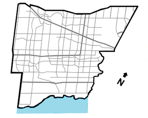

East–west roads
East-west roads in Mississauga were laid out from Dundas Street and (with the exception of Lakeshore Road) divided by Hurontario Street as East or West (e.g. Dundas Street East and Dundas Street West).
SOUTH
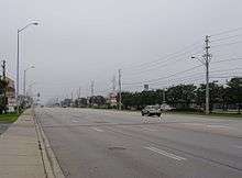
Lakeshore Road
| |
|---|---|
| Location |
Winston Churchill Blvd. - Etobicoke Creek (continues east into Toronto as Lake Shore Blvd; west into Oakville) |
A part of the former Highway 2, Lakeshore Road is the most southerly major arterial road in Mississauga, and is a continuation of Lake Shore Boulevard in Toronto. Lakeshore jogs 2 km south at Southdown Road in order to remain close to the shoreline, and it continues west into Oakville, before ending in Burlington. Lakeshore is the only arterial road which crosses Hurontario Street but is not divided into east and west segments by it, instead being split by the Credit River.
Royal Windsor Drive
| |
|---|---|
| Location |
Winston Churchill Blvd. - Southdown Rd. (continues west into Oakville; east as the eastern leg of Lakeshore Rd.) |
Royal Windsor Drive is the westerly concession road continuation of Lakeshore Road's main (eastern) section. It was the concession road between Concession II SDS (South of Dundas Street) and Concession III SDS, which is the present western section of Lakeshore after it jogs south along Southdown Road.
Queensway
| |
|---|---|
| Location |
Glengarry Rd. - Etobicoke Creek (continues east into Toronto) |
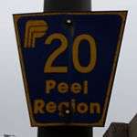
Queensway (often referred to The Queensway after its official name in Toronto) is a western continuation of the Toronto section of the street, and is designated as Peel Regional Road 20 east of Mavis Road. Once referred to as the Upper Middle Road between Dundas Street and the Middle Road (now part of the present-day Queen Elizabeth Way).
Dundas Street
| |
|---|---|
| Location |
Ninth Line - Etobicoke Creek (continues east into Toronto; west into Oakville) |
Dundas Street is a section of the former Highway 5, and was a very busy and important historical route running from Toronto to London. Dundas is traditionally considered Mississauga's main east-west street.
NORTH
Bloor Street
| |
|---|---|
| Location |
Central Pkwy - Etobicoke Creek (continues east into Toronto) |
Bloor Street continues from Toronto and ends at Central Parkway. Formerly had a short, separate western stub running west of Hurontario St, which is part of Central Parkway today.
Central Parkway
| |
|---|---|
| Location |
Burnhamthorpe Rd. - Eglinton Ave. via south-east-north loop (west leg continues north as Creditview Rd.; east leg continues north as Kennedy Rd.) |
Central Parkway is a road with an unusual course; running south from Burnhamthorpe Road as a continuation of Creditview Road, then turns east along the baseline of Bloor St. west of its terminus, where it turns back north to Eglinton Avenue and becomes Kennedy Road. It was the only completed section of what was intended to be a series of ring roads around the City Centre.
Burnhamthorpe Road
| |
|---|---|
| Location |
Ninth Line - Etobicoke Creek (continues east into Toronto; west into Oakville) |
Burnhamthorpe Road runs across the city and continues into both Toronto and Oakville, passing through the Mississauga City Centre en route. An unusual aspect of Burnhamthorpe is that, unlike other thoroughfares originating in Toronto, the road is relatively short in that city and its primary section runs through Mississauga. The road is named after the former hamlet at the intersection of Dixie Road, which was in turn named by settler John Abelson after his hometown of Burnham Thorpe, England.[1]
Burnamthorpe was formerly a concession road between Concession I NDS and Concession II NDS (North of Dundas).
Rathburn Road
| |
|---|---|
| Location | Creditview Rd - dead end at Etobicoke Creek |
Rathburn Road runs from Creditview Road to east of Fieldgate Drive. Originally intended to be an extension of a separate, older section in Toronto. However, the proposed bridge over the Etobicoke Creek to connect the two sections was never constructed due to opposition by residents.
Centre View Drive
| |
|---|---|
| Location |
Mavis Rd/Highway 403 - Rathburn Rd. (continues south as City Centre Dr.) |
Centre View Drive was constructed in the early 1990s to provide direct access between Highway 403 and the City Centre. It splits off the eastbound Mavis Road offramp and passes under it (westbound traffic uses Mavis itself to access the 403) then ducks beneath Confederation Parkway and runs parallel to the freeway until just west of Hurontario Street, where it turns south, crosses Rathburn Rd., and continues as City Centre Drive.
Eastgate Parkway
| |
|---|---|
| Location |
Highway 403 - Eglinton Ave. (continues north as Creekbank Dr.) |
Eastgate Parkway was also constructed in the early 1990s, as an arterial extension of the east-west leg of Highway 403 where the freeway sharply turns north to meet Highway 401 near the northern terminus of Cawthra Road. It runs east to Fieldgate Drive, where it curves north to end at Eglinton Avenue. A portion of the Mississauga Transitway runs parallel to the road for its entire length.
Eglinton Avenue
| |
|---|---|
| Location |
Highway 407 overpass - Renforth Drive (continues east into Toronto; west into Milton as Lower Baseline) |
Eglinton Avenue continues west from Toronto and continues still further west into Milton as Lower Baseline. From Renforth Drive west to the Etobicoke Creek, it forms part of the Mississauga-Toronto city boundary. The Mississauga Transitway runs along the north side of the street along this stretch.
Formerly a part of Lower Baseline, which was so named due its role as the divider between two separate concession road surveys, which resulted in it being the original termini of several north-south roads on both sides of it.
Matheson Boulevard
| |
|---|---|
| Location |
Terry Fox Way - Renforth Drive (continues 350 m. east into Toronto) |
Matheson Boulevard is a mid-concession road built in modern times and follows a gradual diagonal course. It originally had a separate section through the Airport Corporate Centre it was bridged over the Etobicoke Creek. It ends at Renforth Drive in the east and has a brief 350 metre (0.2 mile) extension into Toronto via an overpass to meet Eglinton Ave.[2] It began a minor road which turned south at Dixie Road, and after being extended, the short north-south section was bypassed, though it was not renamed, and was itself extended south to meet Eglinton. However, this is technically not a name duplication, as the main section of the street has "East" and "West" designations, while the bypassed portion does not.
Britannia Road
| |
|---|---|
| Location |
Highway 407 - Pearson Airport cargo terminal (interrupted by the Highways 401, 403, and 410 interchange; continues west into Milton) |
Britannia Road continues east from Milton, and is designated as Peel Regional Road 3 as far as Hurontario St. It then continues to Kennedy Road, where it breaks due to the presence of the Highways 401, 403, and 410 stack interchange. It resumes west of Tomken Road and ends in the cargo terminal area inside Toronto Pearson International Airport. Originally extended to Indian Line, but that section was cut off by the airport, though the easternmost portion still exists and is named Elmbank Drive, after the hamlet the airport displaced.
Britannia was formerly a sideroad between lots 5 and 6.
Courtneypark Drive
| |
|---|---|
| Location |
Mavis Rd. - Britannia Rd. |
Courtneypark Drive is a modern, mid-concession road and runs east from Mavis Road and joins with Britannia Rd. in the western infield area of Pearson Airport.
Derry Road
| |
|---|---|
| Location |
Highway 407 - Highway 427 (continues west into Milton; east into Toronto as Rexdale Blvd.) |
Derry Road is designated as Peel Regional Road 5 with a bypassed section in Meadowvale Village renamed as Old Derry Road; continues as Rexdale Boulevard in Toronto (east of Highway 427)
Derry was formerly a sideroad between lots 10 and 11.
North–south roads
Mississauga's north-south roads were sideroads, running perpendicular to the concession roads, with Hurontario St. as the dividing line. Due to the separate survey grids on either side of Eglinton Ave., few roads run the full north-south distance through the city, except where the two grids line up.
WEST of Hurontario
Ninth Line
| |
|---|---|
| Location |
Dundas St.- north city limits (continues south into Oakville; north into Halton Hills) |
Ninth Line (originally Ninth Line East) was originally in Halton Region, and its designation follows the numbering sequence of roads therein: Bronte Steet in Milton being First; Highway 25 Second; and so forth.
When Mississauga was incorporated as a city, land was transferred from Halton to Peel. At that time, Ninth Line marked much of the western boundary between Mississauga and Halton Region.[3] Due to an additional annexation west to Highway 407 in 2010,[4] the central section is now entirely within the city, but the road was never redesignated to reflect this. However, the stretch between Dundas St. and the vicinity of the Highways 403 and 407 interchange still serves as the west city limits, and Ninth Line also continues entirely within Halton on both the north and south.
Winston Churchill Boulevard
| |
|---|---|
| Location |
Lakeshore Rd. - Highway 401 (continues north and forms the boundary of Halton Hills and Brampton) |
Winston Churchill Boulevard is designated Regional Road 19 between Lakeshore Rd. and Dundas St. It was the original western boundary of the city, and the original border between Halton and Peel Regions, until the lands to the west were annexed from Halton to Peel. It still forms the city limits south of Dundas.
From Eglinton northwards, it was formerly Sixth Line West.
Glen Erin Drive
| |
|---|---|
| Location |
Dundas St. - Derry Rd. |
Glen Erin Drive is a winding road that was constructed in phases to serve the planned communities of Erin Mills and Meadowvale, with the central connecting portion being completed in 1993.
Southdown Road
| |
|---|---|
| Location |
Lakeshore Rd. - QEW (continues west as the western leg of Lakeshore Rd; north as Erin Mills Pkwy) |
Southdown Road begins where Lakeshore Rd. jogs by continuing it northwards at a 90-degree curve, functioning as the link between Lakeshore's two sections. It has two lanes until just south of the intersection of Royal Windsor Dr. and the eastern leg of Lakeshore, and widens to four lanes until it reaches the Queen Elizabeth Way, where it continues as Erin Mills Parkway.
Erin Mills Parkway
| |
|---|---|
| Location |
QEW - Turner Valley/Mississauga Rds. (continues south as Southdown Rd; north as Mississauga Rd.) |
Erin Mills Parkway is designated Regional Road 1, and is a very busy six-lane arterial which begins at the Queen Elizabeth Way as a continuation of Southdown Rd. It was named after the Erin Mills community through which it predominantly runs and was built as a realignment of Fifth Line West (which still exists in two sections; the first which still runs for approximately 1 km. (0.6 mi.) on each side of Dundas St., and the second as a part of Vista Drive near Thomas Street) and runs north to the intersection of Mississauga and Turner Valley Roads. Mississauga Road turns in from the east and continues Erin Mills' course northwards.
Mississauga Road
| |
|---|---|
| Location |
Lake Ontario - north city limits (continues north into Brampton) |
Mississauga Road begins at J.C. Saddington Park by as a north-south road, then angles northwest from near the QEW to south of Dundas St. where it resumes its north-south course. It serves as the main drag of Streetsville where it is called Queen Street and uses Britannia Rd. as an anomalous local north-south divider. Despite its length, it's predominantly a low-capacity two-lane road until Britannia Road, where it widens to four lanes, and expands to a major six-lane artery after it merges with Erin Mills Pkwy (see above) and assumes the Regional Road 1 designation just south of Highway 401. It continues into Brampton and ends in Caledon.
From Eglinton northwards, it was formerly Fourth Line West.
Creditview Road
| |
|---|---|
| Location |
Burnhamthorpe Rd. - Derry Rd. (continues south as Central Pkwy.; north as Meadowvale Blvd.) |
Creditview Road gets its name due to it running very near or within the Credit River valley, although it only runs through the valley itself within Brampton today. The southern portion between Burnhamthorpe Rd. and Eglinton Ave. was realigned to link with the western leg of Central Parkway. The old portion was renamed, on each side of Highway 403, as Perivale and Rathkeale Roads, with their former status as Creditview being evident by the utility poles which still line them. To the north, the street was also realigned near Derry and Old Derry Roads to bring it outside the Credit River valley and interline it with Meadowvale Boulevard, leaving two bypassed sections: Old Creditview Road and Bellshire Gate. Consequently, the Brampton section of Creditview is now entirely discontinuous from its Mississauga counterpart.
Between Eglinton and Old Derry, Creditview was formerly Third Line West.[5]
Mavis Road
| |
|---|---|
| Location |
Queensway - north city limits (continues south as Stavebank Rd; north into Brampton) |

Mavis Road is a continuation (and formerly part) of Stavebank Road. It originally ended at Eglinton, but was extended to its present length in two phases during the 1990s, bypassing Second Line West, and then merging with it just north of the city limits in Brampton.
Confederation Parkway
| |
|---|---|
| Location |
Queensway - Eglinton Ave. (continues north as McLaughlin Rd.) |
Confederation Parkway begins as a two-lane road at Queensway, widens to four lanes at Dundas St., and curves northwesterly towards Eglinton Ave. The section through the City Centre is rapidly developing into a condominium tower highrise node.
McLaughlin Road
| |
|---|---|
| Location |
Eglinton Ave. - north city limits (continues south as Confederation Pkwy; north into Brampton) |
McLaughlin Road is a continuation of Confederation Parkway. When it was reconstructed from a rural to a suburban road in 1989, it was built with only two lanes between Bristol Road and Matheson Boulevard to preserve a maple sugar bush on the western boundary of the historic Britannia Farm property.
McLaughlin Road is formerly First Line West.
Hurontario Street
| |
|---|---|
| Location |
Lakeshore Rd. - north city limits (continues north into Brampton) |
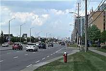
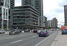
Hurontario Street is Mississauga's main street. Runs north from Lakeshore Road (Lake Ontario) and continues all the way to Collingwood on Georgian Bay (Lake Huron), hence the street's name. Formerly part of Highway 10 and still often colloquially labelled as such. The Hurontario LRT, a Light Rail Transit line planned to run along the street, has been approved, with construction expected to begin in 2018.[6]
Hurontario was the centre of the land survey, and marks the division between 'East' and 'West'.
EAST of Hurontario
Kennedy Road
| |
|---|---|
| Location |
Eglinton Ave. - north city limits (continues south as Central Parkway; north into Brampton) |
Kennedy Road runs north from Eglinton Ave. and continues south of it as Central Parkway. It is named after Thomas Laird Kennedy, a former local MPP and the 15th Premier of Ontario.
It was formerly First Line East.
Cawthra Road
| |
|---|---|
| Location | Lakeshore Rd. - Highway 403 |
Cawthra Road is designated as Peel Regional Road 17 and runs from Lakeshore Rd. to Eastgate Pkwy. and then interchanges with Highway 403. Named after the Cawthra family, whose estate, today owned by the City of Mississauga, is still located on the road.[7]
A different survey grid was used in southern Peel - thus Cawthra does easily fit into the line road numbering.
Tomken Road
| |
|---|---|
| Location |
Dundas St. - north city limits (continues north into Brampton) |
Tomken Road, like Kennedy Road, is named for Thomas Laird Kennedy, with "Tomken" being a portmanteau: Thomas Kennedy. The portion north of Eglinton Ave. was once called Heart Lake Road (parts of which still exist in Brampton), but was absorbed into Tomken when the two roads were interlined.
It was formerly Second Line East.
Dixie Road
| |
|---|---|
| Location |
Lakeshore Rd. - north city limits (continues north into Brampton) |
Dixie Road is designated as Peel Regional Road 4 (and also, as of 2016, Veterans Memorial Roadway)[8] and is one of city's busiest roads, with very heavy truck traffic in the industrial areas in the vicinity of Highway 401. Dixie forms the western boundary of Pearson Airport for a short distance south of Derry Road, and is the easternmost arterial in the southern half of Mississauga, due to the city's eastern boundary tapering towards the lake.
It is named after a former hamlet, which itself was named for Dr. Beaumont Dixie, who lived in Erindale.[9]
North of Eglinton, it was formerly Third Line East. South of Eglinton, the survey system was different, and Dixie was the sideroad between lots 5 and 6.
Bramalea Road
| |
|---|---|
| Location |
Derry Rd. - north city limits (continues north into Brampton) |
Bramalea Road is named after the Bramalea area of Brampton. It was formerly Fourth Line East.
Torbram Road
| |
|---|---|
| Location |
Derry Rd. - Canadian National Halwest Subdivision (continues north into Brampton) |
Torbram Road's name is a portmanteau of Toronto and Brampton. "Toronto" likely refers to Toronto Township, the precursor municipality to Mississauga, rather than to the city. It was formerly Fifth Line East, which once continued south to present-day Eglinton Avenue, with the southern section being removed with the expansion of Pearson Airport.
Airport Road
| |
|---|---|
| Location |
Highway 427 - CN Halwest Subdivision (continues north into Brampton; east into Toronto as Dixon Rd) |
Airport Road is designated as Peel Regional Road 7 and, as the name suggests, passes by Pearson Airport. Its original southern terminus was at Lower Baseline (present-day Eglinton Ave.) but today swings east to link with Dixon Road in Toronto at Highway 427. Northwards, it runs through the Malton neighbourhood, and continues all the way to the Dufferin/Simcoe County line south of Stayner where it officially loses its name.
Goreway Drive
| |
|---|---|
| Location |
Highway 427 overpass - CN Halwest Subdivision (continues north into Brampton; east into Toronto as Disco Rd.) |
Goreway Drive is named after the former Toronto Gore Township. It begins south of Derry Rd. at Highway 427 (but has no interchange), and passes under the freeway into Toronto as Disco Road. The elevated tracks of the Union Pearson Express (UP) run alongside the street near its southern end.
Finch Avenue
| |
|---|---|
| Location |
Highway 427 - CN Halwest Subdivision (continues north into Brampton; east into Toronto) |
Finch Avenue is designated Peel Regional Road 2, and runs for only 1 km. (0.6 mi.)[10] through the extreme northeast corner of the city before continuing into Brampton where it ends at Steeles Avenue after a similarly short distance, making it the shortest regional road in Peel Region. However, to the south, it curves eastwards to cross Highway 427 into Toronto, where it continues as one of that city's major east-west streets and eventually reaches Pickering. The Indian Line Campground, situated in the Claireville Conservation Area, is located on the street.
Provincially maintained highways
The Queen Elizabeth Way, Highway 401, Highway 403, Highway 407, Highway 409, Highway 410 and Highway 427 are provincially maintained highways that intersects with roads in Mississauga.
See also
References
- ↑ http://heritagemississauga.com/page/Burnhamthorpe
- ↑ Google (June 9, 2017). "Matheson Blvd route Toronto" (Map). Google Maps. Google. Retrieved June 9, 2017.
- ↑ "Property Research in Peel ~ A How-To Guide ~" (PDF). Retrieved 2018-02-23.
- ↑ "Home – Welcome to the City of Mississauga". Mississauga.ca. 2010-07-27.
- ↑ Scheinman, André (2006). "FARMSTEADS OF FORMER CHINGUACOUSY TOWNSHIP" (PDF). Retrieved 2018-02-23.
- ↑ "Hurontario Light Rail Transit (LRT)". Metrolinx. Retrieved June 6, 2017.
- ↑ http://heritagemississauga.com/page/Grace-Harry-Cawthra-Elliot
- ↑ "New Peel road signs pay tribute to Canada's Armed Forces veterans". Brampton Guardian. May 10, 2016.
- ↑ http://heritagemississauga.com/page/Dixie
- ↑ Google (June 6, 2017). "Finch Avenue route Mississauga" (Map). Google Maps. Google. Retrieved June 6, 2017.
