Hayrabolu
| Hayrabolu | |
|---|---|
 Hayrabolu | |
| Coordinates: 41°12′47″N 27°06′00″E / 41.21306°N 27.10000°ECoordinates: 41°12′47″N 27°06′00″E / 41.21306°N 27.10000°E | |
| Country |
|
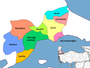
| Province | Tekirdağ |
| Government | |
| • Mayor | Hasan İrtem (DP) |
| • Kaymakam | Ali Fuat Türkel |
| Area[1] | |
| • District | 1,036.87 km2 (400.34 sq mi) |
| Elevation | 81 m (266 ft) |
| Population (2012)[2] | |
| • Urban | 18,708 |
| • District | 34,478 |
| • District density | 33/km2 (86/sq mi) |
| Post code | 59400 |
| Website | www.hayrabolu.bel.tr |
Hayrabolu (Chariòpolis, Χαριόπολη in Greek) is a town and district of Tekirdağ Province in the Marmara region of Turkey. As of 2013 the mayor is Hasan İrtem of the (Democratic Party).
History
Hayrabolu is one of the oldest settled areas of Thrace. Its old name was "Chariupolis" (Hanri-polis: The windy city). Turks first conquered it in 1357, it was soon taken back by the Byzantines. In 1368, during the period of Sultan Murad I, it was conquered for the second and the last time. Families chosen from different districts of Anatolia, especially from Kayseri and Sivas, were settled in and around Hayrabolu, the name of which was changed first to Hayrı-bol and finally to Hayrabolu.
Today
Today Hayrabolu is a small market town serving the countryside around it. There is a military base here. There is a Romani community of long standing.
References
- ↑ "Area of regions (including lakes), km²". Regional Statistics Database. Turkish Statistical Institute. 2002. Retrieved 2013-03-05.
- ↑ "Population of province/district centers and towns/villages by districts - 2012". Address Based Population Registration System (ABPRS) Database. Turkish Statistical Institute. Retrieved 2013-02-27.
External links
- Tekirdağ governor's official website – Hayrabolu
- Hayrabolu.net
- E-Hayrabolu.com
External links