Hardwicke Bay, South Australia
| Hardwicke Bay South Australia | |||||||||||||||
|---|---|---|---|---|---|---|---|---|---|---|---|---|---|---|---|
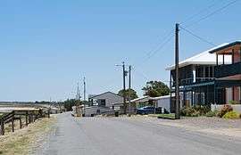 A seaside street in Hardwicke Bay | |||||||||||||||
 Hardwicke Bay | |||||||||||||||
| Coordinates | 34°53′31″S 137°27′29″E / 34.892050°S 137.458150°ECoordinates: 34°53′31″S 137°27′29″E / 34.892050°S 137.458150°E | ||||||||||||||
| Population | 127 (2011 census)[1] | ||||||||||||||
| Established | 1999[2] | ||||||||||||||
| Postcode(s) | 5575[3][2] | ||||||||||||||
| Time zone | ACST (UTC+9:30) | ||||||||||||||
| • Summer (DST) | ACST (UTC+10:30) | ||||||||||||||
| Location |
| ||||||||||||||
| LGA(s) | Yorke Peninsula Council[4] | ||||||||||||||
| Region | Yorke and Mid North[5] | ||||||||||||||
| County | Fergusson[2] | ||||||||||||||
| State electorate(s) | Narungga[6] | ||||||||||||||
| Federal Division(s) | Grey[7] | ||||||||||||||
| |||||||||||||||
| |||||||||||||||
| Footnotes |
Climate[8] Coordinates[2] Adjoining localities[4] | ||||||||||||||
Hardwicke Bay is a locality in the Australian state of South Australia located on the west coast of Yorke Peninsula overlooking the bay also named Hardwicke Bay about 104 kilometres (65 miles) west of the Adelaide city centre and about 9 kilometres (5.6 miles) north of the town of Warooka.[3][4]
The boundaries of the locality were created on 27 May 1999 for the “long established name” and including the two shack sites known respectively as the “original shack site” and the “Moorowie Shack Site.”[2][9][10][11]
Hardwicke Bay is located within the federal Division of Grey, the state electoral district of Narungga and the local government area of the Yorke Peninsula Council.[4][7][6]
The majority land use within the locality is “primary production.”[12]
The 2011 census reported Hardwicke Bay as having a population of 127 people.[1]
See also
References
- 1 2 Australian Bureau of Statistics (31 October 2012). "Hardwicke Bay". 2011 Census QuickStats. Retrieved 5 December 2015.

- 1 2 3 4 5 "Search result for "HARDWICKE BAY (LOCB)" (Record no SA0029357)". Department of Planning, Transport and Infrastructure. Retrieved 1 December 2015.
- 1 2 3 "Hardwicke Bay Postcode". Australian Postcode Finder. Retrieved 4 December 2015.
- 1 2 3 4 "New Ward Structure 2014". Yorke Peninsula Council. Retrieved 21 October 2015.
- ↑ "Yorke and Mid North SA Government region" (PDF). The Government of South Australia. Retrieved 17 April 2017.
- 1 2 Narungga (Map). Electoral District Boundaries Commission. 2016. Retrieved 1 March 2018.
- 1 2 "Federal electoral division of Grey" (PDF). Australian Electoral Commission. Retrieved 24 July 2015.
- ↑ "Summary statistics WAROOKA". Commonwealth of Australia , Bureau of Meteorology. Retrieved 4 December 2015.
- ↑ "Search result for "MOOROWIE SHACK SITE" (Record no SA0046195)". Department of Planning, Transport and Infrastructure. Retrieved 5 December 2015.
- ↑ "Search result for "HARDWOCKE (sic) BAY SHACK SITE " (Record no SA0030679)". Department of Planning, Transport and Infrastructure. Retrieved 5 December 2015.
- ↑ Kentish, P. M. (27 May 1999), "GEOGRAPHICAL NAMES ACT 1991, Notice to Assign Boundaries and Names to Places", The South Australian Government Gazette: 2696, retrieved 5 December 2015
- ↑ "Development Plan - Yorke Peninsula Council" (PDF). Department of Planning, Transport and Infrastructure. pp. 255–257 & 394–396. Archived from the original (PDF) on 4 June 2015. Retrieved 24 July 2015.