Coobowie
| Coobowie South Australia | |||||||||||||||
|---|---|---|---|---|---|---|---|---|---|---|---|---|---|---|---|
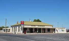 Hotel Coobowie | |||||||||||||||
 Coobowie | |||||||||||||||
| Coordinates | 35°02′0″S 137°43′0″E / 35.03333°S 137.71667°ECoordinates: 35°02′0″S 137°43′0″E / 35.03333°S 137.71667°E | ||||||||||||||
| Population | 220 (shared with other localities in the "State Suburb of Coobowie") (2011 census)[1] | ||||||||||||||
| Established | 1875[2] | ||||||||||||||
| Postcode(s) | 5583[3] | ||||||||||||||
| Location | |||||||||||||||
| LGA(s) | Yorke Peninsula Council | ||||||||||||||
| Region | Yorke and Mid North[4] | ||||||||||||||
| County | Fergusson[2] | ||||||||||||||
| State electorate(s) | Narungga[5] | ||||||||||||||
| Federal Division(s) | Grey[6] | ||||||||||||||
| |||||||||||||||
| |||||||||||||||
| Footnotes |
Locations[3][2] Adjoining localities[8] | ||||||||||||||
Coobowie is a town in the Australian state of South Australia near the south-eastern tip of Yorke Peninsula. Coobowie was proclaimed in 1875. Coobowie comes from an Aboriginal word meaning "wild fowl water".[2] At the 2011 census, Coobowie shared a population of 220 with other localities. Coobowie's current outlook is to create many new features, including a new visitor information pull in being built. The cafe also has a florist.
The protected area known as the Coobowie Aquatic Reserve is partly located within Coobowie with the remainder being located in the adjoining bay, Salt Creek Bay.[9]
See also
References
- ↑ Australian Bureau of Statistics (31 October 2012). "Coobowie". 2011 Census QuickStats. Retrieved 8 April 2016.

- 1 2 3 4 "Search result for "Coobowie (Locality bounded)" (Record no. SA0015219) with the following layers selected - "Suburbs and Localities" and " Place names (gazetteer)"". Property Location Browser. Government of South Australia. Archived from the original on 12 October 2016. Retrieved 24 June 2016.
- 1 2 "Coobowie, South Australia (Postcode)". postcodes-australia.com. Retrieved 24 June 2016.
- ↑ "Yorke and Mid North SA Government region" (PDF). The Government of South Australia. Retrieved 17 April 2017.
- ↑ Narungga (Map). Electoral District Boundaries Commission. 2016. Retrieved 1 March 2018.
- ↑ "Federal electoral division of Grey" (PDF). Australian Electoral Commission. Retrieved 24 July 2015.
- 1 2 3 "Monthly climate statistics: Summary statistics Edithburgh (nearest station)". Commonwealth of Australia , Bureau of Meteorology. Retrieved 24 June 2016.
- ↑ "New Ward Structure 2014". Yorke Peninsula Council. Archived from the original on 15 January 2016. Retrieved 21 October 2015.
- ↑ Primary Industries and Regions South Australia (PIRSA) (2007), Aquatic Reserve: Coobowie (PDF), Primary Industries and Regions South Australia
External links
| Major Townships | |||||||
|---|---|---|---|---|---|---|---|
| Minor Townships | |||||||
| Governance |
| ||||||
| Coastal features | |||||||
| Protected areas |
| ||||||
| Adjacent islands | |||||||
| Related and uncategorised | |||||||
| |||||||
This article is issued from
Wikipedia.
The text is licensed under Creative Commons - Attribution - Sharealike.
Additional terms may apply for the media files.