Brentwood, South Australia
| Brentwood South Australia | |||||||||||||||
|---|---|---|---|---|---|---|---|---|---|---|---|---|---|---|---|
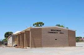 Community hall | |||||||||||||||
 Brentwood | |||||||||||||||
| Coordinates | 34°51′43″S 137°29′46″E / 34.86194°S 137.49611°ECoordinates: 34°51′43″S 137°29′46″E / 34.86194°S 137.49611°E | ||||||||||||||
| Postcode(s) | 5575 | ||||||||||||||
| Location | |||||||||||||||
| LGA(s) | Yorke Peninsula Council | ||||||||||||||
| Region | Yorke and Mid North[1] | ||||||||||||||
| County | Fergusson[2] | ||||||||||||||
| State electorate(s) | Narungga[3] | ||||||||||||||
| Federal Division(s) | Grey[4] | ||||||||||||||
| |||||||||||||||
| Footnotes | Adjoining localities[5] | ||||||||||||||
Brentwood is a locality on the Yorke Peninsula in the Australian state of South Australia.[6] The town is located in the Yorke Peninsula Council local government area, 212 kilometres (132 mi) west of the state capital, Adelaide by road (103 kilometres (64 mi) as the crow flies). It is on the Yorke Highway, between Minlaton and Hardwicke Bay.[2]
See also
References
- ↑ "Yorke and Mid North SA Government region" (PDF). The Government of South Australia. Retrieved 17 April 2017.
- 1 2 3 "Property location Browser". Government of South Australia, Department of Planning, transport and Infrastructure. Retrieved 30 September 2014.
- ↑ Narungga (Map). Electoral District Boundaries Commission. 2016. Retrieved 1 March 2018.
- ↑ "Federal electoral division of Grey" (PDF). Australian Electoral Commission. Retrieved 24 July 2015.
- ↑ "New Ward Structure 2014". Yorke Peninsula Council. Archived from the original on 15 January 2016. Retrieved 21 October 2015.
- ↑ "2905.0 - Statistical Geography: Volume 2 -- Census Geographic Areas, Australia, 2006". Australian Bureau of Statistics. Retrieved 8 December 2009.
| Wikimedia Commons has media related to Brentwood, South Australia. |
This article is issued from
Wikipedia.
The text is licensed under Creative Commons - Attribution - Sharealike.
Additional terms may apply for the media files.