Sandilands, South Australia
| Sandilands South Australia | |||||||||||||||
|---|---|---|---|---|---|---|---|---|---|---|---|---|---|---|---|
 Sandilands | |||||||||||||||
| Coordinates | 34°30′46″S 137°46′54″E / 34.512670°S 137.781680°ECoordinates: 34°30′46″S 137°46′54″E / 34.512670°S 137.781680°E | ||||||||||||||
| Population | 470 (shared with other localities within the “State Suburb of Price”) (2011 census)[1] | ||||||||||||||
| Established | 1999[2] | ||||||||||||||
| Postcode(s) | 5571[3] | ||||||||||||||
| Time zone | ACST (UTC+9:30) | ||||||||||||||
| • Summer (DST) | ACST (UTC+10:30) | ||||||||||||||
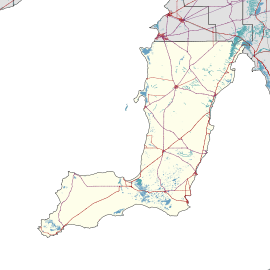
| Location |
| ||||||||||||||
| LGA(s) | Yorke Peninsula Council | ||||||||||||||
| State electorate(s) | Narungga[4] | ||||||||||||||
| Federal Division(s) | Grey[5] | ||||||||||||||
| |||||||||||||||
| |||||||||||||||
| Footnotes |
Distances[3] Coordinates[2] Climate[6] Adjoining localities[2] | ||||||||||||||
Sandilands is a locality in the Australian state of South Australia located on the east coast of Yorke Peninsula immediately adjoining Gulf St Vincent about 88 kilometres (55 miles) north-west of the Adelaide city centre and about 14 kilometres (8.7 mi) south of Ardrossan.[3][2][7]
Its boundaries which were created in May 1999 for the “long established name.”[2][8] The locality’s name is derived from Robert Hamilton Sandilands (1841-1923) who lived there during the 1880s.[9][10]
As of 2014, the majority land use within the locality is “primary production.”[7]
Sandilands is located within the federal division of Grey, the state electoral district of Narungga and the local government area of the Yorke Peninsula Council.[5][4][2]
References
- ↑ Australian Bureau of Statistics (31 October 2012). "Price". 2011 Census QuickStats. Retrieved 27 February 2016.

- 1 2 3 4 5 6 "Search result for "Sandilands (Locality Bounded)" (Record no SA0060457) with the following layers selected - "Suburbs and Localities" and " Place names (gazetteer)"". Property Location Browser. Department of Planning, Transport and Infrastructure. Retrieved 27 February 2016.
- 1 2 3 "Sandilands, South Australia (Postcode)". postcodes-australia.com. Retrieved 27 February 2016.
- 1 2 Narungga (Map). Electoral District Boundaries Commission. 2016. Retrieved 1 March 2018.
- 1 2 "Federal electoral division of Grey" (PDF). Australian Electoral Commission. Retrieved 24 July 2015.
- ↑ "Monthly climate statistics: Summary statistics PRICE". Commonwealth of Australia , Bureau of Meteorology. Retrieved 27 February 2016.
- 1 2 "Development Plan - Yorke Peninsula Council" (PDF). Department of Planning, Transport and Infrastructure. pp. 153, 231–232 & 323. Archived from the original (PDF) on 4 June 2015. Retrieved 25 February 2016.
- ↑ Kentish, P. M. (27 May 1999), "GEOGRAPHICAL NAMES ACT 1991, Notice to Assign Boundaries and Names to Places", The South Australian Government Gazette: 2696, retrieved 5 December 2015
- ↑ "OBITUARY". Observer. LXXX, (5, 983). South Australia. 29 September 1923. p. 39. Retrieved 27 February 2016 – via National Library of Australia.
- ↑ "Sandilands, Nomenclature". State Library of South Australia. Retrieved 25 February 2016.
This article is issued from
Wikipedia.
The text is licensed under Creative Commons - Attribution - Sharealike.
Additional terms may apply for the media files.