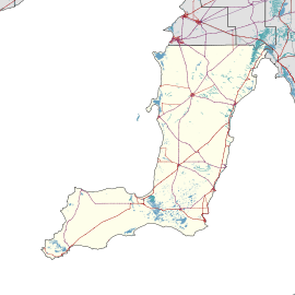
Winulta, South Australia
| Winulta South Australia | |||||||||||||||
|---|---|---|---|---|---|---|---|---|---|---|---|---|---|---|---|
 Winulta | |||||||||||||||
| Coordinates | 34°17′S 137°52′E / 34.28°S 137.86°ECoordinates: 34°17′S 137°52′E / 34.28°S 137.86°E | ||||||||||||||
| Population | 470 (shared with other localities in the ‘State Suburb of Price’) (2011 census)[1] | ||||||||||||||
| Postcode(s) | 5570 | ||||||||||||||
| LGA(s) | Yorke Peninsula Council | ||||||||||||||
| Region | Yorke and Mid North[2] | ||||||||||||||
| County |
Daly[3] Fergusson[3] | ||||||||||||||
| State electorate(s) | Narungga[4] | ||||||||||||||
| Federal Division(s) | Grey[5] | ||||||||||||||
| |||||||||||||||
| Footnotes | Adjoining localities[3] | ||||||||||||||
Winulta was a town in the Australian state of South Australia on northern Yorke Peninsula around 10 km from Clinton on the Clinton-Maitland road. It was first settled for farming around 1876. The earliest farmers were William Short, Thomas Kenny and John Sharrad.[6]
The nearby "Hundred of Tiparra School" opened in 1884, was renamed "Winulta School" in 1891 and closed in 1950.[7]
Winulta is located within the federal division of Grey, the state electoral district of Narungga and the local government area of the Yorke Peninsula Council.[5][4][3]
See also
References
- ↑ Australian Bureau of Statistics (31 October 2012). "Price )". 2011 Census QuickStats. Retrieved 7 May 2017.

- ↑ "Yorke and Mid North SA Government region" (PDF). The Government of South Australia. Retrieved 17 April 2017.
- 1 2 3 4 "Search result(s) for Winulta (LOCB) (Record No. SA0026874) with the following layers being selected - "Suburbs and Localities", "Counties", "Hundreds", "Place names (gazetteer)" and "Road labels"". Property Location Browser. Government of South Australia. Retrieved 28 April 2017.
- 1 2 Narungga (Map). Electoral District Boundaries Commission. 2016. Retrieved 1 March 2018.
- 1 2 "Federal electoral division of Grey" (PDF). Australian Electoral Commission. Retrieved 24 July 2015.
- ↑ "Y.P. Octogenarian Honored". The Kadina and Wallaroo Times (SA : 1888 - 1954). SA: National Library of Australia. 30 October 1926. p. 2. Retrieved 25 October 2015.
- ↑ "Manning Dictionary of South Australian Placenames". State Library of South Australia. Retrieved 25 October 2015.
External links
This article is issued from
Wikipedia.
The text is licensed under Creative Commons - Attribution - Sharealike.
Additional terms may apply for the media files.