Cunningham, South Australia
| Cunningham South Australia | |||||||||||||||
|---|---|---|---|---|---|---|---|---|---|---|---|---|---|---|---|
 Cunningham | |||||||||||||||
| Coordinates | 34°25′12″S 137°47′56″E / 34.42°S 137.799°ECoordinates: 34°25′12″S 137°47′56″E / 34.42°S 137.799°E | ||||||||||||||
| Postcode(s) | 5571 | ||||||||||||||
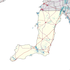
| Location | |||||||||||||||
| LGA(s) | Yorke Peninsula Council | ||||||||||||||
| State electorate(s) | Narungga | ||||||||||||||
| Federal Division(s) | Grey | ||||||||||||||
| |||||||||||||||
| Footnotes | [1] | ||||||||||||||
Cunningham is a locality on Yorke Peninsula in South Australia. It lies on the road between Ardrossan and Maitland.
The area is in the traditional lands of the Narungga people. Cunningham was settled in the 19th century. The present boundaries were formalised in May 1999. They straddle the boundary of the Hundred of Cunningham and Hundred of Maitland.[1] The principal industry is farming, in particular growing cereal grain and sheep.
A Wesleyan Chapel was erected in 1879.[2] In 1881, there was a school operated at Cunningham in a room belonging to Mr Pudney.[3]
References
- 1 2 "Placename Details: Cunningham (LOCB)". Property Location Browser Report. Government of South Australia. 17 October 2013. SA0017328. Retrieved 20 August 2018.
- ↑ "Cunningham Wesleyan Chapel". Yorke's Peninsula Advertiser. VII, (740). South Australia. 28 November 1879. p. 3. Retrieved 21 August 2018 – via National Library of Australia.
- ↑ "Cunningham School". Yorke's Peninsula Advertiser. IX, (913). South Australia. 20 September 1881. p. 3. Retrieved 21 August 2018 – via National Library of Australia.
This article is issued from
Wikipedia.
The text is licensed under Creative Commons - Attribution - Sharealike.
Additional terms may apply for the media files.