Mudanya
| Mudanya | |
|---|---|
 Mudanya | |
| Coordinates: 40°22′35″N 28°53′00″E / 40.37639°N 28.88333°ECoordinates: 40°22′35″N 28°53′00″E / 40.37639°N 28.88333°E | |
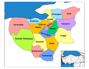
| Country | Turkey |
| Province | Bursa |
| Government | |
| • Mayor | Hayri Türkyılmaz (CHP) |
| • Kaymakam | Orhan Çiftçi |
| Area[1] | |
| • District | 333.72 km2 (128.85 sq mi) |
| Population (2012)[2] | |
| • Urban | 56,153 |
| • District | 75,344 |
| • District density | 230/km2 (580/sq mi) |
| Post code | 16940 |
| Website | www.mudanya.bel.tr |
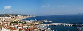
Mudanya (Mudania,[3] Greek: τα Μουδανιά, ta Moudaniá [Pl.]) (the site of ancient Apamea Myrlea), is a town and district of Bursa Province in the Marmara region of Turkey. It is located on the Gulf of Gemlik, part of the southern coast of the Sea of Marmara. As of 1911, it was connected with Bursa by the Mudanya–Bursa railway and a carriage road, and with Istanbul by steamers.[4] Mudanya has only an open anchorage usable in calm weather. The town produces olive oil and there is a pier used by local fishing and cargo boats.
History
As of 1920, Mudanya was reported as having an approximate population of 5,000. A port city, it also had a railway connection to Bursa which was completed in 1875. The railway had a pier at the seaport of Mudanya for exporting. Istanbul was often the recipient of exported goods from Mudanya. Silk was a popular export.[3]
The town was the signing place of the Armistice of Mudanya between Turkey, Italy, France and Britain on October 11, 1922, following the Turkish War of Independence.
After the Treaty of Lausanne and the Greco-Turkish population exchange agreement, the Greeks of the town were transferred into mainland Greece, establishing a settlement to which they gave the name of their previous town, Nea Moudania (New Moudania, located on the Chalkidiki peninsula, in the Macedonia region of Greece.) In return, a number of Cretan Turks were settled in Mudanya.
Traditional architecture in Mudanya
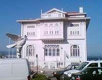 The Armistice of Mudanya was signed in this Ottoman era building
 Ottoman era Governor's House in Mudanya
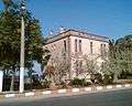 Ottoman era traditional building in Mudanya
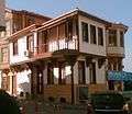 Ottoman era traditional house in Mudanya
 Ottoman era traditional house in Mudanya
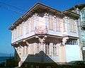 Ottoman era traditional house in Mudanya
 Ottoman era traditional house in Mudanya
 Ottoman era traditional house in Mudanya
 Ottoman era traditional houses in Mudanya
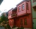 Ottoman era traditional houses in Mudanya
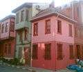 Ottoman era traditional houses in Mudanya
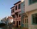 Ottoman era traditional houses in Mudanya
See also
References
- ↑ "Area of regions (including lakes), km²". Regional Statistics Database. Turkish Statistical Institute. 2002. Retrieved 2013-03-05.
- ↑ "Population of province/district centers and towns/villages by districts - 2012". Address Based Population Registration System (ABPRS) Database. Turkish Statistical Institute. Retrieved 2013-02-27.
- 1 2 Prothero, G.W. (1920). Anatolia. London: H.M. Stationery Office.
- ↑

External links
| Wikimedia Commons has media related to Mudanya. |