Großpostwitz
| Großpostwitz/Budestecy | ||
|---|---|---|
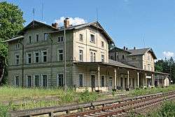 Former train station | ||
| ||
 Großpostwitz/Budestecy Location of Großpostwitz/Budestecy within Bautzen district 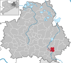  | ||
| Coordinates: 51°7′N 14°27′E / 51.117°N 14.450°ECoordinates: 51°7′N 14°27′E / 51.117°N 14.450°E | ||
| Country | Germany | |
| State | Saxony | |
| District | Bautzen | |
| Municipal assoc. | Großpostwitz-Obergurig | |
| Government | ||
| • Mayor | Frank Lehmann | |
| Area | ||
| • Total | 16.42 km2 (6.34 sq mi) | |
| Elevation | 241 m (791 ft) | |
| Population (2017-12-31)[1] | ||
| • Total | 2,710 | |
| • Density | 170/km2 (430/sq mi) | |
| Time zone | CET/CEST (UTC+1/+2) | |
| Postal codes | 02692 | |
| Dialling codes | 035938 | |
| Vehicle registration | BZ | |
| Website | www.grosspostwitz.de | |
.svg.png)
Großpostwitz (Sorbian Budestecy) is a municipality in the east of Saxony, Germany. It belongs to the district of Bautzen and lies south of the eponymous city.
The municipality except Eulowitz is part of the recognized Sorbian settlement area in Saxony. Upper Sorbian has an official status next to German, all villages bear names in both languages.
Geography
The municipality is situated at the northern edge of the Lausitzer Bergland (Lusatian Hills) along the Spree. The Bundesstraße 96 passes Großpostwitz.
Villages
Several villages belong to the municipality:
- Berge (Zahor)
- Binnewitz (Bónjecy)
- Cosul (Kózły)
- Ebendörfel (Bělšecy)
- Eulowitz (Jiłocy)
- Großpostwitz (Budestecy)
- Klein Kunitz (Chójnička)
- Mehltheuer (Lubjenc)
- Rascha (Rašow)
- Denkwitz (Dźenikecy)
History
Within the German Empire (1871-1918), Großpostwitz was part of the Kingdom of Saxony.
References
- ↑ "Aktuelle Einwohnerzahlen nach Gemeinden 2017] (Einwohnerzahlen auf Grundlage des Zensus 2011)" (PDF). Statistisches Landesamt des Freistaates Sachsen (in German). October 2018.
| Authority control |
|---|
This article is issued from
Wikipedia.
The text is licensed under Creative Commons - Attribution - Sharealike.
Additional terms may apply for the media files.