Grant Parish, Louisiana
| Grant Parish, Louisiana | |
|---|---|
| Parish | |
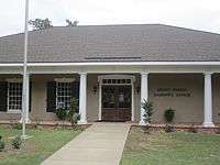
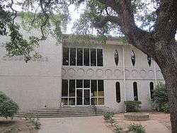 Grant Parish Courthouse in Colfax | |
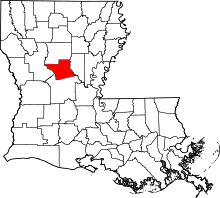 Location in the U.S. state of Louisiana | |
 Louisiana's location in the U.S. | |
| Founded | 1869 |
| Named for | Ulysses S. Grant |
| Seat | Colfax |
| Largest town | Colfax |
| Area | |
| • Total | 665 sq mi (1,722 km2) |
| • Land | 643 sq mi (1,665 km2) |
| • Water | 22 sq mi (57 km2), 3.3% |
| Population (est.) | |
| • (2015) | 22,343 |
| • Density | 35/sq mi (14/km2) |
| Congressional district | 5th |
| Time zone | Central: UTC−6/−5 |
Grant Parish (French: Paroisse de Grant) is a parish located in the North Central portion of the U.S. state of Louisiana. As of the 2010 census, the population was 22,309.[1] The parish seat is Colfax[2]. The parish was founded in 1869.[3]
Grant Parish is part of the Alexandria, LA Metropolitan Statistical Area and Red River Valley. From 1940-1960, the parish had a dramatic population loss, as many African Americans left in the Great Migration to seek better opportunities elsewhere. Such migration continued until about 1970. The parish was also one of the eleven Reconstruction parishes created, created from Winn and Rapides parishes.
Grant Parish is a home of United States Penitentiary, Pollock.
History
Grant Parish was originally a part of the more populous Rapides Parish to the south. Prior to the American Civil War, the center of activity focused upon "Calhoun's Landing," named for the cotton and sugar planter Meredith Calhoun, a native of South Carolina. Calhoun also published the former National Democrat newspaper in what became Colfax, the seat of government of the new parish.[4]
Grant was one of several new parishes created by the Reconstruction legislature in an attempt to build the Republican Party. Founded in 1869, it had a slight majority of freedmen. It was named for U.S. President Ulysses S. Grant.[5] The parish seat of Colfax was named for Grant's first vice president, Schuyler M. Colfax (pronounced COAL-facks) of Indiana. However, the town of Colfax is pronounced CAHL-facks. The parish encompassed both cotton plantations and pinewoods. It was one of several areas along the Red River that had considerable violence during Reconstruction, as whites tried to maintain social control.
The gubernatorial election of 1872 was disputed, leading to both parties' certifying their slates of local officers. The election was finally settled in favor of the Republican candidates, but the decision was disputed in certain areas. As social tensions rose, Republican officials took their places at the courthouse in Colfax. They were defended by freedmen and state militia (mostly made up of freedmen), who feared a Democratic Party takeover of the parish. Amid widespread rumors, whites organized a militia and advanced on the courthouse on Easter Sunday, 1873. In the ensuing violence, three whites and 120-150 blacks were killed, including 50 that night who were held as prisoners. Leading 20th-century historians renamed the Colfax Riot, the original state designation, as the Colfax Massacre. The total number of freedmen deaths were never established because some of the bodies were thrown into the river and woods.
The white militia was led by Christopher Columbus Nash, a Confederate officer who had been a prisoner of war at Johnson's Island in Ohio. It consisted of veterans from Grant and neighboring parishes. The following year, Nash gathered many of the white militia members as the basis of the first chapter of the White League. Other chapters quickly grew up across the state. The White League's organized violence in support of the Democratic Party included widespread intimidation of black voters. The League was integral to white Democrats' regaining power in the state by 1876. Soon after, they effectively disfranchised most blacks, a situation that persisted until after the Civil Rights-era legislation of the mid-1960s.
Population and politics
Grant Parish had the highest growth rate in central Louisiana in the five-year period between 2001 and 2006, according to projections of the United States Census Bureau. The parish has had a 4.3 percent growth rate compared to 1.7 percent for its larger neighbor, Rapides Parish. Some neighboring parishes, including Winn, have experienced population decreases.[6]
Grant Parish is heavily Republican in contested elections. Mitt Romney polled 7,082 votes (81.7 percent) in his 2012 race against the Democrat U.S. President Barack H. Obama, who trailed with 1,422 votes (16.4 percent).[7] In 2008, U.S. Senator John McCain of Arizona swept the parish too, with 6,907 votes (80.7 percent) to Obama's 1,474 (17.2 percent).[8]
In 1996, Republican Robert J. Dole narrowly won in Grant Parish over U.S. President Bill Clinton, 3,117 votes (42.8 percent) to 2,980 (40.9 percent). Ross Perot, founder of his Reform Party, polled another 1,055 (14.5 percent).[9] In 1992, George Herbert Walker Bush carried Grant Parish in his unsuccessful bid for reelection. He polled 3,214 votes (40.8 percent) to Bill Clinton's 3,122 (39.6 percent) and Perot's 1,174 (14.9 percent).[10]
The last Democrat to win in Grant Parish at the presidential level was former Governor Jimmy Carter of Georgia in his 1976 defeat of U.S. President Gerald R. Ford, Jr., with Bob Dole as the Republican vice-presidential choice.[11]
Republican U.S. President-elect Donald Trump was a runaway winner in Grant Parish in 2016 over Hillary Rodham Clinton: 7,408 (84 percent) to 1,181 (13 percent).[12]
Nativity scene
In December 2016, a courthouse nativity scene in Colfax drew a complaint from the New Orleans chapter of the American Civil Liberties Union. In a letter to the Grant Parish Police Jury, the ACLU said that officials must include secular symbols of the Christmas holiday if a nativity scene is placed alone on public property. District Attorney Jay Lemoine objected to the ACLU challenge in a statement to Alexandria Town Talk: "There have been various holiday displays presented both inside and outside the courthouse over many years. This year, as in years past, they include both secular and non-secular symbols. It is unfortunate that some are offended by these displays during this holiday season, as that was not the intent."[13]
Geography
According to the U.S. Census Bureau, the parish has a total area of 665 square miles (1,720 km2), of which 643 square miles (1,670 km2) is land and 22 square miles (57 km2) (3.3%) is water.[14]
Major highways
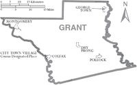
Adjacent parishes
- Winn Parish (north)
- La Salle Parish (east)
- Rapides Parish (south)
- Natchitoches Parish (west)
National protected area
- Kisatchie National Forest (part)
Demographics
| Historical population | |||
|---|---|---|---|
| Census | Pop. | %± | |
| 1870 | 4,517 | — | |
| 1880 | 6,188 | 37.0% | |
| 1890 | 8,270 | 33.6% | |
| 1900 | 12,902 | 56.0% | |
| 1910 | 15,958 | 23.7% | |
| 1920 | 14,403 | −9.7% | |
| 1930 | 15,709 | 9.1% | |
| 1940 | 15,933 | 1.4% | |
| 1950 | 14,263 | −10.5% | |
| 1960 | 13,330 | −6.5% | |
| 1970 | 13,671 | 2.6% | |
| 1980 | 16,703 | 22.2% | |
| 1990 | 17,526 | 4.9% | |
| 2000 | 18,698 | 6.7% | |
| 2010 | 22,309 | 19.3% | |
| Est. 2016 | 22,365 | [15] | 0.3% |
| U.S. Decennial Census[16] 1790-1960[17] 1900-1990[18] 1990-2000[19] 2010-2013[1] | |||
As of the census[20] of 2000, there were 18,698 people, 7,073 households, and 5,276 families residing in the parish. The population density was 29 people per square mile (11/km²). There were 8,531 housing units at an average density of 13 per square mile (5/km²). The racial makeup of the parish was 85.43% White, 11.88% Black or African American, 0.89% Native American, 0.14% Asian, 0.03% Pacific Islander, 0.36% from other races, and 1.28% from two or more races. 1.14% of the population were Hispanic or Latino of any race.
The decreases in population from 1910–1920, and from 1940–1960, were chiefly caused by different phases of the Great Migration, as African Americans left segregation and oppression of the South to seek better opportunities in the North, during the first phase, and in the West, especially California's defense industry, in the second phase. Tens of thousands of migrants left Louisiana during times of agricultural difficulties and the collapse of agricultural labor after mechanization.[21]
In 2000, there were 7,073 households out of which 36.50% had children under the age of 18 living with them, 57.20% were married couples living together, 12.90% had a female householder with no husband present, and 25.40% were non-families. 22.60% of all households were made up of individuals and 10.10% had someone living alone who was 65 years of age or older. The average household size was 2.61 and the average family size was 3.06.
In the parish the population was spread out with 28.30% under the age of 18, 7.90% from 18 to 24, 28.10% from 25 to 44, 23.00% from 45 to 64, and 12.70% who were 65 years of age or older. The median age was 36 years. For every 100 females there were 96.10 males. For every 100 females age 18 and over, there were 93.00 males.
The median income for a household in the parish was $29,622, and the median income for a family was $34,878. Males had a median income of $31,235 versus $20,470 for females. The per capita income for the parish was $14,410. About 16.90% of families and 21.50% of the population were below the poverty line, including 27.30% of those under age 18 and 16.20% of those age 65 or over.
Government and infrastructure
The Federal Bureau of Prisons U.S. Penitentiary, Pollock is located in an unincorporated area in the parish, near Pollock.[22][23]
| Year | Republican | Democratic | Third parties |
|---|---|---|---|
| 2016 | 84.0% 7,408 | 13.4% 1,181 | 2.6% 232 |
| 2012 | 81.7% 7,082 | 16.4% 1,422 | 1.9% 163 |
| 2008 | 80.7% 6,907 | 17.2% 1,474 | 2.1% 177 |
| 2004 | 74.0% 5,911 | 24.7% 1,977 | 1.3% 103 |
| 2000 | 67.8% 4,784 | 29.8% 2,099 | 2.4% 172 |
| 1996 | 42.8% 3,117 | 40.9% 2,980 | 16.4% 1,195 |
| 1992 | 40.8% 3,214 | 39.6% 3,122 | 19.6% 1,542 |
| 1988 | 60.8% 4,402 | 36.3% 2,628 | 3.0% 215 |
| 1984 | 65.9% 5,334 | 32.0% 2,588 | 2.2% 175 |
| 1980 | 50.5% 3,611 | 46.0% 3,290 | 3.5% 247 |
| 1976 | 37.2% 2,280 | 59.8% 3,670 | 3.0% 186 |
| 1972 | 76.5% 3,626 | 18.1% 859 | 5.4% 254 |
| 1968 | 20.2% 1,113 | 16.9% 932 | 62.9% 3,470 |
| 1964 | 69.4% 3,292 | 30.6% 1,454 | |
| 1960 | 32.3% 1,254 | 31.4% 1,219 | 36.3% 1,409 |
| 1956 | 46.1% 1,630 | 43.6% 1,542 | 10.4% 367 |
| 1952 | 35.3% 1,443 | 64.7% 2,646 | |
| 1948 | 9.6% 273 | 39.4% 1,120 | 51.0% 1,447 |
| 1944 | 22.3% 556 | 77.7% 1,939 | |
| 1940 | 8.4% 232 | 91.6% 2,534 | |
| 1936 | 21.7% 511 | 78.3% 1,847 | |
| 1932 | 4.0% 81 | 96.0% 1,966 | 0.1% 1 |
| 1928 | 33.1% 505 | 67.0% 1,023 | |
| 1924 | 21.9% 167 | 78.1% 595 | |
| 1920 | 13.9% 109 | 86.1% 674 | |
| 1916 | 4.6% 31 | 94.8% 640 | 0.6% 4 |
| 1912 | 2.1% 15 | 62.2% 446 | 35.7% 256 |
Education
Public schools in Grant Parish are operated by the Grant Parish School Board.
National Guard
A Company 199TH FSB (Forward Support Battalion) resides in Colfax, Louisiana. This unit deployed twice to Iraq as part of the 256TH IBCT in 2004-5 and 2010.
Communities
Towns
- Colfax (parish seat)
- Montgomery
- Pollock
Villages
Census-designated places
Prison
| Name | Address | Zip | Aged |
|---|---|---|---|
| Grant Parish Detention Center | Richardson Drive, Colfax, Louisiana | 71417 | 18+ |
Notable people
- W. K. Brown, state representative from Grant Parish from 1960 to 1972
- Joe T. Cawthorn (1911-1967), lawyer, businessman, and politician affiliated with the Long faction, born in Selma in Grant Parish, resided in Mansfield in DeSoto Parish[25]
- Billy Ray Chandler, state representative from Grant Parish, 2006-2012
- Preston Allen "Pap" Dean, Jr., cartoonist and Colfax native
- Jesse C. Deen (1922-2015), state representative from primarily Bossier Parish, 1972-1988; reared in the Hargis Community near Montgomery
- P. Elmo Futrell, Jr., mayor of Pineville, 1962–1966, was originally from Grant Parish.
- Stephen Lee "Steve" Gunn, former mayor of Montgomery; represented Grant Parish in the legislature as an Independent from 1992–1996
- Leonard R. "Pop" Hataway, sheriff of Grant Parish, 1976 to 2008; member of the Louisiana Board of Pardons and Paroles; member of the Louisiana Political Museum and Hall of Fame[26]
- Ed Head (1918–1980), Major League Baseball player who played for the Brooklyn Dodgers
- Swords Lee, timber owner from Pollock and Alexandria; former Grant Parish assessor and state representative[27]
- W. T. McCain (1913-1993) - State representative for Grant Parish 1940 to 1948; first state court judge for only Grant Parish (1976), lawyer in Colfax
- Wyatt Luther Nugent (1891-1936) - Sheriff of Grant Parish killed in the line of duty, along with a deputy, Delmer Lee Brunson[28]
- W.L. Rambo, member of both houses of the Louisiana State Legislature from Georgetown.
- Joe D. Smith, Jr., the publisher of the Alexandria Daily Town Talk from 1962 until his retirement in 1996, was a native of Grant Parish.
- Ed Tarpley (born 1953), district attorney for Grant Parish from 1991 to 1997
- Richard S. Thompson (1916-1997), state representative from Grant Parish from 1972 to 1984
- Russ Springer, Major League baseball player
See also
References
- 1 2 "State & County QuickFacts". United States Census Bureau. Archived from the original on July 11, 2011. Retrieved August 9, 2013.
- ↑ "Find a County". National Association of Counties. Archived from the original on 2011-05-31. Retrieved 2011-06-07.
- ↑ "Grant Parish". Center for Cultural and Eco-Tourism. Retrieved September 4, 2014.
- ↑ "Calhoun, Meredith". Louisiana Historical Association, A Dictionary of Louisiana Biography (lahistory.com). Archived from the original on February 25, 2012. Retrieved December 22, 2010.
- ↑ Gannett, Henry (1905). The Origin of Certain Place Names in the United States. Govt. Print. Off. p. 141.
- ↑ Alexandria Daily Town Talk, December 20, 2006
- ↑ "Grant Parish election returns, November 6, 2012". staticresults.sos.la.gov. Retrieved November 17, 2012.
- ↑ "Grant Parish election returns, November 4, 2008". staticresults.sos.la.gov. Retrieved November 17, 2012.
- ↑ "Grant Parish election returns, November 5, 1996". staticresults.sos.la.gov. Retrieved November 17, 2012.
- ↑ "Grant Parish election returns, November 3, 1992". staticresults.sos.la.gov. Retrieved November 17, 2012.
- ↑ Louisiana Secretary of State, Presidential election returns, November 2, 1976
- ↑ "General Election Returns". Louisiana Secretary of State. Retrieved December 21, 2016.
- ↑ Melissa Gregory (December 20, 2016). "ACLU to Grant Parish: Courthouse display needs to change". The Alexandria Town Talk. Retrieved December 21, 2016.
- ↑ "2010 Census Gazetteer Files". United States Census Bureau. August 22, 2012. Archived from the original on September 28, 2013. Retrieved August 20, 2014.
- ↑ "Population and Housing Unit Estimates". Retrieved June 9, 2017.
- ↑ "U.S. Decennial Census". United States Census Bureau. Archived from the original on May 12, 2015. Retrieved August 20, 2014.
- ↑ "Historical Census Browser". University of Virginia Library. Retrieved August 20, 2014.
- ↑ "Population of Counties by Decennial Census: 1900 to 1990". United States Census Bureau. Retrieved August 20, 2014.
- ↑ "Census 2000 PHC-T-4. Ranking Tables for Counties: 1990 and 2000" (PDF). United States Census Bureau. Retrieved August 20, 2014.
- ↑ "American FactFinder". United States Census Bureau. Archived from the original on 2013-09-11. Retrieved 2008-01-31.
- ↑ "African American Migration Experience: The Second Great Migration", New York Public Library, Schomburg Center for Research in Black Culture, accessed 24 April 2008
- ↑ "USP Pollock." Federal Bureau of Prisons. Retrieved on May 29, 2010.
- ↑ "USP Pollock Contact Information." Federal Bureau of Prisons. Retrieved on May 29, 2010.
- ↑ Leip, David. "Dave Leip's Atlas of U.S. Presidential Elections". uselectionatlas.org. Retrieved 2018-03-07.
- ↑ "Joe T. Cawthorn". Many, Louisiana: Sabine Index. November 16, 1967. Retrieved October 28, 2014.
- ↑ "Jindal appoints former lawmakers to pardon board". WBRZ-TV. Archived from the original on January 5, 2013. Retrieved February 4, 2012.
- ↑ "Col. Stephen R. Lee of Alexandria Dies at His Home Feb. 13: Industrial and Political Leader, Descendant of Famous Lees". Winnfield, Louisiana: Winnfield News-American. February 22, 1929. Retrieved May 23, 2015.
- ↑ "Sheriff Wyatt Luther Nugent, Deputy Delmer Lee Brunson [Killed]". libertychapelcemetery.org. Retrieved January 15, 2011.
Places adjacent to Grant Parish, Louisiana | ||||||||||
|---|---|---|---|---|---|---|---|---|---|---|
| ||||||||||
Municipalities and communities of Grant Parish, Louisiana, United States | ||
|---|---|---|
| Towns | | |
| Villages | ||
| CDPs | ||
| Other unincorporated communities | ||
| Indian reservation | ||