Bossier Parish, Louisiana
| Bossier Parish, Louisiana | |
|---|---|
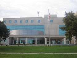 Renovated Bossier Parish Courthouse in Benton | |
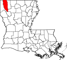 Location in the U.S. state of Louisiana | |
 Louisiana's location in the U.S. | |
| Founded | February 24, 1843 |
| Named for | Pierre Bossier |
| Seat | Benton |
| Largest city | Bossier City |
| Area | |
| • Total | 867 sq mi (2,246 km2) |
| • Land | 840 sq mi (2,176 km2) |
| • Water | 27 sq mi (70 km2), 3.1% |
| Population (est.) | |
| • (2015) | 125,175 |
| • Density | 139/sq mi (54/km2) |
| Congressional district | 4th |
| Time zone | Central: UTC−6/−5 |
| Website |
www |
Bossier Parish (/ˈboʊʒər/ BOH-zhər; French: Paroisse de Bossier) is a parish located in the northwestern part of the U.S. state of Louisiana. As of the 2010 census, the population was 116,979.[1] The parish seat is Benton.[2] The principal city is Bossier City, which is located east of the Red River and across from the larger city of Shreveport, the seat of Caddo Parish. The parish was formed in 1843 from the western portion of Claiborne Parish.[3][4]
Bossier Parish is part of the Shreveport–Bossier City Metropolitan Statistical Area.
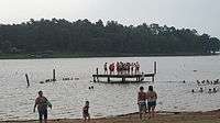
Lake Bistineau and Lake Bistineau State Park are included in parts of Bossier and neighboring Webster and Bienville parishes. Loggy Bayou flows south from Lake Bistineau in southern Bossier Parish, traverses western Bienville Parish, and in Red River Parish joins the Red River.
History
Bossier Parish is named for Pierre Bossier, an ethnic French, 19th-century Louisiana state senator and U.S. representative from Natchitoches Parish.
Bossier Parish was spared fighting on its soil during the American Civil War. In July 1861, at the start of the war, the Bossier Parish Police Jury appropriated $35,000 for the benefit of Confederate volunteers and their family members left behind, an amount then considered generous.[6]
After the war, whites used violence and intimidation to maintain dominance over the newly emancipated freedmen. From the end of Reconstruction into the 20th century, violence increased as conservative white Democrats struggled to maintain power over the state. In this period, Bossier Parish had 26 lynchings of African Americans by whites, part of racial terrorism. This was the fifth-highest total of any parish in Louisiana, tied with the total in Iberia Parish in the South of the state.[7] Overall, parishes in northwest Louisiana had the highest rates of lynchings.
Law, government, and politics
Bossier Parish is governed by a 12-member elected body, the Bossier Parish Police Jury (equivalent to county commission in other states). Members are elected from single-member districts. Eddy Shell, a prominent Bossier City educator, was repeatedly re-elected, serving on the police jury from 1992 until his death in 2008.
The current members of the police jury are :
- District 1 - Hank Meachum
- District 2 - Glenn Benton
- District 3 - Wanda Bennett
- District 4 - Douglas (Sonny) Cook
- District 5 - Barry Butler
- District 6 - Rick Avery
- District 7 - Jimmy Cochran
- District 8 - J. Brad Cummings
- District 9 - William R. Altimus
- District 10 - Jerome Darby
- District 11 - Wayne Hammack
- District 12 - Paul M. "Mac" Plummer[8]
Since the late 20th century, the white majority of the parish has shifted from the Democratic to the Republican Party, as have most conservative whites in Louisiana and other Southern states. Before this, the state was a one-party state dominated by the Democratic Party, in the period after the turn of the century when most blacks were disenfranchised in Louisiana.
Bossier Parish has since reliably supported Republican candidatese in most contested US presidential elections. Since 1952, George Wallace, the former governor of Alabama who ran in 1968 on the American Independent Party ticket, is the only non-Republican to have carried Bossier Parish.[9][10]
In 2008, U.S. Senator John McCain of Arizona won in Bossier Parish with 32,713 votes (71.4 percent) over the Democrat Barack H. Obama of Illinois, who polled 12,703 votes (27.8 percent).[11] In 2012, Mitt Romney polled 34,988 votes (72 percent) in Bossier Parish, or 2,275 more ballots than McCain drew in 2008. President Obama trailed in Bossier Parish with 12,956 votes (26.7 percent), or 253 more votes than he had received in 2008.[12]
In 2011, Bossier Parish elected a Republican, Julian C. Whittington, as sheriff to succeed the long-term Larry Deen. He was a Democrat and later changed his registration to the Republican Party.
| Year | Republican | Democratic | Third parties |
|---|---|---|---|
| 2016 | 71.2% 35,474 | 25.4% 12,641 | 3.5% 1,733 |
| 2012 | 72.1% 34,988 | 26.7% 12,956 | 1.3% 618 |
| 2008 | 71.4% 32,713 | 27.7% 12,703 | 0.9% 419 |
| 2004 | 70.3% 30,040 | 28.8% 12,317 | 0.8% 348 |
| 2000 | 64.7% 23,224 | 33.2% 11,933 | 2.1% 758 |
| 1996 | 47.6% 16,852 | 43.8% 15,504 | 8.6% 3,026 |
| 1992 | 47.6% 15,628 | 34.5% 11,313 | 17.9% 5,860 |
| 1988 | 69.2% 20,807 | 30.0% 9,035 | 0.8% 243 |
| 1984 | 76.0% 22,638 | 23.5% 7,006 | 0.5% 138 |
| 1980 | 62.7% 16,515 | 35.6% 9,377 | 1.7% 447 |
| 1976 | 59.2% 12,132 | 39.4% 8,062 | 1.4% 293 |
| 1972 | 78.6% 12,856 | 17.8% 2,914 | 3.6% 580 |
| 1968 | 23.7% 3,745 | 17.6% 2,782 | 58.6% 9,249 |
| 1964 | 83.5% 9,822 | 16.5% 1,937 | |
| 1960 | 39.3% 3,429 | 25.2% 2,198 | 35.5% 3,093 |
| 1956 | 49.0% 3,107 | 30.8% 1,954 | 20.2% 1,284 |
| 1952 | 57.8% 3,677 | 42.2% 2,683 | |
| 1948 | 8.7% 338 | 29.6% 1,147 | 61.7% 2,391 |
| 1944 | 20.4% 622 | 79.6% 2,430 | 0.0% 1 |
| 1940 | 8.2% 275 | 91.2% 3,045 | 0.6% 20 |
| 1936 | 8.9% 193 | 91.0% 1,975 | 0.1% 2 |
| 1932 | 2.5% 56 | 97.5% 2,191 | |
| 1928 | 15.9% 225 | 84.1% 1,187 | |
| 1924 | 5.8% 48 | 91.4% 751 | 2.8% 23 |
| 1920 | 5.7% 44 | 94.3% 731 | |
| 1916 | 1.3% 9 | 98.7% 675 | |
| 1912 | 1.2% 6 | 87.7% 427 | 11.1% 54 |
Geography
According to the U.S. Census Bureau, the parish has a total area of 867 square miles (2,250 km2), of which 840 square miles (2,200 km2) is land and 27 square miles (70 km2) (3.1%) is water.[14] Four miles east of Bossier City is Barksdale Air Force Base.
Major highways
Adjacent counties and parishes
- Miller County, Arkansas (northwest)
- Lafayette County, Arkansas (north)
- Webster Parish (east)
- Bienville Parish (southeast)
- Red River Parish (south)
- Caddo Parish (west)
National protected area
Demographics
| Historical population | |||
|---|---|---|---|
| Census | Pop. | %± | |
| 1850 | 6,962 | — | |
| 1860 | 11,348 | 63.0% | |
| 1870 | 12,675 | 11.7% | |
| 1880 | 16,042 | 26.6% | |
| 1890 | 20,330 | 26.7% | |
| 1900 | 24,153 | 18.8% | |
| 1910 | 21,738 | −10.0% | |
| 1920 | 22,266 | 2.4% | |
| 1930 | 28,388 | 27.5% | |
| 1940 | 33,162 | 16.8% | |
| 1950 | 40,139 | 21.0% | |
| 1960 | 57,622 | 43.6% | |
| 1970 | 64,519 | 12.0% | |
| 1980 | 80,721 | 25.1% | |
| 1990 | 86,088 | 6.6% | |
| 2000 | 98,310 | 14.2% | |
| 2010 | 116,979 | 19.0% | |
| Est. 2016 | 126,057 | [15] | 7.8% |
| U.S. Decennial Census[16] 1790-1960[17] 1900-1990[18] 1990-2000[19] 2010-2013[1] | |||
As of the census of 2010, there were 116,979 people, 62,000 households, and 37,500 families residing in the parish. The population density was 142 people per square mile (45/km²). There were 49,000 housing units at an average density of 48 per square mile (19/km²). The racial makeup of the parish was 70.66% White, 18.52% Black or African American, 0.82% Native American, 2.18% Asian, 0.18% Pacific Islander, 1.00% from other races, and 1.65% from two or more races. 8.15% of the population were Hispanic or Latino of any race.
There were 46,020 households out of which 36.90% had children under the age of 18 living with them, 54.60% were married couples living together, 14.10% had a female householder with no husband present, and 27.30% were non-families. 22.90% of all households were made up of individuals and 7.80% had someone living alone who was 65 years of age or older. The average household size was 2.63 and the average family size was 3.09.
In the parish the population was spread out with 28.00% under the age of 18, 9.70% from 18 to 24, 30.50% from 25 to 44, 21.30% from 45 to 64, and 10.40% who were 65 years of age or older. The median age was 34 years. For every 100 females there were 96.10 males. For every 100 females age 18 and over, there were 92.80 males.
The median income for a household in the parish was $39,203, and the median income for a family was $45,542. Males had a median income of $32,305 versus $23,287 for females. The per capita income for the parish was $18,119. About 10.60% of families and 13.70% of the population were below the poverty line, including 19.00% of those under age 18 and 12.50% of those age 65 or over.
National Guard
The 165th CSS (Combat Service Support) Battalion is headquartered in Bossier City. This unit was deployed to Iraq in 2008. Also located in Bossier City is the 156TH Army Band which deployed as part of the 256th Infantry Brigade in 2010 to Iraq.
Education
Bossier Parish School Board operates public schools in the parish.
Communities
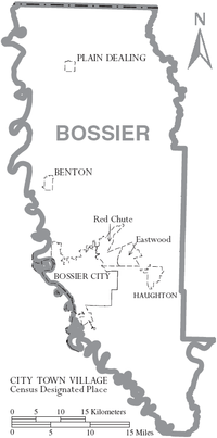
Cities
- Bossier City (largest incorporated places)
- Shreveport (partial)
Towns
- Benton (parish seat)
- Haughton
- Plain Dealing
Census-designated places
Unincorporated communities
- Fillmore[20]
- Midway
- Princeton, birthplace was George Dement
- Taylortown
Notable people
- William Benton Boggs (1854-1922), first mayor of Plain Dealing (1890) and member of the Louisiana House of Representatives from 1892 to 1900 for Bossier Parish[21] and the Louisiana State Senate for Bossier and Webster parishes from 1908 to 1916[22]
- Dewey E. Burchett, Jr., state district court judge for Bossier and Webster parishes, 1988-2008[23]
- Roy A. Burrell, state representative from District 2 (Caddo and Bossier parishes) since 2004[24]
- Harvey Locke Carey, lawyer and politician; lived off Wafer Road in Bossier Parish in the 1960s[25]
- James L. Cathey, Jr., mayor of Bossier City from 1973 to 1977; former Bossier Parish sheriff's deputy and first juvenile officer in Bossier Parish[26]
- Robert Houston Curry (1842-1892), state representative for Bossier Parish from 1888 to 1892; wounded Confederate Army soldier[27]
- Jesse C. Deen, late principal in the Rocky Mount community, served on the Bossier Parish Police Jury and then in the Louisiana House of Representatives from 1972 to 1988. His older son, Larry Callaway Deen, is a former Bossier Parish sheriff.
- E. S. Dortch, planter and politician and last surviving (1943) Bossier Parish veteran of the Confederate States Army[28]
- Jack Favor, a rodeo star, was falsely imprisoned in 1967 at the Louisiana State Penitentiary for the murders of Mr. and Mrs. W. H. Richey, who operated a bait and tackle business near Haughton. Convicted on false testimony, he claimed collusion against him among Bossier Parish officials, including Judge O. E. Price, Sheriff Willie Waggonner, and chief deputy and Waggonner's successor as sheriff, Vol Dooley. Favor was acquittal in a second trial in the parish courthouse in Benton in 1974; thereafter, he returned to Fort Worth and then Arlington, Texas, where he sold used cars and counseled wayward youth of the dangers of lawless behavior.[29][30]
- Ryan Gatti, state senator for District 36 since 2016; Bossier City lawyer[31]
- Ray Germany, Louisiana Tech Bulldogs basketball All-American in 1959 and 1960; resident of Haughton[32]
- Hoffman L. Fuller, politician, four-term mayor of Bossier City, 1937-1953
- Thomas Hickman, mayor of Bossier City, 1925-1937; native of Fillmore[33]
- Mike Johnson, Republican member of the Louisiana House of Representatives; constitutional attorney in Benton[34]
- J. A. W. Lowry (died 1899), district attorney and state senator[35]
- Jerry Miculek, American professional speed and competition shooter known for his 20 world records; resides in Princeton
- George Nattin, mayor of Bossier City, 1961-1973
- Ford E. Stinson, Jr., retiring chief judge of the Louisiana 26th Judicial District Court, based in Benton
- William Washington Vance, state senator from 1886 to 1892[36]
Gallery
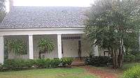
 Bossier Parish Library in Benton
 Bossier Parish's Sheriff's Department in Benton
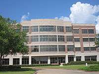
 Bossier Parish School Board office in Benton
See also
- National Register of Historic Places listings in Bossier Parish, Louisiana
- Bossier Press-Tribune
- Michael Craig, state 26th Judicial District Court judge since 2009
- Mike Nerren, state district court judge since 2012
- John M. Robinson, state district court judge, 1999-2014
- Ford E. Stinson, Jr., state district court judge, 1997-2014
References
- 1 2 "Bossier Parish, Louisiana". quickfacts.census.gov. Retrieved November 21, 2012.
- ↑ "Find a County". National Association of Counties. Archived from the original on 2011-05-31. Retrieved 2011-06-07.
- ↑ Stinson, Louise. "Bossier City History". www.bossiercity.org. City of Bossier City. Archived from the original on February 6, 2015. Retrieved September 3, 2014.
- ↑ Anonymous. "About Bossier Parish". www.bossierparishla.gov. Bossier Parish. Retrieved December 14, 2014.
- ↑ Arnold-Tidwell House, Historical marker, Bossier Parish, Louisiana
- ↑ John D. Winters, The Civil War in Louisiana, Baton Rouge: Louisiana State University Press, 1963, ISBN 0-8071-0834-0, p. 38
- ↑ Lynching in America, Third Edition: Supplement by County, p. 6, Equal Justice Initiative, Mobile, AL, 2017
- ↑ "Archived copy". Archived from the original on 2007-08-08. Retrieved 2008-05-12.
- ↑ David Leip's Presidential election Atlas (Louisiana electoral maps
- ↑ Geographie Electorale
- ↑ "Bossier Parish presidential election returns, November 4, 2008". staticresults.sos.la.gov. Retrieved November 11, 2012.
- ↑ "Bossier Parish presidential election returns, November 6, 2012". staticresults.sos.la.gov. Retrieved November 11, 2012.
- ↑ Leip, David. "Dave Leip's Atlas of U.S. Presidential Elections". uselectionatlas.org. Retrieved 2018-03-07.
- ↑ "2010 Census Gazetteer Files". United States Census Bureau. August 22, 2012. Archived from the original on September 28, 2013. Retrieved August 20, 2014.
- ↑ "Population and Housing Unit Estimates". Retrieved June 9, 2017.
- ↑ "U.S. Decennial Census". United States Census Bureau. Archived from the original on May 12, 2015. Retrieved August 20, 2014.
- ↑ "Historical Census Browser". University of Virginia Library. Retrieved August 20, 2014.
- ↑ "Population of Counties by Decennial Census: 1900 to 1990". United States Census Bureau. Retrieved August 20, 2014.
- ↑ "Census 2000 PHC-T-4. Ranking Tables for Counties: 1990 and 2000" (PDF). United States Census Bureau. Retrieved August 20, 2014.
- ↑ "Kay McMahan, "Bossier Parish, LA, Towns"". usgwarchives.net. Retrieved July 2, 2013.
- ↑ "Membership in the Louisiana House of Representatives, 1812-2012" (PDF). legis.state.la.us. Archived from the original (PDF) on December 29, 2009. Retrieved July 24, 2015.
- ↑ "My Hometown: Plain Dealing, Louisiana". oocities.org. Retrieved March 23, 2015.
- ↑ "Dewey E. Burchett, Jr". The Shreveport Times. November 22, 2009. Retrieved June 26, 2015.
- ↑ "Roy Burrell". house.louisiana.gov. Retrieved April 29, 2015.
- ↑ "Notes for Harvey Locke Carey". familytreemaker.genealogy.com. Archived from the original on February 20, 2015. Retrieved February 18, 2015.
- ↑ "James L. Cathey, Jr". findagrave. Retrieved December 24, 2014.
- ↑ "Curry, Robert H." The Political Graveyard. Retrieved July 24, 2015.
- ↑ "Col. E. S. Dortch Dies at Atlanta: Bossier Veteran Who Fought Under Stonewall Jackson Succumbs". The Shreveport Times through findagrave.com. Retrieved March 23, 2015.
- ↑ "Not Guilty" (PDF). cowboysforchrist.net. Archived from the original (PDF) on February 21, 2014. Retrieved February 6, 2014.
- ↑ "List of Louisiana Wrongful Convictions Overturned since 1966, November 23, 2003". Baton Rouge Morning Advocate. Archived from the original on February 6, 2012. Retrieved February 6, 2014.
- ↑ "About Ryan". rayangatti.com. Archived from the original on May 7, 2016. Retrieved March 30, 2016.
- ↑ "Slaughter, Germany to be honored: Tech duo will be enshrined into the Ark-La-Tex Museum of Champions". Ruston Daily Leader. July 2, 2016. Retrieved July 10, 2016.
- ↑ Clifton D. Cardin (November 19, 2000). "Hickman Family of Bossier Parish". archiver.rootsweb.ancestry.com. Retrieved January 5, 2015.
- ↑ "Mike Johnson State Representative". mikejohnsonlouisiana.com. Retrieved March 30, 2015.
- ↑ ""John A. W. Lowry of Bossier Parish, Louisiana" in Biographical and Historical Memoirs of Northwest Louisiana". Chicago and Nashville, Tennessee: Southern Publishing Company. 1890. Retrieved March 23, 2015.
- ↑ "William Washington Vance". findagrave.com based on Baton Rouge newspaper clipping. February 17, 1900. Retrieved March 27, 2015.
External links
Places adjacent to Bossier Parish, Louisiana | ||||||||||
|---|---|---|---|---|---|---|---|---|---|---|
| ||||||||||
Municipalities and communities of Bossier Parish, Louisiana, United States | ||
|---|---|---|
| Cities | | |
| Towns | ||
| CDPs | ||
| Other unincorporated communities |
| |
| Footnotes | ‡This populated place also has portions in an adjacent parish or parishes | |