Concordia Parish, Louisiana
| Concordia Parish, Louisiana | |
|---|---|
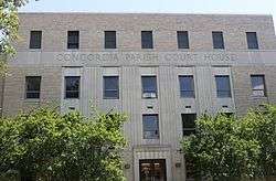 Concordia Parish Courthouse in Vidalia | |
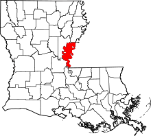 Location in the U.S. state of Louisiana | |
 Louisiana's location in the U.S. | |
| Founded | 1807 |
| Named for | Possibly a land grant, New Concordia |
| Seat | Vidalia |
| Largest city | Vidalia |
| Area | |
| • Total | 747 sq mi (1,935 km2) |
| • Land | 697 sq mi (1,805 km2) |
| • Water | 50 sq mi (129 km2), 6.7% |
| Population (est.) | |
| • (2015) | 20,142 |
| • Density | 30/sq mi (10/km2) |
| Congressional district | 5th |
| Time zone | Central: UTC−6/−5 |
| Website |
www |
Concordia Parish (French: Paroisse de Concordia) borders the Mississippi River in eastern central Louisiana. As of the 2010 census, the population was 20,822.[1] The parish seat is Vidalia.[2] The parish was formed in 1807.[3]
Concordia Parish is part of the Natchez, MS–LA Micropolitan Statistical Area. It is also historically considered part of the Natchez District, devoted to cotton cultivation as a commodity crop, in contrast to the sugar cane of southern Louisiana. Other Louisiana parishes of similar character are East and West Carroll, Madison and Tensas, all in this lowlying delta land. On the east side of the Mississippi is the Natchez District around the city of Natchez.[4]
History
Prehistory

Concordia Parish was the home to many succeeding Native American groups in the thousands of years before European settlements began. Peoples of the Marksville culture, Troyville culture, Coles Creek culture and Plaquemine culture built villages and earthwork mound sites throughout the area. Notable examples include Cypress Grove Mound, DePrato Mounds, Frogmore Mound Site, and Lamarque Landing Mound.
Historic era
Concordia was named by Anglo-American settlers for a Latin word meaning "harmony". They came mostly after the Louisiana Purchase of 1803, when the United States took over this formerly French colonial area. Like other parishes of the lands along the Mississippi River, it was developed largely for cotton cultivation in the antebellum era and the crop depended on the labor of enslaved African Americans.
"Concordia County" was a creation of the first Legislative Council held in New Orleans on December 2, 1804 with territory that included parts of the present parishes of East Carroll, Madison, and Tensas.[5] Land between the Mississippi, Red, Black, and Tensaw rivers comprised the early local administration of Concordia.[6]
During the American Civil War, Concordia Parish was staunchly Confederate. According to the historian John D. Winters in his The Civil War in Louisiana (1963), Concordia, "a planter-dominated parish, displayed unusual Confederate patriotism in early March [1862]. A handsome bounty of $100 was offered to any man who joined one of three designated companies forming for the duration of the war. A bounty of $50 would be paid to those joining either of two companies being raised in the neighboring parish of Catahoula. A $50,000 bond issue was voted to finance the bounty program. . . . $40,000 was appropriated for the relief of needy families of volunteers in the parish."[7]
Law and government
The current elected sheriff is Kenneth Hedrick, who won the office after former Sheriff Randy Maxwell announced his retirement.
The parish trends Democratic for local offices, and Republicans rarely contest such elections. For national offices, the white majority has favored Republican candidates. In the 2008 presidential election, the Democrat Barack Obama of Illinois received 3,766 votes (39.5 percent) in Concordia Parish to 5,668 (59.5 percent) for the Republican nominee, John McCain of Arizona.[8] In 2004, Concordia Parish cast 5,427 votes (60 percent) for President George W. Bush and 3,446 ballots (38 percent) for his Democratic rival, Senator John F. Kerry of Massachusetts.
| Year | Republican | Democratic | Third parties |
|---|---|---|---|
| 2016 | 61.7% 5,477 | 36.9% 3,272 | 1.4% 123 |
| 2012 | 58.1% 5,450 | 40.9% 3,833 | 1.0% 97 |
| 2008 | 59.5% 5,668 | 39.5% 3,766 | 1.0% 93 |
| 2004 | 60.4% 5,427 | 38.4% 3,446 | 1.2% 107 |
| 2000 | 54.4% 4,627 | 42.0% 3,569 | 3.6% 303 |
| 1996 | 36.0% 3,134 | 52.4% 4,565 | 11.7% 1,016 |
| 1992 | 35.2% 3,223 | 46.8% 4,283 | 18.0% 1,642 |
| 1988 | 57.5% 5,037 | 39.5% 3,461 | 3.0% 263 |
| 1984 | 63.7% 6,177 | 34.4% 3,332 | 1.9% 183 |
| 1980 | 54.2% 4,933 | 43.5% 3,956 | 2.3% 213 |
| 1976 | 48.7% 3,849 | 49.2% 3,892 | 2.2% 171 |
| 1972 | 64.4% 4,521 | 30.5% 2,142 | 5.1% 360 |
| 1968 | 13.0% 974 | 26.4% 1,983 | 60.6% 4,542 |
| 1964 | 83.3% 4,022 | 16.8% 809 | |
| 1960 | 30.3% 1,009 | 23.1% 768 | 46.7% 1,554 |
| 1956 | 39.7% 841 | 33.0% 699 | 27.2% 576 |
| 1952 | 47.0% 1,110 | 53.0% 1,252 | |
| 1948 | 6.3% 98 | 21.0% 329 | 72.8% 1,140 |
| 1944 | 17.1% 201 | 82.9% 974 | |
| 1940 | 9.2% 119 | 90.8% 1,173 | |
| 1936 | 4.8% 58 | 95.1% 1,152 | 0.1% 1 |
| 1932 | 2.0% 20 | 98.0% 999 | |
| 1928 | 18.4% 133 | 81.6% 591 | |
| 1924 | 12.6% 46 | 87.4% 319 | |
| 1920 | 3.1% 12 | 96.9% 380 | |
| 1916 | 3.6% 10 | 95.3% 264 | 1.1% 3 |
| 1912 | 2.7% 6 | 91.1% 205 | 6.2% 14 |
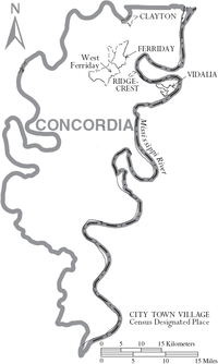
Geography
According to the U.S. Census Bureau, the parish has a total area of 747 square miles (1,930 km2), of which 697 square miles (1,810 km2) is land and 50 square miles (130 km2) (6.7%) is water.[10]
The parish is completely agricultural bottomlands. The Ouachita River runs along the west boundary, the Red River along the south, and the Mississippi River along the east. All three rivers are contained by large levee systems.
Major highways
Adjacent counties and parishes
- Tensas Parish (north)
- Adams County, Mississippi (northeast)
- Wilkinson County, Mississippi (east)
- West Feliciana Parish (southeast)
- Pointe Coupee Parish (south)
- Avoyelles Parish (southwest)
- Catahoula Parish (west)
National protected area
State protected area
Demographics
| Historical population | |||
|---|---|---|---|
| Census | Pop. | %± | |
| 1820 | 2,626 | — | |
| 1830 | 4,662 | 77.5% | |
| 1840 | 9,414 | 101.9% | |
| 1850 | 7,758 | −17.6% | |
| 1860 | 13,805 | 77.9% | |
| 1870 | 9,977 | −27.7% | |
| 1880 | 14,914 | 49.5% | |
| 1890 | 14,871 | −0.3% | |
| 1900 | 13,559 | −8.8% | |
| 1910 | 14,278 | 5.3% | |
| 1920 | 12,466 | −12.7% | |
| 1930 | 12,778 | 2.5% | |
| 1940 | 14,562 | 14.0% | |
| 1950 | 14,398 | −1.1% | |
| 1960 | 20,467 | 42.2% | |
| 1970 | 22,578 | 10.3% | |
| 1980 | 22,981 | 1.8% | |
| 1990 | 20,828 | −9.4% | |
| 2000 | 20,247 | −2.8% | |
| 2010 | 20,822 | 2.8% | |
| Est. 2016 | 19,920 | [11] | −4.3% |
| U.S. Decennial Census[12] 1790-1960[13] 1900-1990[14] 1990-2000[15] 2010-2013[1] | |||
As of the census[16] of 2000, there were 20,247 people, 7,521 households, and 5,430 families residing in the parish. The population density was 29 people per square mile (11/km²). There were 9,148 housing units at an average density of 13 per square mile (5/km²). The racial makeup of the parish was 57.9% White, 40.7% Black or African American, 0.16% Native American, 0.3% Asian, 0.55% from other races, and 0.8% from two or more races. 1.2% of the population were Hispanic or Latino of any race.
There were 7,521 households out of which 33.00% had children under the age of 18 living with them, 49.00% were married couples living together, 19.00% had a female householder with no husband present, and 27.80% were non-families. 25.30% of all households were made up of individuals and 11.50% had someone living alone who was 65 years of age or older. The average household size was 2.60 and the average family size was 3.12.
In the parish the population was spread out with 27.80% under the age of 18, 8.90% from 18 to 24, 25.60% from 25 to 44, 23.00% from 45 to 64, and 14.70% who were 65 years of age or older. The median age was 37 years. For every 100 females, there were 95.20 males. For every 100 females age 18 and over, there were 91.90 males.
The median income for a household in the parish was $22,742, and the median income for a family was $28,629. Males had a median income of $27,453 versus $18,678 for females. The per capita income for the parish was $11,966. About 24.30% of families and 29.10% of the population were below the poverty line, including 42.00% of those under age 18 and 20.60% of those age 65 or over.
Education
Concordia Parish School Board operates public schools in the parish.
National Guard
1086TH Transportation Company of the 165TH CSS (Combat Service Support) Battalion of the 139TH RSG (Regional Support Group) resides in Vidalia, Louisiana on the western border of Mississippi.
Communities
City
- Vidalia (parish seat)
Towns
Census-designated places
Other unincorporated communities
Notable people
Arts and entertainment
- Jerry Lee Lewis, musician
- Jimmy Swaggart, televangelist
Journalism
- Campbell Brown, Emmy-award winning journalist, CNN Anchor/host and daughter of Jim Brown
- Sam Hanna, Sr., late publisher of Concordia Sentinel in Ferriday
- Howard K. Smith, ABC and CBS commentator
Politics
- Al Ater, State representative (1984–1988) and secretary of state (2005–2006)
- Leo Boothe, longest-serving District Judge of Concordia Parish and Catahoula Parish (1991−2015)
- Clifford Cleveland Brooks, planter in St. Joseph, represented Concordia Parish in the Louisiana State Senate from 1924−1932.[17]
- James H. "Jim" Brown, state senator (1972–1980), Louisiana secretary of state (1980–1988), and insurance commissioner (1992–2000)
- Eugene P. Campbell, longest-serving Concordia Parish sheriff, 1908−1940
- Hyram Copeland, mayor of Vidalia since 1992
- Charles C. Cordill, Louisiana state senator representing Concordia and Tensas parishes from 1884−1912[18]
- Noah W. Cross, Concordia Parish sheriff, 1944−1948; 1952−1973
- Brenham C. Crothers, Ferriday cattleman; state senator from delta parishes from 1948−1952 and 1956−1960
- Troyce Guice, U.S. Senate candidate, 1966 and 1986
- Bryant Hammett, state representative, 1992–2006
- Shelby M. Jackson, Education superintendent, 1948–1964
- Consuelo Montagu, Duchess of Manchester (1858−1909), spent part of her childhood at Ravenswood Place plantation, in the vicinity of Lake St. John.
- Ed Rand, late state representative (1960−1964) from Rapides Parish had a second home on Lake St. John.
- Dan Richey, state senator, 1980–1984
- Fred L. Schiele, state representative (1964−1968), Concordia Parish sheriff (1973−1980)
- J. Robert Wooley, state insurance commissioner (2000−2006); practiced law in Concordia Parish with James H. "Jim" Brown in late 1970s[19]
See also
References
- 1 2 "State & County QuickFacts". United States Census Bureau. Retrieved August 20, 2013.
- ↑ "Find a County". National Association of Counties. Archived from the original on 2011-05-31. Retrieved 2011-06-07.
- ↑ "Concordia Parish". Center for Cultural and Eco-Tourism. Retrieved September 6, 2014.
- ↑ John C. Rodrigue, Reconstruction in the Cane Fields: From Slavery to Free Labor in Louisiana's Sugar Parishes, 1862--1880, LSU Press, 2001, p. 176
- ↑ Calhoun, Robert Dabney. (1932). A history of Concordia Parish, Louisiana. (1768-1931). New Orleans, LA: n.p. pp. 33-34.
- ↑ Brackenridge, Henry Marie. (1817). Views of Louisiana : containing geographical, statistical, and historical notices of that vast and important portion of America. Baltimore: Schaeffer & Maund. Google Books website pp. 287-288.
- ↑ John D. Winters, The Civil War in Louisiana, Baton Rouge: Louisiana State University Press, 1963, ISBN 0-8071-0834-0, pp, 74-75
- ↑ "Louisiana general election returns, November 4, 2008". sos.louisiana.gov. Retrieved June 15, 2010.
- ↑ Leip, David. "Dave Leip's Atlas of U.S. Presidential Elections". uselectionatlas.org. Retrieved 2018-03-07.
- ↑ "2010 Census Gazetteer Files". United States Census Bureau. August 22, 2012. Archived from the original on September 28, 2013. Retrieved August 27, 2014.
- ↑ "Population and Housing Unit Estimates". Retrieved June 9, 2017.
- ↑ "U.S. Decennial Census". United States Census Bureau. Archived from the original on May 12, 2015. Retrieved August 27, 2014.
- ↑ "Historical Census Browser". University of Virginia Library. Retrieved August 27, 2014.
- ↑ "Population of Counties by Decennial Census: 1900 to 1990". United States Census Bureau. Retrieved August 27, 2014.
- ↑ "Census 2000 PHC-T-4. Ranking Tables for Counties: 1990 and 2000" (PDF). United States Census Bureau. Retrieved August 27, 2014.
- ↑ "American FactFinder". United States Census Bureau. Archived from the original on 2013-09-11. Retrieved 2008-01-31.
- ↑ Henry E. Chambers, History of Louisiana, Vol. 2 (Chicago and New York City: The American Historical Society, Inc., 1925, p. 71)
- ↑ "Membership in the Louisiana State Senate, 1880-2012" (PDF). legis.state.la.us. Retrieved July 15, 2013.
- ↑ "Mike Hasten, "Louisiana insurance commissioner's race Wooley turns temporary job into a mission", November 7, 2003". capitolwatch.reallouisiana.com. Archived from the original on May 5, 2012. Retrieved June 18, 2013.
External links
| Wikimedia Commons has media related to Concordia Parish, Louisiana. |
- Heinrich, P. V., 2008, Woodville 30 x 60 minute geologic quadrangle. Louisiana Geological Survey, Baton Rouge, Louisiana.
Places adjacent to Concordia Parish, Louisiana | |
|---|---|
Municipalities and communities of Concordia Parish, Louisiana, United States | ||
|---|---|---|
| Cities | | |
| Towns | ||
| CDPs | ||
| Other unincorporated communities |
| |