St. Mary Parish, Louisiana
| Saint Mary Parish, Louisiana | |
|---|---|
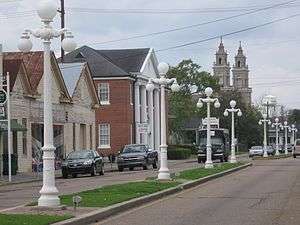 Main street in Franklin. | |
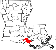 Location in the U.S. state of Louisiana | |
 Louisiana's location in the U.S. | |
| Founded | 1811 |
| Named for | Saint Mary |
| Seat | Franklin |
| Largest city | Morgan City |
| Area | |
| • Total | 1,119 sq mi (2,898 km2) |
| • Land | 555 sq mi (1,437 km2) |
| • Water | 564 sq mi (1,461 km2), 50% |
| Population (est.) | |
| • (2015) | 52,810 |
| • Density | 98/sq mi (38/km2) |
| Congressional district | 3rd |
| Time zone | Central: UTC−6/−5 |
| Website |
www |
St. Mary Parish (French: Paroisse de Sainte-Marie) is a parish located in the U.S. state of Louisiana. As of the 2010 census, the population was 54,650.[1] The parish seat is Franklin.[2] The parish was created in 1811.[3]
St. Mary Parish comprises the Morgan City, LA Micropolitan Statistical Area, which is also included in the Lafayette-Opelousas-Morgan City, LA Combined Statistical Area.
Geography
According to the U.S. Census Bureau, the parish has a total area of 1,119 square miles (2,900 km2), of which 555 square miles (1,440 km2) is land and 564 square miles (1,460 km2) (50%) is water.[4] Cypremort Point State Park is located in the parish on Vermilion Bay.
Major highways
Adjacent parishes
- Iberia Parish (north)
- St. Martin Parish (east)
- Assumption Parish (southeast)
- Terrebonne Parish (south)
Protected areas
The parish has both national and state protected areas within its borders.
National protected area
State protected areas
Part of the Attakapas Wildlife Management Area is located within St. Mary Parish as well as in St. Martin and Iberia Parishes.[5]
Demographics
| Historical population | |||
|---|---|---|---|
| Census | Pop. | %± | |
| 1830 | 6,442 | — | |
| 1840 | 8,950 | 38.9% | |
| 1850 | 13,697 | 53.0% | |
| 1860 | 16,816 | 22.8% | |
| 1870 | 13,860 | −17.6% | |
| 1880 | 19,891 | 43.5% | |
| 1890 | 22,416 | 12.7% | |
| 1900 | 34,145 | 52.3% | |
| 1910 | 39,368 | 15.3% | |
| 1920 | 30,754 | −21.9% | |
| 1930 | 29,397 | −4.4% | |
| 1940 | 31,458 | 7.0% | |
| 1950 | 35,848 | 14.0% | |
| 1960 | 48,833 | 36.2% | |
| 1970 | 60,752 | 24.4% | |
| 1980 | 64,253 | 5.8% | |
| 1990 | 58,086 | −9.6% | |
| 2000 | 53,500 | −7.9% | |
| 2010 | 54,650 | 2.1% | |
| Est. 2016 | 52,093 | [6] | −4.7% |
| U.S. Decennial Census[7] 1790-1960[8] 1900-1990[9] 1990-2000[10] 2010-2013[1] | |||
As of the census[11] of 2000, there were 53,500 people, 19,317 households, and 14,082 families residing in the parish. The population density was 87 people per square mile (34/km²). There were 21,650 housing units at an average density of 35 per square mile (14/km²). The racial makeup of the parish was 62.79% White, 31.79% Black or African American, 1.39% Native American, 1.64% Asian, 0.02% Pacific Islander, 0.88% from other races, and 1.50% from two or more races. 2.15% of the population were Hispanic or Latino of any race. 5.43% reported speaking French or Cajun French at home, while 2.45% speak Spanish and 1.59% Vietnamese.
There were 19,317 households out of which 36.70% had children under the age of 18 living with them, 51.00% were married couples living together, 16.50% had a female householder with no husband present, and 27.10% were non-families. 23.20% of all households were made up of individuals and 8.70% had someone living alone who was 65 years of age or older. The average household size was 2.74 and the average family size was 3.23.
In the parish the population was spread out with 29.70% under the age of 18, 8.70% from 18 to 24, 28.70% from 25 to 44, 21.90% from 45 to 64, and 11.00% who were 65 years of age or older. The median age was 34 years. For every 100 females there were 95.00 males. For every 100 females age 18 and over, there were 92.20 males.
The median income for a household in the parish was $28,072, and the median income for a family was $33,064. Males had a median income of $31,570 versus $18,341 for females. The per capita income for the parish was $13,399. About 20.60% of families and 23.60% of the population were below the poverty line, including 31.30% of those under age 18 and 19.00% of those age 65 or over.
Education
St. Mary Parish School Board operates local public schools.
The Bureau of Indian Affairs has the Chitimacha Day School in the Charenton community of unincorporated St. Mary Parish.[12]
Media
St. Mary Parish has two daily newspapers, the Morgan City Daily Review (circulation under 6,000) and the Franklin Banner-Tribune in Franklin (circulation 3,350).
National Guard
B Company 2-156TH Infantry Battalion of the 256TH IBCT resides in Franklin, Louisiana. This unit has deployed to Iraq twice, 2004-5 and 2010.
Communities

Cities
- Franklin (parish seat)
- Morgan City
- Patterson
Towns
Census-designated places
Other unincorporated areas
- Centerville
- Garden City
- Ricohoc
Politics
| Year | Republican | Democratic | Third parties |
|---|---|---|---|
| 2016 | 62.8% 14,359 | 35.2% 8,050 | 2.0% 468 |
| 2012 | 58.7% 13,885 | 40.0% 9,450 | 1.3% 305 |
| 2008 | 57.6% 13,183 | 40.8% 9,345 | 1.6% 375 |
| 2004 | 56.7% 12,877 | 42.1% 9,547 | 1.2% 270 |
| 2000 | 51.9% 11,325 | 45.2% 9,851 | 2.9% 634 |
| 1996 | 35.5% 8,018 | 55.0% 12,402 | 9.5% 2,149 |
| 1992 | 37.5% 8,792 | 45.4% 10,648 | 17.1% 4,000 |
| 1988 | 51.7% 11,540 | 46.4% 10,364 | 1.9% 414 |
| 1984 | 61.2% 15,275 | 37.7% 9,411 | 1.2% 288 |
| 1980 | 48.0% 10,378 | 48.6% 10,506 | 3.3% 722 |
| 1976 | 47.7% 8,919 | 50.3% 9,401 | 2.1% 388 |
| 1972 | 68.4% 11,117 | 27.3% 4,435 | 4.3% 691 |
| 1968 | 27.5% 4,586 | 31.9% 5,312 | 40.6% 6,761 |
| 1964 | 43.0% 5,530 | 57.0% 7,327 | |
| 1960 | 27.6% 2,992 | 61.6% 6,671 | 10.8% 1,169 |
| 1956 | 61.5% 4,097 | 35.9% 2,395 | 2.6% 171 |
| 1952 | 51.0% 4,417 | 49.0% 4,249 | |
| 1948 | 23.5% 824 | 26.2% 918 | 50.3% 1,761 |
| 1944 | 13.0% 538 | 87.0% 3,591 | |
| 1940 | 16.7% 739 | 83.3% 3,686 | |
| 1936 | 20.1% 487 | 80.0% 1,942 | |
| 1932 | 18.6% 473 | 81.4% 2,072 | |
| 1928 | 25.7% 605 | 74.4% 1,754 | |
| 1924 | 48.7% 633 | 49.2% 639 | 2.2% 28 |
| 1920 | 59.4% 788 | 40.6% 539 | |
| 1916 | 11.4% 162 | 46.0% 652 | 42.6% 605 |
| 1912 | 13.9% 147 | 61.6% 652 | 24.5% 259 |
Notable people
- Bret Allain (born c. 1958), sugar cane farmer and the current District 21 state senator from St. Mary Parish
- Clarence C. "Taddy" Aycock (1915–1987), state House Speaker from 1952 to 1956 and lieutenant governor from 1960 to 1972
- Carl W. Bauer (1933-2013), attorney-lobbyist; former member of both houses of the Louisiana State Legislature
- Ralph Norman Bauer (1899-1963), attorney; former Speaker of the Louisiana House; a leader of the impeachment forces against Governor Huey P. Long, Jr., in 1929
- V.J. Bella (born 1927), former state representative (1972–1990) and state fire marshal (1990–1992; 1996–2004)
- Elizabeth Bisland (1861–1929), noted journalist and author[14]
- Lewis Strong Clarke, sugar planter and 19th century Republican politician, owned the plantation Lagonda near Patterson[15]
- Sally Clausen, former president of Southeastern Louisiana University in Hammoned and Louisiana commissioner of higher education; reared in St. Mary Parish[16]
- Thomas G. Clausen, Louisiana education superintendent from 1984 to 1988; reared in St. Mary Parish[17]
- Murphy James "Mike" Foster, Jr. (born 1930), governor of Louisiana from 1996 to 2004
- Sam S. Jones, state representative for St. Mary Parish since 2008
- Geronimo Pratt, Vietnam War veteran who served twenty-seven years in prison wrongfully accused of murder
- Percy Saint (1870-1958), Louisiana attorney general (1924-1932)
- William Joseph Seymour (born 1870), considered to be the most influential African American minister of the twentieth century and pastor of the famous Azusa Street Revival
- Lester Vetter, reared in St. Mary Parish; mayor of Coushatta prior to 1952 and state representative for Red River Parish from 1952 until his death in office in 1960
- Warren Wells, Pro football player for the Detroit Lions and Oakland Raiders
See also
| Wikimedia Commons has media related to Saint Mary Parish, Louisiana. |
References
- 1 2 "State & County QuickFacts". United States Census Bureau. Retrieved August 18, 2013.
- ↑ "Find a County". National Association of Counties. Retrieved 2011-06-07.
- ↑ "St. Mary Parish". Center for Cultural and Eco-Tourism. Retrieved September 6, 2014.
- ↑ "2010 Census Gazetteer Files". United States Census Bureau. August 22, 2012. Archived from the original on September 28, 2013. Retrieved September 1, 2014.
- ↑ Attakapas WMA- Retrieved 2017-02-19
- ↑ "Population and Housing Unit Estimates". Retrieved June 9, 2017.
- ↑ "U.S. Decennial Census". United States Census Bureau. Retrieved September 1, 2014.
- ↑ "Historical Census Browser". University of Virginia Library. Retrieved September 1, 2014.
- ↑ "Population of Counties by Decennial Census: 1900 to 1990". United States Census Bureau. Retrieved September 1, 2014.
- ↑ "Census 2000 PHC-T-4. Ranking Tables for Counties: 1990 and 2000" (PDF). United States Census Bureau. Retrieved September 1, 2014.
- ↑ "American FactFinder". United States Census Bureau. Retrieved 2008-01-31.
- ↑ "Archived copy". Archived from the original on 2008-09-04. Retrieved 2008-09-03.
- ↑ Leip, David. "Dave Leip's Atlas of U.S. Presidential Elections". uselectionatlas.org. Retrieved 2018-03-06.
- ↑ Marks, Jason. Around the World in 72 Days: The race between Pulitzer's Nellie Bly and Cosmopolitan's Elizabeth Bisland (Gemittarius Press 1993) ( ISBN 978-0963369628)
- ↑ "Clarke, Lewis Strong". Louisiana Historical Association, A Dictionary of Louisiana Biography (lahistory.com). Archived from the original on February 25, 2012. Retrieved December 21, 2010.
- ↑ "Dr. Sally Clausen" (PDF). regents.ohio.gov. Retrieved October 7, 2013.
- ↑ "Senate Concurrent Resolution No. 32, 2002" (PDF). lanewsbureau.com. Retrieved October 7, 2013.
External links
Places adjacent to St. Mary Parish, Louisiana | ||||||||||
|---|---|---|---|---|---|---|---|---|---|---|
| ||||||||||
Municipalities and communities of St. Mary Parish, Louisiana, United States | ||
|---|---|---|
| Cities | | |
| Towns | ||
| CDPs | ||
| Other unincorporated communities |
| |
| Indian reservation | ||
| Footnotes | ‡This populated place also has portions in an adjacent parish or parishes | |