Goldcliff, Newport
Goldcliff
| |
|---|---|
 A reen in Goldcliff with The Farmer's Arms beyond | |
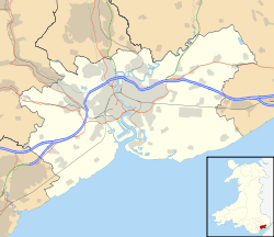 Goldcliff Goldcliff shown within Newport | |
| Population | 233 (2001 census[1]) |
| Principal area | |
| Ceremonial county | |
| Country | Wales |
| Sovereign state | United Kingdom |
| Post town | NEWPORT |
| Postcode district | NP18 2 |
| Dialling code |
01633 Maindee exchange |
| Police | Gwent |
| Fire | South Wales |
| Ambulance | Welsh |
| EU Parliament | Wales |
| UK Parliament | |

1606
ON THE XX DAY OF JANVARY EVEN AS IT CAME TO
PAS IT PLEASED GOD THE FLVD DID FLOW TO THE
EDGE OF THIS SAME BRAS – AND IN THIS PARISH
THERE WAS LOST 5000 AND ODD POWNDS BESIDES
XXII PEOPLE WAS IN THIS PARRISH DROWN'D
GOLDCLIF JOHN WILKINS OF PILREW AND
WILLIAM TAP CHURCHWARDENS
1609
from the 1607 plaque in St Mary's Church
Goldcliff (Welsh: Allteuryn) is a village, parish and community to the south east of the city of Newport in South Wales. It lies within the Newport city boundaries in the historic county of Monmouthshire and the preserved county of Gwent. Administratively, the community of Goldcliff includes the parish of Whitson.
Origin of the English name
The name is said to have originated from the siliceous limestone cliff, standing about 60 feet (18 m) high, at Hill Farm, rising over a great bed of yellow mica which breaks the level at the shore and has a glittering appearance in sunshine, especially to ships passing in the Bristol Channel. Giraldus Cambrensis, who toured Wales in 1188 refers to the location as "Gouldclyffe" and describes it in Latin as "...glittering with a wonderful brightness".[2]
Character
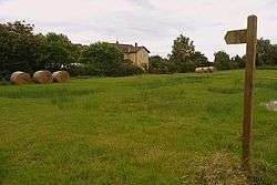
Together with the neighbouring parishes of Nash and Whitson, it is one of "The Three Parishes" which have long been a unit – geographical, socially, economically and ecclesiastically. All three parishes are typical of the Caldicot Levels. At the highest tides the village lies below sea-level. The entire area is drained by a vast network of inter-linking ditches or 'reens'.[3] A main drainage ditch, with an origin near Llanwern, known as "Monksditch" or "Goldcliff Pill"[4] passes through the village on its way to the sea. Local folklore maintains that the sides of the Monksditch are laced with smugglers' brandy.
Fields are drained by low depressions running the width of the fields, known locally as grips. The field area between grips is termed a span or Spain. The grips drain into the reens which are slow-moving and in summer months are often stagnant. Reens run towards the sea where they empty between tides at a gout. The levels of the reens is controlled by means of a series of sluices or stanks, separate boards in which may be raised or lowered to keep water levels high enough for livestock to drink. The faster flowing Monksditch carries water from more distant higher ground, above the level of the reens, some of which pass underneath the ditch by means of culverts.
The south of the village is bounded by the foreshore of the Severn Estuary, which lies behind a tall concrete-faced sea wall. A number of groynes can be seen at low tide.
History
Prehistoric, Roman and Medieval
A considerable amount of archaeology has centred on Goldcliff and the intertidal region of the coast near the village has attracted archaeological interest. Goldcliff has notable evidence of occupation by the Silures.[5]
Hidden in the laminated silts of the Severn estuary foreshore are 8,000-year-old (mesolithic) human footprints.[6][7] A report, published jointly by CBA and Cadw, was produced by Martin Bell and colleagues.[8] Bell was instrumental in the discovery of the mesolithic footprints and in 2004 his work at Goldcliff featured on Channel 4's archaeological television programme Time Team.[9] Further archaeological excavation has also been carried out by Martin Locock and colleagues prior to the introduction of the Newport Wetlands reserve, for example at Hill Farm.[10]
Following gales and high tides in 1990, a total of eight Iron Age substantial rectangular buildings were discovered, over the course of several season's work, off the coast of the village. Radiocarbon dating dated the site to the second century BC. The buildings, which may have functioned as a short lived and specialised fishing site, were constructed from vertical posts bearing the marks of iron axes. Timbers from the excavation, which was performed by St David's University College, Lampeter, have been conserved at Newport Museum.[11][12]
A connection with Roman activity was firmly established with the discovery near Goldcliff Point in 1878 of the inscribed "Goldcliff Stone" recording the work of legionaries on a linear earthwork, presumably a sea wall.[13] Further evidence of occupation was found when ash pits were dug at Nash during construction of the Uskmouth Power Station.
Goldcliff was originally owned by the native princes of Wales, but was taken from Owain ap Caradog (also known as Owain Wan) son of the last king of Gwent, Caradog ap Gruffydd, by the Norman nobleman Robert de Chandos who, shortly before 1113, founded a priory there.[2]
The higher coastal parts of the area were certainly reclaimed by the late-11th and early-12th century when Goldcliff and Nash were granted to the Benedictine priory. Lower-lying areas inland were enclosed and drained[3] by the 13th and 14th century.
Goldcliff, as "Goldcliffe", and nearby Nash are two of the few villages to appear on the Cambriae Typus map of 1573.[14]
Goldcliff Priory
On the site of Hill Farm, situated on a prominent knoll of high ground, south of the village and next to the sea, stood Goldcliff Priory. Founded in 1113 as a subject house of the Abbey of Bec in Normandy, it passed during the fifteenth century into the control of Tewkesbury Abbey and then of Eton College.
Other historic sites
A small enclosure on Chapel Lane to the north of the present parish church, is thought to hold the remains of an ancient chapel, probably connected with the Priory. Also located off Chapel Lane, the farmhouse and barn at Great Newra Farm has Grade II listed buildings.[15]
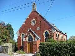
The quaint Congregational (later United Reformed Church) chapel[16] near the junction of the Sea Wall Road, built in 1840 and restored in 1900–01, is now a private dwelling, but was still active as late as the 1980s.
Local industry and education
Goldcliff has long been associated with the tidal putcher fishing of salmon, which may well have had its origins with the Priory or even in Roman times. The technique used the so-called "putcher" basket traditionally made from hazel rods and withy (willow) plait, set out against the tides in huge wooden "ranks". The last main exponent of the art of wooden putcher-making at Goldcliff was George Whittaker, although a working knowledge of the technique was also kept into the 1970s by Wyndham Howells of Saltmarsh Farm, the last full-time fisherman at Goldcliff. Deeds for Saltmarsh Farm for 1867–1918 are held by Gwent Record Office.[17]
The mixed school for the parishes of Goldcliff and Whitson was erected in 1872 for 60 children and in 1901 had an average attendance of 46, with a Miss Mary Edith Tomlinson as the mistress.[18] Until it closed in July 1954, the school received an annual gift of £2 from Eton College.[19]
Kelly's 1901 Directory lists the only private residence in the village as "The Moorlands", but has no fewer than 27 commercial concerns, mostly farmers, but also including a haulier, two fishermen, a female publican, a farm bailiff, a hay dealer, a mason and a shoe maker. The Directory also lists a Mrs Annie Louise Taylor as hotellier at "The Temperance Hotel".[18] The hotel, situated at the end of the Sea Wall Road, was a well-known landmark as late as the 1950s.
The Moorlands, a Victorian house built in 1870 for the Waters family, has a garden which includes acacia, American oak and Christmas strawberry.[20]
The church

The parish church of Saint Mary Magdelene[21] has a well maintained churchyard with a beautiful tree arch canopy and many old gravestones.[22] It is an ancient stone building in the Early English style and is located directly behind The Farmer's Arms public house. At the front of the churchyard are the remains of an ancient mounded cross. The first vicar was Roger de Holbrook in 1349 and church records are available from 1724.[20]

The church itself has a small brass plaque on the north wall near the altar, commemorating the Great Flood of 1607 when a storm surge, or possibly tsunami, swept along the Bristol Channel drowning 2,000 people. The plate, about three feet above ground level today at this point, marks the height of the flood waters. The estimate of financial loss is given as approximately £5,000 (£990,000 in 2016).[23] [24]
The tower contains one bell, recast by Taylors of Loughborough in 1969.[25]
The former vicarage for the three parishes, located in Whitson, is now a private dwelling. The minister for the Rectoral Benefice of Magor, which includes Magor, Nash, Undy, Llanwern, Wilcrick, Bishton, Llanmartin, Langstone and Redwick is based in Magor.[26]
Following interior re-decoration in 2006, including the removal of the old pews and pulpit, a service of re-dedication was held on 4 February 2007 with the Bishop of Monmouth. The interior is now decorated with individually dedicated chairs and matching carpet.[27]
Amenities


Goldcliff is home to part of the extensive Newport Wetlands,[28] opened in March 2000 as a mitigation for the loss of mudflats caused by the building of the Cardiff Bay Barrage.[29] Parts of Goldcliff and Whitson together are designated a Site of Special Scientific Interest SSSI.[30]
The village pub is The Farmer's Arms,[31] located close to the church. The village still has use of a communal parish room located in the Old School at the side of the Monksditch, which there forms the border with Whitson.
The village is served by a public bus service (Route 63 – weekdays, twice daily) provided by Newport Bus.[32] The local newspaper is the South Wales Argus which is published in Newport.[33]
Goldcliff Community Council is a member of the Campaign Against the Levels Motorway (CALM) Alliance formed in 2006 by the Friends of the Earth Cymru.[34]
Goldcliff is a popular venue for sea fishing[35] and ornithology.[36] Bird species sighted include little egret, cormorant, chaffinch, magpie, woodpigeon, wren, greenfinch, moorhen, dunlin, ringed plover, lapwing, shelduck, avocets, common redshank, Canada goose, oystercatcher, shoveler, teal, spotted redshank, black-winged stilt, common buzzard, grey heron, tufted ducks, mallard, swallow, black-tailed godwit, skylark, raven, gadwall, common pochard, kestrel, sedge warbler and peregrine.[37]
There are tea rooms, with toilet facilities, at the seawall.[38]
Government
The area is governed by the Newport City Council and the Goldcliff, Newport community council. The village falls within the Llanwern ward of the Newport East parliamentary constituency.
References
- ↑ "Check Browser Settings". Retrieved 17 January 2015.
- 1 2 Bradney, Sir Joseph, A History of Monmouthshire, Vol 4 part 2: The Hundred of Caldicot (Part 2). pub 1914, reprinted 1994, Merton Priory Press.
- 1 2 "Geograph:: Drainage Ditch by Chapel Road, Goldcliff (C) Ruth Sharville". www.geograph.org.uk. Retrieved 14 November 2017.
- ↑ "Geograph:: Goldcliff Pill (C) Adrian and Janet Quantock". www.geograph.org.uk. Retrieved 14 November 2017.
- ↑ Miranda Aldhouse-Green and Ray Howell (eds.), Gwent In Prehistory and Early History: The Gwent County History Vol.1, 2004, ISBN 0-7083-1826-6
- ↑ "Programmes - Most Popular - All 4". Channel 4. Retrieved 14 November 2017.
- ↑ "Severn Estuary Levels Research Committee". Retrieved 17 January 2015.
- ↑ "Maritime and Intertidal Archaeology in Wales: A Research Agenda". Retrieved 17 January 2015.
- ↑ "Programmes - Most Popular - All 4". Channel 4. Retrieved 14 November 2017.
- ↑ "Gwent Levels Wetland Reserve, Hill Farm, Goldcliff: excavations 1997" at heritagemp.com
- ↑ Children, George; Nash, George (1996). A Guide To Prehistoric Sites In Monmouthshire. Logaston Press. pp. 95–98. ISBN 1-873827-49-0.
- ↑ "Goldcliff". The Modern Antiquarian.com. 26 August 2012. Retrieved 26 May 2016.
- ↑ Morgan, Octavius (1882), "Goldcliff and the Ancient Roman Inscribed Stone Found There 1878", Monmouthshire & Caerleon Antiquarian Association
- ↑ A reproduction of the map is at File:Atlas_Ortelius_KB_PPN369376781-011av-011br.jpg
- ↑ Good Stuff IT Services. "Barn at Great Newra – Goldcliff – Newport – Wales". British Listed Buildings. Retrieved 17 January 2015.
- ↑ Ruth Sharville. "Chapel and road junction, near Goldcliff (C) Ruth Sharville :: Geograph Britain and Ireland". Retrieved 17 January 2015.
- ↑ "Saltmarsh Farm in the Manor of Goldcliff, Deeds". Retrieved 17 January 2015.
- 1 2 "KELLY'S DIRECTORY OF MONMOUTHSHIRE, 1901". Retrieved 17 January 2015.
- ↑ Hando, F.J., (1958) "Out and About in Monmouthshire", R. H. Johns, Newport.
- 1 2 Goldcliff & Whitson at visitoruk.com From: The Gwent Village Book, Gwent Federation of Women's Institutes, published by Countryside Books.
- ↑ Jim Mitchell. "St Mary Magdalene Church, Goldcliff,... (C) Jim Mitchell :: Geograph Britain and Ireland". Retrieved 17 January 2015.
- ↑ "Monmouthshire: Goldcliff: St. Mary Magdalene's Church". Retrieved 14 November 2017.
- ↑ UK Retail Price Index inflation figures are based on data from Clark, Gregory (2017). "The Annual RPI and Average Earnings for Britain, 1209 to Present (New Series)". MeasuringWorth. Retrieved November 6, 2017.
- ↑ "Geograph:: Flood plaque, Goldcliff Parish Church (C) Robin Drayton". www.geograph.org.uk. Retrieved 14 November 2017.
- ↑ St.Mary's Goldcliff at Rectorial Benefice of Magor Archived 2012-03-16 at the Wayback Machine.
- ↑ Rectorial Benefice of Magor Archived 2012-03-31 at the Wayback Machine.
- ↑ Robin Drayton. "Interior of Goldcliff Parish Church (C) Robin Drayton :: Geograph Britain and Ireland". Retrieved 17 January 2015.
- ↑ "Geograph:: Wetlands, Goldcliff, Monmouthshire (C) Ruth Sharville". www.geograph.org.uk. Retrieved 14 November 2017.
- ↑ "The RSPB: Newport Wetlands". The RSPB. Retrieved 17 January 2015.
- ↑ "Newport City – Countryside & Parks – Biodiversity". Retrieved 17 January 2015.
- ↑ "Geograph:: Farmers Arms, Goldcliff, Monmouthshire (C) Ruth Sharville". www.geograph.org.uk. Retrieved 14 November 2017.
- ↑ "Bus Travel through the City of Newport - Timetables Autumn Winter 2017 (AW17)". www.newportbus.co.uk. Retrieved 14 November 2017.
- ↑ "South Wales Argus, latest news, sport and info from Newport and Gwent". www.southwalesargus.co.uk. Retrieved 14 November 2017.
- ↑ "Friends of the Earth Cymru: Press Release: Protest to greet new M4 exhibition". Retrieved 17 January 2015.
- ↑ "Goldcliff beach sea fishing mark". Retrieved 17 January 2015.
- ↑ Dawn at Goldcliff lagoons, Newport Wetlands at thebirdwatcher.co.uk Archived 2012-03-16 at the Wayback Machine.
- ↑ "Black Winger Stilts, Apr 26th 2013, Goldcliff". ecologycymru.co.uk/. Archived from the original on 16 June 2013. Retrieved 23 May 2013.
- ↑ "Sea Wall Tea Rooms". Newport.gov.uk. Retrieved 12 June 2016.
This article contains public domain material from J. A. Bradney's History of Monmouthshire (1904).
External links
| Wikimedia Commons has media related to Goldcliff, Newport. |