St Julians, Newport
| St Julians | |
|---|---|
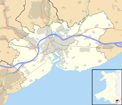 St Julians St Julians shown within Newport | |
| Population | 8,675 (2011 census)[1] |
| OS grid reference | ST322894 |
| Principal area | |
| Country | Wales |
| Sovereign state | United Kingdom |
| Post town | NEWPORT |
| Postcode district | NP19 7 |
| Dialling code | 01633 |
| Police | Gwent |
| Fire | South Wales |
| Ambulance | Welsh |
| EU Parliament | Wales |
| UK Parliament | |
St Julians (Welsh: Sain Silian) is an electoral district (ward) and coterminous community of the City of Newport, South Wales.
The ward is bounded by the River Usk to the west and north, The Moorings, Badminton Road, Reynolds Close, Rembrandt Way, Constable Drive, Heather Road, Kelly Road, Merlin Crescent, Avalon Drive, across St Julian's Road and Norfolk Road to the east, Christchurch Road, Church Road, Clarence Place and Newport Bridge to the south. The ward includes the districts of Barnardtown, Riverside, and most of St. Julians (the rest being in Beechwood ward). The area is governed by the Newport City Council.
St Julians has two primary schools, namely Glan Usk Primary School (formerly Durham Road Infant School and Durham Road Junior School) and St Julians Primary School.
Glan Usk Primary School moved to new school premises in January 2010.[2] The new school has been built on a hazardous waste landfill at the Glebelands in the western part of St Julians. The Glebelands site was operated as a landfill between the 1930s and 1960s such that the waste materials contributed to raising this low-lying part of Newport by some three to four metres. The site received domestic, trade, and industrial wastes including unrecorded amounts of hazardous waste such as polychlorinated biphenyls, asbestos, mercury, and arsenic.[3] The history of this site and concerns about public health and the wider environment resulted in much opposition and delay to construction of the new primary school.[4][5] The new school also provides nursery school places, following the closure of Rockfield Nursery.
All the roads in the post-war St Julian's estate are named after famous painters, where as the older inter-war estate streets are named after the members of the Firbank family who owned the land from 1869-1926. St Julian's itself is named after Saint Julius of Caerleon, the Roman martyr. The Anglican parish church for St Julian's is dedicated to the martyred Saints of Julius and Aaron and sits mid-way along Heather Road and the Roman Catholic church on Beaufort Road is dedicated to St Julius. St Julian's Methodist Church is situated at the junction of Caerleon Road with St Julian's Avenue; St Julian's Baptist Church is in Beaufort Road.
St. Julian's House
Built in 1480 on the site of a chapel that housed the mortal remains of Saint Julius, the house and estate was established by Sir George Herbert (c1462-1504). It was owned and lived in by the Herbert family until about 1720 when the Tudor mansion was downsized to a farmhouse and parts of the estate became derelict. St. Julian's was then passed onto the Duke of Beaufort who leased the farmhouse out in the early 19th century. In 1869, the estate was purchased at a Newport auction by Joseph Firbank (1819-1886), a railway contractor from Durham, for £38,000. In 1880 he rebuilds St. Julian's into a Victorian farmhouse, retaining the Tudor porch and the crucifix layout. He also builds a grander and more modern mansion south of Caerleon Road adjacent to Llanllecha Farm, called (Upper) St. Julians while the original house becomes Lower or Old St. Julians. This is then leased out again to farm tenants from 1892. In 1933, Upper St. Julian's is demolished for a new housing development on Heather Road and following the Second World War the older house is converted into a motor garage. The land surrounding the house has by this point been sold off and built on, leaving St. Julian's to become completely derelict by the 1970s. It was eventually demolished in 1980 and Marina Court is now situated on the site. [6] [7] [8]
See also
References
- ↑ "Newport ward 2011". Retrieved 5 April 2015.
- ↑ "Glan Usk Primary School Newsletter, 'Headlines' - 15 December 2009" (PDF). Glan Usk Primary School.
- ↑ "Planning Support – Enhanced Ground Contamination Risk Assessment and Remediation Strategy: Land at Glebelands, Newport – Application No. 00/0768, Reference: E3803/GO/PSS-RemStrat/JAN06/V2" (PDF). White Young Green Environmental.
- ↑ "Glan Usk meeting reports positive progress". Newport City Council.
- ↑ "Chepstow Friends of the Earth: Glebelands". Chepstow Friends of the Earth.
- ↑ "The Herberts of St Julians". Gwent Local History. 1973. Retrieved 29 May 2018.
- ↑ "St Julians House". Gwent Local History. 1974. Retrieved 29 May 2018.
- ↑ "St Julians Church, Newport". Gwent Local History. 1975. Retrieved 29 May 2018.
External links
| Wikimedia Commons has media related to St Julians, Newport. |