Liswerry
| Lliswerry | |
|---|---|
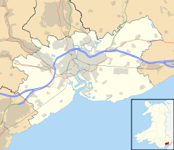 Lliswerry Lliswerry shown within Newport | |
| Population | 12,353 (2011 census)[1] |
| OS grid reference | ST334870 |
| Principal area | |
| Country | Wales |
| Sovereign state | United Kingdom |
| Post town | NEWPORT |
| Postcode district | NP19 0,4 |
| Dialling code |
01633 Maindee exchange |
| Police | Gwent |
| Fire | South Wales |
| Ambulance | Welsh |
| EU Parliament | Wales |
| UK Parliament | |
Lliswerry (Welsh: Llyswyry), is an electoral district (ward)[2] and community of the city of Newport, South Wales. The area is governed by Newport City Council.
Community boundaries
The community is bounded by the River Usk to the west, Lilleshall Street and Telford Street to the northeast, the Great Western main line to the north, the original western end of Llanwern steelworks and Meadows Road to the east, and Nash Road, Traston Road, Corporation Road and Stephenson Street to the south. Lliswerry ward is composed of both the Lliswerry and Nash communities.
Schools & colleges
The ward is the site of the City of Newport Campus for Coleg Gwent (commonly referred to as 'Nash College') and the Newport International Sports Village. Lliswerry has a high school,[3] a junior school and primary school, situated close to each other. Lliswerry High School is adjacent to the college campus, with the junior and infants school located further north along Nash Road.
Churches
Lliswerry has four churches St. Andrews Church in Wales situated on Somerton Road, Lliswerry Baptist church situated in Camperdown Road,St Patrick's Roman Catholic church in Cromwell Road. St Philips churchin Jenkins street.
History and origins
Lliswerry is well-known across the city for the railway bridge over Somerton Road with 'This is Lliswerry with 2 L's' painted in white across it. Lliswerry is an anglicised version of the place name Llyswyry translating to Maiden's Court. (Llys - Court, Gwyryf > Wyryf > Wyry - Maiden). It is believed that there was a manor house in the area belonging to the Welsh King of Brycheiniog. His daughter had connections to the manor/court. It was likely that the house was in the area of Traston Road today.
Sport
The suburb is also home to the Newport International Sports Village and Newport Stadium,[4] which from 1994 to 2012 was the home ground of the Newport County football team. Lliswerry A.F.C. are a football team currently playing in the Welsh Football League Division Three.
References
- ↑ "Newport ward 2011". Retrieved 4 April 2015.
- ↑ Lliswerry ward councillors at Newport City Council
- ↑ Lliswerry High School:: OS grid ST3486 :: Geograph Britain and Ireland - photograph every grid square!
- ↑ Newport Stadium:: OS grid ST3386 :: Geograph Britain and Ireland - photograph every grid square!
External links
| Wikimedia Commons has media related to Lliswerry. |