Gaur, Nepal
| Gaur गौर | |
|---|---|
| Municipality | |
| Nickname(s): Gaur Bazaar/Gaur Nagarpalika | |
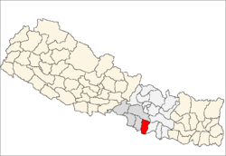
 Gaur Location in Nepal | |
| Coordinates: 26°46′N 85°16′E / 26.767°N 85.267°ECoordinates: 26°46′N 85°16′E / 26.767°N 85.267°E | |
| Country |
|
| Province | Province No. 2 |
| Zone | Narayani Zone |
| District | Rautahat District |
| Government | |
| • Type | Mayor-Council government |
| • Mayor | Ajay Gupta |
| Area | |
| • Total | 31.91 km2 (12.32 sq mi) |
| Elevation | 79 m (260 ft) |
| Population (2011) | |
| • Total | 34,937[1] |
| • Ethnic Groups | Bhumihar, Chhetri, Brahman, Marwari, Maithili, Tharu, Koche, Rajbanshi, Rajput |
| • Religions | Hinduism, Jainism, Islam, Kirant, Buddhism, |
| Time zone | UTC+5:45 (NST) |
| Postal code | 44500 |
| Area code(s) | 055 |
| Geocode | NP-TW |
| Main language | Nepali, Maithili, Bhojpuri |
| Website | gaurmun.gov.np |
Gaur is a municipality and headquarters of Rautahat district of Narayani zone, Nepal. It lies at the border of Nepal that links India via Bairgania and has a customs checkpoint.
The former Prime Minister of Nepal Madhav Kumar Nepal is a resident.[2]
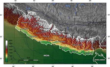
Geography

Gaur lies in plain of Terai region of Nepal.The land, here is fertile and humus containing.
Climate
| Climate Zone[3] | Elevation Range | % of Area |
|---|---|---|
| Lower Tropical | below 300 meters (1,000 ft) | 94.4% |
| Upper Tropical | 300 to 1,000 meters 1,000 to 3,300 ft. |
5.6% |
The Gaur has a humid, tropical climate. The mean annual rainfall at the Gaur was 2,214 mm (87.2 in) between 1995 and 2006. More than 80% of the total annual rainfall occurs during the monsoon season from June to September. Average temperatures ranged from 8.08 °C (46.54 °F) in January to 34.91 °C (94.84 °F) in June.[4]
In the past, the inner and outer Terai were a formidable barrier between Nepal and potential invaders from India because marshes and forests were infested by anopheline mosquitos that transmitted virulent strains of malaria, especially during the hot spring and rainy summer monsoon.
| Gaur, 26°N, 85°E | ||||||||||||||||||||||||||||||||||||||||||||||||||||||||||||
|---|---|---|---|---|---|---|---|---|---|---|---|---|---|---|---|---|---|---|---|---|---|---|---|---|---|---|---|---|---|---|---|---|---|---|---|---|---|---|---|---|---|---|---|---|---|---|---|---|---|---|---|---|---|---|---|---|---|---|---|---|
| Climate chart (explanation) | ||||||||||||||||||||||||||||||||||||||||||||||||||||||||||||
| ||||||||||||||||||||||||||||||||||||||||||||||||||||||||||||
| ||||||||||||||||||||||||||||||||||||||||||||||||||||||||||||
There are several differences between the climate on the eastern edge of the Terai at Biratnagar in Nepal and on the western edge of the Terai at Nepaljung in Nepal to that of Gaur in Nepal although they lies in same plain of Terai.
- Moving inland and away from monsoon sources in the Bay of Bengal, the climate becomes more continental with a greater difference between summer and winter.
- In the far western Terai, which is five degrees latitude further north, the coldest months' average is 3 °C (37 °F) cooler.
- Total rainfall markedly diminishes from east to west. The monsoon arrives later, is much less intense and ends sooner. However, winters are wetter in the west.au in Nepal near the central edge although both lies in Terai.
- Moving inland and away from monsoon sources in the Bay of Bengal, the climate becomes more continental with a greater difference between summer and winter.
- In the far western Terai, which is five degrees latitude further north, the coldest months' average is 3 °C (37 °F) cooler.
- Total rainfall markedly diminishes from east to west. The monsoon arrives later, is much less intense and ends sooner. However, winters are wetter in the west.
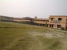
Education
Shree Juddha Campus
The origin of this campus goes back to its former "Shree Juddha Higher Secondary School" and further "Shree Juddha Secondary School", the third-oldest school in Nepal inaugurated by Juddha Shamsher Jang Bahadur Rana during Rana dynasty. The school got its name from his name. The institution has about 1500 students.
Shree Juddha Campus offers bachelor courses like Bachelor of Education, Bachelor of Arts, Bachelor of Commerce, etc. while its former entities "Shree Juddha Higher Secondary School" offers 10+2 courses of Higher Secondary Education Board and "Shree Juddha Secondary School" offers up to 10th class of School Leaving Certificate (Nepal).
It runs a separate school for blind students.
Gauri Shankar Yadav Campus
It offers bachelor courses like B.Ed. and 10+2 courses of Higher Secondary Education Board.
Maharshi Valmiki Campus
it offers bacholar courses like B.Ed. and 10+2 courses of Higher Secondary Education Board.
There are some other schools in the town which offer education up to 10th class and they have English medium of teaching. Some notable ones are:
- Shree Mid Regional Police Boarding Higher Secondary School
- Prabhat Secondary English Boarding School
- Loreto Secondary English Boarding School
- Shree N.B.H.S. School Mudawalwa Gaur Nepal
- Lumbini English Boarding School
- Janak English Boarding school
- Satya Sishu Niketan
- G. Star Academy
- International Bal Academy
- G.N.S. English Boarding School
- Krishna Mercy English Boarding School
- Munali Chid Academy
- Mitra Memorial Secondary English Boarding School
- Gurukul English Boarding school
- Discovery Public School
- New Hope Academy
Transport
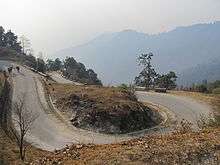
Gaur-Chandranigahpur Highway, Birendra Highway starts there and joins to East-West Highway in Chandrapur which connects Gaur to all major cities of Nepal.
The transport facility is reliable. There are more than 15 buses directly for capital of Nepal, Kathmandu, including 5 Volvo. One can also get direct bus for other major cities like Birgunj, Janakpurdham, Pokhara, Biratnagar, Nepalgunj, Bharatpur, etc.
The nearest domestic airport, Simara Airport, is in Simra while nearest International airport, Nijgadh International Airport is under construction in Nijgadh.[5] Currently passengers use Tribhuvan International Airport located in capital of Nepal, Kathmandu, for International flight.
As it is a border of Nepal that links India via Bairgania, one can reach to all major cities of India using Indian Railways available at Bairgania. Bairgania railway station is about 3 km from Gaur and several local transport like Tanga, Rickshaw, etc. are available from here.
Communication
Nepal Telecom and Ncell have network coverage. Ncell has a 3G network for a long time there but now Nepal Telecom also has a 3G network. Other cellular network available are UTL Nepal, Smart Cell. Indian network providers such as BSNL and MTS's network is available too. ISPs like Worldlink, UTL Nepal and Nepal Telecom is available.
Media
Gaur has some Community radio stations to promote local culture.
- Radio Rajdevi F.M.- 93.2 MHz
- Radio Border – 94.2 MHz
- Radio Sanskriti – 98.2 MHz
- Rautahat FM – 90.8 MHz.
- Kohinoor FM – 87.7 MHZ
Entertainment
Shanta Chalchitra Bhawan is the only cinema hall in the town.
Sports
The most popular sports in Gaur is Cricket.The youths are mainly playing this game for far years.Many players from this place has been participating in different formats of cricket.
Play Grounds
There are many play grounds in city but mainly two of them are popular and most suitable grounds for the playing purpose.
1. Rice Mill Cricket Ground
It is the biggest ground in the city and famous for cricket game.It has boundary of about 60-65 meters long.It hosts many tournaments from school level to district level.It is situated near Municipality Office.
Mayor Cup 2075
This is Second Edition of Mayor Cup schedule to take place in 2075.All the matches take place in Rice mill Cricket Ground.
Points table
The following teams are supposed to take part in this competition.All the matches will be play in Gaur Rice Mill Cricket Ground.
| Team | Pld | W | L | T | NR | Pts | NRR |
|---|---|---|---|---|---|---|---|
| Gaur Mayor Team | 0 | 0 | 0 | 0 | 0 | 0 | 0.000 |
| Gaur 1 Team | 0 | 0 | 0 | 0 | 0 | 0 | 0.000 |
| Gaur 5 Team | 0 | 0 | 0 | 0 | 0 | 0 | 0.000 |
| Gaur 8 Team | 0 | 0 | 0 | 0 | 0 | 0 | 0.000 |
| Gaur 4 Team | 0 | 0 | 0 | 0 | 0 | 0 | 0.000 |
| Gaur 2 Team | 0 | 0 | 0 | 0 | 0 | 0 | 0.000 |
- The four top ranked teams will qualify for the playoffs
- advanced to Qualifier 1
- advanced to the Qualifier 2
- Regelated
2. Barrack Field
It is small in size compare to Rice Mill Cricket Ground.It is mainly famous for football.It is situated next to police station.
Tourism
Barahwa Pool
This a concrete bridge over a canal now. Bagmati River used to flow at this place. Earlier wooden bridge was here that bridge held the record of longest wooden bridge of Nepal. Chhath puja of Mudawalwa Village and this place is very famous. Recently, Boating facilities has also been added.
Shiv Mandir and RajDevi Mandir
This is a temple of lord Shiva made up by Bidhyapatinagar Community. Next to the temple is a pond which have a bridged temple of Sun in the centre. Another temple is Rajdevi Temple which is located three km distance in east from the city. It is one of the ancient temples of the Rautahat district. It Was Built During Malla's Period and it is about 400 years old. For More info Follow on Facebook.com/rajdevimandir Twitter.com/rajdevimandir Instagram.com/rajdevimandir rajdevimandirrautahatnepal.blogspot.com
Suspension Bridge
It is suspension bridge inaugurated by then Prime Minister Baburam Bhattarai. This place developed as a new tourist place among locals for picnics and day-outs.

Gaur Park
It is undergoing on construction park in Gaur.It is situated just next to the Municipality Office near Gaur Cricket Ground.
Border sharing with India
Gaur has its importance because of its border sharing with Bairgania, India also. No documents are required to cross the border. Certain restrictions are enforced on many edible and electronics products and they are properly checked before allowing them to cross.[6]
There is a custom office which keeps a check on the vehicles entering Gaur having Indian vehicle registration number. Certain taxes are imposed by the office on heavy products/items entering Nepal.
References
- ↑ Central Bureau Statistics: National Population and Housing Census 2018 (p. 54, nr 33). Archived July 31, 2013, at the Wayback Machine.
- ↑ The Economist, "Broken peaces", 29 March 2007
- ↑ The Map of Potential Vegetation of Nepal - a forestry/agroecological/biodiversity classification system (PDF), Forest & Landscape Development and Environment Series 2-2005 and CFC-TIS Document Series No.110, 2005, ISBN 87-7903-210-9, retrieved Nov 22, 2013
- ↑ Department of Hydrology and Meteorology (2006). Climatological Records of Nepal (Several Volumes), Babarmahal, Kathmandu.
- ↑ Nijgadh International Airport
- ↑ "MOFA".