Basatpur
| Basatpur बसतपुर | |
|---|---|
| Place (Pride of Rautahat District, Nepal) | |
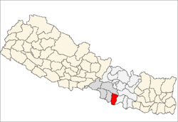
 Basatpur Location in Nepal | |
| Coordinates: 26°47′N 85°19′E / 26.79°N 85.32°ECoordinates: 26°47′N 85°19′E / 26.79°N 85.32°E | |
| Country |
|
| [Province] | Province Number 2 |
| District | Rautahat District |
| Population (1991) | |
| • Total | 4,093 |
| Time zone | UTC+5:45 (Nepal Time) |
Basatpur is situated on the bank of Bagamati River. The word Basatpur is derived from the word Basanta(spring season) which means the People of Basatpur are evergreen and happy like Basanta ritu(spring season). Basatpur was a village development committee in Rautahat District in the Narayani Zone of south-eastern Nepal till Aug, 2017. Currently, it is {technically} jointly two wards (i.e. 3 & 4 ) of Rajdevi Municipality of Rautahat district in Province "2" of federal Nepal. At the time of the 1991 Nepal census it had a population of 4093 people living in 922 individual households. Here is the second most population of Brahmins in Rautahat district. They are well educated & Most of the people of Basatpur are the workers of government of Nepal. They have covered each and every governmental sectors of Nepal as well some reputed private sectors.[1]
References
- ↑ "Nepal Census 2001". Nepal's Village Development Committees. Digital Himalaya. Archived from the original on 12 October 2008. Retrieved 25 November 2008.