Froland
| Froland kommune | |||
|---|---|---|---|
| Municipality | |||
 View of the Froland Church | |||
| |||
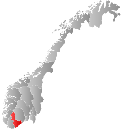
 Froland within Aust-Agder | |||
| Coordinates: 58°34′59″N 08°34′20″E / 58.58306°N 8.57222°ECoordinates: 58°34′59″N 08°34′20″E / 58.58306°N 8.57222°E | |||
| Country | Norway | ||
| County | Aust-Agder | ||
| District | Sørlandet | ||
| Administrative centre | Blakstad | ||
| Government | |||
| • Mayor (2015) | Ove Gundersen (KrF) | ||
| Area | |||
| • Total | 644.54 km2 (248.86 sq mi) | ||
| • Land | 601.02 km2 (232.06 sq mi) | ||
| • Water | 43.52 km2 (16.80 sq mi) | ||
| Area rank | #174 in Norway | ||
| Population (2017) | |||
| • Total | 5,713 | ||
| • Rank | #184 in Norway | ||
| • Density | 9.5/km2 (25/sq mi) | ||
| • Change (10 years) | 20.0% | ||
| Demonym(s) | Frolending[1] | ||
| Time zone | UTC+01:00 (CET) | ||
| • Summer (DST) | UTC+02:00 (CEST) | ||
| ISO 3166 code | NO-0919 | ||
| Official language form | Neutral | ||
| Website |
www | ||

Froland is a municipality in Aust-Agder county, Norway. It is part of the traditional region of Sørlandet. The administrative center is the village of Blakstad, which along with Osedalen form the main population center of the municipality. Other villages in Froland include Bøylefoss, Bøylestad, Froland, Frolands verk, Heldalsmo, Hinnebu, Hynnekleiv, Jomås, Lauvrak, Libru, Løvjomås, Mjåvatn, Mjølhus, Mykland, and Risdal.[2]
The 645-square-kilometre (249 sq mi) municipality is the 174th largest by area out of the 422 municipalities in Norway. Froland is the 184th most populous municipality in Norway with a population of 5,713 (in 2017). The municipality's population density is 9.5 inhabitants per square kilometre (25/sq mi) and its population has increased by 20% over the last decade.[3]
General information


The municipality of Froland was established when it was separated from the municipality of Øyestad in 1850. The new municipality had an initial population of 1,976. During the 1960s, there were many municipal mergers across Norway due to the work of the Schei Committee. On 1 January 1967, the neighboring municipality of Mykland (population: 604) was merged into the municipality of Froland. The newly enlarged municipality had a population of 3,372. On 1 January 1968, the Flateland area of neighboring Åmli municipality (population: 6) was transferred to Froland.
On 1 January 1970, the two uninhabited areas of Neset and Råbudal were separated from Froland and transferred to neighboring Birkenes municipality. Then on 1 January 1979, the uninhabited Landheia area was transferred from Froland to Birkenes municipality. On 1 January 1991, the Dalen area in Birkenes municipality (population: 60) was transferred from Birkenes to Froland municipality.[4]
Name
The municipality (originally the parish) is named after the old Froland farm (Old Norse: Fróðaland), since the first Froland Church was built there. The first element is the genitive case of the male name Fróði and the last element is land which means "land" or "farm".[5]
Coat-of-arms
The coat-of-arms is from modern times; they were granted on 17 January 1986. The green arms show a white or silver squirrel in the centre. The color and the animal were chosen as a symbol for the forests and wildlife in the municipality.[6]
Churches
The Church of Norway has one parish (sokn) within the municipality of Froland. It is part of the Arendal prosti (deanery) in the Diocese of Agder og Telemark.
| Parish (Sokn) | Church Name | Location of the Church | Year Built |
|---|---|---|---|
| Froland | Froland Church | Froland | 1718 |
| Mykland Church | Mykland | 1832 |
History
The iron production facility, Frolands verk, was founded in 1763 and continued in production through 1867. After that the facility became a sawmill. Today the main building from 1791 is a historically protected building, and the old stables are used as a cultural center.
Geography
The municipality is bordered on the north by the municipality of Åmli; on the east by Tvedestrand; on the south by Arendal, Grimstad, and Birkenes; and on the west by Evje og Hornnes and Bygland.
The large rivers Nidelva and Tovdalselva both run through Froland. There are also many lakes in Froland, including Homstølvatnet, Nelaug, Nystølfjorden, and Uldalsåna.
Government
All municipalities in Norway, including Froland, are responsible for primary education (through 10th grade), outpatient health services, senior citizen services, unemployment and other social services, zoning, economic development, and municipal roads. The municipality is governed by a municipal council of elected representatives, which in turn elect a mayor.
Municipal council
The municipal council (Kommunestyre) of Froland is made up of 19 representatives that are elected to four year terms. Currently, the party breakdown is as follows:[7]
| Party Name | Name in Norwegian | Number of representatives | |
|---|---|---|---|
| Labour Party | Arbeiderpartiet | 5 | |
| Progress Party | Fremskrittspartiet | 3 | |
| Conservative Party | Høyre | 1 | |
| Christian Democratic Party | Kristelig Folkeparti | 6 | |
| Centre Party | Senterpartiet | 4 | |
| Total number of members: | 19 | ||
Transportation
The Arendalsbanen railway which runs from Nelaug to Arendal connects Froland and Arendal to the railway system in Norway. Blakstad Station is in the municipal centre of Blakstad, Froland Station is located in the village of Froland, and Bøylestad Station is in the village of Bøylestad.
There are also several highways in Froland including the Norwegian National Road 41, Norwegian County Road 408, and Norwegian County Road 413.
Media
The newspaper Frolendingen is published in Froland.[8]
Notable residents
- Niels Henrik Abel, a well-known 19th century mathematician, died here in April 1829 and is buried at Froland cemetery.
References
- ↑ "Navn på steder og personer: Innbyggjarnamn" (in Norwegian). Språkrådet. Retrieved 2015-12-01.
- ↑ Thorsnæs, Geir, ed. (2017-11-02). "Froland". Store norske leksikon (in Norwegian). Kunnskapsforlaget. Retrieved 2017-12-17.
- ↑ Statistisk sentralbyrå (2017). "Table: 06913: Population 1 January and population changes during the calendar year (M)" (in Norwegian). Retrieved 2017-12-17.
- ↑ Jukvam, Dag (1999). "Historisk oversikt over endringer i kommune- og fylkesinndelingen" (PDF) (in Norwegian). Statistisk sentralbyrå.
- ↑ Rygh, Oluf (1905). Norske gaardnavne: Nedenes amt (in Norwegian) (8 ed.). Kristiania, Norge: W. C. Fabritius & sønners bogtrikkeri. p. 77.
- ↑ "Civic heraldry of Norway - Norske Kommunevåpen". Heraldry of the World. Retrieved 2017-12-09.
- ↑ "Table: 04813: Members of the local councils, by party/electoral list at the Municipal Council election (M)" (in Norwegian). Statistics Norway. 2015.
- ↑ Breivik Pettersen, Øyvind, ed. (2016-07-11). "Frolendingen". Store norske leksikon (in Norwegian). Kunnskapsforlaget. Retrieved 2017-12-17.
External links
| Wikimedia Commons has media related to Froland. |
| Look up Froland in Wiktionary, the free dictionary. |
- Municipal fact sheet from Statistics Norway (in Norwegian)

- Arendals fossekompani (in Norwegian)
- Froland.org (in Norwegian)
- Municipal website (in Norwegian)
- Froland Curlingklubb (in Norwegian)