European route E30
| |
|---|---|
 | |
| Major junctions | |
| West end | Cork, Ireland |
| East end | Omsk, Russia |
| Location | |
| Countries |
|
| Highway system | |
| International E-road network | |
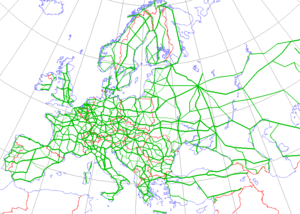
European route E 30 is an A-Class West-East European route, extending from the southern Irish port of Cork in the west to the Russian city of Omsk and then near the Kazakh border in the east. For much of its Russian stretch, it coincides with Trans-Siberian Highway and, east of the Ural Mountains, with AH6 of the Asian Highway Network, which continues to Busan, South Korea. It is one of the longest European routes with a total length of about 6,531 km (4,058 mi)—3,300 km (2,100 mi) from Cork to Moscow, and 3,230 km (2,010 mi) from Moscow to Omsk. The naming is by the United Nations Economic Commission for Europe (UNECE).
Itinerary

- Irish Sea

Although the United Kingdom Government participates fully in activities concerning the E-routes,[1] E-routes are not signposted within the United Kingdom.


.svg.png)
- North Sea The nearest passenger ferries to Hoek van Holland actually depart from Harwich, across the Orwell south of Felixstowe. That ferry has 2 daily departures, one is a day crossing, the other a night crossing, both taking about 7–8 hours. It carries foot (train) passengers and cyclists as well as cars, buses, caravans and freight lorries. The ferry has bunks and rooms available to accommodate those on either crossing. Tickets for Dutch rail travel can be purchased on the ship.[2] Ferries departing from Felixstowe carry freight only.

 E30 near The Hague


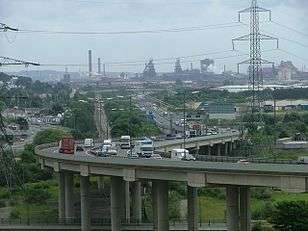
_3_km_east_of_Pozna%C5%84_Komorniki_interchange.jpg) A2/E30 near Poznań Komorniki interchange
A2/E30 near Poznań Komorniki interchange


The Russian stretch of this road coincides partly with the Asian Highway Network's AH6 (though this latter highway passes through Petropavl, Kazakhstan in its stretch between Chelyabinsk and Omsk, unlike the E 30). The E 30 follows the Russian main road M1 Belarus-Moscow, M5 Moscow-Chelyabinsk and M51 Chelyabinsk-Kurgan. It goes along minor roads past Ishim to avoid the Kazakh border towards Omsk.
E30 in the United Kingdom
Brexit, the United Kingdom's withdrawal from the European Union is not intended to affect the denomination or development of Euroroutes which cross the United Kingdom. This is because the Brexit vote provides no mandate for withdrawing from the UNECE, the international body which coordinates the scheme. Throughout the UK, the Euroroute network is largely unsigned.[1][3][4]
The E30 uses primary routes and motorways across the UK and is approximately 355 miles (571 km) between Felixstowe in East Anglia and Fishguard Harbour, Goodwick, in Wales.[5]
Felixstowe - London
On mainland Europe, the E30 terminates at Hoek-van-Holland where a ferry is required to cross the North Sea to Felixstowe, United Kingdom. The Port of Felixstowe is a major UK freight port with limited passenger operations present. In 2014, Felixstowe handled 28.1 megatonnes of freight, demonstrating the importance of the port within UK import and export sectors, as well as within sectors responsible for the development of UK road infrastructure concerning the E30.[6]

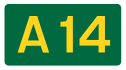
The route from Felixstowe to London:
- A14
- Ipswich - The Port of Ipswich handles approximately 2,000,000 tonnes of freight each year according to the Association of British Ports - Ipswich is the UK's largest export port.[7]
- (Harwich
- Colchester
- Chelmsford
- Brentwood
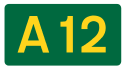
- E30 leaves A12 and joins M25 motorway junction 28.
London
The E30 avoids travelling through the centre of London by using the M25 to the north of London between junctions 28 and 15.
Major connections:
M4 Corridor: London - Bristol
To the west of London, the E30 uses the M4 motorway to South Wales. The destinations along this route are linked as part of the M4 corridor, named "Britain's Science Corridor" by the New York Times upon its inception in 1983.[8] This is because the destinations along the M4 route have become "hubs for the UK bases of major global high-tech companies."[9]
The London to Bristol route largely follows that of the Great Western Main Line, which serves as a major infrastructural passenger and freight route between some of the destinations along this section of the E30.
Major destinations along this route include:
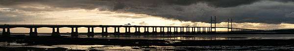
M4 Corridor: Bristol - Pont Abraham
West of Bristol, the E30 crosses the River Severn over the Second Severn Crossing. When this is not in use, the Severn Bridge may be used as an alternative to cross from England into Wales. Both crossings require a toll payment to traffic travelling westbound into Wales.[10]
In Wales, the roads which carry the E30 are managed by the South Wales Trunk Road Agent on behalf of the Welsh Assembly Government.[11]
The E30 serves several major industrial destinations in Wales which are largely an extension of "Britain's Science Corridor". These include:
Chepstow is not directly accessible from the E30, however, it is home to several scientific research centres, for example, CreoMedical, a firm which develops medical technologies for hospitals across the UK. The E30 would serve as important infrastructure to such businesses to transport Welsh scientific development across Europe.[12]
Newport, Cardiff, Port Talbot, Swansea and Llanelli are coastal destinations with sea links. ABP maintains a presence at some of these destinations (not Llanelli, additionally at Barry), and handles over 12 million tonnes of freight each year, contributing over £1.5billion to the economy.[13] This has been developed thanks to the historic development of infrastructure relating to the South Wales Valleys mining industry in the 20th Century, which has since declined in recent decades with the rising imports of foreign oil. This can be shown in the closure of South Wales' last deep mine in 1994.[14]
Cardiff is the capital city of Wales and serves as Wales centre for governance, business and culture.[15] The devolved government of Wales is housed in Cardiff Bay.[16]
In November 2016, Brexit supporter David Rowlands AM (UKIP) argued that the Welsh Government should use trans-European Highways Access funds to maintain the M4 following the UK's departure from the EU. This would be in addition to those which Wales have already received to develop the M4 motorway in Wales. He justified his viewpoint by claiming that a large proportion of all Irish exports, both to the UK and the EU, pass along this route.[17][18]
Pont Abraham - Fishguard
The E30 is carried by the A48 and A40 from Pont Abraham - the western terminal of the M4 - to Fishguard.

Destinations along the A40 are:
At Fishguard, sea connections can be made to Ireland.
See also
- Category:Constituent roads of European route E30
References
- 1 2 For example Economic and Social Council Document ECE/TRANS/WP.6/AC.2/18 – 17 December 2008; Agenda item 6 Participation in the 2005 E-route census
- ↑ For more information see: StenaLine or The Man in Seat 61 Seat61
- ↑ "E Roads - Roader's Digest: The SABRE Wiki". www.sabre-roads.org.uk. Retrieved 10 February 2017.
- ↑ "Why global governance is making the EU irrelevant". The Telegraph. Retrieved 10 February 2017.
- ↑ "Felixstowe, United Kingdom". Retrieved 11 February 2017.
- ↑ "UK Port Freight Statistics: 2014" (PDF). gov.uk. 2015.
- ↑ "Ipswich". 10 February 2017.
- ↑ Feder, Barnaby J. (24 April 1983). "BRITAIN'S SCIENCE CORRIDOR". The New York Times. ISSN 0362-4331. Retrieved 10 February 2017.
- ↑ "Tech Map of Britain: M4 corridor". Telegraph.co.uk. Retrieved 10 February 2017.
- ↑ "Toll Price - Severn River Crossing PLC". www.severnbridge.co.uk. Retrieved 10 February 2017.
- ↑ "Highways England Network Map" (PDF). 3 February 2017.
- ↑ "Microwave surgical device maker Creo Medical to float on Aim". The Telegraph. Retrieved 10 February 2017.
- ↑ "South Wales | Associated British Ports". www.abports.co.uk. Retrieved 10 February 2017.
- ↑ "South Wales Coalfield Timeline". www.agor.org.uk. Retrieved 10 February 2017.
- ↑ "Home - Visit Cardiff". www.visitcardiff.com. Retrieved 10 February 2017.
- ↑ "Welsh Government | Contact us". gov.wales. Retrieved 10 February 2017.
- ↑ "Welsh UKIP politician wants Ireland to pay for road". BBC News. 29 November 2016. Retrieved 10 February 2017.
- ↑ Murphy, Darragh Peter. "UKIP wants the Irish government to help pay for a motorway in Wales with EU funds". TheJournal.ie. Retrieved 10 February 2017.
External links
| Wikimedia Commons has media related to E 30. |