Aliso Creek (Orange County)
| Aliso Creek | |
| Alisos Creek[1] | |
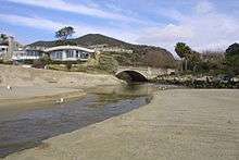
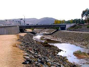 Aliso Creek flows underneath the Aliso Creek Road bridge before it enters Aliso and Wood Canyons Wilderness Park. | |
| Name origin: Spanish language "Aliso" meaning alder, thus "Aliso Creek" means "Alder Creek" | |
| Country | United States |
|---|---|
| State | California |
| Counties | Orange County |
| Tributaries | |
| - left | Sulphur Creek, English Canyon Creek |
| - right | Wood Canyon Creek, Dairy Fork |
| Cities | Laguna Beach, Laguna Niguel, Aliso Viejo, Laguna Woods, Laguna Hills, Lake Forest, Mission Viejo |
| Source | |
| - location | Portola Hills, Cleveland National Forest, Santa Ana Mountains, Orange County, California |
| - elevation | 1,704 ft (519 m) [2] |
| - coordinates | 33°42′10″N 117°37′20″W / 33.70278°N 117.62222°W [3] |
| Mouth | Pacific Ocean |
| - location | Laguna Beach, California |
| - elevation | 0 ft (0 m) [3] |
| - coordinates | 33°30′38″N 117°45′9″W / 33.51056°N 117.75250°WCoordinates: 33°30′38″N 117°45′9″W / 33.51056°N 117.75250°W [3] |
| Length | 19 mi (31 km) |
| Basin | 35.5 sq mi (92 km2) |
| Discharge | for Laguna Beach, California |
| - average | 7.7 cu ft/s (0 m3/s) [4] |
| - max | 5,400 cu ft/s (153 m3/s) |
| - min | 0 cu ft/s (0 m3/s) |
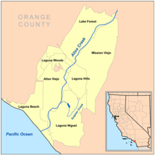
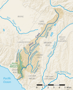 Map of the Aliso Creek watershed showing major tributaries and cities | |
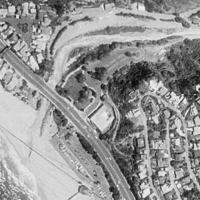
 Location of the mouth of Aliso Creek in California | |
Aliso Creek | ||||||||||||||||||||||||||||||||||||||||||||||||||||||||||||||||||||||||||||||||||||||||||||||||||||||||||||||||||||||||||||||||||||||||||||||||||||||||||||||||||||||||||||||||||||||||||||||||||||||||||||||||||||||||||||||||||||||||||||||||||||||||||||||||||||||||||||||||||||||||||||||||||||||||||||||||||||||||||||||||||||||||||||||||||||||||||||||||||||||||||||||||||||||||||||||||||||||||||||||||||||||||||||||||||||||||||||||||||||||||||||||||||||||||||||||||||||||||||||||||||||||||||||||||||||||
|---|---|---|---|---|---|---|---|---|---|---|---|---|---|---|---|---|---|---|---|---|---|---|---|---|---|---|---|---|---|---|---|---|---|---|---|---|---|---|---|---|---|---|---|---|---|---|---|---|---|---|---|---|---|---|---|---|---|---|---|---|---|---|---|---|---|---|---|---|---|---|---|---|---|---|---|---|---|---|---|---|---|---|---|---|---|---|---|---|---|---|---|---|---|---|---|---|---|---|---|---|---|---|---|---|---|---|---|---|---|---|---|---|---|---|---|---|---|---|---|---|---|---|---|---|---|---|---|---|---|---|---|---|---|---|---|---|---|---|---|---|---|---|---|---|---|---|---|---|---|---|---|---|---|---|---|---|---|---|---|---|---|---|---|---|---|---|---|---|---|---|---|---|---|---|---|---|---|---|---|---|---|---|---|---|---|---|---|---|---|---|---|---|---|---|---|---|---|---|---|---|---|---|---|---|---|---|---|---|---|---|---|---|---|---|---|---|---|---|---|---|---|---|---|---|---|---|---|---|---|---|---|---|---|---|---|---|---|---|---|---|---|---|---|---|---|---|---|---|---|---|---|---|---|---|---|---|---|---|---|---|---|---|---|---|---|---|---|---|---|---|---|---|---|---|---|---|---|---|---|---|---|---|---|---|---|---|---|---|---|---|---|---|---|---|---|---|---|---|---|---|---|---|---|---|---|---|---|---|---|---|---|---|---|---|---|---|---|---|---|---|---|---|---|---|---|---|---|---|---|---|---|---|---|---|---|---|---|---|---|---|---|---|---|---|---|---|---|---|---|---|---|---|---|---|---|---|---|---|---|---|---|---|---|---|---|---|---|---|---|---|---|---|---|---|---|---|---|---|---|---|---|---|---|---|---|---|---|---|---|---|---|---|---|---|---|---|---|---|---|---|---|---|---|---|---|---|---|---|---|---|---|---|---|---|---|---|---|---|---|---|---|---|---|---|---|---|---|---|---|---|---|---|---|---|---|---|---|---|---|---|---|---|---|---|---|---|---|---|---|---|---|---|---|---|---|---|---|---|---|---|---|---|---|---|---|---|---|---|---|---|---|---|---|---|---|---|---|---|---|---|---|---|---|---|---|---|---|---|---|---|---|---|---|---|---|---|---|---|---|---|---|---|
| ||||||||||||||||||||||||||||||||||||||||||||||||||||||||||||||||||||||||||||||||||||||||||||||||||||||||||||||||||||||||||||||||||||||||||||||||||||||||||||||||||||||||||||||||||||||||||||||||||||||||||||||||||||||||||||||||||||||||||||||||||||||||||||||||||||||||||||||||||||||||||||||||||||||||||||||||||||||||||||||||||||||||||||||||||||||||||||||||||||||||||||||||||||||||||||||||||||||||||||||||||||||||||||||||||||||||||||||||||||||||||||||||||||||||||||||||||||||||||||||||||||||||||||||||||||||
Aliso Creek (Spanish for "Alder Creek"; also called Alisos Creek) is a 19-mile (31 km)-long urban stream that runs through Orange County in the U.S. state of California from the Santa Ana Mountains to the Pacific Ocean. The creek's watershed covers 30.4 square miles (79 km2), and it is joined by seven main tributaries. The creek is mostly channelized, and as of 2004, the watershed had a population of 149,000 divided among seven incorporated cities.[5]
Aliso Creek flows over soft marine sedimentary rock of late Eocene to Pliocene age.[6] What would become the Aliso Creek watershed originally lay at the bottom of the Pacific Ocean, before being uplifted as recently as 10 million years ago. About 1.2 million years ago, the San Joaquin Hills began to form in the path of Aliso Creek. Occasionally swollen by wetter climates during glacial periods, the creek carved the deep water gap known as Aliso Canyon, today the main feature of Aliso and Wood Canyons Regional Park.
Historically, Aliso Creek served as the boundary between the Juaneño (Acjachemem) and Gabrieleño (Tongva) Indians. The creek was likely named by Spanish explorers in the 18th century. In 1842 the creek was part of the Rancho Niguel Mexican land grant to Juan Avila. Rancho Niguel was later purchased by the Moulton and Daguerre families, who began to subdivide the area for housing in the mid-20th century.
Today, residential and commercial development covers more than 70 percent of the Aliso Creek watershed. Pollution from urban runoff has blighted the water quality and wildlife of the creek since suburbanization began in the 1960s.[7][6] Despite these environmental issues, the Aliso Creek watershed still supports much native flora and fauna and is home to many parks and wildlife preserves.
Etymology
The name of Aliso Creek was given by Spanish explorers sometime between the 1750s and the 1800s.[8] The word aliso means "alder" in Spanish, and likely refers to the riparian vegetation that lines the creek especially near its mouth. The California sycamore, Platanus racemosa, is also known as aliso in Spanish, and is common in the area around the creek. According to the Geographic Names Information System of the United States Geological Survey, there are now 46 places in California that use the name,[3] as well as five other streams in California that use the name, including as a variant name.[9]
Other derivatives for Aliso Creek's name have arisen since then—including "Los Alisos Creek" and "Alisos Creek".[3] Several nearby geographical features also are named for the creek, including Aliso Peak, a 683-foot (208 m) headland. A middle school in the Saddleback Valley Unified School District, Los Alisos Intermediate School, borders the creek. The creek is also the namesake of Aliso Creek Road, which crosses the creek once and only parallels it for a short length. The city of Aliso Viejo and several other communities that lie near the stream also share their name with the creek.[10]
Course
Aliso Creek rises along the Loma Ridge in the foothills of the Santa Ana Mountains, near the community of Portola Hills, Lake Forest. The creek's headwaters are at an elevation of 1,700 feet (520 m) in the Cleveland National Forest.[2] The creek flows south along Country Home Road then begins to parallel Santiago Canyon Road, which becomes El Toro Road south of Cook's Corner.[11] The creek enters Mission Viejo, flowing freely in a natural streambed along the bottom of a brushy ravine. It turns southwest, crossing under the 241 toll road and passing Saddleback Church, then receives an unnamed tributary from the right. The creek then enters Lake Forest, where it receives Munger Creek from the right and English Canyon Creek from the left.[2][11][12][13]
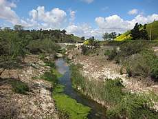
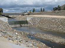
Below English Canyon, Aliso Creek flows in a concrete channel through Heroes Park and then reverts to a natural channel once again in the Lake Forest Golf Center. Past Muirlands Boulevard the creek flows in a concrete channel, making a sharp turn to the southeast before veering back south towards Interstate 5. Downstream of the freeway Aliso Creek flows through Laguna Hills then through Aliso Park in the retirement community of Laguna Woods Village. It enters Aliso Viejo at the Moulton Parkway bridge near Sheep Hills Park. Below this point the valley widens at the northernmost tip of Aliso and Wood Canyons Wilderness Park, the beginning of a greenbelt that stretches from here nearly to the Pacific Ocean.[2][11][12][13]
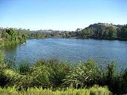
The creek turns southeast and then southwest again where it is joined by the Aliso Hills Channel. It passes under the 73 toll road bridge then receives the Dairy Fork from the right. Dairy Fork was largely buried in the 1990s during the construction of the toll road and is now essentially a large storm drain.[2][11][12][13] Below this point, the creek flows past Journey School, Aliso Niguel High School and Wood Canyon Elementary School as well as the Laguna Niguel Skate and Soccer Park, where it skirts the northwestern part of Laguna Niguel. Below Aliso Creek Road it is joined from the east by its largest tributary, Sulphur Creek. Sulphur Creek drains much of northern Laguna Niguel and is dammed to form Laguna Niguel Lake, the main attraction of Laguna Niguel Regional Park.[11]
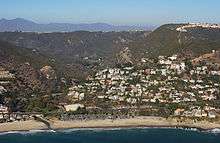
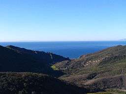
From there, Aliso Creek turns west and enters Aliso Canyon, a nearly 1,000-foot (300 m) deep gorge which cuts through the San Joaquin Hills approaching the Pacific.[2][11][12][13] About a mile (1.6 km) below Sulphur Creek, Aliso Creek is impounded at a small concrete dam. It then receives its second largest tributary, Wood Canyon Creek, to the south of Soka University of America. Below Wood Canyon it turns south, winding through the wilderness park then turning west at the South Orange County Wastewater Agency (SOCWA)'s Coastal Treatment Plant. It then flows through the former Aliso Creek Inn and Golf Course (now The Ranch at Laguna Beach), under Pacific Coast Highway, and empties into the sea at Aliso Beach Park in Laguna Beach.[2][11][12][13]
Aliso Creek forms a narrow tidal lagoon just above its mouth at Aliso Beach. The lagoon originally covered several acres at the outlet of Aliso Canyon, dammed by a sandbar that only breached during the rainy season. Due to development of the golf course and parking lots at the mouth of the creek, the lagoon has been significantly reduced from its original size, destroying habitat for native species such as the tidewater goby. The increased freshwater inflow caused by urban runoff has further disrupted the hydrologic regime of the lagoon, which now breaches on a near-daily basis with large surge flows into the Pacific Ocean before being blocked again by sandbar formation.[14][15][16]
Hydrology
Aliso Creek was historically a seasonal stream with a few sections containing water year round, especially in the Aliso Canyon area. Significant flow only occurred in the rainy months of November through March.[17] Groundwater was available at a shallow depth in the creek's gravel bed, although its quality was said to be poor.[2] As recently as 1982, the creek was observed to be dry in the summer.[4] Urban runoff now contributes a permanent dry season flow of at least 5 million gallons (20,000 m3) per day, or 7.7 cubic feet per second (0.22 m3/s), at the creek's mouth.[4] Urban runoff accounts for at least 80 percent of the creek's dry season flow.[14][15]
The United States Geological Survey had two stream gauges on the creek—one at the mouth in Laguna Beach, and one at the El Toro Road bridge in Mission Viejo. The Laguna Beach gauge was in operation from 1983 to 1986, and the El Toro gauge was operational from 1931 to 1980. The former measured runoff from nearly all of the watershed, while the latter measured runoff from 7.91 square miles (20.49 km2), or 26 percent of the watershed area.[18][19]
The largest flow recorded at the Laguna Beach gauge was 5,400 cubic feet per second (150 m3/s) with a water depth of 11.3 feet (3.4 m) on March 1, 1983.[18] The 1983 flood was caused by an El Niño event causing heavy runoff from the overdeveloped watershed. Damage was worst at the mouth of Aliso Canyon, where Aliso Creek Inn and several other structures were flooded.[20] The largest flow recorded at El Toro was 2,500 cubic feet per second (71 m3/s) on February 24, 1969, with a water depth of 11 feet (3.4 m).[19][21]
Suburban development is the main cause of increased winter flooding, due to the covering of land with impervious surfaces such as roads and parking lots. From 1931 to 1960, the average annual peak flow at the El Toro gauge was 511 cubic feet per second (14.5 m3/s), and between 1960 and 1980, the average peak flow was 1,178 cubic feet per second (33.4 m3/s).[19]
Geology
Most of Southern California, including all of Orange County, was part of the Pacific Ocean as recently as 10 million years ago (MYA). The Santa Ana Mountains, where the creek originates, began to rise about 5.5 million years ago along the Elsinore Fault.[22] About 1.22 million years ago, the San Joaquin Hills along the Orange County coast began their uplift along the San Joaquin Hills blind thrust fault which extends south from the Los Angeles Basin.[23] The hills rose directly in the path of Aliso Creek, which cut a water gap through the range, forming Aliso Canyon. The uplift also diverted Sulphur Creek, which originally flowed south into Salt Creek, to turn north and join Aliso Creek.[6]
During the last glacial period (110,000 to 10,000 years ago), especially in the Wisconsinian glaciation (31,000 to 10,000 years ago), the climate of Southern California became periodically much wetter, with a climate similar to the present-day Pacific Northwest. At this time Aliso Creek was a large river carrying much more water than it does today.[24][25] During glacial periods sea level was as much as 400 feet (120 m) lower, increasing the stream gradient and thus its erosive force. These factors led to Aliso Creek carving out a much larger series of valleys than would appear possible with its present-day volume.[24] As sea levels rose after the Wisconsinian glaciation, Aliso Canyon became a long narrow bay. Over thousands of years Aliso Creek filled in the bay with sediment, creating the flat alluvial valley floor seen today.[24]
Most of the Aliso Creek watershed sits on several layers of marine sedimentary strata, the oldest dating from the Eocene (55.8–33.9 MYA) and the most recent, the Pliocene (5.33–2.59 MYA).[26] These alluvial sediments range from 13 to 36 feet (4.0 to 11.0 m) in depth. Generally throughout the watershed, there are five major soil and rock outcrop types—Capistrano sandy loam, Cieneba sandy loam, Marina loamy sand, Myford sandy loam, and Cieneba-rock outcrop. The water table ranges from 6 to 20 feet (1.8 to 6.1 m) deep.[26]
Watershed
Geography
| Land use |
|
The Aliso Creek drainage basin lies in the south central part of Orange County, roughly halfway between the Santa Ana River and the border of San Diego County.[28] It is a roughly spoon shaped area of 30.4 square miles (79 km2),[29] and is characterized by hilly and sometimes mountainous terrain. The watershed borders five major Orange County watersheds: Santiago Creek to the north, San Diego Creek to the west, Laguna Canyon to the southwest, Salt Creek to the southeast, and San Juan Creek to the east.[12][30]
As of 2004, the Aliso Creek watershed had a human population of 149,087.[5] Nine communities were established in the creek's watershed as it was developed in the 20th century. By 2001 seven of them had become cities (from mouth to source, Laguna Beach, Laguna Niguel, Aliso Viejo, Laguna Hills, Laguna Woods, Lake Forest (formerly El Toro), and Mission Viejo), and the last two, Foothill Ranch and Portola Hills, were incorporated into the city of Lake Forest in 2000.[27] The watershed is most heavily developed between the 241 toll road on the north, in Mission Viejo, and Aliso Creek Road on the south in Aliso Viejo/Laguna Niguel. Above and below these points, the creek has retained more of its natural characteristics.[27]
The portion of the Santa Ana Mountains in the Aliso Creek watershed top out at approximately 2,300 feet (700 m), while the San Joaquin Hills rise to about 1,000 feet (300 m) at Temple Hill ("Top of the World") in Laguna Beach adjacent to Aliso Canyon.[10] The rest of the watershed consists mostly of rolling hills with very little flat land except immediately adjacent to Aliso Creek. Much of the terrain in the watershed has been regraded to build homes and roads, and a number of smaller tributaries such as Dairy Fork have been completely filled in. Laguna Niguel Lake, formed by a dam built in 1966, is the only significant body of water in the watershed.[10][13]
Recreation
The Aliso Creek watershed includes portions of the Cleveland National Forest in the upper watershed, and two major regional parks—the 3,879-acre (1,570 ha) Aliso and Wood Canyons Wilderness Park and its adjoining Aliso Creek Beach, one of the county's most popular beaches with over one million annual visitors;[31] and the 236-acre (96 ha) Laguna Niguel Regional Park, which borders Sulphur Creek. Because of its shallowness and erratic flow, Aliso Creek is not navigable even in the winter and spring (rainy season); the only spot in the entire watershed where boating is possible is Sulphur Creek Reservoir. A mostly paved trail, the Aliso Creek Trail, follows the creek from Aliso Canyon to the Cleveland National Forest.[32]
The only major fishing spot in the Aliso Creek's watershed is the 44-acre (18 ha) Sulphur Creek Reservoir, formed by a large earthfill dam across Sulphur Creek inside Laguna Niguel Regional Park. The lake is regularly stocked with catfish, bass, bluegill, and trout during the winter months.[33] Any other location in the watershed will probably yield only the bottom-dweller carp.
Most of the trails in the watershed are biking and equestrian trails located in the lower portion of the watershed, in the immensely popular Aliso Canyon and its tributary, Wood Canyon. Aside from the main Aliso Creek Trail, the Wood Canyon Trail parallels a tributary of Aliso Creek (Wood Canyon Creek). There is also a bikeway along Sulphur Creek and along parts of English Canyon.[32]
Ecology and environment
Historic environment

Before agricultural and later urban development of the watershed, live oak, sycamore, and alder trees lined the banks of Aliso Creek and its major tributaries, specifically Wood Canyon, Sulphur and English Canyon creeks, in a rich riparian zone.[34] Coyotes, mountain lions, and other large mammals were found throughout the Aliso Creek watershed, especially in the mountainous areas in the San Joaquin Hills and Santa Ana Mountains. These animals can still be found in some number, but they are mostly confined to the wilderness areas that are surrounded by residential development. These "islands" of native vegetation and wildlife still support many native Southern California organisms. As the creek was perennial, the riparian zone surrounding the creek likely was similar to that of San Juan Creek to the south.[5]
Researchers and long-time residents of the lower Aliso Creek watershed have argued for many years over the presence of steelhead trout in Aliso Creek. Up until 2006 the National Marine Fisheries Service stated that Aliso Creek is a "[coastal basin] with no evidence of historical or extant of O. mykiss in anadromous waters." Contrary to that, a 1998 major study co-authored by the US Army Corps of Engineer and US Fish & Wildlife Service declared that steelhead had inhabited the creek until around 1972 when increased density (urbanization) resulted in poor water quality conditions (pollutants and low oxygen levels) that drove the migrational fish out.
On February 20, 2009, in a written rebuke, chastising an Aliso Creek water rights applicant (South Coast Water District) a formal letter sent by NOAA Regional Manager Rodney McGinnis to Antonio Barrales of the State Water Resources Control Board, Water Rights Division, revised that 2006 assessment. Carbon copied was California Fish & Game (Mary Larson) plus US Fish & Wildlife Service (Christine Medak). This was due to 9 years of constant petitioning by the South Orange County environmental protectionist group Clean Water Now (CWN) led by Founder and Executive Director Roger E. Bütow, Board member Michael Hazzard, Joanne Sutch (Laguna Beach Beautification Committee) and Devora Hertz (Planet Laguna). Frank Selby, owner of His & Hers Fly Shop in Costa Mesa, was interviewed by Oc Register and lA Times reporters, he confirmed his own steelhead takings from the 1950s and 60s, last sighting in 1972. Frank then sent a letter to CEMARS (June 2008) titled "Regarding Aliso Creek Steelhead." He was also personally interviewed by the CWN Board to confirm actual sightings and taking.
NMFS then reversed itself and declared that there was sufficient, credible information to declare that Aliso Creek had been steelhead habitat and was added to the Distinct Population Segment List under the jurisdictional domain of NOAA. It is now considered a candidate for re-colonization.
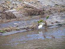
During the prolonged 9-year dispute that began in 2000, Bütow and his working group "Friends of the Aliso Creek Steelhead" provided authentic Native American (Juañeno) anecdotes of takings, pictures by upstream fishermen with their catches and other personal accounts by longtime local residents that helped convince the State. It was a negotiated truce between Bütow and NOAA: Only the lower 7 miles of the creek was eventually listed because its conditions were amenable to historical populations. The habitat "termination line" was drawn at about Aliso Creek where it crosses an arterial road: Pacific Parkway in Aliso Viejo. In fact, Mary Larson (steelhead restoration coordinator for CF&G), declared to reporters when the ruling was reversed that it was obviously true, its historical presence a "duh, no-brainer moment." [35] Many anglers in the 1960s and 1970s reported taking tens or even hundreds of steelhead trout from Aliso Creek's estuary and Aliso Creek Canyon (approximately 4 miles) before suburban development began.[36][37][38][39][40] This indicates that there was a "possible run or population" of steelhead in Aliso Creek at some point.[41] The creek is also inhabited by bottom-dwellers such as carp, and historically shrimp and other benthic organisms were found throughout perennial pools in the Aliso Creek watershed. Historically, a large population of tidewater goby (10,000–15,000) was documented at the creek's mouth by Swift et al.. (1989), from a study period that ranged from March 1973 to January 1977. The tidewater goby, which depended on the transient lagoon at the mouth for survival, has declined in number because of modifications to its habitat.[42]
Human impacts on wildlife
Since urbanization began in the 1960s, increased erosion and pollution have had adverse impacts on the creek's riparian corridor. Invasive plants, including tobacco tree, castor bean, pampas grass, periwinkle, and Artichoke thistle, but most notably the giant reed, have in many places replaced native live oaks, sycamores and alders.[34] These plants have crowded out native vegetation, and in the case of giant reed, crowded out native animals—giant reed does not provide habitat for any native Southern California animals.[34] These invasive species are most prevalent along upper Sulphur Creek (Sulphur Creek Dam blocks these plants from propagating downstream), much of the Aliso Creek mainstem, and some parts of Wood Canyon Creek.
Many of the trees in Aliso Creek's riparian zone were cut down in the Spanish Mission period to construct buildings, ships, and other projects. According to the Flood Protection Corridor Program of the Costa Machado Water Act of 2000, "Aliso Creek was one of the few streams that contained water most of the year, even during the pre-development period. There are documents describing explorers mooring their ships outside the mouth of the river and harvesting large timbers from the river area. Such large timbers could only be available from a relatively lush environment in which water was somewhat plentiful."[5] Some trees survived into the early 20th century, but the lowering of the water table caused in part by groundwater pumping hastened their decline.[34]
Although many fish species were once found in Aliso Creek, the only remaining one is carp, which is known to survive in highly polluted and warm water. Aside from carp, several species of fish and amphibians still inhabited the creek up to the 1980s, when floods destroyed much of the remaining riparian habitat. These included the mosquito fish, bluegill, bass, and channel catfish, as well as several species of native frogs. After the floods, most of these species were reported to have disappeared completely.[5]
Habitat for native birds including California least tern, least Bell's vireo, southwestern willow flycatcher, California gnatcatcher, and western snowy plover has also been reduced by the loss of riparian zones.[5] These species are mostly found in less developed areas in Aliso and Wood Canyons, the upper reaches of Aliso Creek, and some parts of English Canyon Creek.[26]
Bacterial pollution
Aliso Creek's watershed, as well as most of Orange County, saw a rapid jump in urban development from the 1960s onward, which introduced increased flow, non-native vegetation, and high bacterial levels to the creek, severely hurting its ecology.[5] The creek is part of the Clean Water Act list of impaired waters,[43] which is defined as "impaired by one or more pollutants that do not meet one or more water quality standards". It is said that Aliso Creek is one of the "most publicized" streams on the list.[44] As of 2001, the average annual precipitation in the San Juan Hydrological Unit, which Aliso Creek is part of, was 16.42 inches (417 mm).[45]
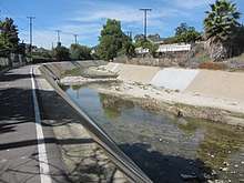
Bacteria affecting the water quality mainly consist of different types of fecal coliforms, with a high level of E. coli bacteria. This comes from pet waste, fertilizer, manure, and other organic pollutants that are washed into the creek, raising the average bacteria level 34 percent higher than levels declared safe under California law.[46] This in turn affects recreation at popular Aliso Creek Beach at the creek's mouth, violating state swimming standards 99 percent of the time, especially during storm events, as beachgoers are warned to avoid the creek for 72 hours (3 days) after a major storm event.[47][48]
According to the county health department, the number of bacteria in the creek, especially at the freshwater lagoon at its mouth, frequently exceeds limits set by California law.[45]
According to the Los Angeles Times, "County health officials acknowledge that the bacterial count at the mouth of the creek—which curls into a warm-water stagnant pond that flushes out onto the beach—is at times alarmingly high, often surpassing the legal limit for California. As a result, the area where the creek meets the sea, and the creek itself, are considered permanently off limits to swimmers and bear prominent signs that warn of the dangers of trespassing into such toxic waters. Nevertheless, people do, almost daily. Officials from the Orange County Environmental Health Department say that skin rashes, infections, "pink eye" and other assorted ailments are not uncommon to those who use Aliso Beach and, unwittingly, come in contact with the creek and its invisible bacteria...".[49] The problems facing the creeks are blamed on urbanization, which has deprived the creeks of needed sediment while increasing pollution.[45]
Other pollutants
Chlorine is responsible for the degradation of fish and shrimp in the creek. The sources for chlorine in urban runoff include irrigation and car washing. The only remaining fish species in the creek is carp, which can withstand high amounts of chlorine. Carp up to 18 inches (1.5 feet / 45 cm) long have been found in Aliso Creek near the mouth. Temperatures of the creek near the mouth have been known to exceed 90 °F (32 °C), although the temperature at the outflow is often much colder because it has been mixed with seawater.[49]
Changes of sediment patterns in the creek have also created another problem. Stemming from the construction of structures interfering with stream flow, and increased runoff from the urban areas adjoining the creek, excessive erosion has created problems not limited to just the creek. The creek is eroding material from its bed and transporting it to the ocean, but naturally, sediment from the whole watershed flowed towards the main stem via a complex network of tributaries. The U.S. Army Corps of Engineers warned in a 1997 study that up to $4.2 million in damage occurs per year as a result of the pollution of Aliso Creek and its neighbor San Juan Creek. This includes physical damage to creek banks, bridges, pipes and other creekside structures.
In the upper portion of the watershed, spectacular erosion-related events have occurred at English Canyon Creek, where water flowing at high velocity around a bend during a flood caused several landslides in the 1990s.[34]
History
First inhabitants
It is believed that in Native American times, Aliso Creek served as part of an important tribal boundary—between the Tongva in the north and the Acjachemen (or Juaneño) tribe in the south.[50] The Tongva's territory extended north, past the Santa Ana River and San Gabriel River, into present-day Los Angeles County, while the Acjachemen's smaller territory extended from Aliso Creek south, past San Juan Creek, and to the vicinity of San Mateo Creek in present-day San Diego County.[50] The creek's perennial flow[5] made it a likely spot for Indian settlement, although the Tongva's main settlements were near the San Gabriel River and the Acjachemen mostly lived at the confluence of San Juan Creek and Trabuco Creek. Even so, some 70 major archaeological sites have been discovered along the creek,[50] and it is believed that there was once an Acjachemen Indian village near the confluence of Aliso Creek and Sulphur Creek, named Niguili, which means "a large spring" in the native Luiseño dialect. The spring still exists near the intersection of Alicia Parkway and Highlands Road in present-day Laguna Niguel, about a mile (1.6) km east of Aliso Creek's confluence with Sulphur Creek.[51]
The creek's use as a tribal boundary is disputed. As other southern California Native Americans have done, a tribe typically claimed both sides of a stream or river—and used drainage divides as boundaries instead. However, the presence of Aliso Canyon, a steep and difficult-to-traverse gorge, suggests the opposite.[50] Kroeber (1907) was the first to support this theory, and many other archaeologists have followed as well. The Juaneño disagree, arguing that their boundary stretches north to the northern drainage divide of the Aliso Creek watershed, which supports the practice of claiming both sides of a stream.[52]
Spanish explorers and missionaries
In 1769, the Portola expedition camped near Aliso Creek on July 24–25, having come north from the San Juan Capistrano area along the route of today's Interstate 5.[53] These first Spanish explorers were accompanied by Franciscan missionaries who took control over nearly all of the coastal Native American groups. They later established Mission San Gabriel Arcángel and Mission San Juan Capistrano near the main native population centers, seeking to convert them to Christianity. Most of the native population was moved to these two missions—the Spanish called the Tongva Gabrielinos[54] and the Acjachemen, the Juaneño,[55] after these two missions. The Spanish began farming and ranching practices on many of the fertile floodplains surrounding the only perennial streams in the area—San Juan and Trabuco Creek, Aliso Creek, and the Santa Ana, San Gabriel and Los Angeles rivers to the north. Many of the trees in the riparian zones surrounding these creeks—specifically Aliso Creek—were cut down, and it was said that the trees near the "river['s]"[5] mouth were especially tall and there were written accounts of Spanish ships mooring in the large bay at the outlet of Aliso Canyon and men going ashore to chop down and take away these trees for constructing mission buildings, ships and other structures.[5][34]
The Mexican period
Mexico won independence from Spain in 1822, keeping the Alta California province, and secularized the missions in the 1830s. Former mission lands were divided into private land grants. In 1842, Juan Avila received the 13,316-acre (53.89 km2) Rancho Niguel grant. The name of the rancho was partially derived from a corruption of the original name of the village, Niguili. (The rancho name later became part of the name of the city of Laguna Niguel.)
Statehood
Following the Mexican–American War, California was annexed by the United States, becoming the 31st state in 1850. In 1871, the first white settler along Aliso Creek, Eugene Salter, claimed 152 acres (0.62 km2) along the lower creek, inside Aliso Canyon.[6] The following year the 152 acres (0.62 km2) were acquired by George and Sarah Thurston, homesteaders who converted the mouth of the creek into an orchard irrigated by its waters for roughly the next half century.[6] Around the beginning of the 20th century, settlers established the town of El Toro (now Lake Forest) along upper Aliso Creek. Citrus was the dominant crop in the area, irrigated by wells sunk into the shallow groundwater basins along the creek.[17] The lower part of the watershed was used extensively for cattle and sheep ranching as well as some dryland farming.[17]
Urbanization and development
In 1895, Rancho Niguel was acquired by rancher Lewis Moulton (1854–1938) and his partner, Jean Pierre Daguerre (1856–1911). The rancho remained under their ownership for approximately thirty-eight years, and the rancho continued to be owned by the Moulton family until the 1960s. Rancho Niguel was eventually subdivided into the planned cities of Laguna Niguel, Aliso Viejo, Laguna Hills, with a portion preserved as Aliso and Wood Canyons Wilderness Park.[5][56][57]
By the 1920s, Aliso Creek was already being experimented with as a municipal water source. In 1924, the City of Laguna Beach drilled wells into gravel deposits near the mouth of the creek, in order to provide drinking water. Just four years later, the unusually high and unexplained presence of chloride in the water prompted the city to abandon Aliso Creek as a water source.[2] Taking advantage of the creek's high winter surges, ranging from 0 to 404 acre feet (0 to 498,327 m3) monthly, local resident A. J. Stead proposed in 1934 to build a dam very near the mouth of the creek, forming a reservoir with a capacity of 2,650 acre feet (3,270,000 m3) and safe annual yield of 150 acre feet (190,000 m3). Although the proposal was accepted, the results are unknown—there is no remaining trace of these works today.[2]
By the late 1960s, increasing runoff in the creek from the growing cities in the watershed begun to spell ecological problems and severe erosion for the creek. Although a series of flood control channels upstream of Aliso Creek Road (near Aliso Canyon) had already begun to prevent erosion in those heavily developed areas, the creek eroded to depths of 20 feet (6.1 m) or more in any unlined areas.[58]
In 1969 severe flooding occurred along Aliso Creek, causing nearly $1 million of damage.[17] That year a flow control and erosion mitigation project for Aliso Creek was begun, requiring the construction of two concrete drop structures on the creek.[58] These two vertical barriers, 11 feet (3.4 m) high and 30 feet (9.1 m) long, were built both upstream and downstream of Aliso Creek Road. Several grouted riprap structures were also constructed between and downstream of these drops.[5]
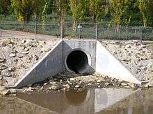
A small dam was built about 1.4 miles (2.3 km) downstream of Aliso Creek Road in the 1990s—inside Aliso Canyon—as part of a "mitigation bank project".[58] This project, known as ACWHEP (Aliso Creek Wildlife Habitat Enhancement Project) was intended to provide water to 70 acres (0.28 km2) of former riparian areas now several feet higher than the eroded channel of the creek. It was conceived and jointly funded by the county and the Mission Viejo Company.[59] The dam was also supposed to control further erosion downstream. Due to faulty design, however, the dam failed to prevent erosion, which has continued to undermine structures throughout the canyon.[34] The grouted riprap structure is about 15 feet (4.6 m) high and 100 feet (30 m) long, and aside from impounding water, captures debris and temporarily controls wet season flows. The building of these modifications, as well as dry weather runoff from seven municipal storm sewer systems, began to contribute to the infamous pollution of Aliso Creek.[58]
Cities and protected areas timeline
In 1927 Laguna Beach became the first city to be incorporated in the Aliso Creek watershed and the second in Orange County. At this time, prior to the 1930s, aside from some farming and ranching practices, the watershed was largely unpopulated.[5] At the end of that decade, the watershed still remained less than 1 percent developed. Up to the 1960s and 1970s, barely 15 percent of the watershed was developed, but by 1990, after doubling its rate in the past two decades, the watershed was roughly 60 percent developed.[5] The cities of Mission Viejo and Laguna Niguel were incorporated in 1988 and 1989, respectively. By the end of the 20th century, more than 70 percent of the watershed was developed.[5] The newest city in the watershed, Aliso Viejo, was incorporated in 2001.
The Cleveland National Forest, the oldest protected area in the Aliso Creek watershed, was created in 1908, and the next major park to be created was Laguna Niguel Regional Park in 1973.[60] Land for Aliso and Wood Canyons Regional Park was first secured in April 1979 with 3,400 acres (14 km2), and small increments were added to the park until the early 1990s forming a total of 3,879 acres (15.70 km2).[61] Also in the 1990s, Aliso and Wood Canyons became part of the Laguna Coast Wilderness, which stretches north to Crystal Cove State Park.
Flooding and mitigation
Like most other coastal Orange County streams, the watershed of Aliso Creek is now heavily urbanized. With 70 percent of the original land surface now underneath impermeable surfaces such as pavement and buildings, far more runoff now enters the creek—not only inducing an increased year-round flow, but much larger rainy season flows. In the 1920s and 1930s, devastating floods wreaked havoc on much of southern California; the Los Angeles Flood of 1938 was the most famous flooding episode of this period.[5]
The Orange County Flood Control Act of 1927 was created in the wake of some of the earlier flooding events of this era. Dams and reservoirs, some of the largest of which include Irvine Lake and the Sulphur Creek Reservoir, were the first features to be constructed following the passage of this act.[62] Starting from the 1960s, most Orange County rivers, including Aliso Creek, were channelized. Some, like the Santa Ana River, were entirely lined with concrete, but Aliso Creek retains a natural riverbed in most parts despite being bound to a narrow channel.[5]
Several tributaries of Aliso Creek—the Dairy Fork, Aliso Hills Channel, Munger Creek, and other smaller ones—have been replaced by storm drains.[63] Wood Canyon Creek remains much like its original condition, despite degradation due to polluted water. Sulphur Creek has been channelized and diverted into culverts in several stretches, and English Canyon Creek has received some riprap stabilization and bank protection.[34]
Although there are no major flood control dams on Aliso Creek itself, there are 19 drop structures, and while doing nothing to reduce the creek's rainy season surges, the drop structures were constructed to mitigate the catastrophic erosion that came with the creek's increased flow. Although the creek has a wide floodplain throughout most of Aliso Canyon, a major bottleneck lies at the south end of the canyon where a sharp bend in the creek is constricted between crowded development and steep cliffs. In flooding events, this area generally sustains heavy damage.[5]
Another major era of floods lasted from the 1980s until the early 21st century. The 1983 El Niño season brought unprecedented rainfall that produced a flow of 5,400 cubic feet per second (150 m3/s) from the creek, an all-time high. The creek overflowed its banks and flooded up to 10 feet (3.0 m) deep in places.[20] There were five large floods throughout the 1990s, including one in 1998 that reputedly destroyed six footbridges.[64] The years of 2004 and 2005 again saw heavy rainfall.[65]
Along the creek
Crossings
Crossings of the creek are listed from mouth to source (year built in parentheses).[13][66] The creek is crossed by roughly 30 major bridges.
|
|
Tributaries
From mouth to source, Aliso Creek is joined by six major tributaries. All of these tributaries as well as several others are listed. Another 46 minor streams and drains flow into the creek.
| Name | Variant name(s) | Source | Source coordinates | Length | Mouth | Mouth coordinates |
|---|---|---|---|---|---|---|
| Mouth | N/A | N/A | N/A | Aliso Creek Beach, Laguna Beach | 33°30′38″N 117°45′12″W / 33.5105°N 117.7532°W | |
| Wood Canyon Creek | Aliso Viejo | 33°35′39″N 117°44′22″W / 33.5941°N 117.7394°W[67] | 2.8 miles (4.5 km)[68] | Aliso Canyon—right bank of Aliso Creek | 33°32′28″N 117°44′13″W / 33.5411°N 117.7369°W[67] | |
| Sulphur Creek | Arroyo Salada, Sulpher Creek, Salt Creek, Cañada Salada[69] | North Laguna Niguel | 33°33′33″N 117°41′04″W / 33.5591°N 117.6844°W[70] | 4.5 miles (7.2 km)[69] | Head of Aliso Canyon—left bank of Aliso Creek | 33°32′32″N 117°42′16″W / 33.5422°N 117.7044°W[70] |
| Aliso Hills Channel | South Laguna Hills | 4.5 miles (7.2 km)[12] | Aliso Viejo—left bank of Aliso Creek | |||
| Dairy Fork | Dairy Fork Storm Drain | South Laguna Woods | 3 miles (4.8 km)[12] | Aliso Viejo- right bank of Aliso Creek | ||
| Munger Creek | Munger Creek Storm Drain | Lake Forest | 1 mile (1.6 km)[12] | Mission Viejo—right bank of Aliso Creek | ||
| Unnamed northern fork | Portola Hills | 2.5 miles (4.0 km) | Mission Viejo—right bank of Aliso Creek | |||
| English Canyon | English Canyon Creek, English Canyon Channel | Mission Viejo | 33°39′30″N 117°38′28″W / 33.6583°N 117.6411°W[71] | 3.5 miles (5.6 km)[72] | Mission Viejo—left bank of Aliso Creek | 33°37′42″N 117°40′52″W / 33.6283°N 117.6811°W[71] |
| Source | Cleveland National Forest, Portola Hills | 33°42′10″N 117°37′21″W / 33.7027°N 117.6225°W[3] | N/A | N/A | N/A |
See also
References
Notes
- ↑ Durham, p. 4
- 1 2 3 4 5 6 7 8 9 10 "California Division of Water Resources, Department of Public Works, Application #7901" (PDF). California Division of Water Rights. March 6, 1936. Archived from the original (PDF) on July 15, 2007. Retrieved 2009-02-04.
- 1 2 3 4 5 6 7 "Aliso Creek". Geographic Names Information System. United States Geological Survey. January 19, 1981. Retrieved October 8, 2009.
- 1 2 3 "Supplemental Comments for Aliso Watershed in South Orange County San Diego Regional Municipal Separate Storm Sewer System (MS4) Permit, Tentative Order No. R9-2012-0011" (PDF). California State Water Resources Control Board. 2012-12-10. Retrieved 2018-03-17.
- 1 2 3 4 5 6 7 8 9 10 11 12 13 14 15 16 17 18 "Flood Protection Corridor Program Project Evaluation Criteria Competitive Grant Application Form" (PDF). California Department of Water Resources. Retrieved 2009-02-12.
- 1 2 3 4 5 O'Neil, Stephen; Christopher Corey; Nancy Sikes (October 2006). "Cultural Resources Inventory and Evaluation for the Proposed Aliso Creek Inn and Golf Course Project, City of Laguna Beach, Orange County, California". SWCA Cultural Resources Report Database No. 2005-115. SWCA Environmental Consultants.
- ↑ "Surface Water Ambient Monitoring Program (SWAMP) Report on the San Juan Hydrologic Unit" (PDF). South California Coastal Water Recovery Project. Retrieved 2009-05-16.
- ↑ Gudde and Bright, p. 8
- ↑ "GNIS Feature Search with "California" and "Stream" parameters selected and "Aliso" search word". Geographic Names Information System. United States Geological Survey. Retrieved 2009-08-12.
- 1 2 3 Map of Aliso Creek (Map). Cartography by NAVTEQ. Google Maps. 2009. Archived from the original on August 7, 2009. Retrieved 2009-08-10.
- 1 2 3 4 5 6 7 "Aliso Creek Watershed" (PDF). 303(d) Fact Sheet Region 9 Water Quality Control Board. State Water Resources Control Board. 1998. Retrieved 2009-02-04.
- 1 2 3 4 5 6 7 8 9 10 "Aliso Creek Watershed and Elevation Ranges". Orange County Watershed and Coastal Resources Division. Watershed and Coastal Resources Division. Archived from the original on October 21, 2007. Retrieved 2009-05-03.
- 1 2 3 4 5 6 7 "South Orange Street Map- San Clemente/Mission Viejo". American Maps. Langenscheidt Publishing Group, 2001.
- 1 2 Mudry, Dwight (June 2008). "Aliso Creek Hydrologic Conditions, Project Plans, and Adaptive Management". Aliso Creek Urban Runoff Recovery, Reuse, and Conservation Project. Environmental & GIS Services, LLC.
- 1 2 Mudry, Dwight (July 2008). "Initial Study and Environmental Checklist for Aliso Creek Urban Runoff Recovery, Reuse, and Conservation Project Laguna Beach, California" (PDF). Environmental & GIS Services, LLC. Retrieved 2009-05-03.
- ↑ "What is to become of Aliso Creek?". Laguna Greenbelt, Inc. June 2, 2009. Retrieved 2009-12-01.
- 1 2 3 4 "Aliso Water Management Agency Project: Environmental Impact Statement".
- 1 2 "USGS Gage #11047700 on Aliso Creek at South Laguna, CA". National Water Information System. United States Geological Survey. 1983–1986. Retrieved 2009-08-14.
- 1 2 3 "USGS Gage #11047500 on Aliso Creek at El Toro". National Water Information System. United States Geological Survey. 1931–1980. Retrieved 2009-02-05.
- 1 2 Martin Beck &, Steve Kresal (June 15, 1998). "Aliso Creek Is Ready for This Surge". Los Angeles Times. Retrieved 2009-02-07.
- ↑ Bardsley, Audra (May 2007). "Patterns of Fecal Indicator Bacteria in the Aliso Creek Watershed" (PDF). Brown University. Retrieved 2009-12-12.
- ↑ "Santa Ana River Watershed Geology". Santa Ana Watershed Project Authority. www.sawpa.org. Archived from the original on February 21, 2011. Retrieved 2009-09-12.
- ↑ Grant, Lisa B.; Mueller, Karl J.; Gath, Eldon M.; Cheng, Hai; Edweards, R. Lawrence; Munro, Rosalind; Kennedy, George L. (November 1999). "Late Quaternary uplift and earthquake potential of the San Joaquin Hills, southern Los Angeles basin, California" (PDF). California Institute for Hazards Research. Archived from the original (PDF) on June 12, 2010. Retrieved 2009-08-10.
- 1 2 3 Colburn, Ivan P. "The Role of Antecedent Rivers in Shaping the Orange/Los Angeles Coastal Plain" (PDF). California State University Los Angeles, Department of Geology. Archived from the original (PDF) on June 2, 2010. Retrieved 2009-08-18.
- ↑ Stadum, Carol J. (2007). "The Geologic History of Orange County". Irvine Valley College. Archived from the original on October 25, 2012. Retrieved 2009-08-18.
- 1 2 3 "Aliso and Wood Canyons Wilderness Park" (PDF). Open House and Information Fair. County of Orange Resources & Development Management Department. Archived from the original (PDF) on November 10, 2006. Retrieved 2009-05-03.
- 1 2 3 "Orange County California Watershed: Aliso Creek Land Use". Watershed and Coastal Resources Division of Orange County. Archived from the original on April 27, 2009. Retrieved 2009-05-03. The Orange County Watershed Website states that "Orange County, California is a rapid[ly] developing area. Land Use is constantly changing and this information may not reflect the current conditions of the land." so therefore, the information provided may only be an estimate.
- ↑ "Aliso Creek Super Project Concept Plan Report" (PDF). www.ocwatersheds.com. February 2007. Archived from the original (PDF) on June 25, 2009. Retrieved 2009-08-17.
- ↑ "Introduction to Aliso Creek Watershed". Watershed and Coastal Resources Division of Orange County. Archived from the original on October 9, 2007. Retrieved 2010-02-13.
- ↑ "Introduction to Watersheds of Orange County, California". Watershed and Coastal Resources Division of Orange County. Archived from the original on August 28, 2009. Retrieved 2009-08-10.
- ↑ "Aliso Beach". Orange County. 2008. Archived from the original on February 5, 2009. Retrieved 2009-02-14.
- 1 2 "Aliso & Wood Canyons Park Amenities". Orange County. 2008. Archived from the original on March 5, 2009. Retrieved 2009-08-29.
- ↑ "Laguna Niguel Regional Park Activities". OC Parks. Archived from the original on February 8, 2009. Retrieved 2009-09-23.
- 1 2 3 4 5 6 7 8 "Aliso Creek – Watershed Management Plan". Watershed and Coastal Resources Division of Orange County. Retrieved 2009-05-25.
- ↑ National Marine Fisheries Service. Technical Memorandum #394 Steelhead of the South-Central/Southern California Coast: Population Characterization for Recovery Planning (2006).
- ↑ "Steelhead/rainbow trout resources of Orange County" (PDF). Center for Ecosystem Management and Restoration. Retrieved 2009-12-01.
- ↑ Hagle, William (June 27, 2008). "Steelhead Spawn a New Water War". Laguna Beach Independent. Retrieved 2010-02-13.
- ↑ Hagle, William. "At Every Turn, Aliso Creek Walk Surprises". Laguna Beach Independent. Retrieved 2010-02-13.
- ↑ Adelson, Andrea (March 20, 2009). "Storms Brew Over Water Protections" (PDF). Laguna Beach Independent. Archived from the original on April 8, 2009. Retrieved 2010-02-13.
- ↑ "Aliso Beach Deserves a Better Fix: Long-term plan needed to avert polluted runoff from ocean". Los Angeles Times. October 5, 1997. Retrieved 2010-02-13.
- ↑ Current status of Oncorhynchus mykiss in coastal streams of Orange County, California (PDF) (Map). Cartography by CEMAR. Center for Ecosystem Management and Restoration. 2008. Retrieved 2009-12-01.
- ↑ "Rules and Regulations" (PDF). Federal Register. Fish and Wildlife Service. 65 (224). November 20, 2000. Archived from the original (PDF) on October 18, 2011. Retrieved December 10, 2011.
- ↑ "Section 303(d) Maps (Impaired Water Bodies)" (PDF). State Water Resources Control Board. Archived from the original (PDF) on December 14, 2009. Retrieved December 12, 2009.
- ↑ Butow, Roger (January 12, 2010). "How to Build an Environmental Activist". Salem News. Archived from the original on March 26, 2010. Retrieved 2010-02-13.
- 1 2 3 "San Juan Watershed". project clean water. Archived from the original on March 27, 2009. Retrieved May 5, 2009.
- ↑ Mariano, Willoughby (May 11, 2000). "Aliso Creek Pollution Is Down, Report Says". Los Angeles Times. Retrieved 2009-02-03.
- ↑ Vardon, Susan Gill; Radcliffe, Jim (August 1, 2001). "Checking up on the creek". Orange County Register. Archived from the original on April 18, 2008. Retrieved 2009-02-12.
- ↑ "Dangerous Pollution Levels Prompt 25 Percent More Beach Closings in California; Closings Hit Record High Nationwide". National Resources Defense Council. August 3, 2006. Archived from the original on December 2, 2008. Retrieved 2009-05-03.
- 1 2 Granberry, Michael (September 28, 1997). "A Cesspool Stew". Los Angeles Times. Retrieved 2009-02-17.
- 1 2 3 4 Cameron, Constance. "Determining Tribal Boundaries Through Potsherds – An Archaeological Perspective" (PDF). Pacific Coast Archaeological Society. PCAS Quarterly, 35 (2 & 3), Spring and Summer 1999. Retrieved 2009-08-10.
- ↑ "Niguel Shores – A History" (PDF). niguelshores.org. Retrieved 2009-08-10.
- ↑ O'Neil, Stephen; Evans, Nancy H. (1980). "Notes on Historical Juaneno Villages and Geographical Features". Journal of California and Great Basin Anthropology (2).
- ↑ Bolton, Herbert E. (1927). Fray Juan Crespi: Missionary Explorer on the Pacific Coast, 1769–1774. HathiTrust Digital Library. pp. 137–139. Retrieved 3 April 2014.
- ↑ McCawley, William (1996). The First Angelinos: The Gabrielino Indians of Los Angeles. Ballena Publishing. ISBN 0-9651016-0-6.
- ↑ Granberry, Michael (March 13, 1994). "Orange County Tribe Battles for Its Identity – The Juaneño Indians were stripped of a large part of Southern California. They seek U.S. recognition to validate their past and enrich their future". Los Angeles Times. Retrieved 2009-08-10.
- ↑ "Wood Canyon Trails". Biketrails. Archived from the original on February 1, 2009. Retrieved 2009-02-10.
- ↑ "Headline History: Orange County 1866 to 1888". Orange County Almanac. Archived from the original on April 8, 2009. Retrieved 2009-08-11.
- 1 2 3 4 "Executive Officer Summary Report: April 08, 2009" (PDF). State of California, Regional Water Quality Control Board, San Diego Region. Retrieved 2009-05-03.
- ↑ Mitigation banking: theory and practice, p. 251
- ↑ OC Parks. "Laguna Niguel Regional Park History". www.ocparks.com. Archived from the original on January 4, 2010. Retrieved 2009-08-11.
- ↑ Yi, Daniel (January 17, 2005). "'Open Space' Doesn't Always Mean Forever". The Los Angeles Times. articles.latimes.com. Retrieved 2009-08-11.
- ↑ "Neighborhood Flood Control Introduction". Orange County Flood Control District. Archived from the original on July 13, 2010. Retrieved 2009-02-02.
- ↑ The County of Orange Watershed and Coastal Resources Division mentions several times in its reports "Dairy Fork Storm Drain" and "Munger Creek Storm Drain".
- ↑ Seymour, Liz (January 29, 1998). "Oft-Battered Laguna Storms into Action". Los Angeles Times. Retrieved 2009-05-03.
- ↑ Schofield, Kent; Earp, Suzie. "Historical Perspectives on flooding in Southern California" (PDF). California State University San Bernardino. Retrieved 2009-08-10.
- ↑ "2007 National Bridge Inventory". www.nationalbridges.com. Retrieved 2009-08-08.
- 1 2 "Wood Canyon". Geographic Names Information System. United States Geological Survey. Retrieved 2009-02-14. Note: The GNIS site details the beginning of the canyon, not the creek, which actually begins as a subterranean channel upstream of the head of the canyon.
- ↑ "Wood Canyon Emergent Wetland Project" (PDF). City of Aliso Viejo. Archived from the original (PDF) on February 6, 2010. Retrieved 2009-02-17.
- 1 2 Durham, p. 176
- 1 2 "Sulphur Creek". Geographic Names Information System. United States Geological Survey. 1981-01-19. Retrieved 2009-02-15.
- 1 2 "English Canyon". Geographic Names Information System. United States Geological Survey. 1981-01-19. Retrieved 2009-10-18.
- ↑ Durham, p. 59
Bibliography
- Durham, David L. (2001). Durham's Place Names of Greater Los Angeles. Clovis, Calif.: Word Dancer Press. ISBN 1-884995-28-4.
- Gudde, Erwin G.; Bright, William (2004). California Place Names: The Origin and Etymology of Current Geographical Names (4th ed.). Berkeley, Calif., and London: University of California Press. ISBN 0-520-24217-3.
- Marsh, Lindell L.; Porter, Douglas R.; Salvesen, David; Urban Land Institute (1996). Mitigation banking: theory and practice. Washington, D.C.: Island Press. ISBN 1-55963-371-9. Retrieved 2010-01-28.
External links
| Wikimedia Commons has media related to Aliso Creek. |
- Orange County Watersheds Introduction
- Aliso Creek Fecal Coliform Indicators
- Wood Canyon Emergent Wetland
- U.S. Geological Survey Geographic Names Information System: Aliso Canyon
Places adjacent to Aliso Creek (Orange County) | |
|---|---|
