Laguna Hills, California
| Laguna Hills, California | ||
|---|---|---|
| City | ||
| ||
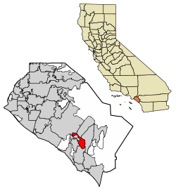 Location of Laguna Hills in Orange County, California. | ||
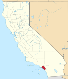
 Laguna Hills, California Location in the United States | ||
| Coordinates: 33°35′59″N 117°41′58″W / 33.59972°N 117.69944°WCoordinates: 33°35′59″N 117°41′58″W / 33.59972°N 117.69944°W | ||
| Country |
| |
| State |
| |
| County | Orange | |
| Incorporated | December 20, 1991[1] | |
| Government | ||
| • Mayor | Dore Gilbert[2] | |
| Area[3] | ||
| • Total | 6.63 sq mi (17.17 km2) | |
| • Land | 6.60 sq mi (17.10 km2) | |
| • Water | 0.03 sq mi (0.06 km2) 0.37% | |
| Elevation[4] | 364 ft (111 m) | |
| Population (2010)[5] | ||
| • Total | 30,344 | |
| • Estimate (2016)[6] | 31,509 | |
| • Density | 4,771.20/sq mi (1,842.27/km2) | |
| Time zone | UTC-8 (Pacific) | |
| • Summer (DST) | UTC-7 (PDT) | |
| ZIP codes | 92637, 92653, 92654, 92656 | |
| Area code | 949 | |
| FIPS code | 06-39220 | |
| GNIS feature ID | 1667917 | |
| Website | ci.laguna-hills.ca.us | |

Laguna Hills is a city in Orange County, California, United States. Its name refers to its proximity to Laguna Canyon and the much older Laguna Beach. Other newer cities nearby—Laguna Niguel and Laguna Woods—are similarly named.
Geography
According to the United States Census Bureau, the city has a total area of 6.7 square miles (17 km2). 6.7 square miles (17 km2) of it is land and 0.025 square miles (0.065 km2) of it (0.37%) is water.
History
Laguna Hills is built on one of the major land grants developed during the rancho era. Following Mexico's independence from Spain in 1821, those who had served in the government or who had friends in authority, were given vast lands for cattle grazing. Rancho Lomas de Santiago, Rancho San Joaquin, and Rancho Niguel covered much of the western portion of the Saddleback Valley. Don Juan Avila was granted the 13,000-acre Rancho Niguel on which Laguna Hills is located.
In 1894, Lewis Moulton purchased Rancho Niguel from Don Juan Avila and increased the original grant to 22,000 acres (89 km2). Moulton and his partner, Jean Piedra Daguerre, used the ranch to raise sheep and cattle. The Moulton Ranch was eventually subdivided in the early 1960s, and part of the division became today's Laguna Hills.
Incorporation efforts began in 1987 and on March 5, 1991, 86% of the residents voted in favor of forming the City of Laguna Hills. On December 20, 1991, Laguna Hills officially became a City. Subsequent annexations have included the North Laguna Hills (1996) and the "Westside Annexation" (2000) areas. The latter included 149 acres (0.60 km2) of residential land, including the Aliso Viejo Community Association's Sheep Hills Park.[7]
In 2004, Laguna Hills' City Hall was moved to an existing office building at 24035 El Toro Road, which was bought and renovated by the city. The city also rents out commercial space in the building, providing the city with a positive net income.[8]
Demographics
| Historical population | |||
|---|---|---|---|
| Census | Pop. | %± | |
| 2000 | 31,178 | — | |
| 2010 | 30,344 | −2.7% | |
| Est. 2016 | 31,509 | [6] | 3.8% |
| U.S. Decennial Census[9] | |||
2010
The 2010 United States Census[10] reported that Laguna Hills had a population of 30,344. The population density was 4,532.4 per square mile (1,750.0/km²). The racial makeup of Laguna Hills was 22,045 (72.7%) White (61.7% Non-Hispanic White),[11] 420 (1.4%) African American, 101 (0.3%) Native American, 3,829 (12.6%) Asian, 58 (0.2%) Pacific Islander, 2,470 (8.1%) from other races, and 1,421 (4.7%) from two or more races. Hispanic or Latino of any race were 6,242 persons (20.6%).

The Census reported that 29,975 people (98.8% of the population) lived in households, 233 (0.8%) lived in non-institutionalized group quarters, and 136 (0.4%) were institutionalized.
There were 10,469 households, of which 3,637 (34.7%) had children under the age of 18 living in them, 6,278 (60.0%) were opposite-sex married couples living together, 983 (9.4%) had a female householder with no husband present, 472 (4.5%) had a male householder with no wife present. There were 445 (4.3%) unmarried opposite-sex partnerships, and 101 (1.0%) same-sex married couples or partnerships. 2,041 households (19.5%) were made up of individuals and 822 (7.9%) had someone living alone who was 65 years of age or older. The average household size was 2.86. There were 7,733 families (73.9% of all households); the average family size was 3.25.
6,762 people (22.3%) were under the age of 18; 2,617 people (8.6%) aged 18 to 24; 7,638 people (25.2%) aged 25 to 44; 9,437 people (31.1%) aged 45 to 64; and 3,890 people (12.8%) who were 65 years of age or older. The median age was 40.8 years. For every 100 females, there were 95.5 males. For every 100 females age 18 and over, there were 93.6 males.
There were 11,046 housing units at an average density of 1,649.9 per square mile (637.0/km²), of which 7,820 (74.7%) were owner-occupied, and 2,649 (25.3%) were occupied by renters. The homeowner vacancy rate was 1.4%; the rental vacancy rate was 11.2%. 22,307 people (73.5% of the population) lived in owner-occupied housing units and 7,668 people (25.3%) lived in rental housing units.
2000

At the 2000 census,[12] there were 31,178 people, 10,895 households and 7,942 families residing in the city. The population density was 4,911.1 per square mile (1,895.7/km²). There were 11,303 housing units at an average density of 1,780.4 per square mile (687.3/km²). The racial makeup of the city was 76.83% White, 1.38% African American, 0.44% Native American, 10.20% Asian, 0.15% Pacific Islander, 7.19% from other races, and 3.81% from two or more races. Hispanic or Latino of any race were 16.40% of the population.
There were 10,895 households of which 37.5% had children under the age of 18 living with them, 61.0% were married couples living together, 8.5% had a female householder with no husband present, and 27.1% were non-families. 21.6% of all households were made up of individuals and 10.0% had someone living alone who was 65 years of age or older. The average household size was 2.82 and the average family size was 3.29.
26.2% of the population were under the age of 18, 7.3% from 18 to 24, 28.8% from 25 to 44, 25.4% from 45 to 64, and 12.1% who were 65 years of age or older. The median age was 38 years. For every 100 females, there were 92.6 males. For every 100 females age 18 and over, there were 89.0 males.
According to a 2007 estimate, the median household income was $89,781 and the median family income was $102,191.[13] Males had a median income of $59,144 versus $38,761 for females. The per capita income for the city was $36,133. About 3.6% of families and 5.0% of the population were below the poverty line, including 5.3% of those under age 18 and 5.1% of those age 65 or over.
Government
In the California State Legislature, Laguna Hills is in the 36th Senate District, represented by Republican Patricia Bates, and in the 73rd Assembly District, represented by Republican Bill Brough.[14]
In the United States House of Representatives, Laguna Hills is in California's 45th congressional district, represented by Republican Mimi Walters.[15]
The Laguna Hills Civic Center was an existing office building at 24035 El Toro Road – near the Laguna Hills Mall – which was bought and totally renovated by the city. The city moved its City Hall there in 2004, but also rents out space in the building on a commercial basis, providing the city with a positive net income on the building.[8]
Emergency services
Fire protection in Laguna Hills is provided by the Orange County Fire Authority with ambulance service by Care Ambulance Service. There is also the Saddleback Memorial Medical Center, a hospital equipped with a full emergency room. Law enforcement is provided by the Orange County Sheriff's Department.
Education
Laguna Hills is served by the Saddleback Valley Unified School District. Laguna Hills students attend a variety of high performing elementary schools; Lomarena Elementary School and Valencia Elementary School. Laguna Hills middle schools are La Paz Intermediate School and Los Alisos Intermediate School in neighboring Mission Viejo. The city has its own high school, Laguna Hills High School, the smallest school in the district built in 1978 and one of the smallest in south Orange County with fewer than 1,700 students. LHHS has been named a National Blue Ribbon School and a California Distinguished School on multiple occasions.
Notable people
- Aloe Blacc, singer and songwriter best known for his single I Need A Dollar
- Chad Carvin (1974), Olympic medalist swimmer
- Phil Collen (current resident), guitarist for the band Def Leppard
- Russ Conway, actor
- Fieldy (current resident), bass guitarist for the band Korn
- Steve Gibson, computer programmer and co-host of Security Now
- Jenna Haze (1982), pornographic actress
- Mike Hopkins, Syracuse Orange men's basketball assistant coach and former player
- Jeff Keane, Family Circus cartoonist
- Tyler Krieger (1994), baseball player in the Cleveland Indians organization[16]
- John Lamb, major league pitcher for the Cincinnati Reds
- Michael Novales (1985), former US figure skating competitor, currently skating for Philippine Skating Union
- Carson Palmer (1998), NFL quarterback and Heisman Trophy winner for the University of Southern California
- Kaitlin Sandeno (1983), Olympic medalist swimmer
- George Sixta, cartoonist of the syndicated Rivets (1953–1985)
- Zacky Vengeance (current resident), rhythm guitarist for the band Avenged Sevenfold
See also
References
- ↑ "California Cities by Incorporation Date". California Association of Local Agency Formation Commissions. Archived from the original (Word) on November 3, 2014. Retrieved August 25, 2014.
- ↑ "City Council". City of Laguna Hills, CA. Archived from the original on March 24, 2015. Retrieved March 13, 2015.
- ↑ "2016 U.S. Gazetteer Files". United States Census Bureau. Retrieved Jul 19, 2017.
- ↑ "Laguna Hills". Geographic Names Information System. United States Geological Survey. Retrieved March 13, 2015.
- ↑ "Laguna Hills (city) QuickFacts". United States Census Bureau. Archived from the original on March 15, 2015. Retrieved March 13, 2015.
- 1 2 "Population and Housing Unit Estimates". Retrieved June 9, 2017.
- ↑
- 1 2 Civic Center as a Business Enterprise Archived 2013-12-14 at the Wayback Machine. on the Strong Cities website
- ↑ "Census of Population and Housing". Census.gov. Archived from the original on May 12, 2015. Retrieved June 4, 2015.
- ↑ "2010 Census Interactive Population Search: CA - Laguna Hills city". U.S. Census Bureau. Retrieved July 12, 2014.
- ↑ "Archived copy". Archived from the original on 2015-03-15. Retrieved 2015-03-13.
- ↑ "American FactFinder". United States Census Bureau. Archived from the original on 2013-09-11. Retrieved 2008-01-31.
- ↑ "Laguna Hills, California Census Fact Sheet". U.S. Census Bureau. Retrieved 6 November 2011.
- ↑ "Statewide Database". Regents of the University of California. Retrieved March 13, 2015.
- ↑ "California's 45th Congressional District - Representatives & District Map". Civic Impulse, LLC.
- ↑ "Archived copy". Archived from the original on 2016-10-18. Retrieved 2017-01-23.
External links
| Wikimedia Commons has media related to Laguna Hills, California. |
- Official website
- Congressman John Campbell
- State Senator Mimi Walters
- State Assemblywoman Diane Harkey