California State Route 241
| ||||
|---|---|---|---|---|
 SR 241 highlighted in red | ||||
| Route information | ||||
| Defined by Streets and Highways Code § 541 | ||||
| Maintained by Caltrans and TCA | ||||
| Length | 24.534 mi[1] (39.484 km) | |||
| Existed | 1993 – present | |||
| Major junctions | ||||
| South end | Oso Parkway near Rancho Santa Margarita | |||
| North end |
| |||
| Location | ||||
| Counties | Orange | |||
| Highway system | ||||
| ||||

State Route 241 (SR 241) is a state highway in the U.S. state of California. For its entire run, Route 241 is a toll road. Its northern half is part of the Eastern Transportation Corridor while its southern half is part of the Foothill Transportation Corridor.
The highway currently runs from Rancho Santa Margarita to Yorba Linda. Route 241 connects with State Route 133, State Route 261, and State Route 91.
Route description
The Foothill Toll Road (also called The Foothill Transportation Corridor) is a 12-mile (19 km) tollway in Orange County. Signed as State Route 241, it travels parallel to Interstate 5, connecting the Eastern Toll Road (at the State Route 133/State Route 241 interchange) outside of Irvine with Oso Parkway near Mission Viejo.
The toll road was constructed by the Transportation Corridor Agencies, also known as the TCA, and is owned by the state of California. Construction was financed with bonds, which are repaid with toll revenues. Taxpayers are not responsible for repaying any debt if toll revenues fall short.[2]
The route begins at Oso Parkway near Rancho Santa Margarita and heads northward. The toll road enters Rancho Santa Margarita, crossing El Toro Road without an exit. Heading north, SR 241 passes through Irvine before meeting SR 133, another toll road. The freeway meets SR 261 near Irvine Lake before turning northeastward. SR 241 meets its terminus at SR 91 near the Santa Ana River.[3]
SR 241 is part of the California Freeway and Expressway System,[4] but is not part of the National Highway System,[5] a network of highways that are considered essential to the country's economy, defense, and mobility by the Federal Highway Administration.[6]
Future
Foothill-South was planned as the last segment of the road, and the final piece in Orange County's planned 67-mile (108 km) network of public toll roads. It has been the subject of regional planning efforts for more than 20 years.[7]
The extension would provide an alternate route to Interstate 5 for those traveling from Riverside, Corona and southeast Orange County to points southward as well as those traveling from North San Diego County northward. Proponents of the project, including a coalition of chambers of commerce, argue it would provide greater access for communities such as Foothill Ranch, Rancho Santa Margarita, Las Flores, Coto de Caza, Wagon Wheel and the future Rancho Mission Viejo. The TCA Board of Directors, local elected officials who represent the areas adjacent to the toll road routes, certified the project's Environmental Impact Report in 2006.
The route was selected by a collaborative group that included the Federal Highway Administration, Environmental Protection Agency, Fish & Wildlife Service, the Army Corps of Engineers and Caltrans.
The route would have extended the toll road to connect to Interstate 5 at the San Diego County line near San Onofre, where the TCA projects traffic to increase 60 percent by 2025. The final four miles (6 km) of the roadway would have been located on Camp Pendleton Marine Base. The road would have gone through a section of the San Onofre State Park, which is leased from the United States Marine Corps. The Marine Corps reserved the right to grant easements for rights of way when the lease with the California Department of Parks and Recreation was signed in 1971. Eventually, spokespeople from Camp Pendleton would deny permission to build the road on the base, but approved the road's construction through the portion of the base that hosts the state park.[8][9]
The TCA estimates that by 2025, Foothill-South would alleviate traffic on Interstate 5 by 2.6% - 8%.
On February 6, 2008, the California Coastal Commission voted 8-2[10] to reject a 16-mile (26 km) southern segment of the 241, Foothill-South, which was planned for the Foothill Toll Road. The TCA appealed the Coastal Commission's decision to the U.S. Secretary of Commerce.[11] On December 18, 2008, the Department of Commerce announced that it would uphold the California Coastal Commission's ruling that found the TCA's proposed extension of the 241 Toll Road inconsistent with the California Coastal Act.[12] In a release issued by the Department of Commerce, the DOC noted that at least one reasonable alternative to the project existed, and that the project was not necessary in the interest of national security.[13]
The Rancho Mission Viejo development is currently building Los Patrones Parkway from the terminus of the 241 at Oso Parkway to Cow Camp Road near SR 74. It is noted that Rancho Mission Viejo has publicly condemned all alignments for the 241 extension. Scheduled for completion in 2018, the four-lane road follows the same alignment as the proposed Tesoro extension, although it will not be built to freeway standards. Local environmental groups expressed the concern that TCA may acquire Los Patrones in the future in order to extend the 241.[14] In 2016 TCA announced its intent to construct a toll bridge over Oso Parkway providing a direct connection between the 241 and Los Patrones. This project is currently under construction.
Environment
The original extension, which went around San Clemente to the east and south, was opposed by many conservationists, environmental groups, and some residents of San Clemente. Former California Attorney General Bill Lockyer filed two lawsuits in 2006, one on behalf of the Native American Heritage Commission. A third lawsuit was filed by a coalition of several groups, including Sierra Club, the Surfrider Foundation, Natural Resources Defense Council.[15] In November 2016, The TCA reached a legal settlement ending a 15-year dispute with the more than a dozen environmental organizations as well as the State of California. The settlement guaranteed that any roadway would avoid the Donna O'Neill Land Conservatory, the San Onofre State Beach Park and other environmentally sensitive areas. In exchange, the environmental organizations have agreed not to sue the TCA over other potential alignments that connect the 241 Toll Road to the I-5 freeway as long as the alignments do not enter the "environmental avoidance area."
The TCA funded a study in support of removing the California gnatcatcher from the federal Endangered Species list,[16] which would have made it easier to build a 241 Toll Road extension.
Traffic
The project's opponents contend that the expansion would not provide significant rush-hour traffic relief as it does not connect the communities of southeast Orange County to any major job centers. In addition, opponents claim that the expansion would draw a portion of its traffic from Interstate 15, twenty-five miles further inland, even though the Foothill Toll Road would run at near right-angles with Interstate 15, which runs through Temecula and leads to Corona, California.
As an alternative to Foothill-South, opponents generally argue that transportation dollars should be spent on a major upgrade to Interstate 5, and on improving mass transit in the area, such as the existing Metrolink line which terminates at Oceanside. The U.S. Federal Highway Administration conducted an analysis of the project opponents' I-5 widening plan (known as "Smart Mobility") and deemed it "not reasonable and feasible." Caltrans Director Will Kempton stated at the February 2008 Coastal Commission meeting that the opponents' Smart Mobility plan to widen I-5 "did not comply with our (Caltrans) design standards. Safety issues were not considered." Kempton went on to say, "We cannot compromise safety in the construction of our transportation infrastructure." The U.S. Federal Highway Administration and Caltrans agree that widening the I-5 would cost more than $2.5 billion and would result in the demolition of more than 1,000 homes and businesses.
Tolls
SR 241 employs a barrier toll system, where drivers are charged flat-rate tolls based on what particular mainline toll booths, on-ramps, or off-ramps they pass through. There are two mainline toll booths: the Tomato Springs Toll Plaza just south of the SR 133 interchange, and the Windy Ridge Toll Plaza to the south of the SR 91 interchange. The two mainline toll plazas and the ramps at the Portola Pkwy – North interchange use a congestion pricing scheme based on the time of day. Patrons who use one of the other exits along the toll road are charged a prorated toll.[17]
Since May 13, 2014, the road has been using an all-electronic, open road tolling system; cash is no longer being accepted.[18] Drivers may pay using the FasTrak electronic toll collection system, license plate tolling (under Transportation Corridor Agencies's brand name "ExpressAccount"), or via a one time payment online. Those using Fastrak are charged a lower toll than those using the other two methods. Drivers must pay within 5 days after their trip on the toll road or they will be assessed a toll violation.[19]
The following table lists the tolls at each of the tolled exits for passenger cars and other two-axle vehicles (as of July 1, 2015). Vehicles with more than two axles pay a higher toll at the two mainline toll plazas.[17]
| Toll Booth | FasTrak | Toll-by-plate ExpressAccount | One-time payment |
|---|---|---|---|
| Oso Pkwy Southbound Exit and Northbound Entrance | $1.36 | $2.36 | $2.36 |
| Antonio Pkwy Southbound Exit and Northbound Entrance | $0.67 | $1.67 | $1.67 |
| Los Alisos Blvd Northbound Exit and Southbound Entrance | $0.57 | $1.57 | $1.57 |
| Portola Pkwy – South Northbound Exit and Southbound Entrance | $0.67 | $1.67 | $1.67 |
| Alton Pkwy Northbound Exit and Southbound Entrance | $1.46 | $2.46 | $2.46 |
| Portola Pkwy – North Northbound Exit and Southbound Entrance |
Peak: $1.88 Pre/Post Peak: $1.88 Off-Peak: $1.46 Weekends: $1.46 |
Peak: $2.88 Pre/Post Peak: $2.88 Off-Peak: $2.46 Weekends: $2.46 |
All times: $2.88 |
| TOMATO SPRINGS TOLL PLAZA Price assumes 2-axle automobile. |
Peak: $2.65 Pre/Post Peak: $2.65 Off-Peak: $2.40 Weekends: $2.40 |
Peak: $3.65 Pre/Post Peak: $3.65 Off-Peak: $3.40 Weekends: $3.40 |
All times: $3.65 |
| WINDY RIDGE TOLL PLAZA Price assumes 2-axle automobile. |
Peak: $2.81 Pre/Post Peak: $2.81 Off-Peak: $2.55 Weekends: $2.55 |
Peak: $3.81 Pre/Post Peak: $3.81 Off-Peak: $3.55 Weekends: $3.55 |
All times: $3.81 |
Exit list
Except where prefixed with a letter, postmiles were measured on the road as it was when the route was established, based on the alignment that existed at the time, and do not necessarily reflect current mileage. R reflects a realignment in the route since then, M indicates a second realignment, L refers an overlap due to a correction or change, and T indicates postmiles classified as temporary (for a full list of prefixes, see the list of postmile definitions).[1] Segments that remain unconstructed or have been relinquished to local control may be omitted. The entire route is in Orange County.
| Location | Postmile [1][20][21] | Exit [22] | Destinations | Notes | |
|---|---|---|---|---|---|
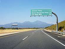
| Las Flores | 14.55 | 14 | Oso Parkway | Southbound exit and northbound entrance; south end of SR 241 | |
| Rancho Santa Margarita | 17.77 | 18 | Antonio Parkway | ||
| 18.49 | 19 | Santa Margarita Parkway | |||
| 20.08 | 20 | Los Alisos Boulevard | |||
| Lake Forest | 21.80 | 22A | Portola Parkway | Signed as exit 22 northbound | |
| | 22B | Lake Forest Drive | Southbound exit and northbound entrance | ||
| 23.42 | 23 | Alton Parkway | |||
| Irvine | 24.97 | 25 | Portola Parkway – Irvine | ||
| | | Tomato Springs toll plaza | |||
| | 27.38 | 27 | SR 133 north exits 14A-B | ||
| | 32.54 | 33 | Santiago Canyon Road, Chapman Avenue (CR S18) | ||
| | | 32 | No northbound exit; SR 261 north exit 6B | ||
| | 36.10 | Windy Ridge toll plaza | |||
| Anaheim–Yorba Linda line | 39.08 | 39 | Northbound exit and southbound entrance; signed as exits 39A (east) and 39B (west); north end of SR 241; SR 91 exit 40 | ||
| 1.000 mi = 1.609 km; 1.000 km = 0.621 mi | |||||
See also

References
- 1 2 3 California Department of Transportation. "State Truck Route List". Sacramento: California Department of Transportation. Archived from the original (XLS file) on June 30, 2015. Retrieved June 30, 2015.
- ↑ "Toll Road Background page".
- ↑ Microsoft; Nokia (February 11, 2011). "SR 241" (Map). Bing Maps. Microsoft. Retrieved February 11, 2011.
- ↑ California State Legislature. "Section 250–257". Streets and Highways Code. Sacramento: California State Legislature. Retrieved June 9, 2017.
- ↑ Federal Highway Administration (March 25, 2015). National Highway System: Los Angeles, CA (PDF) (Map). Scale not given. Washington, DC: Federal Highway Administration. Retrieved September 4, 2017.
- ↑ Natzke, Stefan; Neathery, Mike & Adderly, Kevin (June 20, 2012). "What is the National Highway System?". National Highway System. Washington, DC: Federal Highway Administration. Retrieved July 1, 2012.
- ↑ February 4, 2008 "Foothill South: Developments to date for proposed toll road extension," The Orange County Register
- ↑ The Foothill-South Toll Road: Fact vs. Fiction
- ↑ Toll road must not interfere with base mission
- ↑ Feb 07, 2008 "Panel rejects toll road through San Onofre State Beach", LA Times
- ↑ Oct. 29, 2008 "241 toll road extension proposal", Green OC (The Orange County Register) Archived 2008-12-21 at the Wayback Machine.
- ↑ Rosenblatt, Susannah (2008-12-19). "O.C. toll road hits dead end in D.C." Los Angeles Times. Retrieved 2009-03-11.
- ↑ "Decision and Findings" (PDF). US Secretary of Commerce. 2008-12-18. Retrieved 2009-03-11.
- ↑ Shimura, Tomoya (2015-11-06). "Opponents and environmental groups are closely monitoring roadway construction to the 241 toll road". Orange County Register. Retrieved 2017-04-11.
- ↑ January 3, 2007 "Student protests 241 expansion," Orange County Register
- ↑ Clarke, Chris (September 21, 2016). "This Tiny Bird Scored a Win for Science". Redefine. KCET-TV. Retrieved July 21, 2017.
- 1 2 "The Toll Roads Rate Card" (PDF). July 1, 2015. Archived from the original (PDF) on March 31, 2012. Retrieved July 9, 2015.
- ↑ "All Electronic Tolling". Transportation Corridor Agencies. Archived from the original on October 16, 2012. Retrieved October 12, 2013.
- ↑ "The Toll Roads Overview". Transportation Corridor Agencies. Retrieved December 29, 2013.
- ↑ California Department of Transportation (July 2007). "Log of Bridges on State Highways". Sacramento: California Department of Transportation.
- ↑ California Department of Transportation, All Traffic Volumes on CSHS, 2005 and 2006
- ↑ California Department of Transportation, California Numbered Exit Uniform System, SR-241 Northbound and SR-241 Southbound, accessed February 2008
External links
Route map:
| Wikimedia Commons has media related to California State Route 241. |
- Transportation Corridor Agencies
- California @ AARoads.com — State Route 241
- California Highways: SR 241
- Caltrans: Route 241 highway conditions